|
Cheruthoni
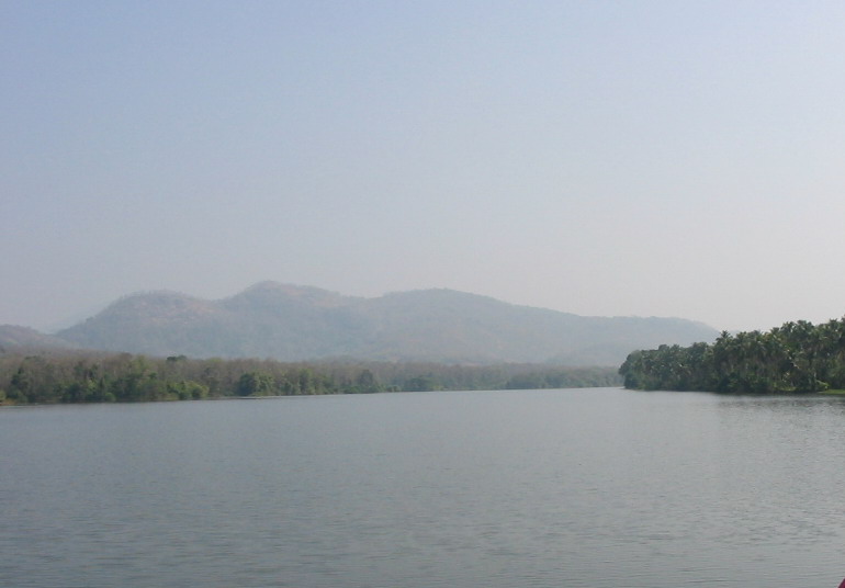
Cheruthoni () is a town on the banks of Cheruthoni River, a major tributary of the Periyar River, the second longest river in Kerala state, India. The area is known by Cheruthoni Dam, which is a part of Idukki reservoir, which provide hydroelectric power to the region. Location The town is adjacent to the famous Idukki Arch Dam and the Cheruthoni dam. These dams, along with the Kulamavu Dam, form the Idukki Reservoir. Cheruthoni is part of Vazhathope Panchayat, in the Idukki District. Other villages adjacent to Cheruthoni are Vazhathope, Thadiyampadu, Karimban, Manjappara, Maniyarankudi, Bhoomiyamkulam, Peppara, Manjikkavala and Painavu. Origin The origins of this place can be traced back to 1940s, following a famine the government allowed farmers to migrate to unoccupied arable lands in the mountains, where they cleared the land for agriculture. Later, this region was identified as an ideal spot for a hydroelectric project. The Hindustan Construction Company was contracted ... [...More Info...] [...Related Items...] OR: [Wikipedia] [Google] [Baidu] |
Cheruthoni Dam
The Cheruthoni Dam, located in Idukki District, Kerala, India, is a 138m tall concrete gravity dam. This dam was constructed in 1976 as part of the Idukki Hydroelectric Project along with two other dams Idukki and Kulamavu. The Government of Canada aided the Project with long-term loans and grants. The dam was constructed by HCC (Hindustan Construction Company Ltd.) and the consultant was S.N.C.Inc., Canada, The water impounded by these three dams of Idukki, Cheruthoni & Kulamavu has formed a single reservoir spread over 60 km2 on a height of 2300 ft above Mean Sea Level. The Idukki Dam is a double curvature arch dam constructed across Periyar River in a narrow gorge between two granite hills and is the tallest double curvature arch dam in Asia. Cheruthoni Dam is located 1 km west of Idukki dam. The spill way of the Idukki Reservoir is in the Cheruthoni dam. Kulamavu Dam was constructed to prevent the water escape through a rivulet called Kilivally, 30 k ... [...More Info...] [...Related Items...] OR: [Wikipedia] [Google] [Baidu] |
Cheruthoni004
Cheruthoni () is a town on the banks of Cheruthoni River, a major tributary of the Periyar River, the second longest river in Kerala state, India. The area is known by Cheruthoni Dam, which is a part of Idukki reservoir, which provide hydroelectric power to the region. Location The town is adjacent to the famous Idukki Arch Dam and the Cheruthoni dam. These dams, along with the Kulamavu Dam, form the Idukki Reservoir. Cheruthoni is part of Vazhathope Panchayat, in the Idukki District. Other villages adjacent to Cheruthoni are Vazhathope, Thadiyampadu, Karimban, Manjappara, Maniyarankudi, Bhoomiyamkulam, Peppara, Manjikkavala and Painavu. Origin The origins of this place can be traced back to 1940s, following a famine the government allowed farmers to migrate to unoccupied arable lands in the mountains, where they cleared the land for agriculture. Later, this region was identified as an ideal spot for a hydroelectric project. The Hindustan Construction Company was contracted to ... [...More Info...] [...Related Items...] OR: [Wikipedia] [Google] [Baidu] |
Cheruthoni River
Cheruthoni () is a town on the banks of Cheruthoni River, a major tributary of the Periyar River, the second longest river in Kerala state, India. The area is known by Cheruthoni Dam, which is a part of Idukki reservoir, which provide hydroelectric power to the region. Location The town is adjacent to the famous Idukki arch dam, Idukki Arch Dam and the Cheruthoni dam. These dams, along with the Kulamavu Dam, form the Idukki District#Electricity and power, Idukki Reservoir. Cheruthoni is part of Vazhathope Panchayat raj, Panchayat, in the Idukki district, Idukki District. Other villages adjacent to Cheruthoni are Vazhathope, Thadiyampadu, Karimban, Manjappara, Maniyarankudi, Bhoomiyamkulam, Peppara, Manjikkavala and Painavu. Origin The origins of this place can be traced back to 1940s, following a famine the government allowed farmers to migrate to unoccupied arable lands in the mountains, where they cleared the land for agriculture. Later, this region was identified as an ideal ... [...More Info...] [...Related Items...] OR: [Wikipedia] [Google] [Baidu] |
Idukki Arch Dam
The Idukki Dam is a double curvature arch dam constructed across the Periyar River in a narrow gorge between two granite hills locally known as ''Kuravanmala, Kuravan'' and ''Kurathi'' in Idukki, Kerala, India. At , it is one of the highest arch dams in Asia. It is constructed and owned by the Kerala State Electricity Board. It supports a 780 MW hydroelectric power station in Moolamattom, which started generating power on 4 October 1975. The dam type is a concrete, double curvature parabolic arch, parabolic, thin arc dam. The Indo-Canadian project was inaugurated by the Prime Minister Indira Gandhi on February 17, 1976. This dam was constructed along with two other dams at Cheruthoni dam, Cheruthoni and Kulamavu Dam, Kulamavu. Together, the three dams and Two saddle dams, Kulamavu Saddle Dam (Near Junction) and Kulamavu Saddle Dam (Right Bank) have created an artificial lake that is in area. The stored water is used to produce electricity at the Moolamattom Power house, which is ... [...More Info...] [...Related Items...] OR: [Wikipedia] [Google] [Baidu] |
Periyar River
Periyar, , (meaning: ''big river'') is the longest river and the river with the largest discharge potential in the Indian state of Kerala. It is one of the few perennial rivers in the region and provides drinking water for several major towns. The Periyar is of utmost significance to the economy of Kerala. It generates a significant proportion of Kerala's electrical power via the Idukki Dam and flows along a region of industrial and commercial activity. The river also provides water for irrigation and domestic use throughout its course besides supporting a rich fishery. Due to these reasons, the river has been named the "Lifeline of Kerala". Kochi city, in the vicinity of the river mouth draws its water supply from Aluva, an upstream site sufficiently free of seawater intrusion. Twenty five percent of Kerala's industries are along the banks of river Periyar. These are mostly crowded within a stretch of in the Eloor-Edayar region (Udhyogamandal), about north of Kochi harbor. ... [...More Info...] [...Related Items...] OR: [Wikipedia] [Google] [Baidu] |
Kattappana
Kattappana is a municipal town in the Sahyadri (or Western Ghats) of Kerala state, India. It is the main urban centre in the high ranges of Idukki district, situated about from sea level. It is the second city to became a municipality in Idukki District. It is a major commercial town and flourished with the boost in production of agriculture and spices. Municipal administration Previously, Kattappana was included in the Udumbanchola tehsil (taluk) of Idukki district and was later included in the newly formed Idukki tehsil (taluk). It was officially declared as municipality by the state government on 1 November 2015. It became the second municipality in the district, while Thodupuzha became the first. The first municipal chairman was Mr. Johny Kulampallil and the current municipal chairperson is Ms Shyni Sunny Cherian. It is one of the more important commercial centre in the high ranges and was on a fast track in terms of development and infrastructure building. Ho ... [...More Info...] [...Related Items...] OR: [Wikipedia] [Google] [Baidu] |
States And Territories Of India
India is a federal union comprising 28 states and 8 union territories, with a total of 36 entities. The states and union territories are further subdivided into districts and smaller administrative divisions. History Pre-independence The Indian subcontinent has been ruled by many different ethnic groups throughout its history, each instituting their own policies of administrative division in the region. The British Raj mostly retained the administrative structure of the preceding Mughal Empire. India was divided into provinces (also called Presidencies), directly governed by the British, and princely states, which were nominally controlled by a local prince or raja loyal to the British Empire, which held ''de facto'' sovereignty ( suzerainty) over the princely states. 1947–1950 Between 1947 and 1950 the territories of the princely states were politically integrated into the Indian union. Most were merged into existing provinces; others were organised into ... [...More Info...] [...Related Items...] OR: [Wikipedia] [Google] [Baidu] |
Periyar River In Cheruthoni
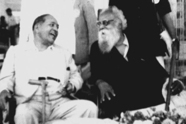
Erode Venkatappa Ramasamy (17 September 1879 – 24 December 1973), revered as Periyar or Thanthai Periyar, was an Indian social activist and politician who started the Self-Respect Movement and Dravidar Kazhagam. He is known as the 'Father of the Dravidian movement'. He rebelled against Brahminical dominance and gender and caste inequality in Tamil Nadu.Thakurta, Paranjoy Guha; Shankar Raghuraman (2004). ''A Time of Coalitions: Divided We Stand''. Sage Publications. New Delhi. p. 230. . Since 2021, the Indian state of Tamil Nadu celebrates his birth anniversary as 'Social Justice Day'. Ramasamy joined the Indian National Congress in 1919, but resigned in 1925 when he felt that the party was only serving the interests of Brahmins. He questioned the subjugation of non-Brahmin Dravidians as Brahmins enjoyed gifts and donations from non-Brahmins but opposed and discriminated against non-Brahmins in cultural and religious matters. In 1924, Ramasamy participated in non-viol ... [...More Info...] [...Related Items...] OR: [Wikipedia] [Google] [Baidu] |
Kerala State Electricity Board
Kerala State Electricity Board (KSEB) is an Indian public sector undertaking under the Government of Kerala that generates, transmits and distributes electricity in the state under government monopoly. Established in 1957, the agency comes under the authority of the Department of Power. It has been registered under Indian companies act during January 2011. History * The history of electricity in the state is around one century old. The first effort in this direction was a private endeavour. Electricity was first brought to the state by a British company – the Kannan Devan Hill Produce Company, Munnar. The first generating station of the state was set up on the right bank of a tributary of River Periyar in 1910. It was a hydroelectric project and that tributary named Mudirappuzha continues to be the site of large a number of hydroelectric projects in the state. * After a spell of 17 years, the attention of the state authorities turned to newer forms of generating energy. The G ... [...More Info...] [...Related Items...] OR: [Wikipedia] [Google] [Baidu] |
Hindustan Construction Company
Hindustan Construction Company Limited (HCC) is an Indian Engineering, Procurement, Construction, and Project Management companies. It is headquartered in Mumbai. HCC was founded by Industrialist Seth Walchand Hirachand in 1926. HCC has executed a majority of India’s landmark infrastructure projects, including 29% of India’s hydropower capacity, over 65% of India’s nuclear power generation capacity, 3,800 km of roads and expressways, 375 bridges and 337 km of complex tunnelling. Ajit Gulabchand is Chairman and Managing Director of HCC. Arjun Dhawan is Executive Vice Chairman. Our Founder: Seth Walchand Hirachand Seth Walchand Hirachand is widely hailed as the Father of the Indian Transportation Industry. He is remembered as the man who took an ambitious yet pragmatic stand in challenging British monopolies, a feat that resulted in India’s first shipyard, aircraft factory and automobile factory. He began his entrepreneurial foray in the Construction ind ... [...More Info...] [...Related Items...] OR: [Wikipedia] [Google] [Baidu] |
Hydropower
Hydropower (from el, ὕδωρ, "water"), also known as water power, is the use of falling or fast-running water to Electricity generation, produce electricity or to power machines. This is achieved by energy transformation, converting the Potential energy, gravitational potential or kinetic energy of a water source to produce power. Hydropower is a method of sustainable energy production. Hydropower is now used principally for Hydroelectricity, hydroelectric power generation, and is also applied as one half of an energy storage system known as pumped-storage hydroelectricity. Hydropower is an attractive alternative to fossil fuels as it does not directly produce Carbon dioxide in Earth's atmosphere, carbon dioxide or other Air pollution, atmospheric pollutants and it provides a relatively consistent source of power. Nonetheless, it has economic, sociological, and environmental downsides and requires a sufficiently energetic source of water, such as a river or elevated lake. Int ... [...More Info...] [...Related Items...] OR: [Wikipedia] [Google] [Baidu] |


.jpg)