|
Charles Alban Buckler
Charles Alban Buckler (1825–1905) was an English author, topographer, architect, artist and officer of arms. According to Historic England, he "became one of the most distinguished of the early to mid-Victorian Catholic architects."Historic EnglandSt Leonards-on-Sea – St Thomas of Canterbury and English Martyrs ''Taking Stock'', retrieved 11 June 2022 In the field of heraldry he was the Surrey Herald Extraordinary. Life Family Charles Alban Buckler was born in 1824. He was born into Buckler dynasty of architects and was the son of the noted architect John Chessell Buckler. He grandfather was John Buckler (artist), John Buckler. Since 2013, the Buckler family of architects and topographical artists has been the subject of a research project hosted by the Institute for the History and Theory of Architecture at ETH Zurich. Career He was a student of medieval art and architecture. Both of he and his father John Chessell Buckler worked together writing architecture books such ... [...More Info...] [...Related Items...] OR: [Wikipedia] [Google] [Baidu] |
John Chessell Buckler
John Chessell Buckler (8 December 1793 – 10 January 1894) was a British architect, the eldest son of the architect John Buckler. J. C. Buckler initially worked with his father before taking over his practice. His work included restorations of country houses and at the University of Oxford. Career Buckler received art lessons from the painter Francis Nicholson. From 1810 onwards he worked with his father. His younger brother, George, later joined them and reported that the three worked "in perfect harmony". In 1830 his father handed over his architectural practice to him, and he worked in partnership with George until 1842.Tyack, 2004 In 1825 Buckler began rebuilding Costessey Hall, Norfolk, for Lord Stafford. His work there was described by Charles Locke Eastlake, writing in 1872, as "one of the most important and successful instances of the othicRevival in Domestic Architecture". It was in a "Tudor" style, in red and white brick, with stone dressings. The new buil ... [...More Info...] [...Related Items...] OR: [Wikipedia] [Google] [Baidu] |
Kirkstall Abbey
Kirkstall Abbey is a ruined Cistercian monastery in Kirkstall, north-west of Leeds city centre in West Yorkshire, England. It is set in a public park on the north bank of the River Aire. It was founded ''c.'' 1152. It was disestablished during the Dissolution of the Monasteries under Henry VIII. The picturesque ruins have been drawn and painted by artists such as J. M. W. Turner, Thomas Girtin and John Sell Cotman. Kirkstall Abbey was acquired by the Leeds Corporation as a gift from Colonel North and opened to the public in the late 19th century. The gatehouse became a museum, which is now part of the Leeds Museums & Galleries group. Foundation Henry de Lacy (1070, Halton, – 1123), Lord of the manor of Pontefract, 2nd Lord of Bowland, promised to dedicate an abbey to the Virgin Mary should he survive a serious illness. He recovered and agreed to give the Abbot of Fountains Abbey land at Barnoldswick in the West Riding of Yorkshire (now in Lancashire) on which to found a ... [...More Info...] [...Related Items...] OR: [Wikipedia] [Google] [Baidu] |
Midhurst
Midhurst () is a market town, parish and civil parish in West Sussex, England. It lies on the River Rother inland from the English Channel, and north of the county town of Chichester. The name Midhurst was first recorded in 1186 as ''Middeherst'', meaning "Middle wooded hill", or "(place) among the wooded hills". It derives from the Old English words ''midd'' (adjective) or ''mid'' (preposition), meaning "in the middle", plus ''hyrst'', "a wooded hill". The Norman St. Ann's Castle dates from about 1120, although the foundations are all that can now be seen. The castle, the parish church of St. Mary Magdalene and St. Denis, together with South Pond, the former fish-pond for the castle, are the only three structures left from this early period. The parish church is the oldest building in Midhurst. Just across the River Rother, in the parish of Easebourne, is the ruin of the Tudor Cowdray House. Governance National The former Parliamentary Constituency of Midhurst is n ... [...More Info...] [...Related Items...] OR: [Wikipedia] [Google] [Baidu] |
Sacred Heart Church, Petworth
Sacred Heart Church is a Roman Catholic Parish church in Petworth, West Sussex, England. It was built in 1896 and designed by Frederick Walters. It is situated on Angel Street to the north of Petworth Cottage Museum in the centre of the town. It is a Gothic Revival church and a Grade II listed building. History Foundation Before the church was built, the local Catholic population of Petworth worshiped at St Richard's Church in Burton Park. Three years after St Richard's was built, a mission was established at Petworth. A priest would travel out to Petworth from Burton Park to say Mass there. After the presbytery, Duncton Cottage, in Burton Park deteriorated to become unliveable, the priest moved house to Petworth.Our History from SacredHeartPetworth.org.uk, retrieved 5 March 2016 Construction In 18 ...[...More Info...] [...Related Items...] OR: [Wikipedia] [Google] [Baidu] |
Battersea Park
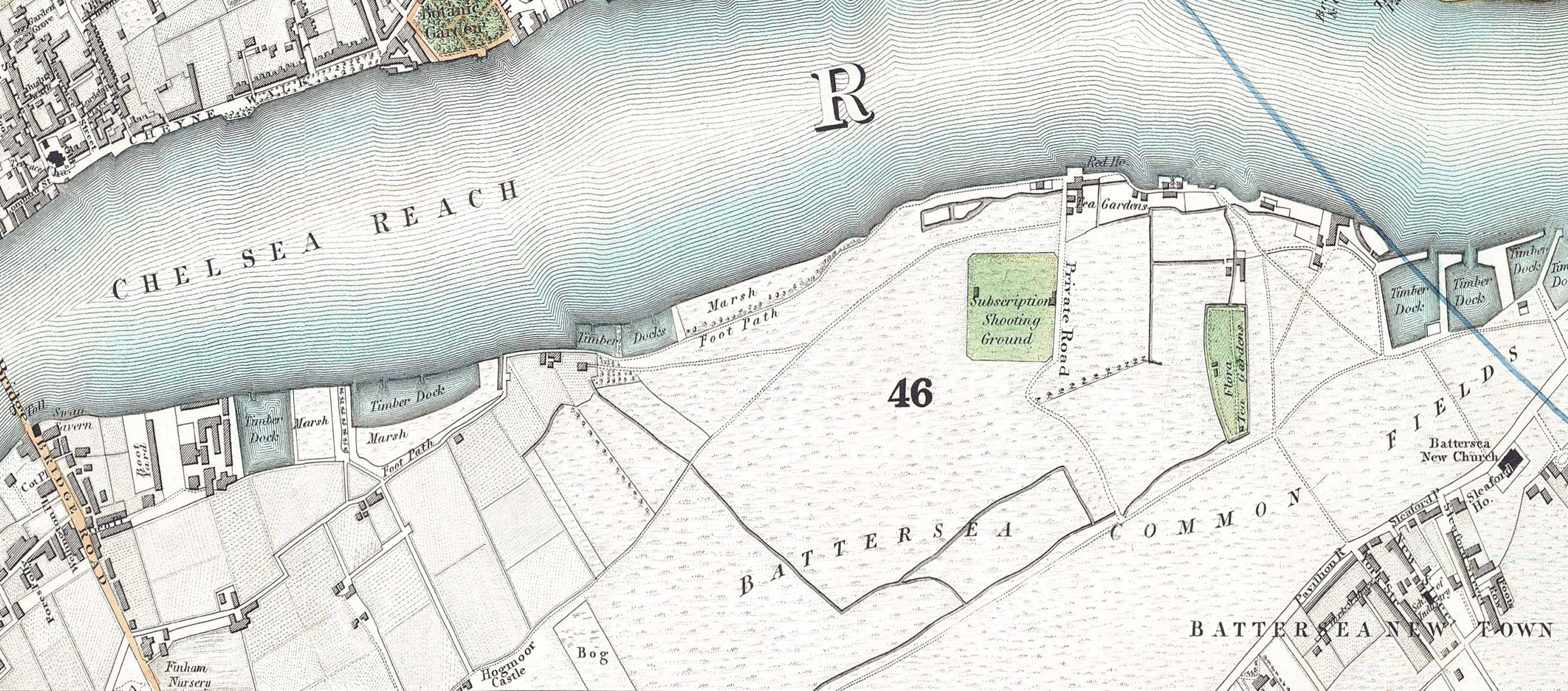
Battersea Park is a 200-acre (83-hectare) green space at Battersea in the London Borough of Wandsworth in London. It is situated on the south bank of the River Thames opposite Chelsea and was opened in 1858. The park occupies marshland reclaimed from the Thames and land formerly used for market gardens. The park is Grade II* listed on the Register of Historic Parks and Gardens. History Prior to 1846, the area now covered by the park was known as Battersea fields, a popular spot for duelling. On 21 March 1829, the Duke of Wellington and the Earl of Winchilsea met on Battersea fields to settle a matter of honour. When it came time to fire, the duke aimed his duelling pistol wide and Winchilsea fired his into the air. Winchilsea later wrote the duke a groveling apology. Separated from the river by a narrow raised causeway, the fields consisted of low, fertile marshes intersected by streams and ditches with the chief crops being carrots, melons, lavender (all the way up to Lave ... [...More Info...] [...Related Items...] OR: [Wikipedia] [Google] [Baidu] |
Windsor, Berkshire
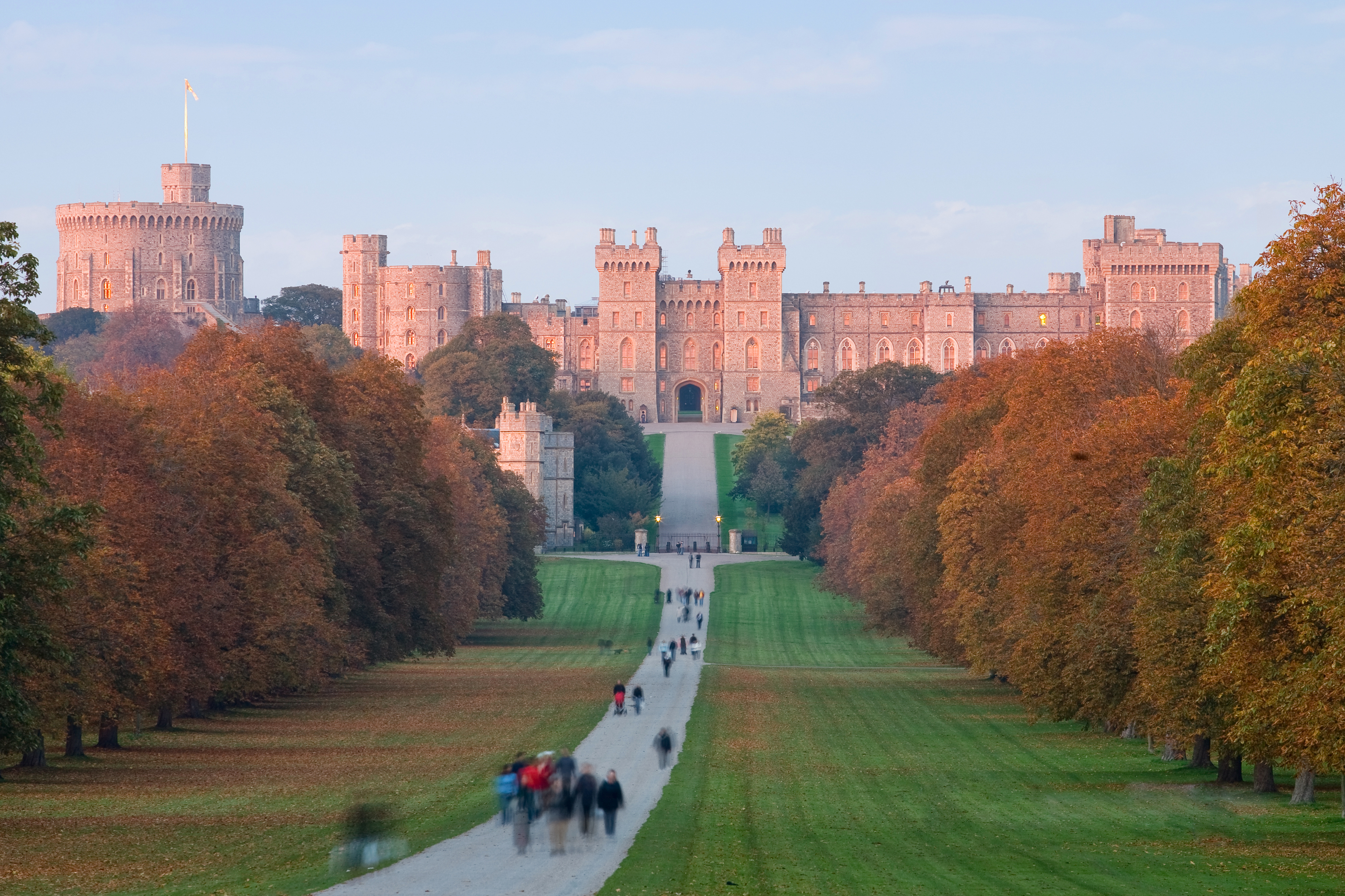
Windsor is a historic market town and unparished area in the Royal Borough of Windsor and Maidenhead in Berkshire, England. It is the site of Windsor Castle, one of the official residences of the British monarch. The town is situated west of Charing Cross, central London, southeast of Maidenhead, and east of the county town of Reading. It is immediately south of the River Thames, which forms its boundary with its smaller, ancient twin town of Eton. The village of Old Windsor, just over to the south, predates what is now called Windsor by around 300 years; in the past Windsor was formally referred to as New Windsor to distinguish the two. Etymology ''Windlesora'' is first mentioned in the ''Anglo-Saxon Chronicle.'' (The settlement had an earlier name but this is unknown.) The name originates from old English ''Windles-ore'' or ''winch by the riverside''.South S.R., ''The Book of Windsor'', Barracuda Books, 1977. By 1110, meetings of the Great Council, which had previousl ... [...More Info...] [...Related Items...] OR: [Wikipedia] [Google] [Baidu] |
Slindon
Slindon is a mostly rural village and civil parish in the Arun District of West Sussex, England, containing a developed nucleus amid woodland. Much of Slindon's woodland belongs to the National Trust on the southern edge of the escarpment of the South Downs National Park. Slindon is centred north-east of Chichester. History The village is listed in the Domesday Book of 1086 as "Eslindone", the name having the probable meaning in Old English of "sloping hill". The Domesday Book records Slindon as having 35 households, putting it in the top 20% of settlements. St Mary's 12th-century parish church contains a memorial to Stephen Langton (c1150–1228), the Archbishop of Canterbury who attended the signing of Magna Carta. In the Middle Ages Slindon House (now Slindon College) was the site of one of the Archbishop's residences. In 1330 Thomas de Natindon, who was a legal representative of the Pope, was sent there to serve a writ on the archbishop. His party were not well rece ... [...More Info...] [...Related Items...] OR: [Wikipedia] [Google] [Baidu] |
Our Lady Of Sorrows Church, Bognor Regis
Our Lady of Sorrows Church is a Roman Catholic Parish church in Bognor Regis, West Sussex, England. It was built from 1881 to 1882 and designed by Joseph Stanislaus Hansom. It is situated on the corner of the High Street and Clarence Road, backing on to Albert Road, in the centre of the town. It was founded by the Servite Order and is a Grade II listed building. History Construction In 1880, the Servites founded a mission in Bognor Regis. On 26 October 1881, the foundation stone of the church was laid.Bognor Regis - Our Lady of Sorrows from , retrieved 1 March 2016 The architect of the church was |
Shipston-on-Stour
Shipston-on-Stour is a town and civil parish in the Stratford-on-Avon District in Warwickshire, England. It is located on the banks of the River Stour, south-southeast of Stratford-upon-Avon, 10 miles (16 km) north-northwest of Chipping Norton, south of Warwick and 14.5 miles (23 km) west of Banbury. In the 2021 census, Shipston-on-Stour had a population of 5,849. This area is sometimes termed the Vale of Red Horse, close to the Oxfordshire and Gloucestershire borders.Beckinsale, R. (1980) ''The English Heartland'', Duckworth, p.5 History Etymology linked to sheep and wool trade In the 8th century, the toponym was ''Scepwaeisctune'', Old English for Sheep-wash-Town. It had a sheep marketplace for many centuries. The name evolved through ''Scepwestun'' in the 11th century, ''Sipestone'', ''Sepwestun'' and ''Schipton'' in the 13th century and ''Sepestonon-Sture'' in the 14th century. Church (vestry) administration, township and parish formation It was a township in the pa ... [...More Info...] [...Related Items...] OR: [Wikipedia] [Google] [Baidu] |
East Hendred
East Hendred is a village and civil parish about east of Wantage in the Vale of White Horse and a similar distance west of Didcot. The village is on East Hendred Brook, which flows from the Berkshire Downs to join the River Thames at Sutton Courtenay. Historically in Berkshire, it has been administered as part of Oxfordshire, England, since the 1974 boundary changes. The westernmost parts of the Harwell Science and Innovation Campus are in the parish. The Ridgeway and Icknield Way pass through the parish. It was called "the most well connected village in Britain" because of its connections with the railway station in Didcot and the M4 motorway. Champs Chapel Museum of East Hendred is a small museum in a former 15th century wayside chapel. History Just over south of the village is Scutchamer Knob, the remains of an Iron Age long barrow. King Edwin of Northumbria is said to have killed Cwichelm of Wessex there in the 7th century. Scutchamer Knob was the meeting point of ... [...More Info...] [...Related Items...] OR: [Wikipedia] [Google] [Baidu] |
St Dominic's Priory Church
St Dominic's Priory Church (formally named "Our Lady of the Rosary and St Dominic") is one of the largest Catholic churches in London. The church is Grade II* listed building on the National Heritage List for England. It has been served by the Order of Preachers (Dominicans) since 1861, the community living in the adjacent Priory. In October 2016, the church was solemnly inaugurated by the Cardinal Archbishop of Westminster, Vincent Nichols, as a diocesan shrine, with a designated mission of promoting the Rosary. Location The church and priory are in Southampton Road just south of Hampstead Heath and close to Belsize Park. The nearest stations are Belsize Park and Chalk Farm tube stations both on the Northern line Edgware branch, and Hampstead Heath railway station and Gospel Oak railway stations on London Overground, all about 15 minutes walk away. History The Dominican Friars came to the area in 1861 with a community of Friars in the Priory, a community of Dominican Sisters ... [...More Info...] [...Related Items...] OR: [Wikipedia] [Google] [Baidu] |
Shifnal
Shifnal is a market town and civil parish in Shropshire, England, about east of Telford, 17 miles (27 km) east of the county town of Shrewsbury and 13 miles (20 km) west-northwest of the city of Wolverhampton. It is near the M54 motorway (Junction 4). At the 2001 census, it had a population of 6,391, increasing to 6,776 at the 2011 census. History Early medieval time The town, also once known as "Idsall" (relating to potential Roman links), most probably began as an Anglian settlement, established by the end of the 7th century. Shifnal is thought to be the place named "Scuffanhalch" in a 9th-century charter, as a possession of the monastery at Medeshamstede (later Peterborough Abbey). Though this seems a dubious claim, and the ancient charter is in fact a 12th-century forgery, the full picture is more complex. Sir Frank Stenton considered that "Scuffanhalch", along with "Costesford" ( Cosford) and "Stretford", formed part of a list of places which had once been c ... [...More Info...] [...Related Items...] OR: [Wikipedia] [Google] [Baidu] |


.jpg)