|
Chanmyathazi Airport
Mandalay Chanmyathazi Airport is a domestic airport in Myanmar that served Mandalay and surrounding areas. It has largely been replaced by Mandalay International Airport Mandalay International Airport ( my, မန္တလေး အပြည်ပြည်ဆိုင်ရာ လေဆိပ်; ), located 35 km south of Mandalay in Tada-U, is one of three international airports in Myanmar. Completed .... During May 1942, the airport was under control of the Imperial Japanese Army. It was attacked by Allied bombers starting in late 1942, and on March 21, 1945, the British Army 14th Army captured the city and the airport after Japanese resistance ceased. References External links Arrivals and departures Airports in Myanmar Mandalay {{Myanmar-airport-stub ... [...More Info...] [...Related Items...] OR: [Wikipedia] [Google] [Baidu] |
Chanmyathazi Township
Chanmyathazi Township (also spelled Chanmyathasi Township; my, ချမ်းမြသာစည် မြို့နယ်, ) is located in south-central area of Mandalay, Myanmar. Chanmyathazi is bounded by the Ayeyarwady river in the west, Maha Aungmye Township in the north, Pyigyidagun Township in the south. The Mahamuni Buddha, one of the city's main tourist attractions, is located in the township. It is home to University of Dental Medicine, Mandalay. Notable places * Chanmyathazi Airport * Jivitadana Sangha Hospital * Kandawgyi Gardens (Tatthay Lake) * Mahamuni Buddha * Mandalay Institute of Nursing The University of Nursing, Mandalay (also the Institute of Nursing, Mandalay; my, သူနာပြု တက္ကသိုလ် (မန္တလေး), ) is a university of nursing, located in Mandalay, Myanmar. It is one of three universit ... References {{Administrative divisions of Burma (Myanmar) Townships of Mandalay Townships of Mandalay Region Mandal ... [...More Info...] [...Related Items...] OR: [Wikipedia] [Google] [Baidu] |
Mandalay
Mandalay ( or ; ) is the second-largest city in Myanmar, after Yangon. Located on the east bank of the Irrawaddy River, 631km (392 miles) (Road Distance) north of Yangon, the city has a population of 1,225,553 (2014 census). Mandalay was founded in 1857 by King Mindon, replacing Amarapura as the new royal capital of the Konbaung dynasty. It was Burma's final royal capital before the kingdom's annexation by the British Empire in 1885. Under British rule, Mandalay remained commercially and culturally important despite the rise of Yangon, the new capital of British Burma. The city suffered extensive destruction during the Japanese conquest of Burma in the Second World War. In 1948, Mandalay became part of the newly independent Union of Burma. Today, Mandalay is the economic centre of Upper Myanmar and considered the centre of Burmese culture. A continuing influx of illegal Chinese immigrants, mostly from Yunnan, since the late 20th century, has reshaped the city's ethnic mak ... [...More Info...] [...Related Items...] OR: [Wikipedia] [Google] [Baidu] |
Myanmar
Myanmar, ; UK pronunciations: US pronunciations incl. . Note: Wikipedia's IPA conventions require indicating /r/ even in British English although only some British English speakers pronounce r at the end of syllables. As John C. Wells, John Wells explains, the English spellings of both Myanmar and Burma assume a non-rhotic variety of English, in which the letter r before a consonant or finally serves merely to indicate a long vowel: [ˈmjænmɑː, ˈbɜːmə]. So the pronunciation of the last syllable of Myanmar as [mɑːr] or of Burma as [bɜːrmə] by some speakers in the UK and most speakers in North America is in fact a spelling pronunciation based on a misunderstanding of non-rhotic spelling conventions. The final ''r'' in ''Myanmar'' was not intended for pronunciation and is there to ensure that the final a is pronounced with the broad a, broad ''ah'' () in "father". If the Burmese name my, မြန်မာ, label=none were spelled "Myanma" in English, this would b ... [...More Info...] [...Related Items...] OR: [Wikipedia] [Google] [Baidu] |
Mandalay International Airport
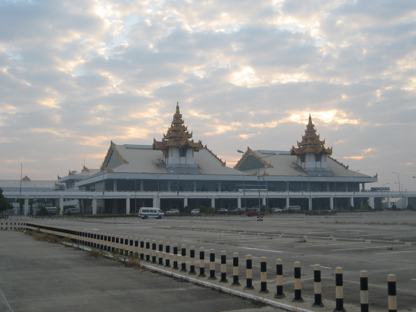
Mandalay International Airport ( my, မန္တလေး အပြည်ပြည်ဆိုင်ရာ လေဆိပ်; ), located 35 km south of Mandalay in Tada-U, is one of three international airports in Myanmar. Completed in 1999, it was the largest and most modern airport in the country until the modernization of Yangon International Airport in 2008. The airport connects 11 domestic and seven international destinations. Its runway is the longest runway in use in Southeast Asia and has the capacity to handle up to 3 million passengers a year. The airport is the main operating base of Golden Myanmar Airlines. History The Mandalay International Airport project was first conceived by the Burmese military government in the mid-1990s as a way to increase overall levels of foreign investment and tourism in Myanmar. With Yangon boasting the only other international airport in the whole country, the new Mandalay airport was regarded as crucial in achieving a planne ... [...More Info...] [...Related Items...] OR: [Wikipedia] [Google] [Baidu] |
Entrance Of Mandalay Chanmyathazi Airport
Entrance generally refers to the place of entering like a gate, door, or road or the permission to do so. Entrance may also refer to: * ''Entrance'' (album), a 1970 album by Edgar Winter * Entrance (display manager), a login manager for the X window manager * Entrance (liturgical), a kind of liturgical procession in the Eastern Orthodox tradition * Entrance (musician), born Guy Blakeslee * ''Entrance'' (film), a 2011 film * The Entrance, New South Wales, a suburb in Central Coast, New South Wales, Australia * "Entrance" (Dimmu Borgir song), from the 1997 album ''Enthrone Darkness Triumphant'' * Entry (cards), a card that wins a trick to which another player made the lead, as in the card game contract bridge * N-Trance, a British electronic music group formed in 1990 * University and college admissions * Entrance Hall * Entryway See also *Enter (other) Enter or ENTER may refer to: * Enter key, on computer keyboards * Enter, Netherlands, a village * ''Enter'' (mag ... [...More Info...] [...Related Items...] OR: [Wikipedia] [Google] [Baidu] |
Airports In Myanmar
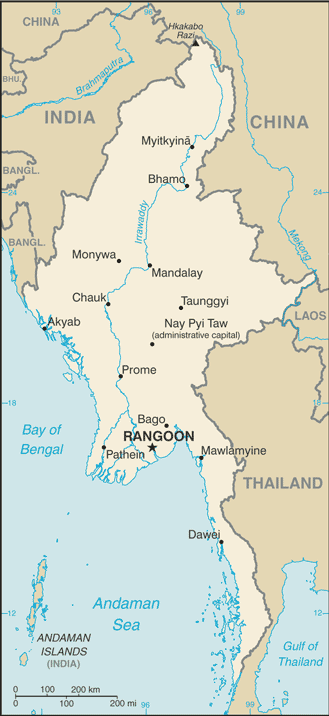
This is a list of airports in Burma (Myanmar), grouped by type and sorted by location. Burma, officially the Union of Burma (now The Republic of the Union of Myanmar), has 25 operating airports with commercial flights. The country is bordered by People's Republic of China to the northeast, Laos to the east, Thailand to the southeast, Bangladesh to the west, India to the northwest, the Bay of Bengal to the southwest, and the Andaman Sea to the south. The country is divided into 14 administrative subdivisions, which include 7 states (''pyi-ne'') and 7 divisions (''tyne''). Its capital is Naypyitaw (Nay Pyi Taw) and its largest city (and prior capital) is Yangon. File:Mandalay_Airport.JPG , Mandalay Airport File:Ygnairport2006.jpg , Yangon Airport __TOC__ Airports Airport names shown in bold have scheduled passenger service on commercial airlines. See also * Myanmar Air Force * Transport in Burma * List of airports by ICAO code: V#VY - Myanmar (Burma) * Wikipedia:Wi ... [...More Info...] [...Related Items...] OR: [Wikipedia] [Google] [Baidu] |


