|
Chalton Street
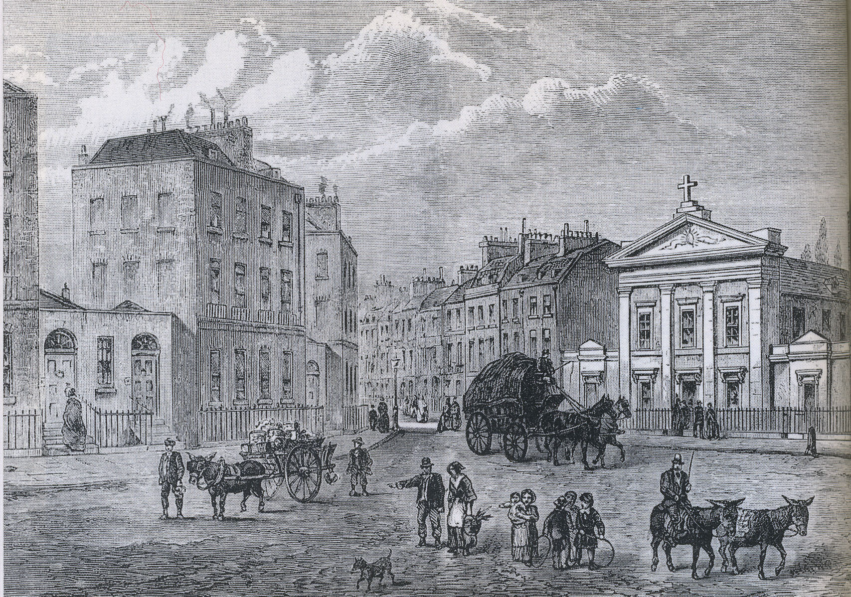
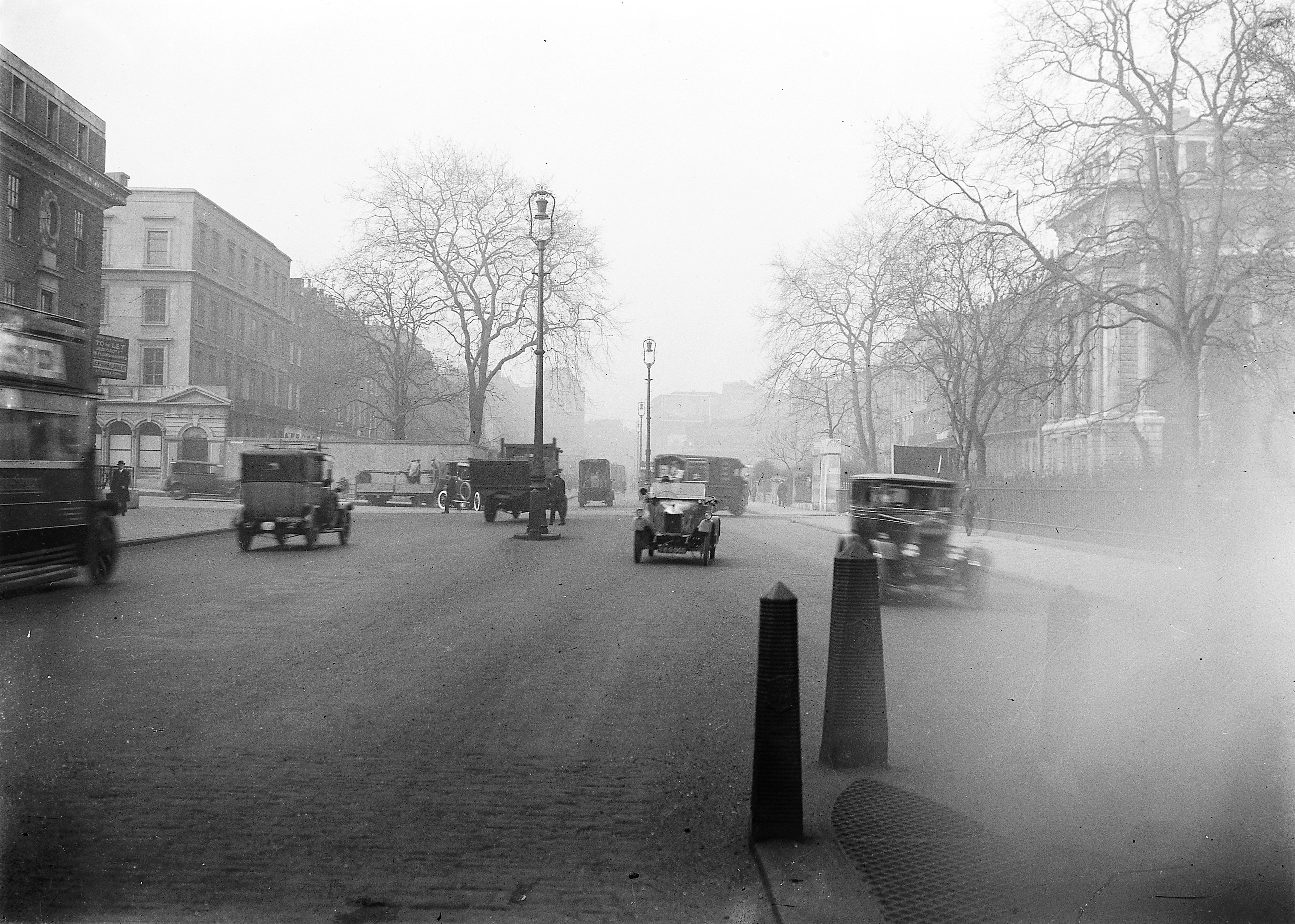
Chalton Street is a street in the Somers Town neighbourhood of London, England. Chalton Street is over a kilometre long and stretches from Euston Road to almost Camden Town, before taking a hard right turn and terminating at St Pancras Hospital. The street defines the centre of Somers Town. It is notable as the home of Chalton Street Market Chalton Street Market is a Street markets in London, street market in Camden London Borough Council, Camden, North London. History Early history (1795–1867) Established circa 1795 (as The Brill). In 1784 the first housing was built at So .... It lies directly to the east of Euston railway station, with Euston underground station having been built on Chalton Street. The southern part of the eastern side of Chalton Street is dominated by the Ossulston Estate. The street is also home to Regent High School. The Ossulston Estate, including Chamberlain House, Levita House and Walker House is all grade II-listed, as are The Somers To ... [...More Info...] [...Related Items...] OR: [Wikipedia] [Google] [Baidu] |
Chalton Street, Somers Town (geograph 2010566)
{{place name disambiguation ...
Chalton may refer to: *Chalton, Bedfordshire, England *Chalton, Hampshire, England See also *Charlton (other) Charlton may refer to: People * Charlton (surname) * Charlton (given name) Places Australia * Charlton, Queensland * Charlton, Victoria * Division of Charlton, an electoral district in the Australian House of Representatives, in New South Wal ... [...More Info...] [...Related Items...] OR: [Wikipedia] [Google] [Baidu] |
Somers Town, London
Somers Town is an inner-city district in North West London. It has been strongly influenced by the three mainline north London railway termini: Euston (1838), St Pancras (1868) and King's Cross (1852), together with the Midland Railway Somers Town Goods Depot (1887) next to St Pancras, where the British Library now stands. Historically, the name "Somers Town" was used for the larger triangular area between the Pancras, Hampstead, and Euston Roads, but it is now taken to mean the rough rectangle centred on Chalton Street and bounded by Pancras Road, Euston Road, Eversholt Street, Crowndale Road, and the railway approaches to St Pancras station. Somers Town was originally within the medieval Parish of St Pancras, Middlesex, which in 1900 became the Metropolitan Borough of St Pancras. In 1965 the Borough of St Pancras was abolished and its area became part of the London Borough of Camden. History St Pancras Old Church is believed by many to be one of the oldest Christi ... [...More Info...] [...Related Items...] OR: [Wikipedia] [Google] [Baidu] |
London
London is the capital and largest city of England and the United Kingdom, with a population of just under 9 million. It stands on the River Thames in south-east England at the head of a estuary down to the North Sea, and has been a major settlement for two millennia. The City of London, its ancient core and financial centre, was founded by the Romans as '' Londinium'' and retains its medieval boundaries.See also: Independent city § National capitals The City of Westminster, to the west of the City of London, has for centuries hosted the national government and parliament. Since the 19th century, the name "London" has also referred to the metropolis around this core, historically split between the counties of Middlesex, Essex, Surrey, Kent, and Hertfordshire, which largely comprises Greater London, governed by the Greater London Authority.The Greater London Authority consists of the Mayor of London and the London Assembly. The London Mayor is distinguished fr ... [...More Info...] [...Related Items...] OR: [Wikipedia] [Google] [Baidu] |
England
England is a country that is part of the United Kingdom. It shares land borders with Wales to its west and Scotland to its north. The Irish Sea lies northwest and the Celtic Sea to the southwest. It is separated from continental Europe by the North Sea to the east and the English Channel to the south. The country covers five-eighths of the island of Great Britain, which lies in the North Atlantic, and includes over 100 smaller islands, such as the Isles of Scilly and the Isle of Wight. The area now called England was first inhabited by modern humans during the Upper Paleolithic period, but takes its name from the Angles, a Germanic tribe deriving its name from the Anglia peninsula, who settled during the 5th and 6th centuries. England became a unified state in the 10th century and has had a significant cultural and legal impact on the wider world since the Age of Discovery, which began during the 15th century. The English language, the Anglican Church, and Engli ... [...More Info...] [...Related Items...] OR: [Wikipedia] [Google] [Baidu] |
Euston Road
Euston Road is a road in Central London that runs from Marylebone Road to King's Cross. The route is part of the London Inner Ring Road and forms part of the London congestion charge zone boundary. It is named after Euston Hall, the family seat of the Dukes of Grafton, who had become major property owners in the area during the mid-19th century. The road was originally the central section of New Road from Paddington to Islington which opened in 1756 as London's first bypass. It provided a route along which to drive cattle to Smithfield Market avoiding central London. Traffic increased when major railway stations, including Euston, opened in the mid-19th century and led to the road's renaming in 1857. Euston Road was widened in the 1960s to cater for the increasing demands of motor traffic, and the Euston Tower was built around that time. The road contains several significant buildings including the Wellcome Library, the British Library and the St Pancras Renaissance L ... [...More Info...] [...Related Items...] OR: [Wikipedia] [Google] [Baidu] |
Camden Town
Camden Town (), often shortened to Camden, is a district of northwest London, England, north of Charing Cross. Historically in Middlesex, it is the administrative centre of the London Borough of Camden, and identified in the London Plan as one of 34 major centres in Greater London. Laid out as a residential district from 1791 and originally part of the manor of Kentish Town and the parish of St Pancras, Camden Town became an important location during the early development of the railways, which reinforced its position on the London canal network. The area's industrial economic base has been replaced by service industries such as retail, tourism and entertainment. The area now hosts street markets and music venues that are strongly associated with alternative culture. History Toponymy Camden Town is named after Charles Pratt, 1st Earl Camden. His earldom was styled after his estate, Camden Place near Chislehurst in Kent (now in the London Borough of Bromley), formerly o ... [...More Info...] [...Related Items...] OR: [Wikipedia] [Google] [Baidu] |
St Pancras Hospital
St Pancras Hospital is part of the Camden and Islington NHS Foundation Trust in St Pancras, London, St Pancras area of Central London, near Camden Town. The hospital specialises in Geriatrics, geriatric and Psychiatry, psychiatric medicine. History The hospital was established as the infirmary for the St Pancras Union Workhouse in 1848. The hospital is partly housed in the original 18th century workhouse buildings. After Highgate Hospital, St Pancras North Infirmary opened in Highgate in 1869, the hospital in St Pancras Way became known as the St Pancras South Infirmary. After the North Infirmary was renamed Highgate Hospital the South Infirmary was renamed St Pancras Hospital in 1920. It joined the National Health Service in 1948 under the management of the University College Hospital. The former maternity wards were occupied by the Hospital for Tropical Diseases from 1951 until 1998. After the hospital chapel became a day nursery, chaplaincy services were provided by St Pancra ... [...More Info...] [...Related Items...] OR: [Wikipedia] [Google] [Baidu] |
Chalton Street Market
Chalton Street Market is a Street markets in London, street market in Camden London Borough Council, Camden, North London. History Early history (1795–1867) Established circa 1795 (as The Brill). In 1784 the first housing was built at Somers Town, London and by 1795 the streets around the market were fully laid out. The Market probably started at this time. Less than sixty years later Henry Mayhew lists a 300 pitch market at the Brill and on Chapel Street,Mayhew, HenryLondon Labour and the London Poor; a cyclopædia of the condition and earnings of those that will work, those that cannot work, and those that will not work (Vol. I), p.11 London, 1851. Retrieved on 1 May 2020. the second largest street market in London after Hampstead Road and Tottenham Court Road. The market was named The Brill after the Brill House tavern at the western end of the street. The area had been known for dog fighting and bull-baiting but the housing development and market chased these entertai ... [...More Info...] [...Related Items...] OR: [Wikipedia] [Google] [Baidu] |
Euston Railway Station
Euston railway station ( ; also known as London Euston) is a central London railway terminus in the London Borough of Camden, managed by Network Rail. It is the southern terminus of the West Coast Main Line, the UK's busiest inter-city railway. Euston is the eleventh-busiest station in Britain and the country's busiest inter-city passenger terminal, being the gateway from London to the West Midlands, North West England, North Wales and Scotland. Intercity express passenger services are operated by Avanti West Coast and overnight services to Scotland are provided by the Caledonian Sleeper. London Northwestern Railway and London Overground provide regional and commuter services. Trains run from Euston to the major cities of Birmingham, Manchester, Liverpool, Glasgow and Edinburgh. It is also the mainline station for services to and through to for connecting ferries to Dublin. Local suburban services from Euston are run by London Overground via the Watford DC Line which runs ... [...More Info...] [...Related Items...] OR: [Wikipedia] [Google] [Baidu] |
Ossulston Estate
The Ossulston Estate is a multi-storey council estate built by the London County Council on Chalton Street in Somers Town between 1927 and 1931. It was unusual at the time both in its inner-city location and in its modernist design, and all the original parts of the estate are now Grade II listed buildings. The estate was built to rehouse those poor who were not being served by the LCC's new suburban estates,Bridget Cherry and Nikolaus Pevsner, ''London'' Volume 4: ''North'', The Buildings of England, Harmondsworth: Penguin/New Haven: Yale University, 1998, p. 380 and was significantly denser to suit the urban site. It was located on the site of the Somers Town slum,John Bold, Tanis Hinchcliffe and Scott Forrester, ''Discovering London's Buildings: With Twelve Walks'', London: Frances Lincoln, 2009, p. 69 between Euston and St Pancras stations. The original proposal made in 1925 was for 9-storey blocks on the American model, which would have required lifts, and with more expen ... [...More Info...] [...Related Items...] OR: [Wikipedia] [Google] [Baidu] |
Regent High School
(Nothing without effort) , established = Leased 1873 (existed prior) , closed = , type = Community school , free_label_1 = Affiliations , free_1 = Reed Group, IiP, Camden Consortium, Eco-Schools , religious_affiliation = , head_label = Headteacher , head = Gary Moore , chair_label = , chair = , founder = London School Board (1877) , address = Chalton Street , city = Somers Town , county = London , country = England , postcode = NW1 1RX , local_authority = Camden , ofsted = yes , urn = 100051 , staff = , enrolment = 1,029 , gender = Coeducational , lower_age = 11 , upper_age = 18 , houses = 6 houses , colours = Blue, Orange, Green, Red, Yellow and Purple , publication = Mosaic, Artisan , free_label_2 = , free_2 = Formerly: South Camden Community School(SCCS) (1993–2012) , Replaced = , free_label ... [...More Info...] [...Related Items...] OR: [Wikipedia] [Google] [Baidu] |
.jpg)


