|
Chak E Wardak Dam
The Chak Dam ( ps, چک برېښناکوټ), referred to by some as Band-e Chak (meaning ''Dam of Chak'' in Dari), is located near Chak, which is the center of Chak District in Maidan Wardak Province of Afghanistan. It is a hydroelectric gravity dam built by German engineers in 1938. It was mainly designed to regulate the flow of the Chak River and provide electricity to Kabul. History Wardak province used to have a significant energy-generating capacity with the Chak Dam. Its four turbines could provide electricity to Maidan Wardak and parts of Kabul, Logar and Ghazni provinces. In May 2005 the Chak Dam nearly overflowed as its main and emergency floodgates were rusted shut after six years of dry weather. The UN Development Programme, the Afghanistan Emergency Trust Fund, and the Ministry of Energy and Water took emergency action to address the threat. The co-operative effort saw a rapid response through immediate financing, planning and implementation of a ancillary ... [...More Info...] [...Related Items...] OR: [Wikipedia] [Google] [Baidu] |
Afghanistan
Afghanistan, officially the Islamic Emirate of Afghanistan,; prs, امارت اسلامی افغانستان is a landlocked country located at the crossroads of Central Asia and South Asia. Referred to as the Heart of Asia, it is bordered by Pakistan to the Durand Line, east and south, Iran to the Afghanistan–Iran border, west, Turkmenistan to the Afghanistan–Turkmenistan border, northwest, Uzbekistan to the Afghanistan–Uzbekistan border, north, Tajikistan to the Afghanistan–Tajikistan border, northeast, and China to the Afghanistan–China border, northeast and east. Occupying of land, the country is predominantly mountainous with plains Afghan Turkestan, in the north and Sistan Basin, the southwest, which are separated by the Hindu Kush mountain range. , Demographics of Afghanistan, its population is 40.2 million (officially estimated to be 32.9 million), composed mostly of ethnic Pashtuns, Tajiks, Hazaras, and Uzbeks. Kabul is the country's largest city and ser ... [...More Info...] [...Related Items...] OR: [Wikipedia] [Google] [Baidu] |
Kabul Province
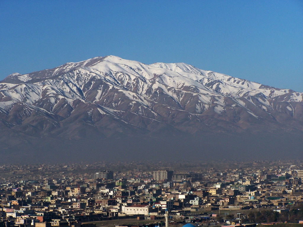
Kabul (Persian: ), situated in the east of the country, is one of the thirty-four provinces of Afghanistan. The capital of the province is Kabul city, which is also Afghanistan's capital and largest city. The population of the Kabul Province is over 5 million people as of 2020, of which over 85 percent live in urban areas. The current governor of the province is Qari Baryal. It borders the provinces of Parwan to the north, Kapisa to the north-east, Laghman to the east, Nangarhar to the south-east, Logar to the south, and Wardak to the west. Geography Kabul is located between Latitude 34-31' North and Longitude 69-12' East at an altitude of 1800 m (6000 feet) above sea level, which makes it one of the world's highest capital cities. Kabul is strategically situated in a valley surrounded by high mountains at crossroads of north-south and east-west trade routes. One million years ago the Kabul region was surrounded from south-east between Lowgar and Paghman Mountains ... [...More Info...] [...Related Items...] OR: [Wikipedia] [Google] [Baidu] |
Water Supply And Sanitation In Afghanistan
Water supply in Afghanistan is managed by the National Water Affairs Regulation Authority (NWARA), which is based in Kabul, Afghanistan. The nation's water supply is characterized by a number of achievements and challenges. Among the achievements are: * the expansion of rural water supply infrastructure with the active participation of communities as part of the National Solidarity Program; * the successful expansion of water supply in the city of Herat and towns such as Kunduz; and * a reform of the institutional framework for urban water supply through the decentralization of service provision from an ineffective national agency to local utilities managed on the basis of commercial principles. Challenges include * the tense security situation, especially in the south and east of the country, that limits the mobility of personnel; * dilapidated infrastructure as a result of decades of war and neglect; * a high level of non-revenue water estimated at 40% including water use from ... [...More Info...] [...Related Items...] OR: [Wikipedia] [Google] [Baidu] |
River Regulation In Afghanistan
A river is a natural flowing watercourse, usually freshwater, flowing towards an ocean, sea, lake or another river. In some cases, a river flows into the ground and becomes dry at the end of its course without reaching another body of water. Small rivers can be referred to using names such as creek, brook, rivulet, and rill. There are no official definitions for the generic term river as applied to geographic features, although in some countries or communities a stream is defined by its size. Many names for small rivers are specific to geographic location; examples are "run" in some parts of the United States, " burn" in Scotland and northeast England, and "beck" in northern England. Sometimes a river is defined as being larger than a creek, but not always: the language is vague. Rivers are part of the water cycle. Water generally collects in a river from precipitation through a drainage basin from surface runoff and other sources such as groundwater recharge, sp ... [...More Info...] [...Related Items...] OR: [Wikipedia] [Google] [Baidu] |
Dams In Afghanistan
A dam is a barrier that stops or restricts the flow of surface water or underground streams. Reservoirs created by dams not only suppress floods but also provide water for activities such as irrigation, human consumption, industrial use, aquaculture, and navigability. Hydropower is often used in conjunction with dams to generate electricity. A dam can also be used to collect or store water which can be evenly distributed between locations. Dams generally serve the primary purpose of retaining water, while other structures such as floodgates or levees (also known as dikes) are used to manage or prevent water flow into specific land regions. The earliest known dam is the Jawa Dam in Jordan, dating to 3,000 BC. The word ''dam'' can be traced back to Middle English, and before that, from Middle Dutch, as seen in the names of many old cities, such as Amsterdam and Rotterdam. History Ancient dams Early dam building took place in Mesopotamia and the Middle East. Dams were us ... [...More Info...] [...Related Items...] OR: [Wikipedia] [Google] [Baidu] |
Tourism In Afghanistan
Tourism in Afghanistan is regulated by the Ministry of Information and Culture. There are at least 350 tourism companies operating in Afghanistan. Tourism was at its peak before the 1978 Saur Revolution, which was followed by the decades of war. Between 2013 and 2016, Afghan embassies issued between 15,000 and 20,000 tourist visas annually. Afghanistan has four international airports, which include Kabul International Airport, Mazar-i-Sharif International Airport, the Ahmad Shah Baba International Airport in Kandahar, and Herat International Airport. It also has a number of smaller domestic airports such as Bamyan Airport, Bost Airport, Chaghcharan Airport, Farah Airport, Fayzabad Airport, Ghazni Airport, Jalalabad Airport, Khost Airport, Kunduz Airport, Maymana Airport, Nili Airport, Tarinkot Airport, and Zaranj Airport. Guest houses and hotels are found in every city of Afghanistan. Some of the major hotels in Kabul are the Serena Hotel, the Hotel Inter-Continental Kab ... [...More Info...] [...Related Items...] OR: [Wikipedia] [Google] [Baidu] |
List Of Power Stations In Afghanistan
This article lists power stations in Afghanistan. Hydroelectric Gas Oil Solar Wind See also *Energy in Afghanistan *List of dams and reservoirs in Afghanistan *List of power stations in Asia * List of largest power stations in the world References External linksFifty-two investors interested in Afghanistan's 2,000 MW solar energy plan(April 16, 2019).Afghanistan launches EoIs ahead of 2-GW solar tender(Dec. 18, 2018).(UNDP, Sept. 13, 2017). {{DEFAULTSORT:Power stations in Afghanistan Afghanistan Afghanistan, officially the Islamic Emirate of Afghanistan,; prs, امارت اسلامی افغانستان is a landlocked country located at the crossroads of Central Asia and South Asia. Referred to as the Heart of Asia, it is bordere ... Power stations in Afghanistan Power stations ... [...More Info...] [...Related Items...] OR: [Wikipedia] [Google] [Baidu] |
List Of Dams And Reservoirs In Afghanistan
Dams and reservoirs in Afghanistan are used for irrigation, water supply, hydro-electric power generation or combination of these. Below are a map and a chart showing some of Afghanistan's dams and reservoirs. Location map of major reservoirs and dams List of major reservoirs and dams in Afghanistan Dams under construction in various parts of Afghanistan * Aino Mina Dam and reservoir in the city of Kandahar (mainly for providing fresh water to the city residents). * Dahan Dara Dam in northwestern Faryab Province. * Kunar Dam in Surtak in Kunar Province. * Lawari Dam in Kandahar Province. * Manogi Power Dam in Kunar Province. * Palto Dam in Sharana, Paktika Province. * Two dams in Baghlan Province. One is named Pul-e-Khumri Dam. See also * List of rivers of Afghanistan * Water supply in Afghanistan * Energy in Afghanistan * International rankings of Afghanistan * Environmental issues in Afghanistan * List of tallest buildings and structures in Afghanistan Reference ... [...More Info...] [...Related Items...] OR: [Wikipedia] [Google] [Baidu] |
Afghanistan Emergency Trust Fund
According to the United Nations's Office for the Coordination of Humanitarian Affairs The United Nations Office for the Coordination of Humanitarian Affairs (OCHA) is a United Nations (UN) body established in December 1991 by the General Assembly to strengthen the international response to complex emergencies and natural disaster ..., the Afghanistan Emergency Trust Fund was established in June 1988 by the Secretary-General. The Afghanistan Emergency Trust Fund ceased financing activities in 2009. It channeled funds received from donors for humanitarian activities in Afghanistan. The fund supported the Office of the Deputy Special Representative of the Secretary-General to the United Nations Assistance Mission in Afghanistan, providing grants to non-governmental organizations working to address rehabilitation needs, and supporting humanitarian and economic development activities. As of 2011, it was in the process of closing its operations. Initiatives In 2005 the fund supported ... [...More Info...] [...Related Items...] OR: [Wikipedia] [Google] [Baidu] |
UN Development Programme
The United Nations Development Programme (UNDP)french: Programme des Nations unies pour le développement, PNUD is a United Nations agency tasked with helping countries eliminate poverty and achieve sustainable economic growth and human development. Headquartered in New York City, it is the largest UN development aid agency, with offices in 170 countries. The UNDP emphasizes developing local capacity towards long-term self-sufficiency and prosperity. It administers projects to attract investment, technical training, and technological development, and provides experts to help build legal and political institutions and expand the private sector. The UNDP operates in 177 countries and is funded entirely by voluntary contributions from UN member states. Also, UNDP is governed by a 36-member executive board overseen by an administrator, who is third-highest ranking UN official after the Secretary-General and Deputy Secretary-General. Founding The UNDP was founded on 22 Novem ... [...More Info...] [...Related Items...] OR: [Wikipedia] [Google] [Baidu] |
Ghazni Province
Ghazni (Dari: ) is one of the 34 provinces of Afghanistan, located in southeastern Afghanistan. The province contains 19 districts, encompassing over a thousand villages and roughly 1.3 million people, making it the 5th most populous province. The city of Ghazni serves as the capital. It lies on the important Kabul–Kandahar Highway, and has historically functioned as an important trade center. The Ghazni Airport is located next to the city of Ghazni and provides limited domestic flights to Afghanistan's capital, Kabul. Ghazni borders the provinces of Maidan Wardak, Logar, Paktia, Paktika, Zabul, Uruzgan, Daykundi and Bamyan. Etymology The province was known as Ghazna in the 10th century, during and after the Ghaznavid era. History Ghazni was a thriving Buddhist center before and during the 7th century AD. Excavations have revealed religious artifacts of both Hindu and Buddhist traditions. In 644 AD, the Chinese pilgrim Xuanzang visited the city of Jaguda (probably G ... [...More Info...] [...Related Items...] OR: [Wikipedia] [Google] [Baidu] |
Logar Province
Logar (Pashto/Dari: ; meaning Greater Mountain ( لوې غر)) is one of the 34 provinces of Afghanistan located in the eastern section of the country. It is divided into 7 districts and contains hundreds of villages. Puli Alam is the capital of the province. As of 2021, Logar has a population of approximately 442,037. It is a multi-ethnic tribal society, while about 65% of its residents are made up by Pashtuns whereas the remainder are Tajiks and Hazaras. The Logar River enters the province through the west and leaves to the north. History Pre Islamic era A 2,600-year-old a Zoroastrian fire temple was found at Mes Aynak (about 25 miles or 40 kilometers southeast of Kabul). Several Buddhist stupas and more than 1,000 statues were also found. Smelting workshops, miners’ quarters (even then the site's copper was well known), a mint, two small forts, a citadel, and a stockpile of Kushan, Sassanian and Indo-Parthian coins were also found at the site. Recent history ... [...More Info...] [...Related Items...] OR: [Wikipedia] [Google] [Baidu] |


