|
Ch'iyar Quta, Oruro
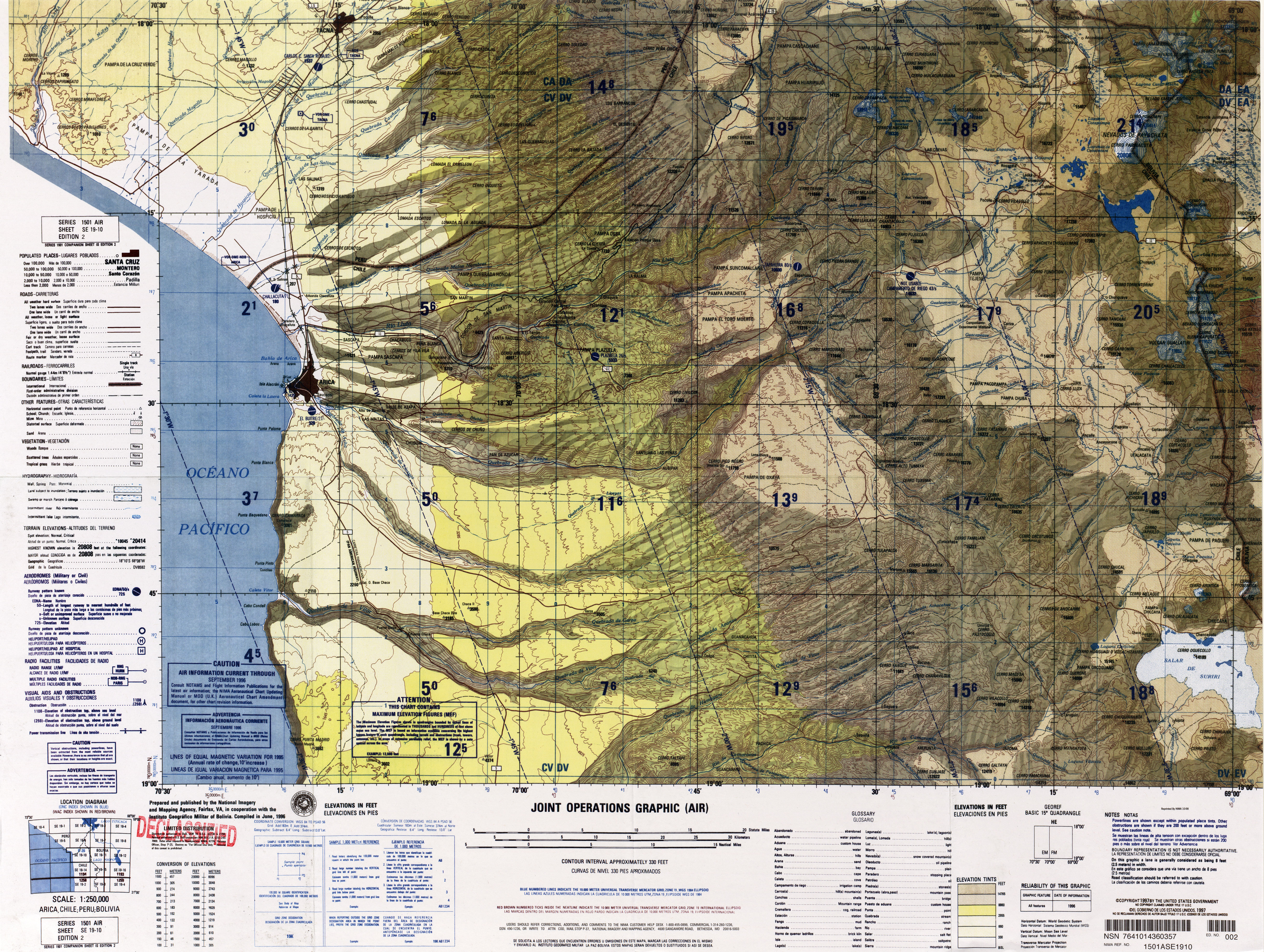
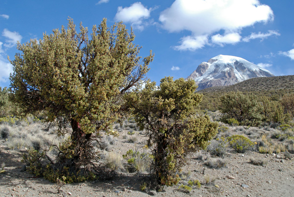
__NOTOC__ Ch'iyar Quta (Aymara ''ch'iyara'' black, ''quta'' lake, "black lake", hispanicized spellings ''Chiar Kkota'' and erroneously also ''Chiar Kkola'') is a small Bolivian lake located in the Sajama Province of the Oruro Department near the border to Chile Chile, officially the Republic of Chile, is a country in the western part of South America. It is the southernmost country in the world, and the closest to Antarctica, occupying a long and narrow strip of land between the Andes to the east a .... It is situated at a height of about inside the boundaries of the Sajama National Park. Dirk Hoffmann, The Sajama National Park in Bolivia, Mountain Research and Development Vol 27 No 1 February 2007 (see map on p. 12) Ch'iyar Quta lies south-east of the peaks of [...More Info...] [...Related Items...] OR: [Wikipedia] [Google] [Baidu] |
Bolivia
, image_flag = Bandera de Bolivia (Estado).svg , flag_alt = Horizontal tricolor (red, yellow, and green from top to bottom) with the coat of arms of Bolivia in the center , flag_alt2 = 7 × 7 square patchwork with the (top left to bottom right) diagonals forming colored stripes (green, blue, purple, red, orange, yellow, white, green, blue, purple, red, orange, yellow, from top right to bottom left) , other_symbol = , other_symbol_type = Dual flag: , image_coat = Escudo de Bolivia.svg , national_anthem = " National Anthem of Bolivia" , image_map = BOL orthographic.svg , map_width = 220px , alt_map = , image_map2 = , alt_map2 = , map_caption = , capital = La Paz Sucre , largest_city = , official_languages = Spanish , languages_type = Co-official languages , languages ... [...More Info...] [...Related Items...] OR: [Wikipedia] [Google] [Baidu] |
Oruro Department
Oruro (; Quechua: ''Uru Uru''; Aymara: ''Ururu'') is a department of Bolivia, with an area of . Its capital is the city of Oruro. According to the 2012 census, the Oruro department had a population of 494,178. Provinces of Oruro The department is divided into 16 provinces which are further subdivided into municipalities and cantons. Note: Eduardo Abaroa Province (#5) is both north of and south of Sebastián Pagador Province (#6). Government The chief executive officer of Bolivian departments (since May 2010) is the governor; until then, the office was called the prefect, and until 2006 the prefect was appointed by the president of Bolivia. The current governor, Santos Tito of the Movement for Socialism – Political Instrument for the Sovereignty of the Peoples, was elected on 4 April 2010. The chief legislative body of the department is the Departmental Legislative Assembly, a body also first elected on 4 April 2010. It consists of 33 members: 16 elected by each of t ... [...More Info...] [...Related Items...] OR: [Wikipedia] [Google] [Baidu] |
Sajama Province
Sajama is a province in the northwestern parts of the Bolivian Oruro Department. Location ''Sajama'' province is one of the sixteen provinces in the Oruro Department. It is located between 17° 39' and 18° 39' South and between 67° 38' and 68° 45' West. The province borders the La Paz Department in the north-west, the Republic of Chile in the west, Sabaya Province in the south-west, Litoral Province in the south-east, Carangas Province in the east, and San Pedro de Totora Province in the north-east. The province extends over 120 km from north to south, and 135 km from east to west. Geography The highest mountain in the province is the extinct Sajama volcano in the Sajama National Park. Other mountains are listed below:Bolivian IGM map 1:50,000 Cerro Uyarani Hoja 5838-I Population The main language of the province is Aymara, spoken by 90.4%, while 88.6% of the population speak Spanish and 4.2% Quechua (1992). The population increased from 7,891 inhabitants ( ... [...More Info...] [...Related Items...] OR: [Wikipedia] [Google] [Baidu] |
Aymara Language
Aymara (; also ) is an Aymaran language spoken by the Aymara people of the Bolivian Andes. It is one of only a handful of Native American languages with over one million speakers.The other native American languages with more than one million speakers are Nahuatl, Quechua languages, and Guaraní. Aymara, along with Spanish and Quechua, is an official language in Bolivia and Peru. It is also spoken, to a much lesser extent, by some communities in northern Chile, where it is a recognized minority language. Some linguists have claimed that Aymara is related to its more widely spoken neighbor, Quechua. That claim, however, is disputed. Although there are indeed similarities, like the nearly identical phonologies, the majority position among linguists today is that the similarities are better explained as areal features rising from prolonged cohabitation, rather than natural genealogical changes that would stem from a common protolanguage. Aymara is an agglutinating and, to a cert ... [...More Info...] [...Related Items...] OR: [Wikipedia] [Google] [Baidu] |
Chile
Chile, officially the Republic of Chile, is a country in the western part of South America. It is the southernmost country in the world, and the closest to Antarctica, occupying a long and narrow strip of land between the Andes to the east and the Pacific Ocean to the west. Chile covers an area of , with a population of 17.5 million as of 2017. It shares land borders with Peru to the north, Bolivia to the north-east, Argentina to the east, and the Drake Passage in the far south. Chile also controls the Pacific islands of Juan Fernández, Isla Salas y Gómez, Desventuradas, and Easter Island in Oceania. It also claims about of Antarctica under the Chilean Antarctic Territory. The country's capital and largest city is Santiago, and its national language is Spanish. Spain conquered and colonized the region in the mid-16th century, replacing Inca rule, but failing to conquer the independent Mapuche who inhabited what is now south-central Chile. In 1818, after declaring in ... [...More Info...] [...Related Items...] OR: [Wikipedia] [Google] [Baidu] |
Sajama National Park
Sajama National Park is a national park located in the Oruro Department, Bolivia. It borders Lauca National Park in Chile. The park is home to the indigenous Aymara people, whose influential ancient culture can be seen in various aspects throughout the park. The park hosts many cultural and ecological sites, and is a hub of ecotourism. Many different indigenous plants and animals are exclusive to this area; therefore its continued conservation is of great ecological importance. Management of the park operates under a co-administrative approach, with local people and park conservationists engaging in a constant dialogue regarding park upkeep and policy. History Sajama National Park is Bolivia's oldest national park. The park lies within the Central Andean dry puna ecoregion. It features a spectacular Andean landscape, with elevations ranging from 4,200 to 6,542 meters (13,780 to 21,463 ft). It contains the snowy cone of the volcano Sajama, the highest mountain in Bolivia a ... [...More Info...] [...Related Items...] OR: [Wikipedia] [Google] [Baidu] |
Laram Q'awa (Charaña)
Laram Q'awa (Aymara ''larama'' blue, ''q'awa'' little river, ditch, crevice, fissure, gap in the earth, "blue brook" or "blue ravine", Hispanicized spellings ''Laram Khaua, Larancagua'') is a mountain in the Andes. According to the Bolivian IGM map 1:50,000 'Nevados Payachata Hoja 5739-I' it is situated on Bolivian terrain in the La Paz Department, Pacajes Province (Charaña Municipality), at the border with Chile. It lies north-west of the mountains Kunturiri, Phaq'u Q'awa and another mountain on the border named Laram Q'awa ''(Laram Khaua)''. One of three different rivers of this area called Kunturiri ''(Condoriri)'' originates north-east of the mountain near Phaq'u Q'awa. It flows in a bow along the northern slopes of Laram Q'awa towards Chile. (unnamed, north-west of Phaq'u Q'awa ''(Paco Khau)'') See also * Jach'a Kunturiri * Sajama National Park Sajama National Park is a national park located in the Oruro Department, Bolivia. It borders Lauca National Park in Ch ... [...More Info...] [...Related Items...] OR: [Wikipedia] [Google] [Baidu] |
Kunturiri (Bolivia-Chile)
Kunturiri (Aymara ''kunturi'' condor, ''-ri'' a suffix, Hispanicized spelling ''Condoriri'') is a volcano in the Andes on the border of Bolivia and Chile which rises up to . On the Chilean side it is located in the Arica and Parinacota Region and on the Bolivian side in the Oruro Department, Sajama Province, Curahuara de Carangas Municipality, Sajama Canton as well as in the La Paz Department, Pacajes Province, Calacoto Municipality, Ulloma Canton. Northeast of it in Bolivian territory lies Jach'a Kunturiri, due east lies Nevado Pumuta, due south Patilla Pata and northwest lies Laram Q'awa. The mountain is covered by ice along with some of the surrounding mountains and is the source of a number of rivers that flow down its slopes. There are several lakes on the mountain, colloquially known as the Casiri Lakes; they include Sora Pata, Ch'iyar Quta, Casiri Macho and Casiri Hembra. Kunturiri is part of a complex of volcanoes along the frontier between Bolivia and Chile, which ha ... [...More Info...] [...Related Items...] OR: [Wikipedia] [Google] [Baidu] |
Patilla Pata
Patilla Pata is a stratovolcano in the Oruro Department in Bolivia. It is situated in the Sajama Province, in the west of the Curahuara de Carangas Municipality, at the border with Chile. Patilla Pata lies south-west of the mountain Jisk'a Kunturiri, north-east of the lake Q'asiri Quta ''(Khasiri Kkota)'' and the mountain Qullqi Warani, west of the little lake Sura Pata, south-east of the mountains Laram Q'awa, Kunturiri and Milluni and south of the little lake named Ch'iyar Quta. The river Junt'uma K'uchu (Aymara ''junt'u'' warm, hot, ''uma'' water, ''k'uchu'' corner, "warm water corner", ''Junthuma Khuchu'') originates south of Patilla Pata. It flows to the south-east as a right affluent of the Sajama River. (unnamed, south of ''Chiar Kkota'') The date of its last eruption is unclear, but it is unlikely to be during the Holocene as the mountain is heavily glaciated. The composition of the volcano is largely andesitic, but there are also a number of basaltic lava flows. See a ... [...More Info...] [...Related Items...] OR: [Wikipedia] [Google] [Baidu] |
Jach'a Kunturiri (Oruro)
Jach'a Kunturiri (Aymara ''jach'a'' big, ''kunturi'' condor, ''-ri'' a suffix, Hispanicized spelling ''Jachcha Condoriri'') is a mountain in the Andes of Bolivia. It is situated in the Oruro Department, Sajama Province, Curahuara de Carangas Municipality, Sajama Canton, near the border to the La Paz Department. Jach'a Kunturi lies north-east of the mountains Kunturiri and Jisk'a Kunturiri and north-west of the extinct Sajama volcano. See also * Ch'iyar Quta * Laram Q'awa * Sajama National Park * List of mountains in the Andes A ''list'' is any set of items in a row. List or lists may also refer to: People * List (surname) Organizations * List College, an undergraduate division of the Jewish Theological Seminary of America * SC Germania List, German rugby union ... References Mountains of Oruro Department {{Oruro-geo-stub ... [...More Info...] [...Related Items...] OR: [Wikipedia] [Google] [Baidu] |


