|
Cerro El Plata
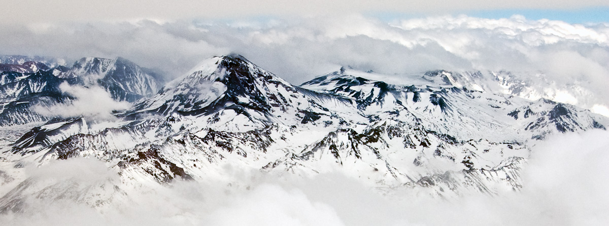
Cerro El Plata is a mountain summit in Argentina. Description Cerro El Plata is the highest peak of the Cordón del Plata which is a subrange of the Andes. The mountain is located southeast of Aconcagua and west of the provincial capital, the city of Mendoza. Precipitation runoff from the mountains drains into the Mendoza River watershed. Topographic relief is significant as the west slope rises 2,170 meters (7,120 feet) in four kilometers (2.5 miles). The Spanish toponym "Cerro El Plata" translates to Silver Peak. The first ascent of the summit was made by Hans Stepanek on January 21, 1925. Climate According to the Köppen climate classification system, Cerro El Plata is located in a Tundra climate The tundra climate is a polar climate sub-type located in high latitudes and high mountains. It is classified as ET according to the Köppen climate classification. It is a climate which at least one month has an average temperature high enough ... zone ... [...More Info...] [...Related Items...] OR: [Wikipedia] [Google] [Baidu] |
Tupungato
Tupungato, one of the highest mountains in the Americas, is a massive Andes, Andean lava dome dating to Pleistocene times. It lies on the Argentina–Chile border, between the Chilean Metropolitan Region (near a major international highway about east of Santiago, Chile, Santiago) and the Argentina, Argentine province of Mendoza province, Mendoza, about south of Aconcagua, the highest peak of both the Southern Hemisphere, Southern and Western Hemisphere, Western hemispheres. Immediately to its southwest is the active Tupungatito volcano (literally, ''little Tupungato''), which last erupted in 1987. Tupungato Department, an important Argentine wine-producing region in Mendoza province, is named for the volcano. Recent Chilean mapping indicates it has a summit elevation of 6635 m. 1947 plane crash On 2 August 1947, the airliner ''Star Dust (aircraft), Star Dust'', an Avro Lancastrian carrying six passengers and five crew over the Andes range, crashed into a steep glacier hi ... [...More Info...] [...Related Items...] OR: [Wikipedia] [Google] [Baidu] |
Mendoza River
The Mendoza River is a river in the provinces of Argentina, province of Mendoza Province, Mendoza, Argentina.Argentina Turística - Mendoza - Circuitos Turísticos It is formed in the Andes range between the Aconcagua and the Tupungato, by the confluence of the Vacas River, Vacas, the Cuevas River, Cuevas and the Tupungato River, Tupungato rivers, the last being its major tributary. Course The upper valley of the Mendoza begins at around above mean sea level, and it is U-shaped, of glacier, glacial origin. The river reaches Uspallata, then crosses the Precordillera through the Potrerillos, Mendoza, Potrerillos Valley, flows along the Cacheuta Canyon and reaches the plain. It forms an arc and turns northeast, finally emptying into the ', which join the ...[...More Info...] [...Related Items...] OR: [Wikipedia] [Google] [Baidu] |


