|
Carvolth Exchange
Carvolth Exchange is a bus loop and park and ride facility serving northwestern Langley Township, British Columbia, Canada. TransLink is the primary operator of the exchange, with routes to Surrey City Centre, New Westminster, Burnaby, Maple Ridge and Langley City, which provide connections to SkyTrain and the West Coast Express rail services for travel towards Vancouver. A single BC Transit route is also operated with service to Abbotsford, Chilliwack Chilliwack ( )( hur, Ts'elxwéyeqw) is a city in the province of British Columbia, Canada. Chilliwack is surrounded by mountains and home to recreational areas such as Cultus Lake and Chilliwack Lake Provincial Parks. There are numerous outdoor ... and Burnaby. History The exchange opened on December 1, 2012, coinciding with the opening of the second Port Mann Bridge. Prior to opening, the area was served by the Walnut Grove Park and Ride. On April 6, 2015, the Chilliwack Transit System began operating the 66 Fraser Val ... [...More Info...] [...Related Items...] OR: [Wikipedia] [Google] [Baidu] |
Langley, British Columbia (district Municipality)
The Township of Langley is a district municipality immediately east of the City of Surrey in southwestern British Columbia, Canada. It extends south from the Fraser River to the Canada–United States border, and west of the City of Abbotsford. Langley Township is not to be confused with the City of Langley, which is adjacent to the township but politically is a separate entity. Langley is located in the eastern part of Metro Vancouver. History First Nations Throughout the last several millennia, the area that is now Langley Township was inhabited by various Stó:lo nations, including the Katzie and Kwantlen. There is limited recorded history from this time, as much was passed down through oral tradition rather than written documents. The Kwantlen were a major factor in the salmon trade that later operated out of the Fort Langley. Simon Fraser, while traveling through the Sto:lo territory in 1808 recorded the image of a Kwantlen village: Their houses are built of c ... [...More Info...] [...Related Items...] OR: [Wikipedia] [Google] [Baidu] |
Abbotsford, British Columbia
Abbotsford is a city located in British Columbia, adjacent to the Canada–United States border, Greater Vancouver and the Fraser River. With an estimated population of 153,524 people it is the largest municipality in the province outside metropolitan Vancouver. Abbotsford-Mission has the third highest proportion of visible minorities among census metropolitan areas in Canada, after the Greater Toronto Area and the Greater Vancouver CMA. It is home to Tradex, the University of the Fraser Valley, and Abbotsford International Airport. As of the 2021 census, it is the largest municipality of the Fraser Valley Regional District and the fifth-largest municipality of British Columbia. The Abbotsford–Mission metropolitan area of around 195,726 inhabitants as of the 2021 census is the 23rd largest census metropolitan area in Canada. It has also been named by Statistics Canada as Canada's most generous city in terms of charitable donations for nine straight years. The community ... [...More Info...] [...Related Items...] OR: [Wikipedia] [Google] [Baidu] |
TransLink (British Columbia) Bus Stations
Translink (or TransLink) may refer to: * TransLink (British Columbia), the public transport operator in Vancouver, Canada * Translink (Northern Ireland) Translink is the brand name of the Northern Ireland Transport Holding Company (NITHCo), a public corporation in Northern Ireland which provides the public transport in the region. NI Railways, Ulsterbus and Metro are all part of Translink. It ..., the public transport operator in Northern Ireland * Translink (Queensland), the public transport operator in Queensland, Australia {{disambiguation ... [...More Info...] [...Related Items...] OR: [Wikipedia] [Google] [Baidu] |
List Of Bus Routes In Metro Vancouver
The following list of current bus routes in Metro Vancouver is sorted by region and route number. Routes with trolleybuses, articulated buses or suburban highway buses are noted as such. All route destination names are based on the official TransLink bus schedules. All routes are operated by Coast Mountain Bus Company except: * Routes 214 (off-peak only), 215, 226, 227, 250–256, 258 and 262 (operated by West Vancouver Blue Bus) * Routes 280–282, 370, 372, and 560–564 (operated by First Transit) This list is effective as of the service changes on January 2, 2023. Notes and explanations General notes Tag legend * Bus/route types: ** ''(default)'' – Operates mostly or always with buses ** – Operates mostly or always with trolley buses (or with addition of ) ** – Operates mostly or always with highway coach buses ** – Operates mostly or always with community shuttle minibuses ** – Operates mostly or always with articulated buses ** – Operates ... [...More Info...] [...Related Items...] OR: [Wikipedia] [Google] [Baidu] |
HandyDART
HandyDART is an accessible transit service in British Columbia that uses vans or small buses to transport disabled or elderly passengers who cannot use the normal transit system. This service provides door-to-door service and is available in all of the province's larger centres, as well as in many smaller communities. BC Transit BC Transit operates 16 Custom Transit (handyDART) Systems * Alberni-Clayoquot * Campbell River * Central Fraser Valley * Chilliwack * Cranbrook * Kamloops * Kelowna Regional * Kitimat * Kootenay Boundary * Nanaimo Regional * Penticton * Prince George Prince George may refer to: People British princes * George Plantagenet, Duke of Clarence (1449-1478), middle brother of Edward IV and Richard III. * Prince George Augustus, later George II of Great Britain (1683–1760) * Prince George Will ... * Prince Rupert * Vernon Regional * Victoria Regional * West Kootenay Metro Vancouver In Metro Vancouver the current contractor for HandyDART servic ... [...More Info...] [...Related Items...] OR: [Wikipedia] [Google] [Baidu] |
Lougheed Station
Lougheed Town Centre (sometimes abbreviated as Lougheed) is an elevated station on the Expo and Millennium Lines of Metro Vancouver's SkyTrain rapid transit system. The station is located at Lougheed Highway and Austin Road in Burnaby, British Columbia, Canada. Initially a Millennium Line station, a reorganization of SkyTrain service patterns in 2016 brought a branch of the Expo Line over the existing tracks to serve the station. It is one of three stations where transfer between the Expo Line and the Millennium Line is possible, the other two such points of transfer being Commercial–Broadway and Production Way–University stations. The station is adjacent to a mid-size shopping mall, the City of Lougheed, formerly named "Lougheed Town Centre", from which the station drew its name. A Korean neighbourhood exists within walking distance of the south side of the station. History Lougheed Town Centre station was opened in 2002 as part of the original Millennium Line project. T ... [...More Info...] [...Related Items...] OR: [Wikipedia] [Google] [Baidu] |
22nd Street Station (TransLink)
22nd Street is an elevated station on the Expo Line of Metro Vancouver's SkyTrain rapid transit system. It is located on 7th Avenue and 22nd Street in the Connaught Heights neighbourhood of New Westminster, British Columbia, Canada. Due to its proximity to the Queensborough interchange, where the Queensborough Bridge meets with Stewardson and Marine Ways, the station serves as a hub for regional bus routes. History 22nd Street station was opened in 1985 as part of the original SkyTrain system (now known as the Expo Line). The Austrian architecture firm Architektengruppe U-Bahn was responsible for designing the station. In 2002, Millennium Line service was introduced to the station, which provided outbound service to VCC–Clark station (originally Commercial Drive) via Columbia station in New Westminster. This service was discontinued and replaced with an Expo Line branch to Production Way–University station in 2016. In February 2019, upgrades began on the station's bus ex ... [...More Info...] [...Related Items...] OR: [Wikipedia] [Google] [Baidu] |
Surrey Central Station
Surrey Central is an elevated station on the Expo Line of Metro Vancouver's SkyTrain rapid transit system. The station is located in the Whalley / City Centre district of Surrey, British Columbia, Canada, just east of the North Surrey Recreation Centre. The station is within walking distance of the Central City shopping centre, Surrey City Hall, and SFU Surrey, the Surrey campus of Simon Fraser University. History Surrey Central station was opened in 1994 along with two other stations when the Expo Line was extended from Scott Road station farther into Whalley, to the "Surrey City Centre" district. Prior to the opening of the station, there was a bus loop on the site known as "Whalley Exchange", which opened in 1975. The station was briefly known as "Whalley Central" during planning; however, the name "Surrey Central" was chosen after an ad was placed in the local paper calling on residents to propose an appropriate name. Over the years, the station has earned a reputat ... [...More Info...] [...Related Items...] OR: [Wikipedia] [Google] [Baidu] |
Langley Centre
Langley Centre is an on-street bus exchange located in downtown Langley City, British Columbia, Canada. As part of the TransLink system, it serves the municipalities of Langley City and Langley Township with routes to Surrey, Maple Ridge, and White Rock, that provide connections to SkyTrain and the West Coast Express rail services for travel towards Vancouver. Structure and location The exchange opened on October 31, 1975, and is located on the curb lanes at the intersection of Glover Road and Logan Avenue in Langley City. It is not separated from regular traffic and can accommodate regular-length diesel buses and smaller community shuttles. Beside the exchange is the Rainbow Mall, a small shopping complex. It is less than a kilometre from the main commercial centre of Langley City on Fraser Highway, and a few kilometres from Langley's largest shopping mall, Willowbrook Shopping Centre. In 2022, an Expo Line extension from King George station to 203 Street in Langley City ... [...More Info...] [...Related Items...] OR: [Wikipedia] [Google] [Baidu] |
Walnut Grove, British Columbia
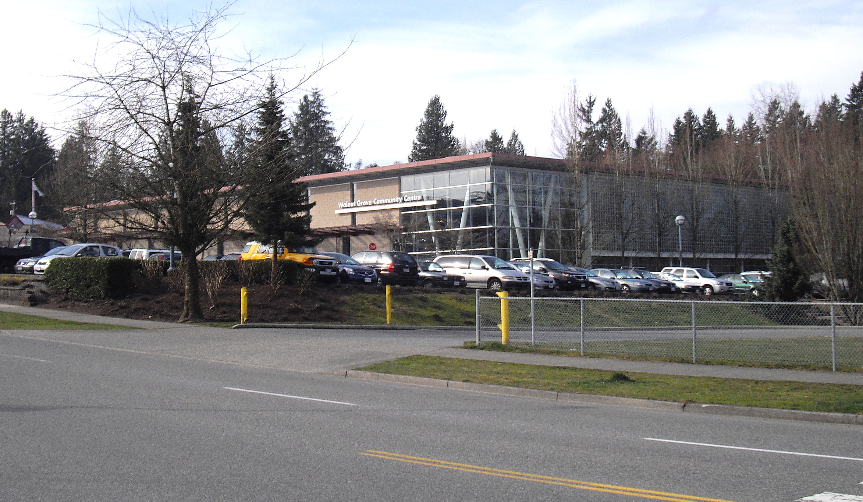
Walnut Grove is a town centre (approx pop. 23,295) located within the Township of Langley, British Columbia. "Walnut Grove" is located at cross roads north of Highway 1. To the north lie the cities of Maple Ridge and Pitt Meadows, connected by the Golden Ears Bridge. To the south is Langley City and Surrey is on the west. East of Walnut Grove lies the historic community of Fort Langley and other cities such as Abbotsford Infrastructure Community Amenities The Walnut Grove Community Centre hosts an olympic sized swimming pool, gymnasiums, meeting rooms, fitness facility, library and skate park. To the north of the community centre is a full sized running track, adjacent to the high school. Fire Hall There is full-time fire protection provided by the Township of Langley Fire Hall 8 Policing As with other town centres in Langley, policing is provided by the Royal Canadian Mounted Police. A community police station is located in a strip mall in Walnut Grove. Health Care The ... [...More Info...] [...Related Items...] OR: [Wikipedia] [Google] [Baidu] |
Lougheed Town Centre Station
Lougheed Town Centre (sometimes abbreviated as Lougheed) is an elevated station on the Expo and Millennium Lines of Metro Vancouver's SkyTrain rapid transit system. The station is located at Lougheed Highway and Austin Road in Burnaby, British Columbia, Canada. Initially a Millennium Line station, a reorganization of SkyTrain service patterns in 2016 brought a branch of the Expo Line over the existing tracks to serve the station. It is one of three stations where transfer between the Expo Line and the Millennium Line is possible, the other two such points of transfer being Commercial–Broadway and Production Way–University stations. The station is adjacent to a mid-size shopping mall, the City of Lougheed, formerly named "Lougheed Town Centre", from which the station drew its name. A Korean neighbourhood exists within walking distance of the south side of the station. History Lougheed Town Centre station was opened in 2002 as part of the original Millennium Line project. ... [...More Info...] [...Related Items...] OR: [Wikipedia] [Google] [Baidu] |


