|
Cape Donington
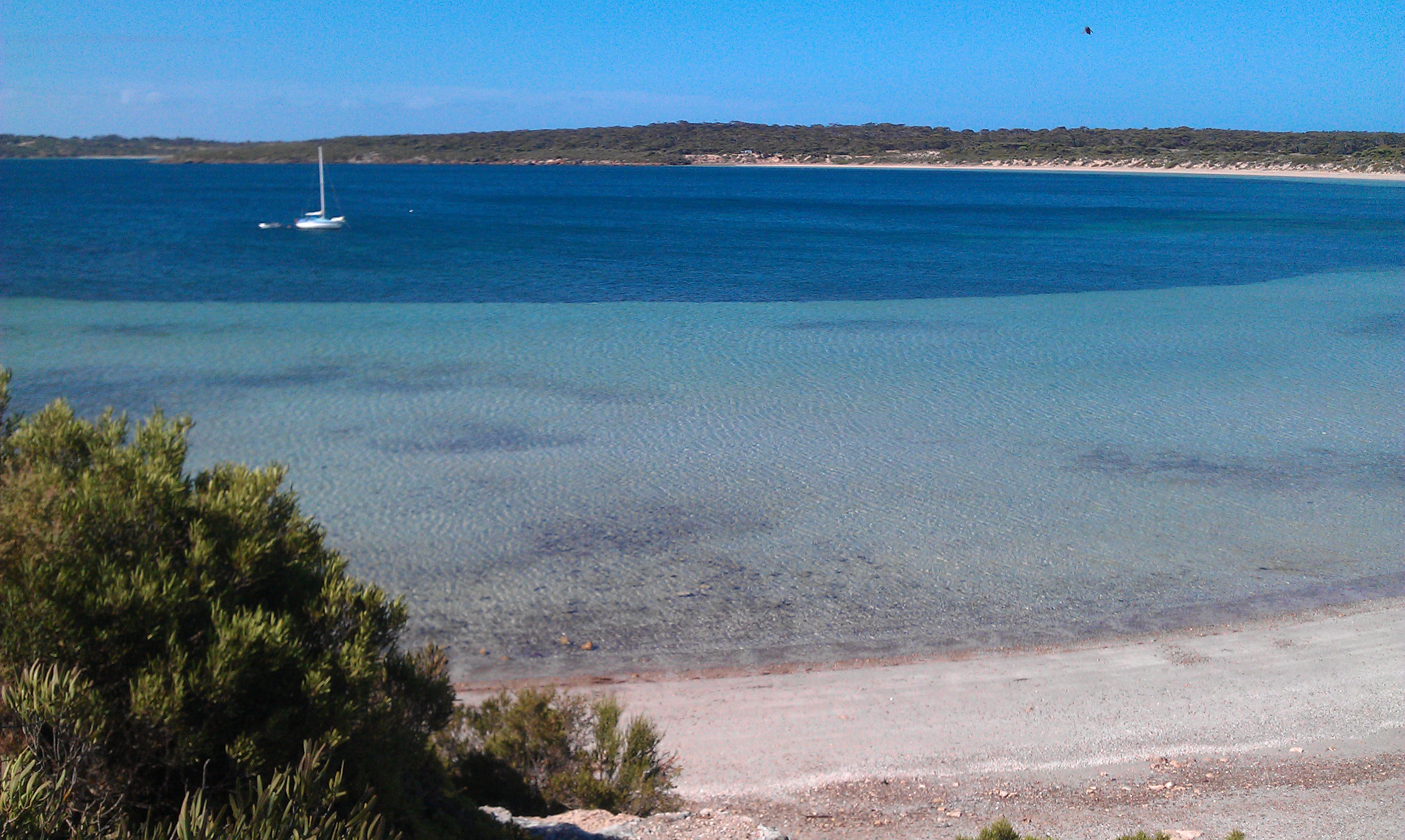
Cape Donington is a headland in the Australian state of South Australia located at the most northerly part of the Jussieu Peninsula on the east coast of Eyre Peninsula in about east of the city of Port Lincoln. It is the southern entrance point for the natural harbour known as Port Lincoln. The cape is described by one source as being "the Nrthextremity of a peninsula which extends Nrthfrom the coast", that "this extension forms the E stside of Spalding Cove" and that "about SuthW stof the cape, the land rises to a wooded summit, high." It was named by the Royal Navy officer, Matthew Flinders, on 25 February 1802 reportedly after "his native village in Lincolnshire". The land around Cape Donington was first used for agricultural purposes in 1875. A navigation aid consisting of a light was installed in 1905 and was subsequently replaced by a lighthouse. After 1972, the land was added to the Lincoln National Park with a parcel of land sized at being leased to the Au ... [...More Info...] [...Related Items...] OR: [Wikipedia] [Google] [Baidu] |
Port Lincoln, South Australia
Port Lincoln is a town on the Lower Eyre Peninsula in the Australian state of South Australia. It is situated on the shore of Boston Bay, which opens eastward into Spencer Gulf. It is the largest city in the West Coast region, and is located approximately 280 km as the crow flies from the State's capital city of Adelaide (646 km by road). In June 2019 Port Lincoln had an estimated population of 16,418, having grown at an average annual rate of 0.55% year-on-year over the preceding five years. The city is reputed to have the most millionaires per capita in Australia, as well as claiming to be Australia's "Seafood Capital". History and name The Eyre Peninsula has been home to Aboriginal people for over 40 thousand years, with the Barngarla (eastern Eyre, including Port Lincoln), Nauo (south western Eyre), Wirangu (north western Eyre) and Mirning (far western Eyre) being the predominant original cultural groups present at the time of the arrival of Europeans. The ori ... [...More Info...] [...Related Items...] OR: [Wikipedia] [Google] [Baidu] |
South Australia
South Australia (commonly abbreviated as SA) is a state in the southern central part of Australia. It covers some of the most arid parts of the country. With a total land area of , it is the fourth-largest of Australia's states and territories by area, and second smallest state by population. It has a total of 1.8 million people. Its population is the second most highly centralised in Australia, after Western Australia, with more than 77 percent of South Australians living in the capital Adelaide, or its environs. Other population centres in the state are relatively small; Mount Gambier, the second-largest centre, has a population of 33,233. South Australia shares borders with all of the other mainland states, as well as the Northern Territory; it is bordered to the west by Western Australia, to the north by the Northern Territory, to the north-east by Queensland, to the east by New South Wales, to the south-east by Victoria, and to the south by the Great Australian Bight.M ... [...More Info...] [...Related Items...] OR: [Wikipedia] [Google] [Baidu] |
Jussieu Peninsula
__NOTOC__ Jussieu Peninsula is a peninsula located at the south east end of Eyre Peninsula in South Australia. It is bounded by Proper Bay and Spalding Cove within the natural harbour known as Port Lincoln to the north, Spencer Gulf to the east and the Great Australian Bight to the south. While it was first explored and mapped by Matthew Flinders during February 1802, Flinders did not name it. In 1913, the name proposed by François Péron and Louis de Freycinet from Baudin's expedition when it visited later in 1802 was declared as the peninsula's official name by the Government of South Australia. Jussieu refers to the French botanist, Antoine Laurent de Jussieu. While parts of its surface have been cleared and used for agricultural purposes in the past, it is currently occupied by two protected areas: the Lincoln National Park and the Memory Cove Wilderness Protection Area. History A shore-based bay whaling station is believed to have operated at Spalding Cove betwe ... [...More Info...] [...Related Items...] OR: [Wikipedia] [Google] [Baidu] |
Eyre Peninsula
The Eyre Peninsula is a triangular peninsula in South Australia. It is bounded by the Spencer Gulf on the east, the Great Australian Bight on the west, and the Gawler Ranges to the north. Originally called Eyre’s Peninsula, it was named after explorer Edward John Eyre, who explored parts of the peninsula in 1839–41. The coastline was first charted by the expeditions of Matthew Flinders in 1801–02 and French explorer Nicolas Baudin around the same time. Flinders also named the nearby Yorke’s Peninsula and Spencer’s Gulph on the same voyage. The peninsula's economy is primarily agricultural, with growing aquaculture, mining, and tourism sectors. The main towns are Port Lincoln in the south, Whyalla and Port Augusta in the northeast, and Ceduna in the northwest. Port Lincoln (''Galinyala'' in Barngarla), Whyalla and Port Augusta (''Goordnada'') are part of the Barngarla Aboriginal country. Ceduna is within the Wirangu country. Naming and extent The peninsula was n ... [...More Info...] [...Related Items...] OR: [Wikipedia] [Google] [Baidu] |
Royal Navy
The Royal Navy (RN) is the United Kingdom's naval warfare force. Although warships were used by English and Scottish kings from the early medieval period, the first major maritime engagements were fought in the Hundred Years' War against France. The modern Royal Navy traces its origins to the early 16th century; the oldest of the UK's armed services, it is consequently known as the Senior Service. From the middle decades of the 17th century, and through the 18th century, the Royal Navy vied with the Dutch Navy and later with the French Navy for maritime supremacy. From the mid 18th century, it was the world's most powerful navy until the Second World War. The Royal Navy played a key part in establishing and defending the British Empire, and four Imperial fortress colonies and a string of imperial bases and coaling stations secured the Royal Navy's ability to assert naval superiority globally. Owing to this historical prominence, it is common, even among non-Britons, to ref ... [...More Info...] [...Related Items...] OR: [Wikipedia] [Google] [Baidu] |
Matthew Flinders
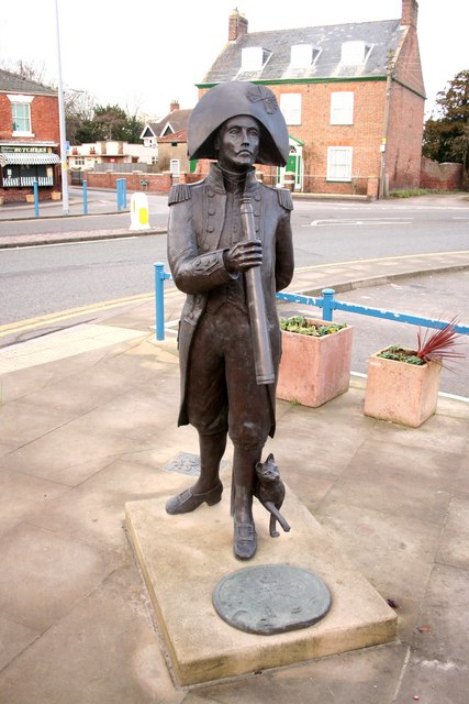
Captain Matthew Flinders (16 March 1774 – 19 July 1814) was a British navigator and cartographer who led the first inshore circumnavigation of mainland Australia, then called New Holland. He is also credited as being the first person to utilise the name ''Australia'' to describe the entirety of that continent including Van Diemen's Land (now Tasmania), a title he regarded as being "more agreeable to the ear" than previous names such as ''Terra Australis''. Flinders was involved in several voyages of discovery between 1791 and 1803, the most famous of which are the circumnavigation of Australia and an earlier expedition when he and George Bass confirmed that Van Diemen's Land was an island. While returning to Britain in 1803, Flinders was arrested by the French governor at Isle de France (Mauritius). Although Britain and France were at war, Flinders thought the scientific nature of his work would ensure safe passage, but he remained under arrest for more than six years. In ... [...More Info...] [...Related Items...] OR: [Wikipedia] [Google] [Baidu] |
Lincolnshire
Lincolnshire (abbreviated Lincs.) is a county in the East Midlands of England, with a long coastline on the North Sea to the east. It borders Norfolk to the south-east, Cambridgeshire to the south, Rutland to the south-west, Leicestershire and Nottinghamshire to the west, South Yorkshire to the north-west, and the East Riding of Yorkshire to the north. It also borders Northamptonshire in the south for just , England's shortest county boundary. The county town is Lincoln, where the county council is also based. The ceremonial county of Lincolnshire consists of the non-metropolitan county of Lincolnshire and the area covered by the unitary authorities of North Lincolnshire and North East Lincolnshire. Part of the ceremonial county is in the Yorkshire and the Humber region of England, and most is in the East Midlands region. The county is the second-largest of the English ceremonial counties and one that is predominantly agricultural in land use. The county is fourth-larg ... [...More Info...] [...Related Items...] OR: [Wikipedia] [Google] [Baidu] |
Navigation Aid
Navigation is a field of study that focuses on the process of monitoring and controlling the movement of a craft or vehicle from one place to another.Bowditch, 2003:799. The field of navigation includes four general categories: land navigation, marine navigation, aeronautic navigation, and space navigation. It is also the term of art used for the specialized knowledge used by navigators to perform navigation tasks. All navigational techniques involve locating the navigator's position compared to known locations or patterns. Navigation, in a broader sense, can refer to any skill or study that involves the determination of position and direction. In this sense, navigation includes orienteering and pedestrian navigation. History In the European medieval period, navigation was considered part of the set of '' seven mechanical arts'', none of which were used for long voyages across open ocean. Polynesian navigation is probably the earliest form of open-ocean navigation; it was b ... [...More Info...] [...Related Items...] OR: [Wikipedia] [Google] [Baidu] |
Lincoln National Park
Lincoln National Park is a protected area in the Australian state of South Australia located about west of the state capital of Adelaide and about south of the municipal seat of Port Lincoln. It consists of a mainland area on the Jussieu Peninsula on the south eastern tip of Eyre Peninsula and a number of nearby islands. The national park contains significant sites of natural, indigenous and early European heritage. Description Lincoln National Park is located on the Jussieu Peninsula on the south-eastern tip of Eyre Peninsula in South Australia as well as an adjoining portion of Eyre Peninsula and a number of islands adjoining the coastline. The part of the national park located on Jussieu Peninsula is located within the gazetted localities of Lincoln National Park and Sleaford. Jussieu Peninsula Lincoln National Park occupies the majority of Jussieu Peninsula. The remainder of the Jussieu Peninsula is occupied by the Memory Cove Wilderness Protection Area. The wester ... [...More Info...] [...Related Items...] OR: [Wikipedia] [Google] [Baidu] |
Australian Maritime Safety Authority
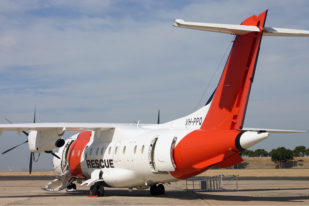
Australian Maritime Safety Authority (AMSA) is an Australian statutory authority responsible for the regulation and safety oversight of Australia's shipping fleet and management of Australia's international maritime obligations. The authority has jurisdiction over Australia's exclusive economic zone which covers an area of . AMSA maintains Australia's shipping registries: the generalAMSARegister a vessel/ref> and the international shipping registers.AMSAAustralian international shipping register/ref> AMSA was established in 1990 under the ''Australian Maritime Safety Authority Act 1990'' and governed by the ''Commonwealth Authorities and Companies Act 1997''. AMSA is an agency within the Department of Infrastructure and Transport. Directors are appointed by the minister. The international treaties which AMSA administers include the ''Navigation Act 2012'' and the ''Protection of the Sea (Prevention of Pollution from Ships) Act 1983''. Organised sea rescue in Australia was ... [...More Info...] [...Related Items...] OR: [Wikipedia] [Google] [Baidu] |
Donington, Lincolnshire
__NOTOC__ Donington is a large village and civil parish in the South Holland district of Lincolnshire, England. It is north from the market town of Spalding on the A152, is bypassed by the A52, and sits between the A16 and A17. The parish includes the hamlet of Northorpe, and falls within the drainage area of the Black Sluice Internal Drainage Board. Donington is the birthplace of the explorer Matthew Flinders. History Donington was large enough in the C18th to attract the travelling theatrical companies. In 1784 Mathew Flinders, father of the famous navigator, wrote 'in the latter half of October and beginning of November we have a small Company of Comedians with us. I went 3 or 4 times and once or twice was tolerably entertained'. Governance As well as having its own parish council, Donington is part of the electoral ward of Donington, Quadring and Gosberton within the South Holland district of Lincolnshire. The total population of the ward taken at the 2011 census was 7, ... [...More Info...] [...Related Items...] OR: [Wikipedia] [Google] [Baidu] |
Headlands Of South Australia
A headland, also known as a head, is a coastal landform, a point of land usually high and often with a sheer drop, that extends into a body of water. It is a type of promontory. A headland of considerable size often is called a cape.Whittow, John (1984). ''Dictionary of Physical Geography''. London: Penguin, 1984, pp. 80, 246. . Headlands are characterised by high, breaking waves, rocky shores, intense erosion, and steep sea cliff. Headlands and bays are often found on the same coastline. A bay is flanked by land on three sides, whereas a headland is flanked by water on three sides. Headlands and bays form on discordant coastlines, where bands of rock of alternating resistance run perpendicular to the coast. Bays form when weak (less resistant) rocks (such as sands and clays) are eroded, leaving bands of stronger (more resistant) rocks (such as chalk, limestone, and granite) forming a headland, or peninsula. Through the deposition of sediment within the bay and the erosion of the ... [...More Info...] [...Related Items...] OR: [Wikipedia] [Google] [Baidu] |


