|
Canterbury (district)
The City of Canterbury () is a local government district with city status in Kent, England. As well as Canterbury itself, the district extends north to the coastal towns of Whistable and Herne Bay. History The district was formed on 1 April 1974 by the merger of the existing city of Canterbury with the Whitstable and Herne Bay Urban Districts, and Bridge-Blean Rural District. The latter district entirely surrounded the city; the urban districts occupied the coastal area to the north. Politics Elections for to all seats on the city council are held every four years. After being under no overall control for a number of years, the Conservative party gained a majority in 2005 following a by election and defection from the Liberal Democrats. Following the 2019 United Kingdom local elections the political composition of Canterbury council is as follows (2017 results follows by-elections): Meeting place After the Church of the Holy Cross, which was commissioned by Archbishop ... [...More Info...] [...Related Items...] OR: [Wikipedia] [Google] [Baidu] |
Greenwich Mean Time
Greenwich Mean Time (GMT) is the Local mean time, mean solar time at the Royal Observatory, Greenwich, Royal Observatory in Greenwich, London, counted from midnight. At different times in the past, it has been calculated in different ways, including being calculated from noon; as a consequence, it cannot be used to specify a particular time unless a context is given. The term 'GMT' is also used as Western European Time, one of the names for the time zone UTC+00:00 and, in UK law, is the basis for civil time in the United Kingdom. English speakers often use GMT as a synonym for Coordinated Universal Time (UTC). For navigation, it is considered equivalent to UT1 (the modern form of mean solar time at 0° longitude); but this meaning can differ from UTC by up to 0.9s. The term GMT should thus not be used for purposes that require precision. Because of Earth's uneven angular velocity in its elliptical orbit and its axial tilt, noon (12:00:00) GMT is rarely the exact moment the S ... [...More Info...] [...Related Items...] OR: [Wikipedia] [Google] [Baidu] |
Canterbury
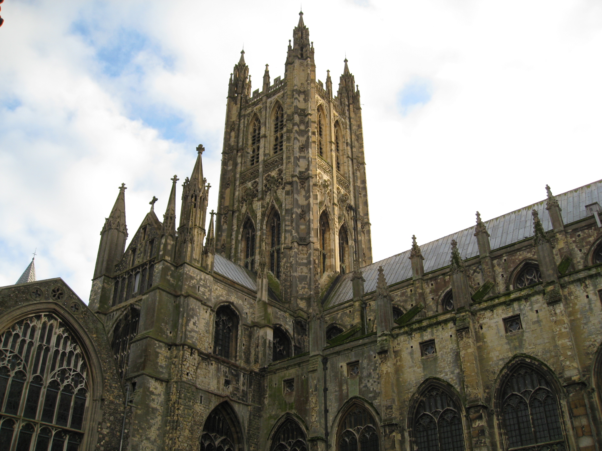
Canterbury (, ) is a City status in the United Kingdom, cathedral city and UNESCO World Heritage Site, situated in the heart of the City of Canterbury local government district of Kent, England. It lies on the River Stour, Kent, River Stour. The Archbishop of Canterbury is the primate (bishop), primate of the Church of England and the worldwide Anglican Communion owing to the importance of Augustine of Canterbury, St Augustine, who served as the apostle to the Anglo-Saxon paganism, pagan Kingdom of Kent around the turn of the 7th century. The city's Canterbury Cathedral, cathedral became a major focus of Christian pilgrimage, pilgrimage following the 1170 Martyr of the Faith, martyrdom of Thomas Becket, although it had already been a well-trodden pilgrim destination since the murder of Ælfheah of Canterbury, St Alphege by the men of cnut, King Canute in 1012. A journey of pilgrims to Becket's shrine served as the narrative frame, frame for Geoffrey Chaucer's 14th-century Wes ... [...More Info...] [...Related Items...] OR: [Wikipedia] [Google] [Baidu] |
List Of Mayors Of Canterbury
Canterbury was granted a city charter in 1448 which gave it the right to have a mayor and a sheriff. The city's web site records that King Henry VI decreed that the City should be "of one Mayor and one commonalty, wholly corporate for ever". The first mayor elected under royal charter was John Lynde. The responsibilities of mayors have diminished over the years. They were once in charge of keeping the peace, serving as chief magistrate and presiding over the local lawcourt. This caused problems as the mayor could be asked to chair sessions without experience or knowledge of law. The Justices of the Peace Act of 1968 decreed that mayors were no longer entitled to sit as magistrates by virtue of their office alone.www.canterbury.gov.uk, 'The History of Office of Mayor' , consulted 10 January 2010. ... [...More Info...] [...Related Items...] OR: [Wikipedia] [Google] [Baidu] |
Rural District
Rural districts were a type of local government area – now superseded – established at the end of the 19th century in England, Wales, and Ireland for the administration of predominantly rural areas at a level lower than that of the Administrative county, administrative counties.__TOC__ England and Wales In England and Wales they were created in 1894 (by the Local Government Act 1894) along with Urban district (Great Britain and Ireland), urban districts. They replaced the earlier system of sanitary districts (themselves based on poor law unions, but not replacing them). Rural districts had elected rural district councils (RDCs), which inherited the functions of the earlier sanitary districts, but also had wider authority over matters such as local planning, council house, council housing, and playgrounds and cemeteries. Matters such as education and major roads were the responsibility of county councils. Until 1930 the rural district councillors were also poor law gu ... [...More Info...] [...Related Items...] OR: [Wikipedia] [Google] [Baidu] |
Blean
Blean is a village and civil parish in the City of Canterbury, Canterbury district of Kent, England. The civil parish is large and is mostly woodland, much of which is ancient woodland. The village, developed village within the parish is scattered along the road between Canterbury and Whitstable, in the middle of the Forest of Blean. The parish of St. Cosmus and St. Damian in the Blean was renamed "Blean" on 1 April 2019. History According to Edward Hasted's 1800 county study, the village was once part of the king's ancient forest of Blean in the Hundred (county division), hundred of Westgate. The name Blean is the dative form of the Old English word ‘blea’ which means rough ground. Therefore the name of the parish means "the church of Saints Cosmas and Damian (sic) in the rough ground." In 1835, the Blean Union Workhouse, designed by William Edmunds, was built on four acres south of Herne Common. The design was based on Sir Francis Bond Head , Sir Francis Bond Head's ''Pla ... [...More Info...] [...Related Items...] OR: [Wikipedia] [Google] [Baidu] |
Bridge, Kent
Bridge is a village and civil parish near Canterbury in Kent, South East England. Bridge village is in the Nailbourne valley in a rural setting on the old Roman road, Watling Street, formerly the main road between London and Dover. The village itself is centred 2.5 miles south-east of the city of Canterbury. History It is likely that the parish took its name from "Bregge", a bridge which crossed the river Nailbourne, a tributary of the Stour. The parish church is dedicated to Saint Peter. Geography The village is surrounded by a buffer zone, and is almost entirely residential and agricultural. Its layout is a cross between a linear settlement A linear settlement is a (normally small to medium-sized) settlement or group of buildings that is formed in a long line. Many of these settlements are formed along a transport route, such as a road, river, or canal. Others form due to physical re ... and a clustered settlement. Amenities Bourne Park is a Queen Anne mansion with la ... [...More Info...] [...Related Items...] OR: [Wikipedia] [Google] [Baidu] |
Urban District (Great Britain And Ireland)
In England and Wales, Northern Ireland, and the Republic of Ireland, an urban district was a type of local government district that covered an urbanised area. Urban districts had an elected urban district council (UDC), which shared local government responsibilities with a county council. England and Wales In England and Wales, urban districts and rural districts were created in 1894 (by the Local Government Act 1894) as subdivisions of administrative counties. They replaced the earlier system of urban and rural sanitary districts (based on poor law unions) the functions of which were taken over by the district councils. The district councils also had wider powers over local matters such as parks, cemeteries and local planning. An urban district usually contained a single parish, while a rural district might contain many. Urban districts were considered to have more problems with public health than rural areas, and so urban district councils had more funding and greater power ... [...More Info...] [...Related Items...] OR: [Wikipedia] [Google] [Baidu] |
Herne Bay, Kent
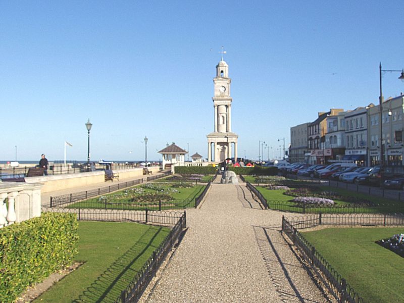
Herne Bay is a seaside town on the north coast of Kent in South East England. It is north of Canterbury and east of Whitstable. It neighbours the ancient villages of Herne and Reculver and is part of the City of Canterbury local government district, although it remains a separate town with countryside between it and Canterbury. Herne Bay's seafront is home to the world's first freestanding purpose-built Clock Tower, built in 1837. From the late Victorian period until 1978, the town had the second-longest pier in the United Kingdom.Herne Bay Pier at www.theheritagetrail.co.uk (accessed 7 July 2008) The town began as a small shipping community, receiving goods and passengers from London en route to Canterbury and |
Whitstable
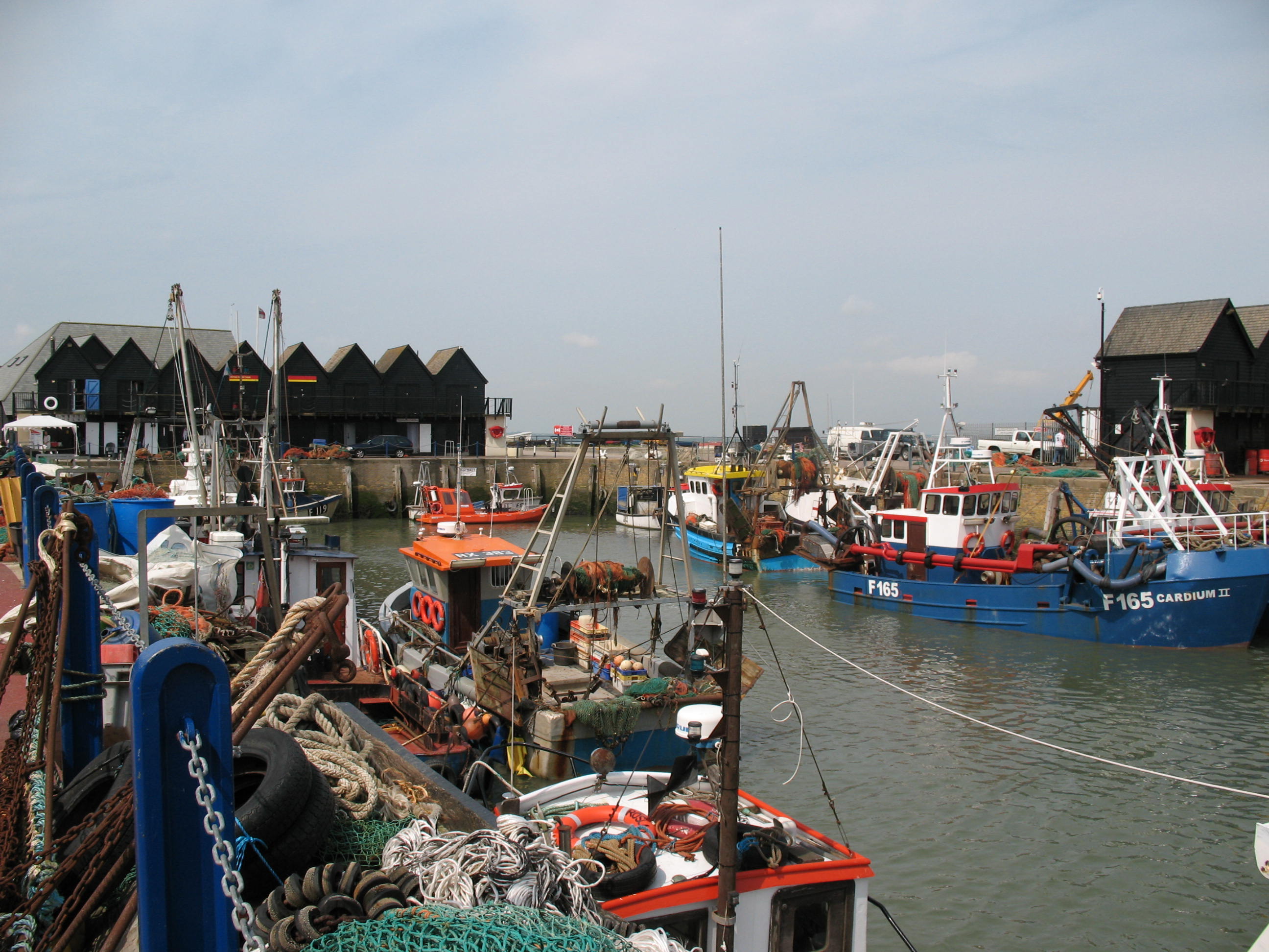
Whitstable () is a town on the north coast of Kent adjoining the convergence of the Swale Estuary and the Greater Thames Estuary in southeastern England, north of Canterbury and west of Herne Bay. The 2011 Census reported a population of 32,100. The town, formerly known as Whitstable-on-Sea, was famous for its 'Native Oysters' which were collected from beds beyond the low water mark from Roman times until the mid-20th century. The annual Whitstable Oyster Festival takes place during the summer. In 1830, one of the earliest passenger railway services was opened by the Canterbury and Whitstable Railway Company. In 1832 the company built a harbour and extended the line to handle coal and other bulk cargos for the City of Canterbury. The railway has closed but the harbour still plays an important role in the town's economy. The railway route, known as The Crab and Winkle Line, is now a cycle path which leads to the neighbouring city of Canterbury. History Archaeological finds ... [...More Info...] [...Related Items...] OR: [Wikipedia] [Google] [Baidu] |
List Of Cities In The United Kingdom
This is a list of cities in the United Kingdom that are officially designated such . It lists those places that have been granted city status by letters patent or royal charter. There are currently a total of 76 such cities in the United Kingdom: 55 in England, eight in Scotland, seven in Wales, and six in Northern Ireland.Department for Culture, Media and Sport.Civic Honours Competition: UK Cities. The National Archives (United Kingdom), 18 January 2011. Accessed 17 December 2018. Of these, 23 in England, two in Wales, and two in Northern Ireland have Lord Mayors; four in Scotland have Lord Provosts. In some cases, the area holding city status does not coincide with the built up area or conurbation of which it forms part. In Greater London, for example, the City of London and that of Westminster each hold city status separately but no other local authority has been granted city status, nor has Greater London as a whole. In other cases, such as the Cities of Canterbury and ... [...More Info...] [...Related Items...] OR: [Wikipedia] [Google] [Baidu] |
List Of English Districts By Population
This is a list of the 314 districts of England ordered by population, according to estimated figures for from the Office for National Statistics. The list consists of 188 non-metropolitan districts, 32 London boroughs, 36 metropolitan boroughs, 56 Unitary authorities of England, unitary authorities, and two ''sui generis'' authorities (the City of London and the Isles of Scilly). North Northamptonshire and West Northamptonshire are new unitary authorities from 1 April 2021. See also *List of two-tier counties of England by population *List of ceremonial counties of England by population *List of English districts by area *List of English districts and their ethnic composition *List of English districts by population density *List of districts in south east England by population *List of towns and cities in England by population References {{List of Settlements in the UK Demographics of England Districts of England England geography-related lists, Districts by populat ... [...More Info...] [...Related Items...] OR: [Wikipedia] [Google] [Baidu] |
List Of English Districts By Area
This is a list of districts of England ordered by area, according to Standard Area Measurements published by the Office for National Statistics The Office for National Statistics (ONS; cy, Swyddfa Ystadegau Gwladol) is the executive office of the UK Statistics Authority, a non-ministerial department which reports directly to the UK Parliament. Overview The ONS is responsible for th .... More than 1,000 km2 100–1,000 km2 Less than 100 km2 References {{List of Settlements in the UK Districts by area Districts of England Demographics of England Local government in England ... [...More Info...] [...Related Items...] OR: [Wikipedia] [Google] [Baidu] |


