|
Canaan, Connecticut
Canaan is a town in Litchfield County, Connecticut, United States. The population was 1,080 at the 2020 census, down from 1,234 at the 2010 census. The town of Canaan is often referred to locally by the name of its principal settlement, Falls Village. Geography Canaan is in northwestern Litchfield County; it is bordered to the north by the town of North Canaan, to the east by Norfolk, to the south by Cornwall, and to the west, across the Housatonic River, by Salisbury. It is northwest of Torrington, north of Danbury, and south of Great Barrington, Massachusetts. According to the United States Census Bureau, the town of Canaan has a total area of , of which are land and , or 0.97%, are water. Principal communities * Falls Village (town center) *Huntsville *Lower City *South Canaan History The town was incorporated in 1739. The name "Canaan" is derived from Hebrew. Demographics As of the census of 2000, there were 1,081 people, 445 households, and 298 families residing ... [...More Info...] [...Related Items...] OR: [Wikipedia] [Google] [Baidu] |
Canaan (village), Connecticut
Canaan is a village and census-designated place (CDP) within the town of North Canaan in Litchfield County, Connecticut, United States. Formerly known as Canaan Depot, the village is more commonly known as Canaan Village to distinguish it from the town of Canaan located to the south of North Canaan. The Canaan Village Historic District is listed on the National Register of Historic Places. As of the 2010 census, the CDP had a population of 1,212, out of a total population of 3,315 in the town of North Canaan. The historic district comprises about , covering the central business district and surrounding residences of the village that preserve the period from the mid-19th to early 20th centuries. Canaan village developed as a regional commercial center, first by the construction of the north-south Housatonic Railroad, and then by the arrival of the east-west Connecticut Western Railroad. This junction made the village a major transit point for bringing the area's commercial goods ... [...More Info...] [...Related Items...] OR: [Wikipedia] [Google] [Baidu] |
Geographic Names Information System
The Geographic Names Information System (GNIS) is a database of name and locative information about more than two million physical and cultural features throughout the United States and its territories, Antarctica, and the associated states of the Marshall Islands, Federated States of Micronesia, and Palau. It is a type of gazetteer. It was developed by the United States Geological Survey (USGS) in cooperation with the United States Board on Geographic Names (BGN) to promote the standardization of feature names. Data were collected in two phases. Although a third phase was considered, which would have handled name changes where local usages differed from maps, it was never begun. The database is part of a system that includes topographic map names and bibliographic references. The names of books and historic maps that confirm the feature or place name are cited. Variant names, alternatives to official federal names for a feature, are also recorded. Each feature receives a per ... [...More Info...] [...Related Items...] OR: [Wikipedia] [Google] [Baidu] |
Census
A census is the procedure of systematically acquiring, recording and calculating information about the members of a given population. This term is used mostly in connection with national population and housing censuses; other common censuses include censuses of agriculture, traditional culture, business, supplies, and traffic censuses. The United Nations (UN) defines the essential features of population and housing censuses as "individual enumeration, universality within a defined territory, simultaneity and defined periodicity", and recommends that population censuses be taken at least every ten years. UN recommendations also cover census topics to be collected, official definitions, classifications and other useful information to co-ordinate international practices. The UN's Food and Agriculture Organization (FAO), in turn, defines the census of agriculture as "a statistical operation for collecting, processing and disseminating data on the structure of agriculture, covering th ... [...More Info...] [...Related Items...] OR: [Wikipedia] [Google] [Baidu] |
Canaan
Canaan (; Phoenician: 𐤊𐤍𐤏𐤍 – ; he, כְּנַעַן – , in pausa – ; grc-bib, Χανααν – ;The current scholarly edition of the Greek Old Testament spells the word without any accents, cf. Septuaginta : id est Vetus Testamentum graece iuxta LXX interpretes. 2. ed. / recogn. et emendavit Robert Hanhart. Stuttgart : Dt. Bibelges., 2006 . However, in modern Greek the accentuation is , while the current (28th) scholarly edition of the New Testament has . ar, كَنْعَانُ – ) was a Semitic-speaking civilization and region in the Ancient Near East during the late 2nd millennium BC. Canaan had significant geopolitical importance in the Late Bronze Age Amarna Period (14th century BC) as the area where the spheres of interest of the Egyptian, Hittite, Mitanni and Assyrian Empires converged or overlapped. Much of present-day knowledge about Canaan stems from archaeological excavation in this area at sites such as Tel Hazor, Tel Megiddo, En Esur ... [...More Info...] [...Related Items...] OR: [Wikipedia] [Google] [Baidu] |
Great Barrington, Massachusetts
Great Barrington is a town in Berkshire County, Massachusetts, United States. It is part of the Pittsfield, Massachusetts, Metropolitan Statistical Area. The population was 7,172 at the 2020 census. Both a summer resort and home to Ski Butternut, a ski resort, Great Barrington includes the villages of Van Deusenville and Housatonic. History 1676–1995 The Mahican Indians called the area ''Mahaiwe'', meaning "the place downstream". It lay on the New England Path, which connected Fort Orange near Albany, New York, with Springfield and Massachusetts Bay. The first recorded account of Europeans in the area happened in August 1676, during King Philip's War. Major John Talcott and his troops chased a group of 200 Mahican Natives west from Westfield, eventually overtaking them at the Housatonic River in what is now Great Barrington. According to reports at the time, Talcott's troops killed twenty-five Indians and imprisoned another twenty. Today, a plaque for John Talcott marks t ... [...More Info...] [...Related Items...] OR: [Wikipedia] [Google] [Baidu] |
Danbury, Connecticut
Danbury is a city in Fairfield County, Connecticut, United States, located approximately northeast of New York City. Danbury's population as of 2022 was 87,642. It is the seventh largest city in Connecticut. Danbury is nicknamed the "Hat City" because it was the center of the American hat industry for a period in the nineteenth and early twentieth centuries. The mineral danburite is named for Danbury while the city itself is named for Danbury in Essex, England. Danbury is home to Danbury Hospital, Western Connecticut State University, Danbury Fair Mall and Danbury Municipal Airport. In November 2015, ''USA Today'' ranked Danbury as the second best city to live in the United States. In April 2021, ''WalletHub'' ranked Danbury as the 10th most diverse city in the United States, the most diverse city in New England, and the third most diverse city in the New York metropolitan area (behind Jersey City and New York City). The ranking considers socioeconomic, cultural, economic, ... [...More Info...] [...Related Items...] OR: [Wikipedia] [Google] [Baidu] |
Torrington, Connecticut
Torrington is the most populated municipality and only city in Litchfield County, Connecticut, Litchfield County, Connecticut and the Northwest Hills (Connecticut), Northwest Hills region. It is also the core city of Greater Torrington, one of the largest United States micropolitan area, micropolitan areas in the United States. The city population was 35,515 according to the 2020 United States Census, 2020 census. The city is located roughly west of Hartford, Connecticut, Hartford, southwest of Springfield, Massachusetts, southeast of Albany, New York, northeast of New York City, and west of Boston, Massachusetts. Torrington is a former mill town, as are most other towns along the Naugatuck River Valley. Downtown Torrington is home to thNutmeg Conservatory for the Arts which trains ballet dancers and whose Company performs in the Warner Theatre (Torrington, Connecticut), Warner Theatre, a 1,700-seat auditorium built in 1931 as a movie theater, cinema by the Warner Brothers fil ... [...More Info...] [...Related Items...] OR: [Wikipedia] [Google] [Baidu] |
Salisbury, Connecticut
Salisbury () is a town situated in Litchfield County, Connecticut, United States. The town is the northwesternmost in the state of Connecticut; the Massachusetts-New York-Connecticut tri-state marker is located at the northwest corner of the town. The population was 4,194 at the 2020 census. History Salisbury was established and incorporated in 1741, and contains several historic homes, though some were replaced by larger modern structures in the late 20th century. Salisbury was named for Salisbury, a city in England. Historian Ed Kirby tells that traces of iron were discovered in what was to become Salisbury in 1728, with the discovery of the large deposit at Old Hill (later Ore Hill) in 1731 by John Pell and Ezekiel Ashley. From before the American Revolution, through the Federal Period of the nation, and until around 1920, Salisbury was the seat of an important iron industry. Additional iron mines were opened, mostly in the western end of the town, although historian Diana ... [...More Info...] [...Related Items...] OR: [Wikipedia] [Google] [Baidu] |
Housatonic River
The Housatonic River ( ) is a river, approximately long,U.S. Geological Survey. National Hydrography Dataset high-resolution flowline dataThe National Map , accessed April 1, 2011 in western Massachusetts and western Connecticut in the United States. It flows south to southeast, and drains about of southwestern Connecticut into Long Island Sound. Its Drainage basin, watershed is just to the west of the watershed of the lower Connecticut River. History Indigenous history Indigenous people began using the river area for fishing and hunting at least 6,000 years ago. By 1600, the inhabitants were mostly Mohicans and may have numbered 30,000. The river's name is derived from the Mohican phrase ''"usi-a-di-en-uk"'', translated as "beyond the mountain place" or "river of the mountain place".Housatonic Valley Association. Cornwall Bridge, CT"History of the Housatonic Valley." Accessed 2015-10-1. It is referred to in the deed by which a group of twelve colonists called "The Proprietor ... [...More Info...] [...Related Items...] OR: [Wikipedia] [Google] [Baidu] |
Cornwall, Connecticut
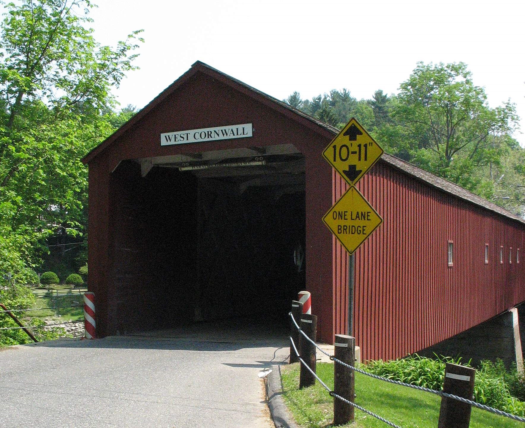
Cornwall is a town in Litchfield County, Connecticut, United States. The population was 1,567 at the 2020 census. History The town of Cornwall, Connecticut, is named after the county of Cornwall, England. The town was incorporated in 1740, nearly four decades before the United States declared its independence. The town encompasses three distinct townships: Cornwall Bridge and West Cornwall, each bordered by the Housatonic River to the west, and Cornwall Village, located three miles east of the river. One significant natural feature is the vast amount of forested land, including hundreds of acres of Mohawk State Forest, resulting in Cornwall often being called “the “Greenest Town in Connecticut”. The proximity of its settlements to the Housatonic River offered an efficient means of transporting materials and goods, which helped stimulate Cornwall's early farming economy as well as assisting in the evolution of business and industry. During the 19th century and the arrival o ... [...More Info...] [...Related Items...] OR: [Wikipedia] [Google] [Baidu] |
Norfolk, Connecticut
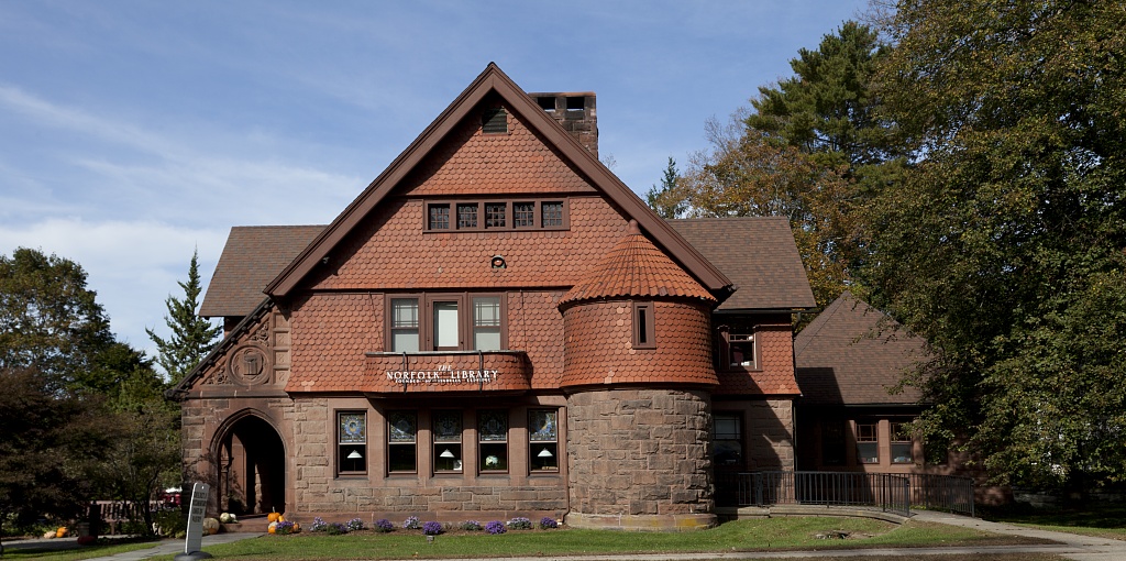
Norfolk () is a town in Litchfield County, Connecticut, United States. The population was 1,588 at the 2020 census. The urban center of the town is the Norfolk census-designated place, with a population of 553 at the 2010 census. Norfolk is perhaps best known as the site of the Yale Summer School of Music— Norfolk Chamber Music Festival, which hosts an annual chamber music concert series in "the Music Shed", a performance hall located on the Ellen Battell Stoeckel estate to the west of the village green. Norfolk has important examples of regional architecture, notably the Village Hall (now Infinity Hall, a shingled 1880s Arts-and-Crafts confection, with an opera house upstairs and storefronts at street level); the Norfolk Library (a shingle-style structure, designed by George Keller, /1889); and over thirty buildings, in a wide variety of styles, designed by Alfredo S. G. Taylor (of the New York firm Taylor & Levi) in the four decades before the Second World War. History ... [...More Info...] [...Related Items...] OR: [Wikipedia] [Google] [Baidu] |
Falls Village, Connecticut
Falls Village is a village and census-designated place in the town of Canaan in Litchfield County, Connecticut, United States. As of the 2010 census it had a population of 538, out of 1,234 in the entire town of Canaan. Because Falls Village is the town center and principal constituent village in Canaan, the entire town is often referred to as "Falls Village". That usage also avoids confusion of the town with Canaan Village in the town of North Canaan, Connecticut, just to the north. Falls Village derives its name from a waterfall, known as Great Falls, on the Housatonic River within the village. The Falls Village post office is assigned ZIP code 06031, which encompasses the entire town of Canaan. Geography Falls Village is on the western side of the town of Canaan in northwestern Connecticut. The western edge of the census-designated place is the Canaan–Salisbury town line following the Housatonic River, it extends north of the village as far as Page Road, and south to a pow ... [...More Info...] [...Related Items...] OR: [Wikipedia] [Google] [Baidu] |


.jpg)


