|
Camden Industrial Area, Minneapolis
Camden Industrial Area is an official neighborhood in the Camden community of Minneapolis. It is located along the west bank of the Mississippi River and includes several industrial businesses, a portion of the North Mississippi Regional Park, a few residents, establishments, and other undeveloped space. Several industrial buildings in the area date to the turn of the 20th century and are now part of the C.A. Smith Lumber Historic District, an important part of North Minneapolis' contributions to the industrial growth of the city. Description and notable features The neighborhood is located in Minneapolis City Council Ward 4, currently represented by Minneapolis City Council member LaTrisha Vetaw. The area is geographically distinct and not part of any other residential neighborhood in the Camden community. The industrial area’s boundaries are 48th Avenue North to the north, Dowling Avenue North to the south, the middle of the Mississippi River to the east, and Lyndale Av ... [...More Info...] [...Related Items...] OR: [Wikipedia] [Google] [Baidu] |
Neighborhoods Of Minneapolis
Minneapolis is officially defined by its city council as divided into 83 neighborhoods. The neighborhoods are historically grouped into 11 communities. Informally, there are city areas with colloquial labels. Residents may also group themselves by their city street suffixes: North, Northeast, South, and Southeast. General areas The local community defines several general areas based on the directional suffixes added to streets in the city. These city areas do not necessarily correlate with official community or neighborhood definitions. Downtown Minneapolis refers to the street grid area aligned on a diagonal with the Mississippi River bend, as opposed to the true north-south grid orientation. The area north of downtown on the west bank of the Mississippi River is considered North Minneapolis. The part of Minneapolis on the east bank of the Mississippi River is divided by East Hennepin Avenue into Northeast and Southeast, approximately aligned with the communities of Northeas ... [...More Info...] [...Related Items...] OR: [Wikipedia] [Google] [Baidu] |
Minneapolis City Council
The Minneapolis City Council is the Legislature, legislative branch of the city of Minneapolis in Minnesota, United States. Comprising 13 members, the council holds the authority to create and modify laws, policies, and ordinances that govern the city. Each member represents one of the 13 wards in Minneapolis, elected for a four-year term. The current council structure has been in place since the 1950s. In recent elections, council membership has been dominated by the Minnesota Democratic–Farmer–Labor Party (DFL). As of 2024, 12 members identified with the DFL, while four identified with Democratic Socialists of America (three members identify as both DFL and DSA). Until the 2021 Minneapolis municipal election, the city's government structure was considered a Weak mayor, weak-mayor, strong-council system. However, a strong-mayor charter amendment was passed, and since 2021, the mayor holds executive power and the council has purely legislative duties. History Pre-charter (185 ... [...More Info...] [...Related Items...] OR: [Wikipedia] [Google] [Baidu] |
Humboldt Industrial Area, Minneapolis
Humboldt Industrial Area is an official neighborhood in the Camden, Minneapolis, Camden community of Minneapolis. It shares a border with Robbinsdale, Minnesota, Robbinsdale to the west and is located roughly between Ryan and Shingle creeks to the north, Humboldt Yard railway tracks to the south, and North Humboldt Avenue to the east. The neighborhood is an industrial park with no official residents, though activities at the area have impact on surrounding residential neighborhoods.Cornwall, Faith (August 2002).Humboldt Industrial Area Community Land Use Plan. Center for Urban and Regional Affairs, University of Minnesota. Retrieved May 22, 2025. History The neighborhood is located in Minneapolis City Council Ward 4, currently represented by Minneapolis City Council member LaTrisha Vetaw. It is officially designated as an industrial employment district with total employment of approximately 500 people.Frenz, Andrew (July 17, 2023).Community Planning and Economic Developmen ... [...More Info...] [...Related Items...] OR: [Wikipedia] [Google] [Baidu] |
History Of Minneapolis
Minneapolis is the largest city by population in the U.S. state of Minnesota, and the county seat of Hennepin County. The origin and growth of the city was spurred by the proximity of Fort Snelling, the first major United States military presence in the area, and by its location on Saint Anthony Falls, which provided power for sawmills and flour mills. Fort Snelling was established in 1819, at the confluence of the Mississippi and Minnesota rivers, and soldiers began using the falls for waterpower. When land became available for settlement, two towns were founded on either side of the falls: Saint Anthony, on the east side, and Minneapolis, on the west side. The two towns later merged into one city in 1872. Early development focused on sawmills, but flour mills eventually became the dominant industry. This industrial development fueled the development of railroads and banks, as well as the foundation of the Minneapolis Grain Exchange. Through innovations in milling techniques, ... [...More Info...] [...Related Items...] OR: [Wikipedia] [Google] [Baidu] |
History Of The Lumber Industry In The United States
The history of the lumber industry in the United States spans from the precolonial period of British timber speculation, subsequent British colonization, and American development into the twenty-first century. Following the near eradication of domestic timber on the British Isles, the abundance of old-growth forests in the New World posed an attractive alternative to importing choice timber from the Baltic via the narrow straits and channels between Denmark and Sweden.Manning 1979, p. 7 The easily available timber proved an incredible resource to early settlers, with both domestic consumption and overseas trade fueling demand. The industry expanded rapidly as Americans logged their way across the country. In this pursuit, hundreds of thousands of indigenous peoples were displaced, murdered, and enslaved for the purpose of the timber industry. By the 1790s, New England was exporting 36 million feet of pine boards and 300 ship masts annually, with over 75 percent coming from Massa ... [...More Info...] [...Related Items...] OR: [Wikipedia] [Google] [Baidu] |
List Of City Of Minneapolis Designated Landmarks
Designated landmarks of the Minneapolis, City of Minneapolis are determined by the Heritage Preservation Commission, which is overseen by the Community Planning & Economic Development (CPED). Many of these landmarks are also listed on the National Register of Historic Places. The City of Minneapolis has over 175 landmarks and 18 historic districts. Heritage Preservation Commission The heritage preservation commission was established by Minnesota Statutes sections 138.71 through 138.75, Minnesota Historic District Act of 1971, and Minnesota Statutes section 471.193, Municipal Heritage Preservation, Code of Ordinance § 599.120 of the Heritage Preservation Ordinance. Criteria Criteria is established in Code of Ordinance § 599.210. List of landmarks Individual landmarks Historic Districts National Historic Districts * Healy Block Residential Historic District, Healy Block Historic District * Milwaukee Avenue Historic District * Minnehaha Park (Minneapolis), Mi ... [...More Info...] [...Related Items...] OR: [Wikipedia] [Google] [Baidu] |
Minneapolis Neighborhood Camden Industrial Area (52082650401)
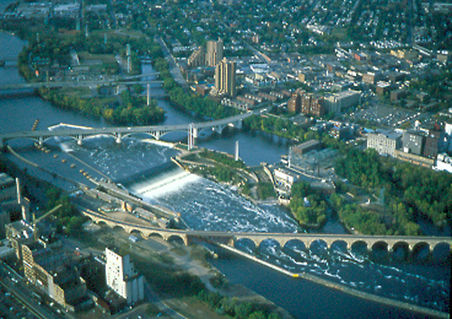
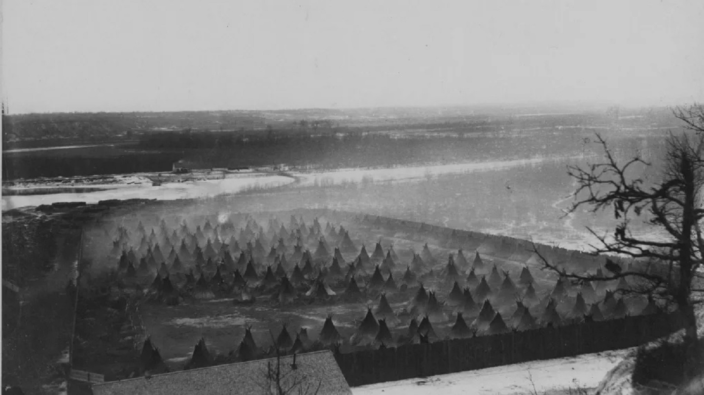
Minneapolis is a city in Hennepin County, Minnesota, United States, and its county seat. With a population of 429,954 as of the 2020 census, it is the state's most populous city. Located in the state's center near the eastern border, it occupies both banks of the Upper Mississippi River and adjoins Saint Paul, the state capital of Minnesota. Minneapolis, Saint Paul, and the surrounding area are collectively known as the Twin Cities, a metropolitan area with 3.69 million residents. Minneapolis is built on an artesian aquifer on flat terrain and is known for cold, snowy winters and hot, humid summers. Nicknamed the "City of Lakes", Minneapolis is abundant in water, with thirteen lakes, wetlands, the Mississippi River, creeks, and waterfalls. The city's public park system is connected by the Grand Rounds National Scenic Byway. Dakota people originally inhabited the site of today's Minneapolis. European colonization and settlement began north of Fort Snelling along Saint Anth ... [...More Info...] [...Related Items...] OR: [Wikipedia] [Google] [Baidu] |
Grand Rounds National Scenic Byway
The Grand Rounds National Scenic Byway is a linked series of park areas in Minneapolis, Minnesota, United States, that takes a roughly circular path through the city. The Minneapolis Park and Recreation Board developed the system over many years. The corridors include roads for automobile traffic plus separate paths for pedestrians and bicycles, and extend slightly into neighboring cities. About of roadway and paths are in the system, and much of it was built in the 1930s as part of Civilian Conservation Corps projects. Byway districts There are seven districts along the byway: #Downtown Riverfront lies along the Mississippi River, and includes Saint Anthony Falls and nearby historic milling districts. The byway follows West River Parkway, beginning at Plymouth Avenue, passing Boom Island Park and Nicollet Island Park (both across the river), and Mill Ruins Park, adjacent to the Mill City Museum and the Stone Arch Bridge. #Mississippi River gorge area extends from downtow ... [...More Info...] [...Related Items...] OR: [Wikipedia] [Google] [Baidu] |
Soo Line Railroad
The Soo Line Railroad is one of the primary United States railroad subsidiaries for the CPKC Railway , one of six U.S. Class I railroads, controlled through the Soo Line Corporation. Although it is named for the Minneapolis, St. Paul and Sault Ste. Marie Railroad (MStP&SSM), which was commonly known as the Soo Line after the phonetic spelling of Sault, it was formed in 1961 by the consolidation of that company with two other CPKC subsidiaries: The Duluth, South Shore and Atlantic Railway, and the Wisconsin Central Railway. It is also the successor to other Class I railroads, including the Minneapolis, Northfield and Southern Railway (acquired 1982) and the Chicago, Milwaukee, St. Paul and Pacific Railroad (Milwaukee Road, acquired at bankruptcy in 1985). On the other hand, a large amount of mileage was spun off in 1987 to Wisconsin Central Ltd., now part of the Canadian National Railway. The Soo Line Railroad and the Delaware and Hudson Railway, CPKC's other major subsidi ... [...More Info...] [...Related Items...] OR: [Wikipedia] [Google] [Baidu] |
Camden Bridge
Camden Bridge is a continuous span plate girder bridge, that spans the Mississippi River in Minneapolis. It connects 42nd Avenue North in the Camden, Minneapolis, Camden community’s Camden Industrial Area, Minneapolis, industrial area on the west side of the river to 37th Avenue Northeast in Northeast Minneapolis on the east side. It also links Webber Parkway (on the west side) to St. Anthony Parkway on the east side, completing a link in the Grand Rounds Scenic Byway. It was built in 1977 and was designed by Jacus Associates Incorporated. The bridge was closed in April 2010 for a six-month resurfacing project and reopened ahead of schedule on August 21, 2010. Image:Camden Bridge 2.jpg, The Camden Bridge at street level, looking east into Northeast Minneapolis See also *List of crossings of the Upper Mississippi River References * Bridges completed in 1977 Bridges in Minneapolis Bridges over the Mississippi River Road bridges in Minnesota Plate girder bridges ... [...More Info...] [...Related Items...] OR: [Wikipedia] [Google] [Baidu] |
Interstate 94 In Minnesota
Interstate 94 (I-94) in the US state of Minnesota runs east–west through the central portion of the state. The highway connects the cities of Moorhead, Fergus Falls, Alexandria, St. Cloud, Minneapolis, and Saint Paul. Authorized in 1956, it was mostly constructed in the 1960s. For its whole length, it runs concurrently with either US Highway 52 (US 52) or US 12. Route description I-94 enters the state from North Dakota at the city of Moorhead and heads southeast after serving Moorhead. Traveling southeast from Moorhead, there are several places where the elevation of I-94 rises slightly; these are "beaches" that formed as the glacial lake rose or fell. Finally, at Rothsay, I-94 climbs the last beach line and enters terrain more typical for Minnesota. From Rothsay to the Twin Cities, the terrain of I-94 is rolling with frequent lakes visible from the highway. I-94 traverses by Fergus Falls, Alexandria, and Sauk Centre on its way to St. Cloud. ... [...More Info...] [...Related Items...] OR: [Wikipedia] [Google] [Baidu] |
Star Tribune
''The Minnesota Star Tribune'', formerly the ''Minneapolis Star Tribune'', is an American daily newspaper based in Minneapolis, Minnesota. As of 2023, it is Minnesota's largest newspaper and the List of newspapers in the United States, seventh-largest in the United States by circulation, and is distributed throughout the Minneapolis–Saint Paul metropolitan area, the state, and the Upper Midwest. It originated as the ''Minneapolis Tribune'' in 1867 and the competing ''Minneapolis Daily Star'' in 1920. During the 1930s and 1940s, the two papers consolidated, with the ''Tribune'' published in the morning and the ''Star'' in the evening. They merged in 1982, creating the ''Minneapolis Star and Tribune'', renamed the ''Star Tribune'' in 1987. After a tumultuous period in which the newspaper was sold and resold and filed for Bankruptcy in the United States, bankruptcy protection in 2009, it was purchased by local billionaire and former Minnesota State Senator Glen Taylor in 2014. I ... [...More Info...] [...Related Items...] OR: [Wikipedia] [Google] [Baidu] |


