|
Calixto García, Cuba
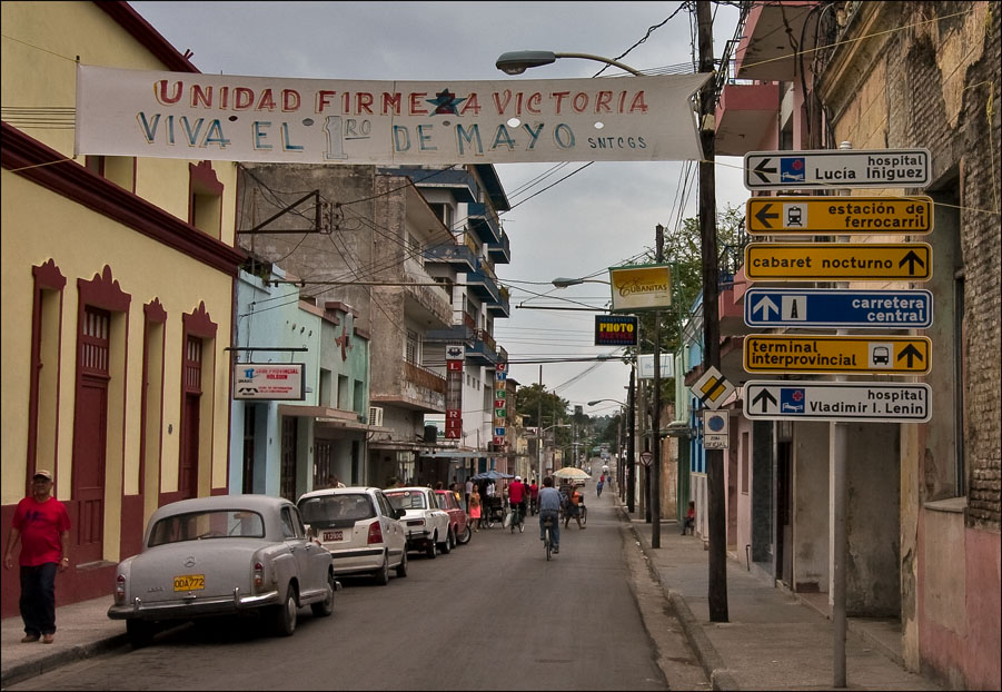
Calixto García () is a municipality in the Holguín Province of Cuba. The municipal seat is located in the town of Buenaventura. The municipality was named for Calixto García Iñiguez, an independence war hero. Geography The municipality includes the town of Buenaventura (municipal seat), the villages of Las Calabazas, Mir, Sabanazo, San Agustín, and other minor localities. Demographics In 2004, the municipality of Calixto Garcia had a population of 57,867. With a total area of , it has a population density of . See also * List of cities in Cuba *Municipalities of Cuba The provinces of Cuba are divided into 168 municipalities or ''municipios''. They were defined by Cuban Law Number 1304 of July 3, 1976Fifth United Nations Conference on the Standardization of Geographical Names, Vol. II, published by the United N ... References External links Populated places in Holguín Province {{Cuba-geo-stub ... [...More Info...] [...Related Items...] OR: [Wikipedia] [Google] [Baidu] |
Municipalities Of Cuba
The Provinces of Cuba, provinces of Cuba are divided into 168 municipality, municipalities or ''municipios''. They were defined by Cuban Law Number 1304 of July 3, 1976Fifth United Nations Conference on the Standardization of Geographical Names, Vol. II, published by the United Nations, New York, 1991 and reformed in 2010 with the abrogation of the municipality of Varadero and the creation of two new provinces: Artemisa Province, Artemisa and Mayabeque Province, Mayabeque in place of former La Habana Province. Summary The municipalities are listed below, by province: List of municipalities Municipal maps The maps below show the municipal subdivision of each province, in yellow, within Cuba. Each provincial capital is shown in red. Artemisa (Cuban municipal map).png, Artemisa Province, Artemisa Camagüey (Cuban municipal map).png, Camagüey Province, Camagüey Ciego de Ávila (Cuban municipal map).png, Ciego de Ávila Province, Ciego de Ávila Cienfuegos (Cuban municipal map). ... [...More Info...] [...Related Items...] OR: [Wikipedia] [Google] [Baidu] |
Jesús Menéndez
Jesús Menéndez also known as Chaparra is a municipality and town in the Las Tunas Province of Cuba. It was named after the Cuban trade unionist . Demographics In 2004, the municipality of Jesús Menéndez had a population of 51,002. With a total area of , it has a population density of . See also *Municipalities of Cuba The provinces of Cuba are divided into 168 municipalities or ''municipios''. They were defined by Cuban Law Number 1304 of July 3, 1976Fifth United Nations Conference on the Standardization of Geographical Names, Vol. II, published by the United N ... * List of cities in Cuba References External links Populated places in Las Tunas Province {{Cuba-geo-stub ... [...More Info...] [...Related Items...] OR: [Wikipedia] [Google] [Baidu] |
Granma Province
Granma is one of the provinces of Cuba. Its capital is Bayamo. Other towns include Manzanillo (a port on the Gulf of Guacanayabo) and Pilón. History The province takes its name from the yacht '' Granma'', used by Che Guevara and Fidel Castro to land in Cuba with 82 guerrillas on December 2, 1956; until 1976 the area formed part of Santiago de Cuba larger province " Oriente Province". The American who sold the guerillas the secondhand yacht in Mexico apparently had named it "Granma" ("Granma", more usually "Grandma", is an affectionate term for a grandmother) after his grandmother. The name of the vessel became an icon for Cuban communism. The province is full of reminders of the Cuban Revolution, and of the Cuban Wars of Independence; plaques in the mountain commemorate the 1959 struggle against Fulgencio Batista. Other sites, unmarked, include archaeological digs, the sites of several palenques, and the fortified hamlets of escaped slaves. In 2005 Hurricane Dennis destroye ... [...More Info...] [...Related Items...] OR: [Wikipedia] [Google] [Baidu] |
Cauto Cristo
Cauto Cristo is a municipality and town in the Granma Province of Cuba. It is located on the banks of the Río Cauto, in the western part of the province, bordering the provinces of Holguín and Las Tunas. Demographics In 2004, the municipality of Cauto Cristo had a population of 21,159. With a total area of , it has a population density of . See also *Municipalities of Cuba The provinces of Cuba are divided into 168 municipalities or ''municipios''. They were defined by Cuban Law Number 1304 of July 3, 1976Fifth United Nations Conference on the Standardization of Geographical Names, Vol. II, published by the United N ... * List of cities in Cuba References External links Populated places in Granma Province {{Cuba-geo-stub ... [...More Info...] [...Related Items...] OR: [Wikipedia] [Google] [Baidu] |
Cacocum
Cacocum is a municipality and town in the Holguín Province of Cuba. Overview It is located south of the city of Holguín and east of the Frank País International Airport towards the city of Bayamo on the Carretera Central Highway. The area includes extremely flat ground stretching south to the municipality's boundaries with Granma Province. Its territory is bounded on the west by Las Tunas Province, and on the east with the Báguanos municipality, its nearest neighbor. Carretera Central and the Central Railroad pass near the Cacocum townsite, the most populated settlement of this municipality. Two local sugar mills, called ''Antonio Maceo'' and ''Cristino Naranjo'' represent Cacocum's main economic activity. Demographics In 2004, the municipality of Cacocum had a population of 42,623. With a total area of , it has a population density of . See also *List of cities in Cuba *Municipalities of Cuba The Provinces of Cuba, provinces of Cuba are divided into 168 municipality, mu ... [...More Info...] [...Related Items...] OR: [Wikipedia] [Google] [Baidu] |
Holguín
Holguín () is a municipality and city in Cuba, and the capital of Province of Holguín. After Havana, Santiago de Cuba, and Camagüey, it is the fourth largest city in Cuba. History Before Columbus, the Taino people settled in huts made from royal palm in the Holguin area later urbanized by the Spanish; their artifacts are shown at the local Holguin La Periquera museum. The settlement was founded in 1523 on land donated by Diego Velázquez de Cuéllar to Captain Francisco García Holguín, a Spanish military officer. Holguin added his maternal surname to the name of the town, giving it the name San Isidoro de Holguín. Prior to 1976, Holguín was located in the province of Oriente. Before Pope Francis's visit to the United States, in September 2015, he visited Cuba, and one of his stops was at the Diocese of Holguín to, among other things, commemorate the location where Christopher Columbus landed. Geography The municipality is divided into ''repartos'' or barrios. The ol ... [...More Info...] [...Related Items...] OR: [Wikipedia] [Google] [Baidu] |
Gibara
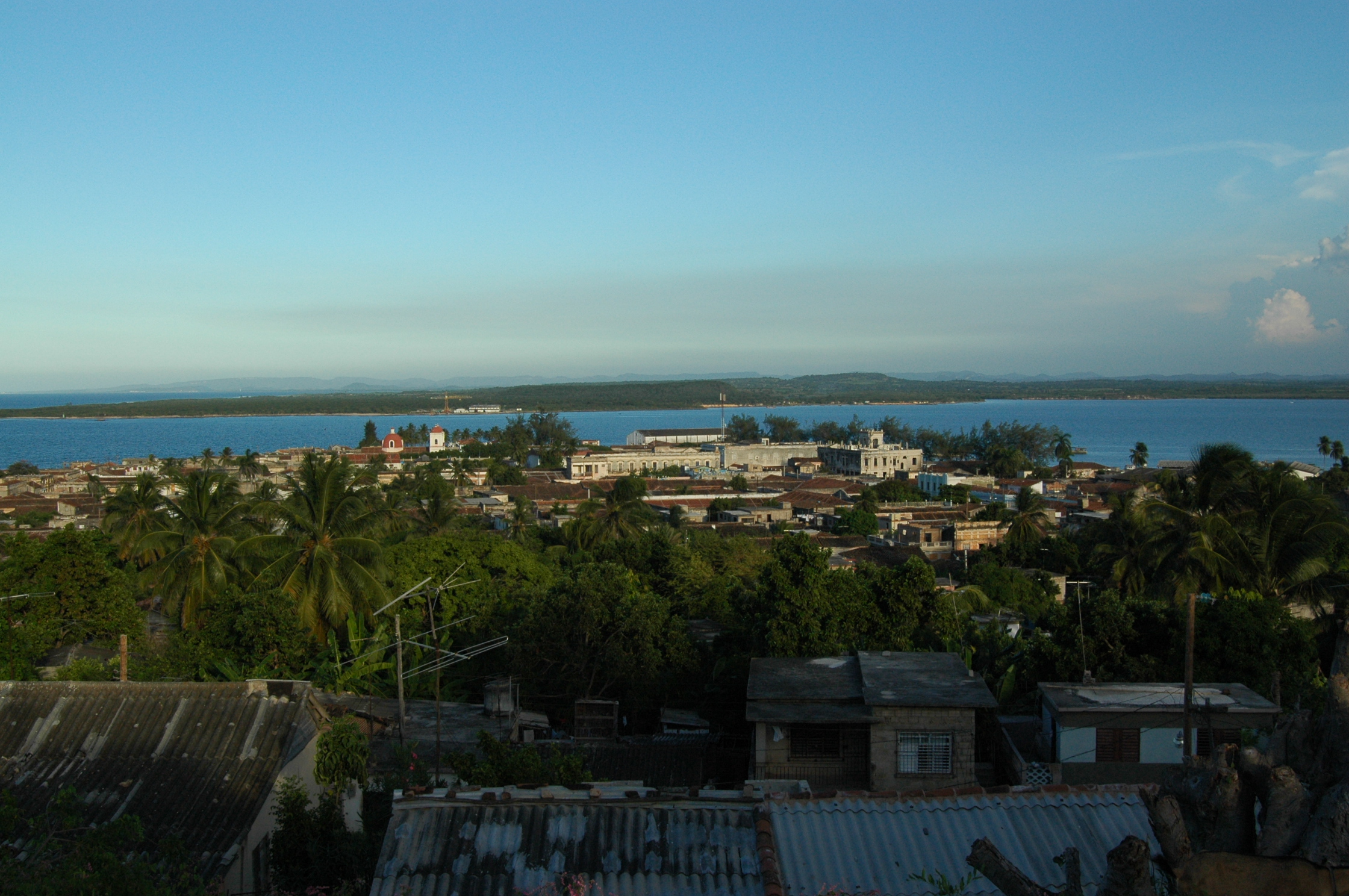
Gibara () is a town and municipality of the Province of Holguín in the Republic of Cuba. Gibara is the fourth largest town by population and the ninth by area in Holguín. History The main town was founded on January 16, 1817. It is also known as "The White Town", es, La Villa Blanca. Gibara has a beautiful and breezy landscape, and also possesses excellent architectural designs and a well-planned layout of its streets, houses and parks. Even so, Gibara's biggest asset, according to visitors, are its people, which are described as cooperative, friendly, affectionate, and proud of their village and of its history. It is said Admiral Christopher Columbus had remarked of Gibara's environs that "it is the most beautiful land that human eyes saw." "The White Villa" in Gibara, although small, is said to possess a peculiar charm, exhibiting an architectural patrimony reflecting almost two centuries of history, as well as its people's cultural roots. Currently, some controversy exists ... [...More Info...] [...Related Items...] OR: [Wikipedia] [Google] [Baidu] |
Las Tunas Province
Las Tunas is one of the provinces of Cuba. Major towns include Puerto Padre, Amancio, and the capital city, Las Tunas (historically Victoria de Las Tunas). Climate and agriculture The southern coast, which opens onto the , is y and characterised by s. This wet area is used to grow |
List Of Cities In Cuba ...
This is a list of cities in Cuba with at least 20,000 inhabitants, listed in descending order. Population data refers to city proper and not to the whole municipality, because they include large rural areas with several villages. All figures are accurate and provincial capitals are shown in bold. See also * List of places in Cuba * Municipalities of Cuba * Provinces of Cuba References External links 2012 population statistics of Cuba {{North America topic, List of cities in Cuba, List of cities in Cities * Cuba Cuba ( , ), officially the Republic of Cuba ( es, República de Cuba, links=no ), is an island country comprising the island of Cuba, as well as Isla de la Juventud and several minor archipelagos. Cuba is located where the northern Caribbea ... [...More Info...] [...Related Items...] OR: [Wikipedia] [Google] [Baidu] |
Cuba
Cuba ( , ), officially the Republic of Cuba ( es, República de Cuba, links=no ), is an island country comprising the island of Cuba, as well as Isla de la Juventud and several minor archipelagos. Cuba is located where the northern Caribbean Sea, Gulf of Mexico, and Atlantic Ocean meet. Cuba is located east of the Yucatán Peninsula (Mexico), south of both the American state of Florida and the Bahamas, west of Hispaniola ( Haiti/Dominican Republic), and north of both Jamaica and the Cayman Islands. Havana is the largest city and capital; other major cities include Santiago de Cuba and Camagüey. The official area of the Republic of Cuba is (without the territorial waters) but a total of 350,730 km² (135,418 sq mi) including the exclusive economic zone. Cuba is the second-most populous country in the Caribbean after Haiti, with over 11 million inhabitants. The territory that is now Cuba was inhabited by the Ciboney people from the 4th millennium BC with the Gua ... [...More Info...] [...Related Items...] OR: [Wikipedia] [Google] [Baidu] |
Mir (Calixto García)
Mir is a Cuban village and ''consejo popular'' ("people's council", i.e. hamlet) of the municipality of Calixto García, in Holguín Province. In 2011 it had a population of 6,647. History The village was founded on December 6, 1902, following the construction of the central railway (''Ferrocarril Central'') Havana-Santiago, that crosses it in the middle. Previously, it was a rural locality named ''Aguada Ciego de la Rioja''. Geography Mir spans on a plain next to some scattered hills and close to the border with Las Tunas Province. It lies between the cities of Holguín (47 km east), Las Tunas (51 km west) and Bayamo (53 km south); and is 15 km from the town of Buenaventura, the municipal seat of Calixto García. It is 8 km from Sabanazo, 13 from Omaja, 16 from Maceo, 42 from Cacocum and 43 from Holguín-Frank País Airport. Transport The village is served by a railway station on the Havana-Santa Clara-Camagüey-Santiago line, the principal one of ... [...More Info...] [...Related Items...] OR: [Wikipedia] [Google] [Baidu] |
Calixto García
Calixto García Íñiguez (August 4, 1839 – December 11, 1898) was a Cuban general in three Cuban uprisings, part of the Cuban War for Independence: the Ten Years' War, the Little War, and the War of 1895, itself sometimes called the Cuban War for Independence, which bled into the Spanish–American War, ultimately resulting in national independence for Cuba. Ancestry and progeny García was born in Holguín to parents of Cuban ''Criollo'' descent. He was a large, strong, educated man with a short fuse. García was the grandson of Calixto García de Luna e Izquierdo, who had fought as royalist in the Battle of Carabobo in 1821 during Venezuelan War of Independence. His grandmother was Maria de los Angeles Gonzalez, said to be the daughter of a '' cacique'' from Valencia, Venezuela. His grandfather (who had dropped the aristocratic "de Luna" upon taking refuge in Cuba) had been jailed on March 18, 1837 for demanding emancipation of slaves, constitutional freedom for all, ... [...More Info...] [...Related Items...] OR: [Wikipedia] [Google] [Baidu] |


