|
Cactus Flat
Cactus Flat is one of the Central Nevada Desert Basins in the Cactus-Sacrobatus Watershed, for which it is an eponym. The flat is the location of the Tonopah Test Range Airport and Tonopah Test Range, a component of the Nevada Test and Training Range used for weapons testing since the 1950s. The flat is also the site of the Nevada Wild Horse Range of the Nellis Air Force Range. The Kawich Range lies to the northeast and the Cactus Range to the southwest. Jack Rabbit Knob is east of Antelope Lake playa in Cactus Flat.''Cactus Flat, Nevada'' 1:100,000 scale topographic map, 37116-EM-TM-100, USGS, 1988 Cactus Flat has three cactus types (Beavertail cactus, Calico cactus and Barrel cactus Barrel cacti are various members of the two genera ''Echinocactus'' and ''Ferocactus'', endemic to the deserts of Southwestern North America southward to north central Mexico. Some of the largest specimens are found in the Sonoran Desert in Sout ...). References External links * {{cite ... [...More Info...] [...Related Items...] OR: [Wikipedia] [Google] [Baidu] |
Tonopah Test Range Airport
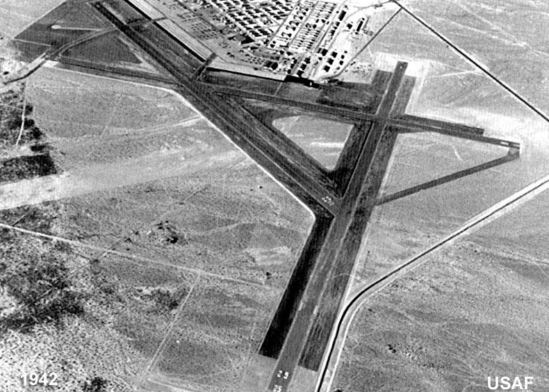
Tonopah Test Range Airport , at the Tonopah Test Range (Senior Trend project site PS-66) is southeast of Tonopah, Nevada and northwest of Las Vegas, Nevada. It is a major airfield with a runway, instrument approach facilities, and nighttime illumination. The facility has over fifty hangars and an extensive support infrastructure. Overview Tonopah is controlled by the USAF Air Combat Command. The known primary use of this airport is to shuttle government employees to the weapons test range from Harry Reid International Airport in Las Vegas. The primary (paved) access to the facility is off of U.S. Route 6 at the north end of the airport. Dirt road access points also exist on the south and east sides of the range. The site is plainly visible from commercial airliners, which pass north of the base on transcontinental flights. History The Tonopah Range Airport first opened in 1957, supporting operations on the test range itself, which was used for United States Atomic Energy ... [...More Info...] [...Related Items...] OR: [Wikipedia] [Google] [Baidu] |
Cactus Range
The Cactus Range is a small mountain range in Nye County, Nevada. The range lies southwest of Cactus Flat and north of Pahute Mesa. Goldfield lies to the west in Esmeralda County. The range lies within the restricted area of the Tonopah Test Range The Tonopah Test Range (TTR, also designated as Area 52) is a highly classified, restricted military installation of the United States Department of Defense, and United States Department of Energy ( nuclear stockpile stewardship) located about .... Named peaks in the range include: *Antelope Peak at *Cactus Peak at *Urania Peak at *Mount Helen at Cactus Range was so named on account of cacti in the area. References Mountain ranges of Nevada Mountain ranges of Nye County, Nevada Mountain ranges of the Great Basin {{NyeCountyNV-geo-stub ... [...More Info...] [...Related Items...] OR: [Wikipedia] [Google] [Baidu] |
Kawich Range
The Kawich Range is a mountain range in Nye County in southern Nevada in the United States, just south of the Hot Creek Range. The southern part of the range lies on the Nellis Air Force Range. The mountains cover an area of about and contain Kawich Peak, at above sea level.''Cactus Flat, Nevada'' 1:100,000 scale topographic map, 37116-EM-TM-100, USGS, 1988 and ''Warm Springs, Nevada'' 1:100,000 scale topographic map, 38116-A1-TM-100, USGS, 1987 U.S. Route 6 crosses the pass between The Kawich and the Hot Creek ranges and meets State Route 375 at Warm Springs just north of the range.''Warm Springs, Nevada'' 1:100,000 scale topographic map, USGS, 1987 To the east lies the Reveille and Kawich valleys with the Reveille Range to the east of the northern portion and the Belted Range east of Quartzite Mountain at the southern end. The broad Pahute Mesa and Gold Flat lie to the south with Cactus Flat and the Cactus Range to the southwest. To the northwest across Stone Cabin Valley ... [...More Info...] [...Related Items...] OR: [Wikipedia] [Google] [Baidu] |
Eponym
An eponym is a person, a place, or a thing after whom or which someone or something is, or is believed to be, named. The adjectives which are derived from the word eponym include ''eponymous'' and ''eponymic''. Usage of the word The term ''eponym'' functions in multiple related ways, all based on an explicit relationship between two named things. A person, place, or thing named after a particular person share an eponymous relationship. In this way, Elizabeth I of England is the eponym of the Elizabethan era. When Henry Ford is referred to as "the ''eponymous'' founder of the Ford Motor Company", his surname "Ford" serves as the eponym. The term also refers to the title character of a fictional work (such as Rocky Balboa of the Rocky film series, ''Rocky'' film series), as well as to ''self-titled'' works named after their creators (such as the album The Doors (album), ''The Doors'' by the band the Doors). Walt Disney created the eponymous The Walt Disney Company, Walt Disney Com ... [...More Info...] [...Related Items...] OR: [Wikipedia] [Google] [Baidu] |
Tonopah Test Range
The Tonopah Test Range (TTR, also designated as Area 52) is a highly classified, restricted military installation of the United States Department of Defense, and United States Department of Energy ( nuclear stockpile stewardship) located about southeast of Tonopah, Nevada. It is part of the northern fringe of the Nellis Range, measuring . Tonopah Test Range is located about northwest of Groom Lake, the home of the Area 51 facility. Like the Groom Lake facility, Tonopah is a site of interest to conspiracy theorists, mostly for its use of experimental and classified aircraft. As such, it is not generally the focus of alien enthusiasts, unlike its neighbor. It is currently used for nuclear weapons stockpile reliability testing, research and development of fusing and firing systems, and testing nuclear weapon delivery systems. The airspace comprises restricted area R-4809 of the Nevada Test and Training Range and is often used for military training. Description The Tonop ... [...More Info...] [...Related Items...] OR: [Wikipedia] [Google] [Baidu] |
Nevada Test And Training Range
The Nevada Test and Training Range (NTTR) is one of two military training areas at the Nellis Air Force Base Complex in Nevada and used by the United States Air Force Warfare Center at Nellis Air Force Base. The NTTR land area includes a "simulated Integrated Air Defense System", several individual ranges with 1200 targets, and 4 remote communication sites. The current NTTR area and the range's former areas have been used for aerial gunnery and bombing, for nuclear tests, as a proving ground and flight test area, for aircraft control and warning, and for Blue Flag, Green Flag, and Red Flag exercises. Geography The Nevada Test and Training Range land area is mostly Central Basin and Range ecoregion (cf. southernmost portion in the Mojave Desert), and smaller ecoregions (e.g., Tonopah Basin, Tonopah Playa, & Bald Mountain biomes) are within the area of numerous basin and range landforms of the NTTR. Landforms The NTTR is at the serpentine section of the Great Basin Divide in so ... [...More Info...] [...Related Items...] OR: [Wikipedia] [Google] [Baidu] |
Nevada Wild Horse Range
Nevada ( ; ) is a U.S. state, state in the Western United States, Western region of the United States. It is bordered by Oregon to the northwest, Idaho to the northeast, California to the west, Arizona to the southeast, and Utah to the east. Nevada is the List of U.S. states and territories by area, 7th-most extensive, the List of U.S. states and territories by population, 32nd-most populous, and the List of U.S. states and territories by population density, 9th-least densely populated of the U.S. states. Nearly three-quarters of Nevada's people live in Clark County, Nevada, Clark County, which contains the Las Vegas–Paradise, NV MSA, Las Vegas–Paradise metropolitan area, including three of the state's four largest incorporated cities. Nevada's capital is Carson City, Nevada, Carson City. Las Vegas is the largest city in the state. Nevada is officially known as the "Silver State" because of the importance of silver to its history and economy. It is also known as the "Battle ... [...More Info...] [...Related Items...] OR: [Wikipedia] [Google] [Baidu] |
Nellis Air Force Base
Nellis Air Force Base ("Nellis" colloq.) is a United States Air Force installation in southern Nevada. Nellis hosts air combat exercises such as Exercise Red Flag and close air support exercises such as Green Flag-West flown in " Military Operations Area (MOA) airspace", associated with the nearby Nevada Test and Training Range (NTTR). The base also has the Combined Air and Space Operations Center-Nellis. History After World War I, Nevada and other western inland states were surveyed by Capt. Lowell H. Smith and Sgt. William B. Whitefield for landing sites, and by "mid-1925 the Air Service possessed information on nearly thirty-five hundred landing places, including more than twenty-eight hundred emergency landing areas, in the United States." The 1929 airfield (dirt runway, water well, and small operations shack) north of Las Vegas—operated by the 1925 Western Air Express for Contract Air Mail (CAM) Route #4, Los Angeles, LA-to-Salt Lake City, SLC—was used by the ... [...More Info...] [...Related Items...] OR: [Wikipedia] [Google] [Baidu] |
Beavertail Cactus
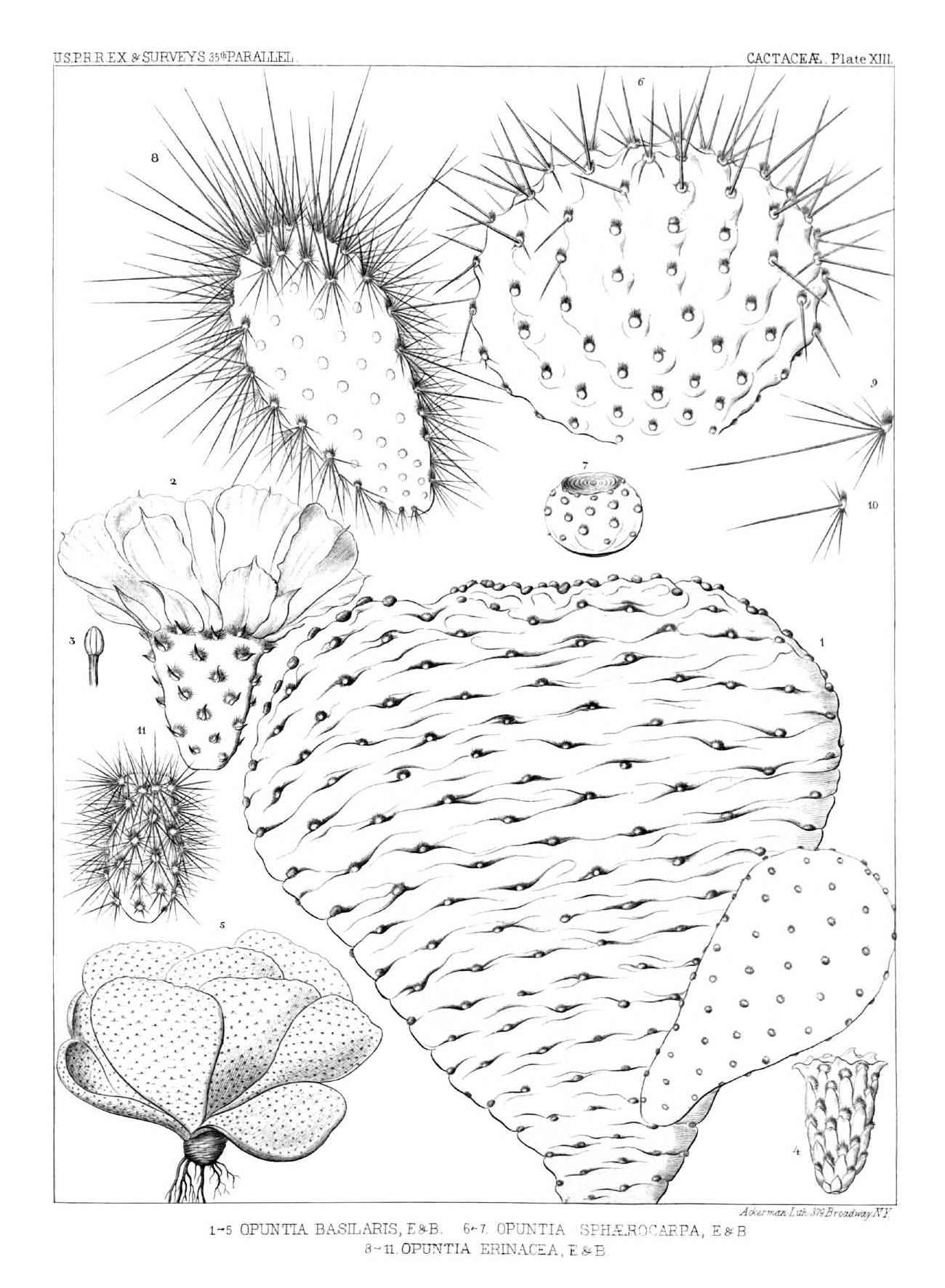
''Opuntia basilaris'', the beavertail cactus or beavertail pricklypear, is a cactus species found in the southwest United States. It occurs mostly in the Mojave, Anza-Borrego, and Colorado Deserts, as well as in the Colorado Plateau and northwest Mexico. It is also found throughout the Grand Canyon and Colorado River region as well as into southern Utah and Nevada, and in the western Arizona regions along the Lower Colorado River Valley. Description ''Opuntia basilaris'' is a medium-sized to small prickly pear cactus tall, with pink to rose colored flowers. A single plant may consist of hundreds of fleshy, flattened pads. These are more or less blue-gray, depending on variety, long and less than wide and thick. They are typically spineless, but as is typical for ''Opuntia'' species, have many small barbed bristles, called glochids, that easily penetrate the skin. ''Opuntia basilaris'' blooms from spring to early summer. Taxonomy One of the first known descriptions of ... [...More Info...] [...Related Items...] OR: [Wikipedia] [Google] [Baidu] |
Calico Cactus
''Opuntia engelmannii'' is a prickly pear common across the south-central and Southwestern United States and northern Mexico. It goes by a variety of common names, including desert prickly pear, discus prickly pear, Engelmann's prickly pear in the US, and nopal, abrojo, joconostle, and vela de coyote in Mexico. The nomenclatural history of this species is somewhat complicated due to the varieties, as well as its habit of hybridizing with ''Opuntia phaeacantha''. It differs from ''Opuntia phaeacantha'' by being green year round instead of turning reddish purple during winter or dry seasons, as well as having yellow flowers with red centers. Varieties *''Opuntia engelmannii'' var. ''cuija'' — nopal cuijo; endemic to Mexico, in Guanajuato, Hidalgo, San Luis Potosí. *''Opuntia engelmannii'' var. ''engelmannii'' — Engelmann's prickly pear; Mexico, southwestern U.S., California *''Opuntia engelmannii'' var. ''flavispina'' — yellow-spined prickly pear; Arizona, Mexico *''Opu ... [...More Info...] [...Related Items...] OR: [Wikipedia] [Google] [Baidu] |
Barrel Cactus
Barrel cacti are various members of the two genera ''Echinocactus'' and ''Ferocactus'', endemic to the deserts of Southwestern North America southward to north central Mexico. Some of the largest specimens are found in the Sonoran Desert in Southern Arizona . Description Some species of barrel cactus reach over in height at maturity, and have been known to reach in some regions. The ribs are numerous and pronounced, and the spines are long and can range in color from yellow to tan to red, depending on the age of the plant and the species. Flowers appear at the top of the plant only after many years. The barrel cactus can live to be over 100 years old. Barrel cactus buds typically start to bloom in April with a bright yellow or orange flower. Pink and red varieties also exist but occur less frequently. The flowers only appear on the very top of the plant. As the flowers begin to wilt in early May, they may change color. A late summer desert rainstorm can produce a late bloom, ... [...More Info...] [...Related Items...] OR: [Wikipedia] [Google] [Baidu] |


.png)


