|
CAPPI
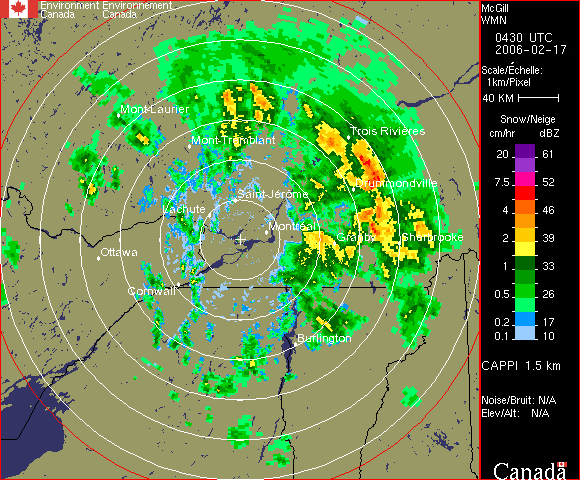
The constant altitude plan position indicator, better known as CAPPI, is a radar display which gives a horizontal cross-section of data at constant altitude. It has been developed by McGill University in Montreal by the ''Stormy Weather Group'' to circumvent some problems with the PPI: * Altitude changing with distance to the radar. * Ground echoes problems near the radar. Definition and history In 1954,''Radar in Meteorology by David Atlas'', published by the American Meteorological Society McGill University obtained a new radar (CPS-9) which had a better resolution and used FASE (Fast Azimuth Slow Elevation) to program multi-angle soundings of the atmosphere. In 1957, Langleben and Gaherty developed a scheme with FASE to keep only the data at a certain height at each angle and scan on 360 degrees. If we look at the diagram, each angle of elevation or PPI has data at height X at a certain distance from the radar. Using the data at the right distance, one forms an annular r ... [...More Info...] [...Related Items...] OR: [Wikipedia] [Google] [Baidu] |
Radar Meteorology
Weather radar, also called weather surveillance radar (WSR) and Doppler weather radar, is a type of radar used to locate precipitation, calculate its motion, and estimate its type (rain, snow, hail etc.). Modern weather radars are mostly pulse-Doppler radars, capable of detecting the motion of rain droplets in addition to the intensity of the precipitation. Both types of data can be analyzed to determine the structure of storms and their potential to cause severe weather. During World War II, radar operators discovered that weather was causing echoes on their screen, masking potential enemy targets. Techniques were developed to filter them, but scientists began to study the phenomenon. Soon after the war, surplus radars were used to detect precipitation. Since then, weather radar has evolved on its own and is now used by national weather services, research departments in universities, and in television stations' weather departments. Raw images are routinely used and specialize ... [...More Info...] [...Related Items...] OR: [Wikipedia] [Google] [Baidu] |
Weather Radar
Weather radar, also called weather surveillance radar (WSR) and Doppler weather radar, is a type of radar used to locate precipitation, calculate its motion, and estimate its type (rain, snow, hail etc.). Modern weather radars are mostly pulse-Doppler radars, capable of detecting the motion of rain droplets in addition to the intensity of the precipitation. Both types of data can be analyzed to determine the structure of storms and their potential to cause severe weather. During World War II, radar operators discovered that weather was causing echoes on their screen, masking potential enemy targets. Techniques were developed to filter them, but scientists began to study the phenomenon. Soon after the war, surplus radars were used to detect precipitation. Since then, weather radar has evolved on its own and is now used by national weather services, research departments in universities, and in television stations' weather departments. Raw images are routinely used and speciali ... [...More Info...] [...Related Items...] OR: [Wikipedia] [Google] [Baidu] |
Plan Position Indicator
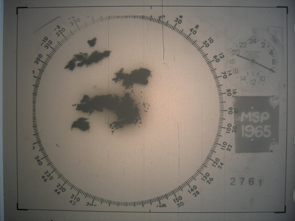
A plan position indicator (PPI) is a type of radar display that represents the radar antenna in the center of the display, with the distance from it and height above ground drawn as concentric circles. As the radar antenna rotates, a radial trace on the PPI sweeps in unison with it about the center point. It is the most common type of radar display. Description The radar antenna sends pulses while rotating 360 degrees around the radar site at a fixed elevation angle. It can then change angle or repeat at the same angle according to the need. Return echoes from targets are received by the antenna and processed by the receiver and the most direct display of those data is the PPI. The height of the echoes increases with the distance to the radar, as represented in the adjacent image. This change is not a straight line but a curve as the surface of the Earth is curved and ''sinks'' below the radar horizon. For fixed-site installations, north is usually represented at the top of ... [...More Info...] [...Related Items...] OR: [Wikipedia] [Google] [Baidu] |
Radar
Radar is a detection system that uses radio waves to determine the distance (''ranging''), angle, and radial velocity of objects relative to the site. It can be used to detect aircraft, ships, spacecraft, guided missiles, motor vehicles, weather formations, and terrain. A radar system consists of a transmitter producing electromagnetic waves in the radio or microwaves domain, a transmitting antenna, a receiving antenna (often the same antenna is used for transmitting and receiving) and a receiver and processor to determine properties of the objects. Radio waves (pulsed or continuous) from the transmitter reflect off the objects and return to the receiver, giving information about the objects' locations and speeds. Radar was developed secretly for military use by several countries in the period before and during World War II. A key development was the cavity magnetron in the United Kingdom, which allowed the creation of relatively small systems with sub-meter resolution. Th ... [...More Info...] [...Related Items...] OR: [Wikipedia] [Google] [Baidu] |
McGill University
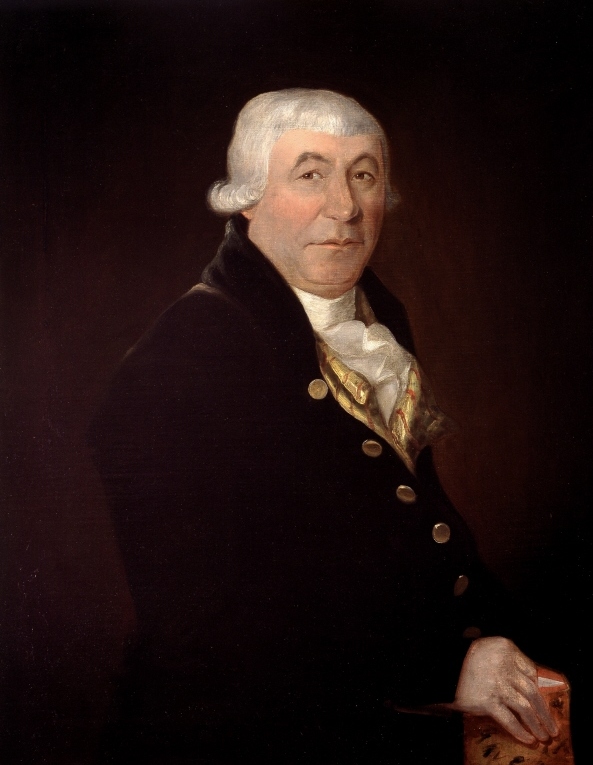
McGill University (french: link=no, Université McGill) is an English-language public research university located in Montreal, Quebec, Canada. Founded in 1821 by royal charter granted by King George IV,Frost, Stanley Brice. ''McGill University, Vol. I. For the Advancement of Learning, 1801–1895.'' McGill-Queen's University Press, 1980. the university bears the name of James McGill, a Scottish merchant whose bequest in 1813 formed the university's precursor, University of McGill College (or simply, McGill College); the name was officially changed to McGill University in 1885. McGill's main campus is on the slope of Mount Royal in downtown Montreal in the borough of Ville-Marie, with a second campus situated in Sainte-Anne-de-Bellevue, west of the main campus on Montreal Island. The university is one of two members of the Association of American Universities located outside the United States, alongside the University of Toronto, and is the only Canadian member of the Glob ... [...More Info...] [...Related Items...] OR: [Wikipedia] [Google] [Baidu] |
David Atlas
David Atlas (May 25, 1924 – November 10, 2015) was an American meteorologist and one of the pioneers of radar meteorology. His career extended from World War II to his death: he worked for the US Air Force, then was professor at the University of Chicago and National Center for Atmospheric Research (NCAR), researcher at NASA and private consultant. Atlas owned 22 patents, published more than 260 papers, was a member of many associations, and received numerous honors in his field. Early life Atlas was born May 25, 1924, in Brooklyn, New York, from Jewish parents who immigrated from Poland and Russia. He studied primary and high school in Brooklyn, starting college in City College of New York afterward. He served in the U.S. Army during the Second World War in the US Army Air Corps, where he worked on the development of radars, in particular on the problem of precipitation echos. After the war, Atlas remained in the U.S. Air Force for 18 years, working at the Cambridge Research ... [...More Info...] [...Related Items...] OR: [Wikipedia] [Google] [Baidu] |
American Meteorological Society
The American Meteorological Society (AMS) is the premier scientific and professional organization in the United States promoting and disseminating information about the Atmospheric sciences, atmospheric, Oceanography, oceanic, and Hydrology, hydrologic sciences. Its mission is to advance the atmospheric and related sciences, technologies, applications, and services for the benefit of society. Background Founded on December 29, 1919, by Charles Franklin Brooks at a meeting of the American Association for the Advancement of Science in St. Louis and incorporated on January 21, 1920, the American Meteorological Society has a membership of more than 13,000 weather, water, and climate scientists, professionals, researchers, educators, students, and enthusiasts. AMS offers numerous programs and services in the sphere of water, weather and climate sciences. It publishes eleven atmospheric and related oceanic and hydrologic journals (in print and online), sponsors as many as twelve conf ... [...More Info...] [...Related Items...] OR: [Wikipedia] [Google] [Baidu] |
Reflectivity
The reflectance of the surface of a material is its effectiveness in reflecting radiant energy. It is the fraction of incident electromagnetic power that is reflected at the boundary. Reflectance is a component of the response of the electronic structure of the material to the electromagnetic field of light, and is in general a function of the frequency, or wavelength, of the light, its polarization, and the angle of incidence. The dependence of reflectance on the wavelength is called a ''reflectance spectrum'' or ''spectral reflectance curve''. Mathematical definitions Hemispherical reflectance The ''hemispherical reflectance'' of a surface, denoted , is defined as R = \frac, where is the radiant flux ''reflected'' by that surface and is the radiant flux ''received'' by that surface. Spectral hemispherical reflectance The ''spectral hemispherical reflectance in frequency'' and ''spectral hemispherical reflectance in wavelength'' of a surface, denoted and respectively, are ... [...More Info...] [...Related Items...] OR: [Wikipedia] [Google] [Baidu] |
Louis J
Louis may refer to: * Louis (coin) * Louis (given name), origin and several individuals with this name * Louis (surname) * Louis (singer), Serbian singer * HMS Louis, HMS ''Louis'', two ships of the Royal Navy See also Derived or associated terms * Lewis (other) * Louie (other) * Luis (other) * Louise (other) * Louisville (other) * Louis Cruise Lines * Louis dressing, for salad * Louis Quinze, design style Associated names * * Chlodwig, the origin of the name Ludwig, which is translated to English as "Louis" * Ladislav and László - names sometimes erroneously associated with "Louis" * Ludovic, Ludwig (other), Ludwig, Ludwick, Ludwik, names sometimes translated to English as "Louis" {{disambiguation ... [...More Info...] [...Related Items...] OR: [Wikipedia] [Google] [Baidu] |
San Diego
San Diego ( , ; ) is a city on the Pacific Ocean coast of Southern California located immediately adjacent to the Mexico–United States border. With a 2020 population of 1,386,932, it is the List of United States cities by population, eighth most populous city in the United States and the county seat, seat of San Diego County, the List of the most populous counties in the United States, fifth most populous county in the United States, with 3,338,330 estimated residents as of 2019. The city is known for its mild year-round climate, natural deep-water harbor, extensive beaches and parks, long association with the United States Navy, and recent emergence as a healthcare and biotechnology development center. San Diego is the List of municipalities in California, second largest city in the U.S. state, state of California, after Los Angeles. Historically home to the Kumeyaay people, San Diego is frequently referred to as the "Birthplace of California", as it was the first site vi ... [...More Info...] [...Related Items...] OR: [Wikipedia] [Google] [Baidu] |


.jpg)