|
Barrow-in-Furness
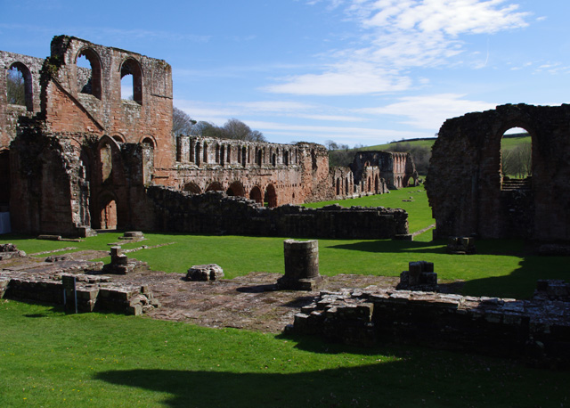
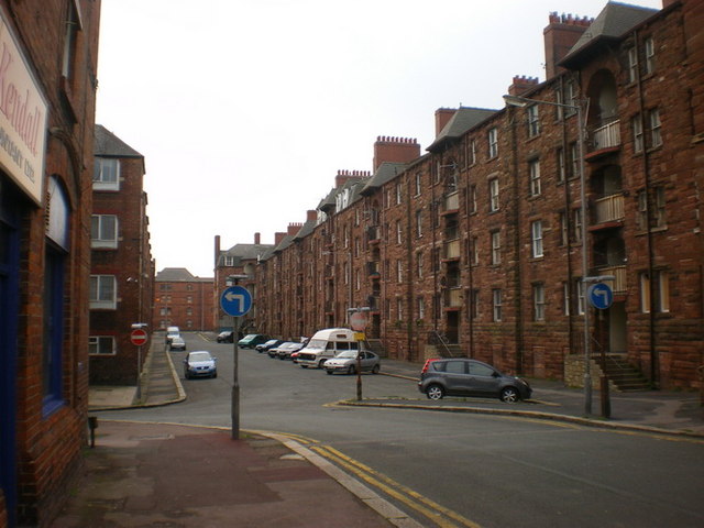
Barrow-in-Furness is a port town in Cumbria, England. Historically in Lancashire, it was incorporated as a municipal borough in 1867 and merged with Dalton-in-Furness Urban District in 1974 to form the Borough of Barrow-in-Furness. In 2023 the borough will merge with Eden and South Lakeland districts to form a new unitary authority; Westmorland and Furness. At the tip of the Furness peninsula, close to the Lake District, it is bordered by Morecambe Bay, the Duddon Estuary and the Irish Sea. In 2011, Barrow's population was 56,745, making it the second largest urban area in Cumbria after Carlisle. Natives of Barrow, as well as the local dialect, are known as Barrovian. In the Middle Ages, Barrow was a small hamlet within the parish of Dalton-in-Furness with Furness Abbey, now on the outskirts of the town, controlling the local economy before its dissolution in 1537. The iron prospector Henry Schneider arrived in Furness in 1839 and, with other investors, opened th ... [...More Info...] [...Related Items...] OR: [Wikipedia] [Google] [Baidu] |
Cumbria
Cumbria ( ) is a ceremonial and non-metropolitan county in North West England, bordering Scotland. The county and Cumbria County Council, its local government, came into existence in 1974 after the passage of the Local Government Act 1972. Cumbria's county town is Carlisle, in the north of the county. Other major settlements include Barrow-in-Furness, Kendal, Whitehaven and Workington. The administrative county of Cumbria consists of six districts (Allerdale, Barrow-in-Furness, Carlisle, Copeland, Eden and South Lakeland) and, in 2019, had a population of 500,012. Cumbria is one of the most sparsely populated counties in England, with 73.4 people per km2 (190/sq mi). On 1 April 2023, the administrative county of Cumbria will be abolished and replaced with two new unitary authorities: Westmorland and Furness (Barrow-in-Furness, Eden, South Lakeland) and Cumberland (Allerdale, Carlisle, Copeland). Cumbria is the third largest ceremonial county in England by area. It is ... [...More Info...] [...Related Items...] OR: [Wikipedia] [Google] [Baidu] |
Barrow-in-Furness (borough)
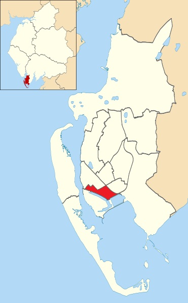
Barrow-in-Furness is a local government district with borough status in Cumbria, England. It is named after its main town, Barrow-in-Furness. Other settlements include Dalton-in-Furness and Askam-in-Furness. It is the smallest district in the county, but is the most densely populated, with 924 people per square kilometre. The population was 71,980 in 2001, reducing to 69,087 at the 2011 Census. In July 2021 the Ministry of Housing, Communities and Local Government announced that in April 2023, Cumbria will be reorganised into two unitary authorities. Barrow-in-Furness Borough Council is to be abolished and its functions transferred to a new authority, to be known as Westmorland and Furness, which will cover the current districts of Barrow-in-Furness, Eden and South Lakeland. In April 2022 Gareth Davies became the first person to run every single street in the Borough of Barrow-In-Furness. Covering all 1,026 streets over an end to end distance of 201 miles. Background The ... [...More Info...] [...Related Items...] OR: [Wikipedia] [Google] [Baidu] |
Borough Of Barrow-in-Furness
Barrow-in-Furness is a local government district with borough status in Cumbria, England. It is named after its main town, Barrow-in-Furness. Other settlements include Dalton-in-Furness and Askam-in-Furness. It is the smallest district in the county, but is the most densely populated, with 924 people per square kilometre. The population was 71,980 in 2001, reducing to 69,087 at the 2011 Census. In July 2021 the Ministry of Housing, Communities and Local Government announced that in April 2023, Cumbria will be reorganised into two unitary authorities. Barrow-in-Furness Borough Council is to be abolished and its functions transferred to a new authority, to be known as Westmorland and Furness, which will cover the current districts of Barrow-in-Furness, Eden and South Lakeland. In April 2022 Gareth Davies became the first person to run every single street in the Borough of Barrow-In-Furness. Covering all 1,026 streets over an end to end distance of 201 miles. Background T ... [...More Info...] [...Related Items...] OR: [Wikipedia] [Google] [Baidu] |
Barrow And Furness (UK Parliament Constituency)
Barrow and Furness, formerly known as Barrow-in-Furness, is a constituency in Cumbria which has been represented in the House of Commons of the UK Parliament by Simon Fell of the Conservative Party since 2019. History and profile The seat of was established by the Redistribution of Seats Act 1885 and covers the southwest part of Cumbria. The largest town in the constituency, Barrow-in-Furness, grew on the back of the shipbuilding industry and is now the site of the BAE Systems nuclear submarine and shipbuilding operation. This reliance on the industry aligns many of its columnists and in its community with strong nuclear deterrents, from which Labour has recoiled since its involvement in the Iraq War that removed dictator Saddam Hussain. Labour Cabinet member Albert Booth represented Barrow from 1966 for many years but was defeated in 1983, in the aftermath of the Falklands War, by a Manchester lawyer, Cecil Franks of the Conservative Party, who retained the seat until 19 ... [...More Info...] [...Related Items...] OR: [Wikipedia] [Google] [Baidu] |
Barrow-in-Furness Town Hall
Barrow-in-Furness Town Hall is a Gothic Revival style municipal building in Barrow-in-Furness, Cumbria, England. The building, which serves as the base of Barrow Borough Council, lies within a Conservation Area with Grade II* listed status. History In the mid-19th century, Barrow was little more than a small fishing village. However, after the discovery of iron ore in local mountains and the establishment of a port in the town, the area became a municipal borough in 1867. In 1877 architects were invited to submit proposals for a large civic building in Barrow which would represent the growth and current stature of the town. Irish-born architect, William Henry Lynn had the winning design that began construction in 1882. The building was constructed almost entirely from local Hawcoat sandstone with Westmorland slate for the roof. At tall, it became one of the tallest buildings in Barrow. Financial constraints alongside changes to the design were the reason that constructio ... [...More Info...] [...Related Items...] OR: [Wikipedia] [Google] [Baidu] |
Barrow Island, Barrow-in-Furness
Barrow Island is an area and electoral ward of Barrow-in-Furness, Cumbria, England. Originally separate from the British mainland, land reclamation in the 1860s saw the northern fringes of the island connected to Central Barrow. Barrow Island is also bound to the south and east by the town's dock system and to the west by Walney Channel. The Ward population taken at the 2011 census was 2,616. The ward itself will be combined with Central and Hindpool wards in April 2023 following formation of the new Westmorland and Furness Local Authority and be named 'Old Barrow'. Background and history The name of the town of Barrow-in-Furness is believed to derive from the Norse word ''Barrae'', meaning ''Bare Island'', which actually referred to Barrow Island. Since the 1860s the island has been connected to the mainland as its channel was modified to form two docks, the Buccleuch Dock and the Devonshire Dock. The remainder of its channel has also now been developed as part of the dock ... [...More Info...] [...Related Items...] OR: [Wikipedia] [Google] [Baidu] |
Coat Of Arms Of Barrow-in-Furness
The coat of arms of Barrow-in-Furness is the official symbol of Barrow Borough Council, the governing body of the Borough of Barrow-in-Furness, England. The arms were officially granted on 13 December 1867 to the County Borough of Barrow-in-Furness. Upon the amalgamation of the County Borough and adjacent Dalton-in-Furness Urban District on 16 April 1975 the arms were adopted by the Barrow Borough Council. Symbolism The chief of the arms incorporates a steam ship, emblematic of Barrow's shipping and port related industries. Below diagonally intercepting the arms is a band containing a bee and arrow to reflect the town's name (B-arrow). The stag and serpent either side are taken from the crests of the Duke of Buccleuch and the Duke of Devonshire respectively, who were the principal landowners at the time of Barrow's early growth. The ram's head a top of the arms symbolises Sir James Ramsden, Barrow's first mayor and a major figure in the development of the town. The Latin script ... [...More Info...] [...Related Items...] OR: [Wikipedia] [Google] [Baidu] |
Dalton-in-Furness
Dalton-in-Furness is a town and former civil parish in the Borough of Barrow-in-Furness, Cumbria, England. In 2011 it had a population of 7,827. It is located north east of Barrow-in-Furness. History Dalton is mentioned in the Domesday Book, written as "Daltune" as one of the townships forming the Manor of Hougun held by Tostig Godwinson, Earl of Northumbria. Historically, it was the capital of Furness. The ancient parish of Dalton covered the area which is now occupied by the borough of Barrow-in-Furness. The town is now in the civil parish of Dalton Town with Newton. Historically a part of Lancashire, the town is associated with a number of famous artists, including George Romney. In 1961 the parish had a population of 10,316. Dalton in Furness was formerly a civil parish, it was abolished in 1974 and became an unparished area, on 1 April 1987 the unparished area was abolished to form the parishes of " Askam and Ireleth", "Dalton Town with Newton" and " Lindal and Marton". ... [...More Info...] [...Related Items...] OR: [Wikipedia] [Google] [Baidu] |
Central Barrow
Central Barrow refers both to the town centre of Barrow-in-Furness, Cumbria, England and to the electoral ward that roughly covers the eastern part of that town centre. In 2001 5,584 ( ranking 5th out of 13) lived in the Central ward. The population density was 55.96 per hectare, which was well above the local average of 9.24, and England average, 3.77. The population of Central ward had reduced to 4,583 at the 2011 Census. Central Barrow is amongst the 3% most deprived areas in the country and households have an average weekly income around £100 lower than the region's average, however the area being the central business district of the town is also home to many of Barrow's retail outlets, as well as a large amount of offices, restaurants and governmental buildings. Part of the £200 million Waterfront Barrow-in-Furness project is being constructed in the southern part of Central Barrow (including the new Marina Village). The ward itself will be combined with Barrow Island a ... [...More Info...] [...Related Items...] OR: [Wikipedia] [Google] [Baidu] |
Dock Museum
The Dock Museum is situated in Barrow-in-Furness, Cumbria, England. Most of its exhibits concern the history of the town, focusing on the shipbuilding industry at VSEL (now BAE Systems), the steelworks industry — of which Barrow once had the world's largest, the Furness Railway and the World War II bombings of the town. There has been a museum in Barrow since 1907 and in its current location since 1994, when 50,000 people visited it in its first year, visitor numbers peaked at 120,000 in 2001. The museum has free entry and remains under public ownership. Exhibits On initial entrance to the museum, the ground floors galleries are about the town's history, its rapid mushrooming, as well as how it was affected by World War II. The largest part of the museum is housed in a former dry dock, where three floors containing models of ships and submarines built in Barrow, along with other exhibits can be found. The Vickers Photographic Archive, an archive of 10,000 glass plat ... [...More Info...] [...Related Items...] OR: [Wikipedia] [Google] [Baidu] |
Morecambe Bay
Morecambe Bay is a large estuary in northwest England, just to the south of the Lake District National Park. It is the largest expanse of intertidal mudflats and sand in the United Kingdom, covering a total area of . In 1974, the second largest gas field in the UK was discovered west of Blackpool, with original reserves of over 7 trillion cubic feet (tcf) (200 billion cubic metres). At its peak, 15% of Britain's gas supply came from the bay but production is now in decline. It is also one of the homes of the high brown fritillary butterfly. Natural features The rivers Leven, Kent, Keer, Lune and Wyre drain into the Bay, with their various estuaries making a number of peninsulas within the bay. Much of the land around the bay is reclaimed, forming salt marshes used in agriculture. Morecambe Bay is also an important wildlife site, with abundant birdlife and varied marine habitats, and there is a bird observatory at Walney Island. The bay has rich cockle beds, which hav ... [...More Info...] [...Related Items...] OR: [Wikipedia] [Google] [Baidu] |
Barrovian
Barrovian (or Barrow dialect) is an accent and dialect of English found in Barrow-in-Furness and several parts of the town's wider borough in Cumbria, England, historically in the county of Lancashire. Although a member of the Cumbrian dialect, The Barrovian and south Cumbria accent has a lot in common with the dialect of northern Lancashire, particularly the Lancaster/Morecambe area. Barrovian is also used as a demonym for inhabitants of Barrow. Origins Up until the mid-19th century Barrow was nothing but a cluster of small villages with the Cumbrian dialect prevailing throughout, huge growth however occurred between 1860 and 1880 spurred on by the introduction of the railway to the Furness peninsula and the rapidly expanding steel and jute works. Barrow also became a major shipbuilding centre in the early 20th century. From a few thousand to 70,000 residents in under half a century, the majority of these were immigrants to the town drawn by the burgeoning industries. Larg ... [...More Info...] [...Related Items...] OR: [Wikipedia] [Google] [Baidu] |


