|
Asuka, Nara
is a village located in Takaichi District, Nara Prefecture, Japan. As of April 1, 2017, the village has an estimated population of 5,681, with 2,170 households, and a population density of . The total area is . Asuka is the land where ancient palaces were located. There are strict rules governing construction in this historic town. Asuka can be reached from Okadera or Asuka Station on Kintetsu Yoshino Line train line. Although it's outside Asuka, Kashiharajingū-mae Station in neighboring Kashihara has service on the Kintetsu Kashihara Line, Minami Osaka Line and Yoshino Lines. By car, Asuka is on Route 169. History ''For the ancient Asuka, see Asuka period and Asuka, Yamato.'' In 1956, the village of Asuka (明日香) was founded as a result of a merger of three villages, Sakaai, Takechi and Asuka (飛鳥村). In 1966, Asuka was proclaimed a "historic town", as defined by the national Special Arrangement for Preservation of Historic Sites Laas well as Kyoto, Nara and ... [...More Info...] [...Related Items...] OR: [Wikipedia] [Google] [Baidu] |
Nara Prefecture
is a prefecture of Japan located in the Kansai region of Honshu. Nara Prefecture has a population of 1,321,805 and has a geographic area of . Nara Prefecture borders Kyoto Prefecture to the north, Osaka Prefecture to the northwest, Wakayama Prefecture to the southwest, and Mie Prefecture to the east. Nara is the capital and largest city of Nara Prefecture, with other major cities including Kashihara, Ikoma, and Yamatokōriyama. Nara Prefecture is located in the center of the Kii Peninsula on Japan's Pacific Ocean coast, and is one of only eight landlocked prefectures. Nara Prefecture has the distinction of having more UNESCO World Heritage listings than any other prefecture in Japan. History Nara Prefecture region is considered one of the oldest regions in Japan, having been in existence for thousands of years, and is widely viewed as the Japanese cradle of civilization. Like Kyoto, Nara was one of Imperial Japan's earliest capital cities. The current form of Nara Prefec ... [...More Info...] [...Related Items...] OR: [Wikipedia] [Google] [Baidu] |
Yoshino Line
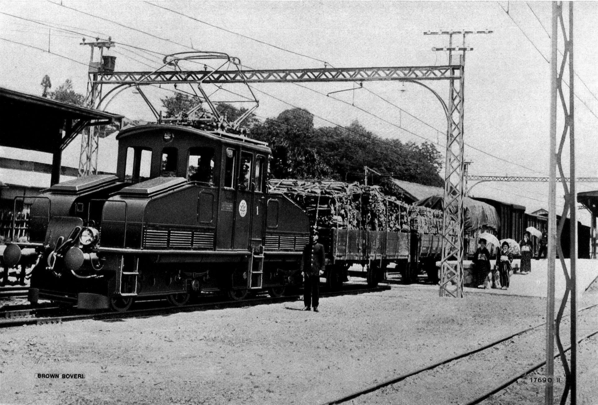
The is a railway line in Nara Prefecture, Japan, operated by the private railway operator Kintetsu Railway. It connects in Kashihara and in Yoshino. All Express and Limited Express trains continue to and from Ōsaka Abenobashi Station on the Minami Osaka Line. History The Co. opened the Yoshino - Muda section in 1912, and extended the line to Kashiharajingū-mae in 1923, electrifying the entire line at 1500 VDC at that time. Amongst the rolling stock were three Bo'Bo' goodtrain locomotives delivered from Brown, Boveri & Cie in Switzerland ). Swiss law does not designate a ''capital'' as such, but the federal parliament and government are installed in Bern, while other federal institutions, such as the federal courts, are in other cities (Bellinzona, Lausanne, Luzern, Neuchâtel .... In 1929 the company merged with the Osaka Electric Railway Co., which merged with Kintetsu in 1944. Freight services ceased in 1984, and CTC signalling was commissioned in 2001. Kintetsu ... [...More Info...] [...Related Items...] OR: [Wikipedia] [Google] [Baidu] |
Ishibutai Kofun
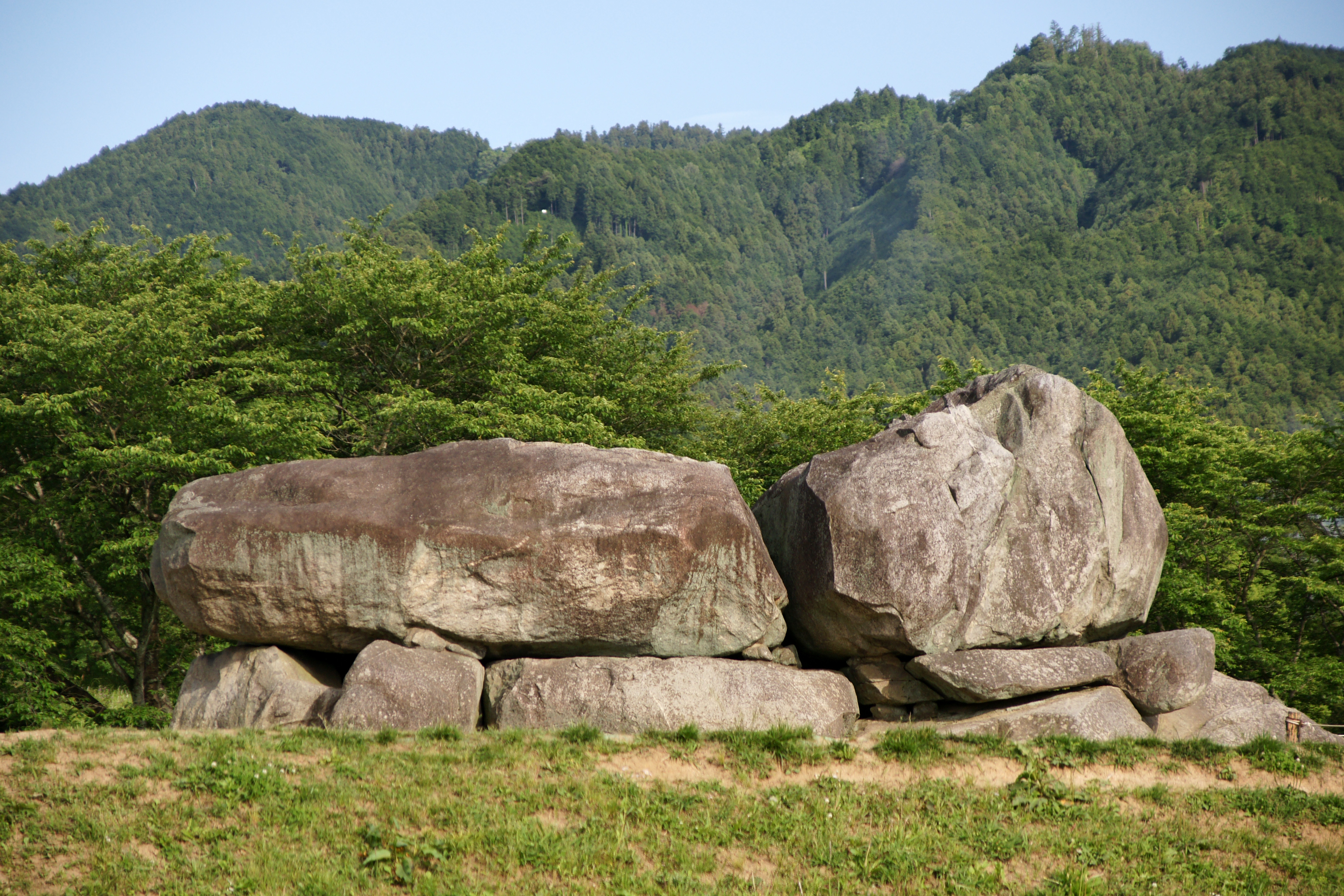
is a stone ''kofun'' or tumulus of the Asuka period in the east of Shimanoshō, Asuka, Nara Prefecture, Japan. The kofun is believed to be the tomb of Soga no Umako. It occupies an area of , and is the largest known megalithic structure in Japan. The kofun is also known as the Kofun. Name The name of the ''kofun'' in Japanese is a combination of two words, the first, , meaning "stone", and the second, , meaning "stage". The name of the ''kofun'' therefore originates in its resemblance to a large stone stage. The Ishibutai ''kofun'' has been known by this name at least as early as the Tokugawa period, as evidenced by its entry in the ''Saigoku sanjūsansho meisho zue'', a large guide to Buddhist pilgrimage sites written by Kanenari Akatsuki in 1853. Association with Soga no Umako The Ishibutai Kofun is inferred to be the tomb of Soga no Umako (559? - 626), and his death during the reign of Empress Suiko is recorded in the '' Nihon Shoki''. :Summer, 5th month, 20th day. The ... [...More Info...] [...Related Items...] OR: [Wikipedia] [Google] [Baidu] |
Kofun
are megalithic tombs or tumuli in Northeast Asia. ''Kofun'' were mainly constructed in the Japanese archipelago between the middle of the 3rd century to the early 7th century CE.岡田裕之「前方後円墳」『日本古代史大辞典』大和書房、2006年。 The term is the origin of the name of the Kofun period, which indicates the middle 3rd century to early–middle 6th century. Many ''kofun'' have distinctive keyhole-shaped mounds (). The Mozu- Furuichi kofungun or tumulus clusters were inscribed on the UNESCO World Heritage List in 2019, while Ishibutai Kofun is one of a number in Asuka-Fujiwara residing on the Tentative List. Overview The ''kofun tumuli'' have assumed various shapes throughout history. The most common type of ''kofun'' is known as a , which is shaped like a keyhole, having one square end and one circular end, when viewed from above. There are also circular-type (), "two conjoined rectangles" typed (), and square-type () kofun. Orientation ... [...More Info...] [...Related Items...] OR: [Wikipedia] [Google] [Baidu] |
Takamatsuzuka Tomb
The or "Tall Pine Tree Ancient Burial Mound" in Japanese is an ancient circular tomb in Asuka village, Nara Prefecture, Japan. History The tomb is thought to have been built at some time between the end of the 7th century and the beginning of the 8th century. It was accidentally discovered by a local farmer in the 1960s. Description The mound of the tomb was built of alternating layers of clay and sand. It is about in diameter and high. Excavation yielded a burial chamber with painted fresco wall paintings of courtiers in Goguryeo-style garb. The paintings are in full color with red, blue, gold, and silver foil representing four male followers and four serving maidens together with the Azure Dragon, Black Tortoise, White Tiger, and Vermilion Bird groups of stars. The paintings are designated a National Treasure. For whom the tomb was built is unknown, but the decorations suggest it is for a member of the Japanese royal family or a high-ranking nobleman. Candidates include: ... [...More Info...] [...Related Items...] OR: [Wikipedia] [Google] [Baidu] |
Kamakura, Kanagawa
is a city in Kanagawa Prefecture, Japan. Kamakura has an estimated population of 172,929 (1 September 2020) and a population density of 4,359 persons per km² over the total area of . Kamakura was designated as a city on 3 November 1939. Kamakura was the ''de facto'' capital of Japan from 1185 to 1333 as the seat of the Kamakura Shogunate, and became the nation's most populous settlement during the Kamakura period. Kamakura is a popular domestic tourist destination in Japan as a coastal city with a high number of seasonal festivals, as well as ancient Buddhist and Shinto shrines and temples. Geography Surrounded to the north, east, and west by hills and to the south by the open water of Sagami Bay, Kamakura is a natural fortress. Before the construction of several tunnels and modern roads that now connect it to Fujisawa, Ofuna ( ja) and Zushi, on land it could be entered only through narrow artificial passes, among which the seven most important were called , a name some ... [...More Info...] [...Related Items...] OR: [Wikipedia] [Google] [Baidu] |
Nara, Nara
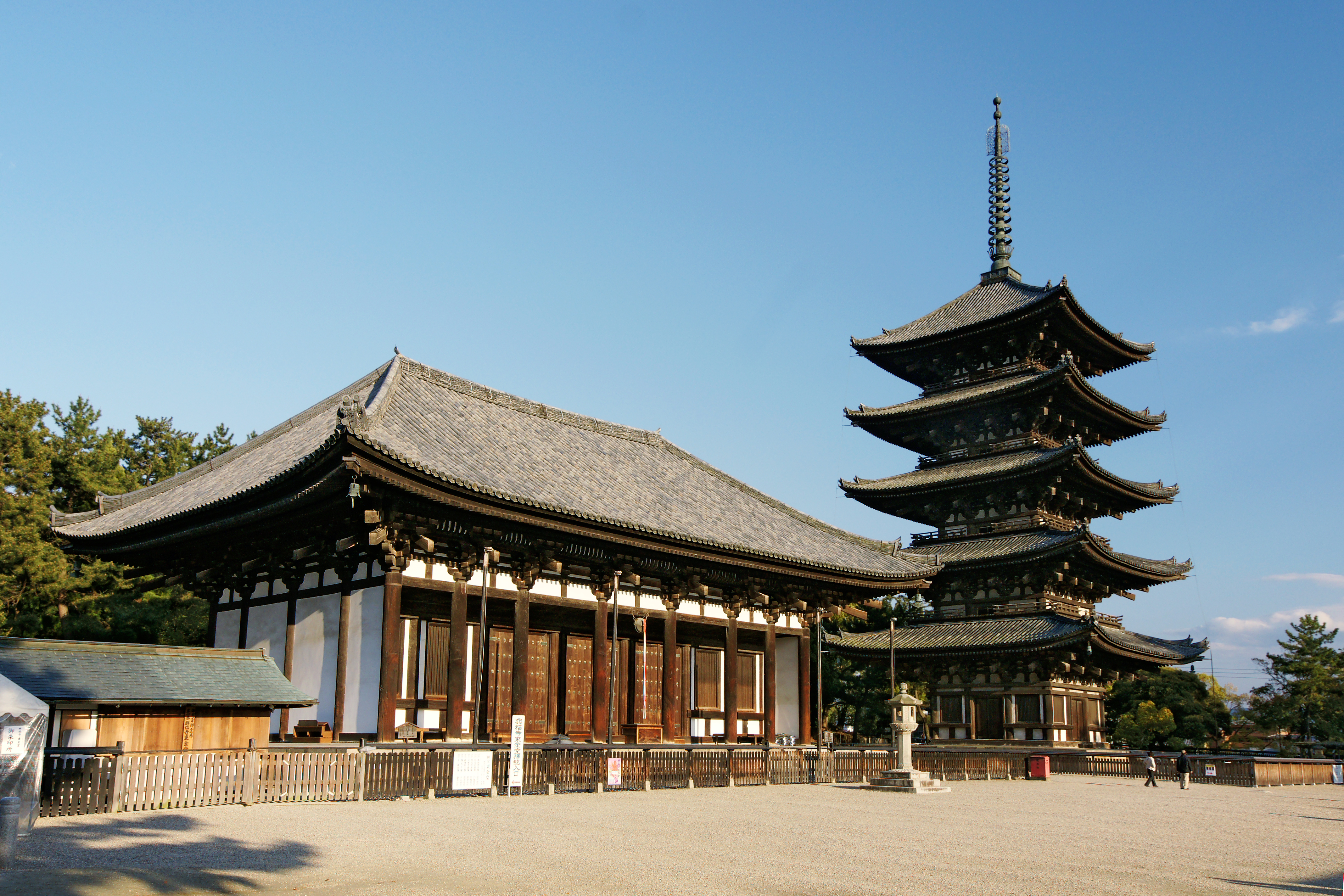
is the capital city of Nara Prefecture, Japan. As of 2022, Nara has an estimated population of 367,353 according to World Population Review, making it the largest city in Nara Prefecture and sixth-largest in the Kansai region of Honshu. Nara is a core city located in the northern part of Nara Prefecture bordering the Kyoto Prefecture. Nara was the capital of Japan during the Nara period from 710 to 794 as the seat of the Emperor before the capital was moved to Kyoto. Nara is home to eight temples, shrines, and ruins, specifically Tōdai-ji, Saidai-ji, Kōfuku-ji, Kasuga Shrine, Gangō-ji, Yakushi-ji, Tōshōdai-ji, and the Heijō Palace, together with Kasugayama Primeval Forest, collectively form the Historic Monuments of Ancient Nara, a UNESCO World Heritage Site. Etymology By the Heian period, a variety of different characters had been used to represent the name Nara: , , , , , , , , , , , , , , , and . A number of theories for the origin of the name "Nara" have been pro ... [...More Info...] [...Related Items...] OR: [Wikipedia] [Google] [Baidu] |
Kyoto
Kyoto (; Japanese: , ''Kyōto'' ), officially , is the capital city of Kyoto Prefecture in Japan. Located in the Kansai region on the island of Honshu, Kyoto forms a part of the Keihanshin metropolitan area along with Osaka and Kobe. , the city had a population of 1.46 million. The city is the cultural anchor of a substantially larger metropolitan area known as Greater Kyoto, a metropolitan statistical area (MSA) home to a census-estimated 3.8 million people. Kyoto is one of the oldest municipalities in Japan, having been chosen in 794 as the new seat of Japan's imperial court by Emperor Kanmu. The original city, named Heian-kyō, was arranged in accordance with traditional Chinese feng shui following the model of the ancient Chinese capital of Chang'an/Luoyang. The emperors of Japan ruled from Kyoto in the following eleven centuries until 1869. It was the scene of several key events of the Muromachi period, Sengoku period, and the Boshin War, such as the Ōnin War, the Ho ... [...More Info...] [...Related Items...] OR: [Wikipedia] [Google] [Baidu] |
Asuka, Yamato
was the Imperial capital of Japan during the Asuka period (538 – 710 AD), which takes its name from this place. It is located in the present-day village of Asuka, Nara Prefecture. Etymology Some of the many theories of what the place was named after include the bird common crossbill, or ''isuka'' in Japanese, or local geological features, e.g. 洲処 (''suka'', meaning sandbar, sandbank or delta) or 崩地 (''asu'') + 処 (''ka''). Or it may have been named in honor of Asuka (or Ashuku) Nyorai, the Japanese equivalent of Akshobhya, one of the Five Buddhas of Wisdom, who is still worshiped in Asuka-dera (Asuka Temple), the Asuka-niimasu-jinja (the shrine for his manifestation as a Shinto god), and several other structures from those days. Archaeology Archaeology projects continue to uncover relics from these ruins. Recent discoveries in the area include Wado coins, believed to be some of the oldest coins in Japan, and paintings in the Kitora and Takamatsuzuka Kofun, or tom ... [...More Info...] [...Related Items...] OR: [Wikipedia] [Google] [Baidu] |
Asuka Period
The was a period in the history of Japan lasting from 538 to 710 (or 592 to 645), although its beginning could be said to overlap with the preceding Kofun period. The Yamato polity evolved greatly during the Asuka period, which is named after the Asuka region, about south of the modern city of Nara. The Asuka period is characterized by its significant artistic, social, and political transformations, having their origins in the late Kofun period. The introduction of Buddhism marked a change in Japanese society. The Asuka period is also distinguished by the change in the name of the country from to . Naming The term "Asuka period" was first used to describe a period in the history of Japanese fine-arts and architecture. It was proposed by fine-arts scholars and Okakura Kakuzō around 1900. Sekino dated the Asuka period as ending with the Taika Reform of 646. Okakura, however, saw it as ending with the transfer of the capital to the Heijō Palace of Nara. Although historians ge ... [...More Info...] [...Related Items...] OR: [Wikipedia] [Google] [Baidu] |
Route 169 (Japan)
National Route 169 is a national highway of Japan connecting Nara, Nara and Shingū, Wakayama in Japan, with a total length of 184.6 km (114.71 mi). History National Route 169 was originally designated on 18 May 1953 as a second-class national highway connecting the now dissolved town, Kinomoto, in Mie Prefecture to Yamatotakada, Nara is a city located in Nara Prefecture, Japan. As of April 1, 2017, the city had an estimated population of 66,400 and 29,713 households. The population density is 4,000 persons per km², and the total area is 16.48 km². The city continue .... See also * * References External links * National highways in Japan Roads in Mie Prefecture Roads in Nara Prefecture Roads in Wakayama Prefecture {{Japan-road-stub ... [...More Info...] [...Related Items...] OR: [Wikipedia] [Google] [Baidu] |
Minami Osaka Line
is a railway line operated by Kintetsu Railway connecting in Osaka and in Kashihara, Nara Prefecture via Osaka's southern suburb cities of Matsubara, Fujiidera and Habikino in Osaka Prefecture, and Katsuragi and Yamato-Takada in Nara Prefecture. The line is the major access from Osaka to southern part of Nara Basin, and together with the Yoshino Line is the main access to the Yoshino refuge of Emperor Godaigo, a popular tourism destination, especially during spring. The network formed by this line and some branch lines use a track gauge of , making them the only lines of the Kintetsu network at this gauge, other lines of Kintetsu are 1435mm gauge and 762mm gauge. History The first section of the line opened in 1898 in a part between Kashiwara Station and Furuichi Station by . The next year took over the line, then the company renamed itself . The railway constructed its own access line to Osaka center, completed in 1923 and electrified at 1,500 V DC, then the highest vol ... [...More Info...] [...Related Items...] OR: [Wikipedia] [Google] [Baidu] |


