|
1981 Atlantic Hurricane Season
The 1981 Atlantic hurricane season featured direct or indirect impacts from nearly all of its 12 tropical or subtropical storms. Overall, the season was fairly active, with 22 tropical depressions, 12 of which became a namable storm, while 7 of those reached hurricane status and 3 intensified into major hurricanes. The season officially began on June 1, 1981, and lasted until November 30, 1981. These dates conventionally delimit the period of each year when most tropical cyclones form in the Atlantic basin. However, tropical cyclogenesis can occur before these dates, as demonstrated with the development of two tropical depressions in April and Tropical Storm Arlene in May. At least one tropical cyclone formed in each month between April and November, with the final system, Subtropical Storm Three, becoming extratropical on November 17, 1981. Although many tropical cyclones impacted land, few caused significant damage. Tropical Depressi ... [...More Info...] [...Related Items...] OR: [Wikipedia] [Google] [Baidu] |
1979 Atlantic Hurricane Season
The 1979 Atlantic hurricane season was the first season to include both male and female names, as well as the common six-year rotating lists of tropical cyclone names. The season officially began on June 1, and lasted until November 30. These dates conventionally delimit the period of each year when most tropical cyclones form in the Atlantic basin. It was slightly below average, with nine systems reaching tropical storm intensity. The first system, an unnumbered tropical depression, developed north of Puerto Rico on June 9. Two days later, Tropical Depression One formed and produced severe flooding in Jamaica, with 40 deaths and about $27 million (1979 USD) in damage. Tropical Storm Ana caused minimal impact in the Lesser Antilles. Hurricane Bob spawned tornadoes and produced minor wind damage along the Gulf Coast of the United States, primarily in Louisiana, while the remnants caused flooding, especially in Indiana. Tropical Storm Claudette cause ... [...More Info...] [...Related Items...] OR: [Wikipedia] [Google] [Baidu] |
Hurricane Katrina (1981)
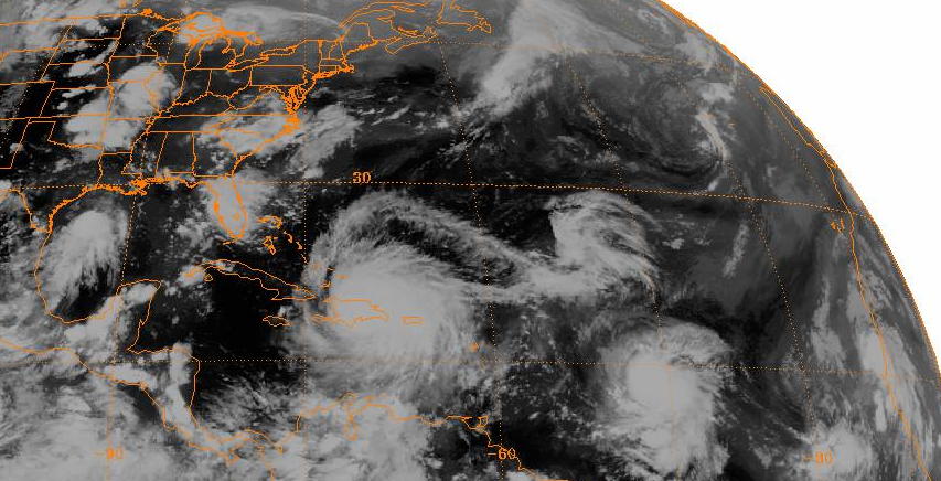
Hurricane Katrina was a late-forming tropical cyclone that impacted portions of the Greater Antilles and Bahamas in November 1981. The twenty-first tropical cyclone, eleventh named storm, and seventh hurricane of the 1981 Atlantic hurricane season, Katrina developed from an area of cloudiness in the western Caribbean Sea early on November 3. The initial tropical depression deepened slowly, and was upgraded to Tropical Storm Katrina on November 5. About six hours later, Katrina peaked with sustained winds of 85 mph (140 km/h). The storm made landfall along the south coast of Camagüey Province in Cuba early on November 6. Katrina quickly weakened to a tropical storm, before emerging into the Atlantic Ocean hours later. The system then accelerated northeastward and crossed the Bahamas late on November 6. Katrina dissipated late on November 7, shortly before merging with a frontal system. On Grand Cayman, a waterspout ripped out a grape tree ... [...More Info...] [...Related Items...] OR: [Wikipedia] [Google] [Baidu] |
South Carolina
)'' Animis opibusque parati'' ( for, , Latin, Prepared in mind and resources, links=no) , anthem = "Carolina";" South Carolina On My Mind" , Former = Province of South Carolina , seat = Columbia , LargestCity = Charleston , LargestMetro = Greenville (combined and metro)Columbia (urban) , BorderingStates = Georgia, North Carolina , OfficialLang = English , population_demonym = List of U.S. state residents names, South Carolinian , Governor = , Lieutenant Governor = , Legislature = South Carolina General Assembly, General Assembly , Upperhouse = South Carolina Senate, Senate , Lowerhouse = South Carolina House of Representatives, House of Representatives , Judiciary = South Carolina Supreme Court , Senators = , Representative = 6 Republicans1 Democrat , postal_code = SC , TradAbbreviation = S.C. , area_rank = 40th , area_total_sq_mi = 32,020 , area_total_km2 = 82,932 , area_land_sq_mi = 30,109 , area_land_km2 = 77,982 , area_water_sq_mi = 1,911 , area_wat ... [...More Info...] [...Related Items...] OR: [Wikipedia] [Google] [Baidu] |
Andros
Andros ( el, Άνδρος, ) is the northernmost island of the Greece, Greek Cyclades archipelago, about southeast of Euboea, and about north of Tinos. It is nearly long, and its greatest breadth is . It is for the most part mountainous, with many fruitful and well-watered valleys. The municipality, which includes the island Andros and several small, uninhabited islands, has an area of . The largest towns are Andros (town), Gavrio, Batsi, and Ormos Korthiou. Palaiopoli, Andros, Palaeopolis, the ancient capital, was built into a steep hillside, and the breakwater (structure), breakwater of its harbor can still be seen underwater. At the village of Apoikia, there is the notable spring of Sariza, where the water flows from a sculpted stone lion's head. Andros also offers great hiking options with many new paths being added each year. History Antiquity During the Final Neolithic (over 5,000 years ago), Andros had a fortified village on its west coast, which archaeologists ha ... [...More Info...] [...Related Items...] OR: [Wikipedia] [Google] [Baidu] |
Delmarva Peninsula
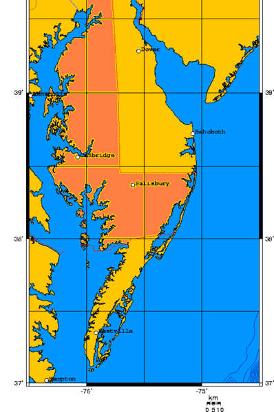
The Delmarva Peninsula, or simply Delmarva, is a large peninsula and proposed state on the East Coast of the United States, occupied by the vast majority of the state of Delaware and parts of the Eastern Shore regions of Maryland and Virginia. The peninsula is long. In width, it ranges from near its center, to at the isthmus on its northern edge, to less near its southern tip of Cape Charles. It is bordered by the Chesapeake Bay on the west, Pocomoke Sound on the southwest, and the Delaware River, Delaware Bay, and the Atlantic Ocean on the east. Etymology In older sources, the peninsula between Delaware Bay and Chesapeake Bay was referred to variously as the Delaware and Chesapeake Peninsula or simply the Chesapeake Peninsula. The toponym ''Delmarva'' is a clipped compound of Delaware, Maryland, and Virginia ( official abbreviation ''VA''), which in turn was modeled after Delmar, a border town named after two of those states. While Delmar was founded and named in 1859 ... [...More Info...] [...Related Items...] OR: [Wikipedia] [Google] [Baidu] |
Bermuda
) , anthem = " God Save the King" , song_type = National song , song = "Hail to Bermuda" , image_map = , map_caption = , image_map2 = , mapsize2 = , map_caption2 = , subdivision_type = Sovereign state , subdivision_name = , established_title2 = English settlement , established_date2 = 1609 (officially becoming part of the Colony of Virginia in 1612) , official_languages = English , demonym = Bermudian , capital = Hamilton , coordinates = , largest_city = Hamilton , ethnic_groups = , ethnic_groups_year = 2016 , government_type = Parliamentary dependency under a constitutional monarchy , leader_title1 = Monarch , leader_name1 = Charles III , leader_title2 = Governor , leader_name2 = Rena Lalgie , leader_title3 = Premier , leader_name3 = Edward David Burt , legislature = Parliament , upper_house = Senate , lower_house = House of Assembly , area_km2 = 53.2 , area_sq_mi = 20.54 , area_rank = , percent_water = 27 , elevation_max ... [...More Info...] [...Related Items...] OR: [Wikipedia] [Google] [Baidu] |
Tampico
Tampico is a city and port in the southeastern part of the state of Tamaulipas, Mexico. It is located on the north bank of the Pánuco River, about inland from the Gulf of Mexico, and directly north of the state of Veracruz. Tampico is the fifth-largest city in Tamaulipas, with a population of 314,418 in the city proper and 929,174 in the metropolitan area. During the period of Mexico's first oil boom in the early 20th century, the city was the "chief oil-exporting port of the Americas" and the second-busiest in the world, yielding great profits that were invested in the city's famous architecture, often compared to that of Venice and New Orleans.Dave Graham, "Crime-ridden state poses acid test for Mexican oil reform" ''Reuters,'' 25 June 2014, access ... [...More Info...] [...Related Items...] OR: [Wikipedia] [Google] [Baidu] |
Bay Of Campeche
The Bay of Campeche ( es, Bahía de Campeche), or Campeche Sound, is a bight in the southern area of the Gulf of Mexico, forming the north side of the Isthmus of Tehuantepec. It is surrounded on three sides by the Mexican states of Campeche, Tabasco and Veracruz. The area of the bay is and maximum depth of the bay is approximately . It was named by Francisco Hernández de Córdoba and Antón de Alaminos during their expedition in 1517. Oil resources The Cantarell Complex of five oil fields lies beneath the Bay of Campeche. In 2003, it was the second most productive oil field in the world, then supplying about two thirds of Mexico's crude oil output, but it went into a steep decline soon thereafter. On June 3, 1979, ''Ixtoc I'', an exploratory oil well located in the bay, suffered a blowout that caused a catastrophic explosion, resulting in what has been ranked as the third largest unintentional oil spill in history. Climate During the months of June and July, the Bay of Camp ... [...More Info...] [...Related Items...] OR: [Wikipedia] [Google] [Baidu] |
Cuba
Cuba ( , ), officially the Republic of Cuba ( es, República de Cuba, links=no ), is an island country comprising the island of Cuba, as well as Isla de la Juventud and several minor archipelagos. Cuba is located where the northern Caribbean Sea, Gulf of Mexico, and Atlantic Ocean meet. Cuba is located east of the Yucatán Peninsula (Mexico), south of both the American state of Florida and the Bahamas, west of Hispaniola (Haiti/Dominican Republic), and north of both Jamaica and the Cayman Islands. Havana is the largest city and capital; other major cities include Santiago de Cuba and Camagüey. The official area of the Republic of Cuba is (without the territorial waters) but a total of 350,730 km² (135,418 sq mi) including the exclusive economic zone. Cuba is the second-most populous country in the Caribbean after Haiti, with over 11 million inhabitants. The territory that is now Cuba was inhabited by the Ciboney people from the 4th millennium BC with the Gua ... [...More Info...] [...Related Items...] OR: [Wikipedia] [Google] [Baidu] |
Tropical Cyclogenesis
Tropical cyclogenesis is the development and strengthening of a tropical cyclone in the atmosphere. The mechanisms through which tropical cyclogenesis occurs are distinctly different from those through which temperate cyclogenesis occurs. Tropical cyclogenesis involves the development of a warm-core cyclone, due to significant convection in a favorable atmospheric environment. Tropical cyclogenesis requires six main factors: sufficiently warm sea surface temperatures (at least ), atmospheric instability, high humidity in the lower to middle levels of the troposphere, enough Coriolis force to develop a low-pressure center, a pre-existing low-level focus or disturbance, and low vertical wind shear. Tropical cyclones tend to develop during the summer, but have been noted in nearly every month in most basins. Climate cycles such as ENSO and the Madden–Julian oscillation modulate the timing and frequency of tropical cyclone development. There is a limit on tropical cyclon ... [...More Info...] [...Related Items...] OR: [Wikipedia] [Google] [Baidu] |
The Daily News (Texas)
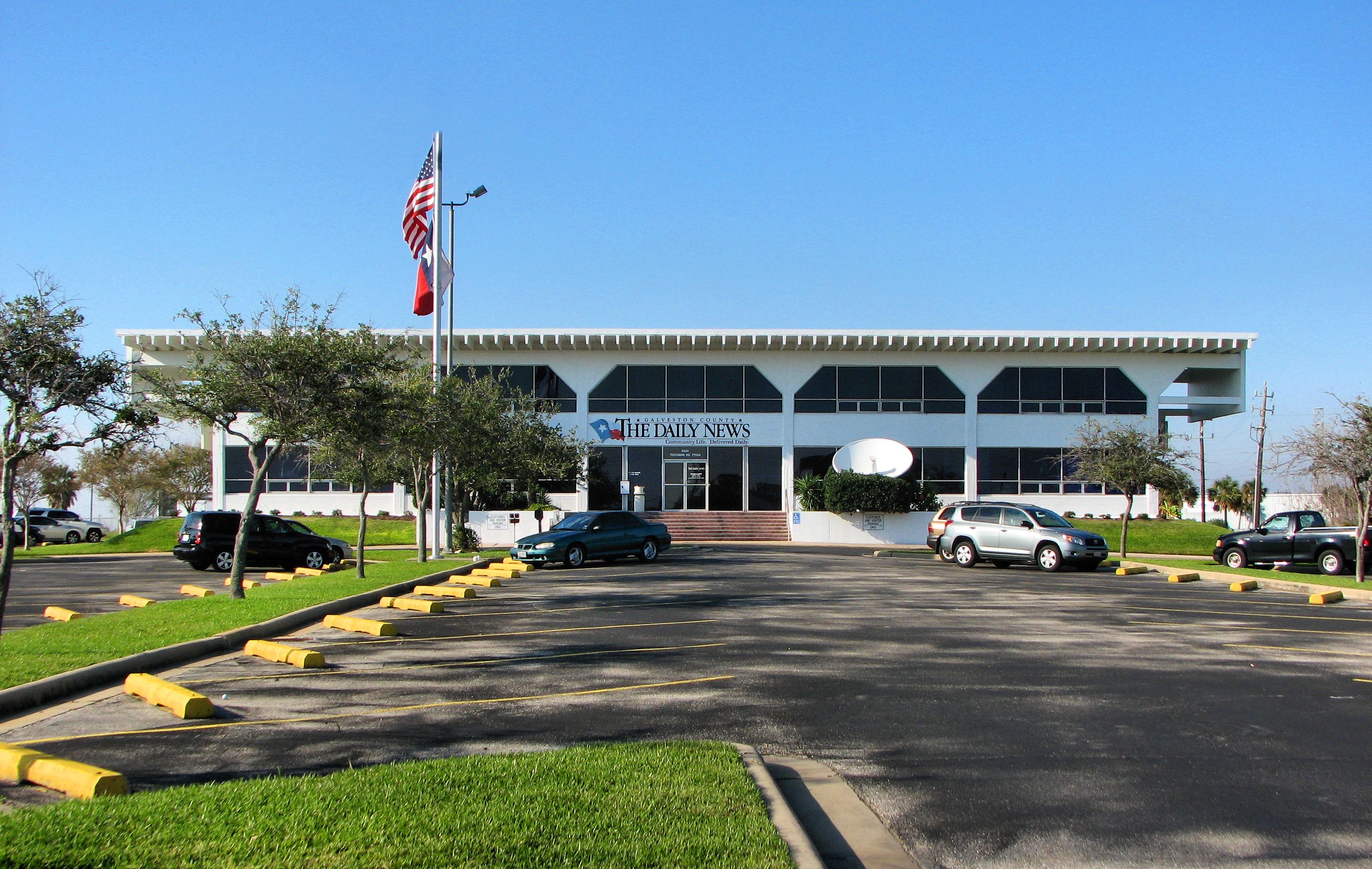
''The Daily News'', formerly the ''Galveston County Daily News'' and ''Galveston Daily News'', is a newspaper published in Galveston, Texas, United States. It was first published April 11, 1842, making it the oldest newspaper in the U.S. state of Texas. The newspaper founded ''The Dallas Morning News'' on October 1, 1885, as a sister publication. It currently serves as the newspaper of record for the City of Galveston as well as Galveston County. History On April 11, 1842, George H. French began publication of the ''Daily News'', as a single broadsheet paper. At the time, Texas was an independent Republic, with Sam Houston serving as president, and Galveston was its largest port and primary city. By 1843, Willard Richardson was named editor of the paper and in 1845 decided to purchase the growing publication. ''The News'' continued to grow and became a "major voice in the Republic of Texas", and was one of the first papers in the US with a dedicated train to manage its c ... [...More Info...] [...Related Items...] OR: [Wikipedia] [Google] [Baidu] |
Climate Prediction Center
The Climate Prediction Center (CPC) is a United States federal agency that is one of the National Centers for Environmental Prediction, which are a part of the National Oceanic and Atmospheric Administration's National Weather Service. CPC is headquartered in College Park, Maryland. Its roots trace back to the climatological work of Thomas Jefferson, with the United States Army Signal Corp taking over responsibility of the climate program in the late 19th century. Once it became part of the United States Weather Bureau, it was known as the Weather Bureau Climate and Crop Services. From 1957 through 1966, the United States Weather Bureau's Office of Climatology, located in Washington, D.C., and then Suitland, Maryland, published the Mariners Weather Log publication. Late in the 20th century, it was known as the Climate Analysis Center for a time, before evolving into CPC in 1995. CPC issues climate forecasts valid for weeks and months in advance. History The roots of modern ... [...More Info...] [...Related Items...] OR: [Wikipedia] [Google] [Baidu] |


