|
Buckley Bay, British Columbia
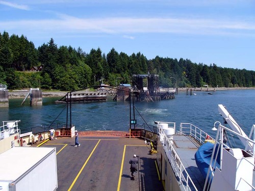
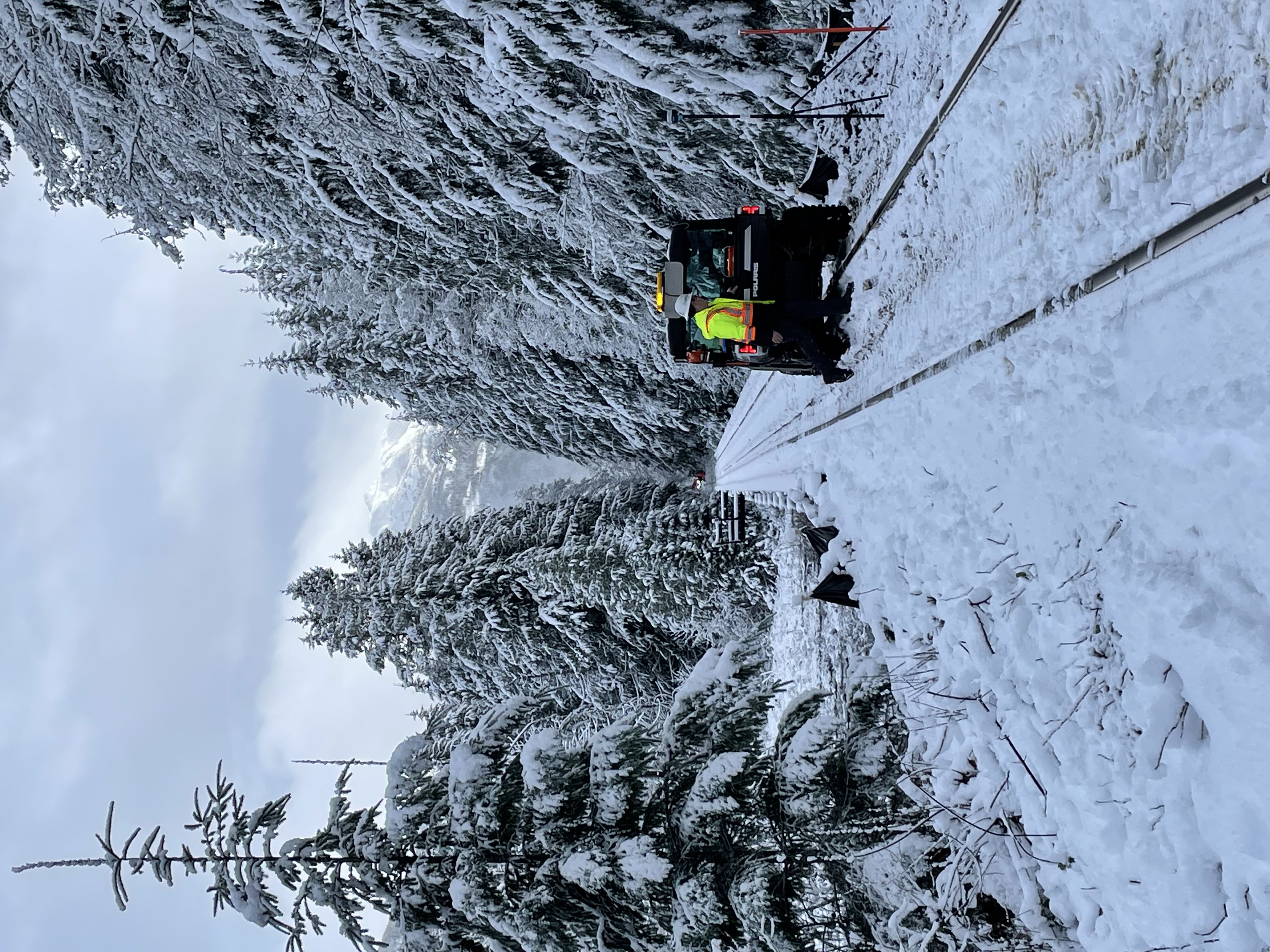
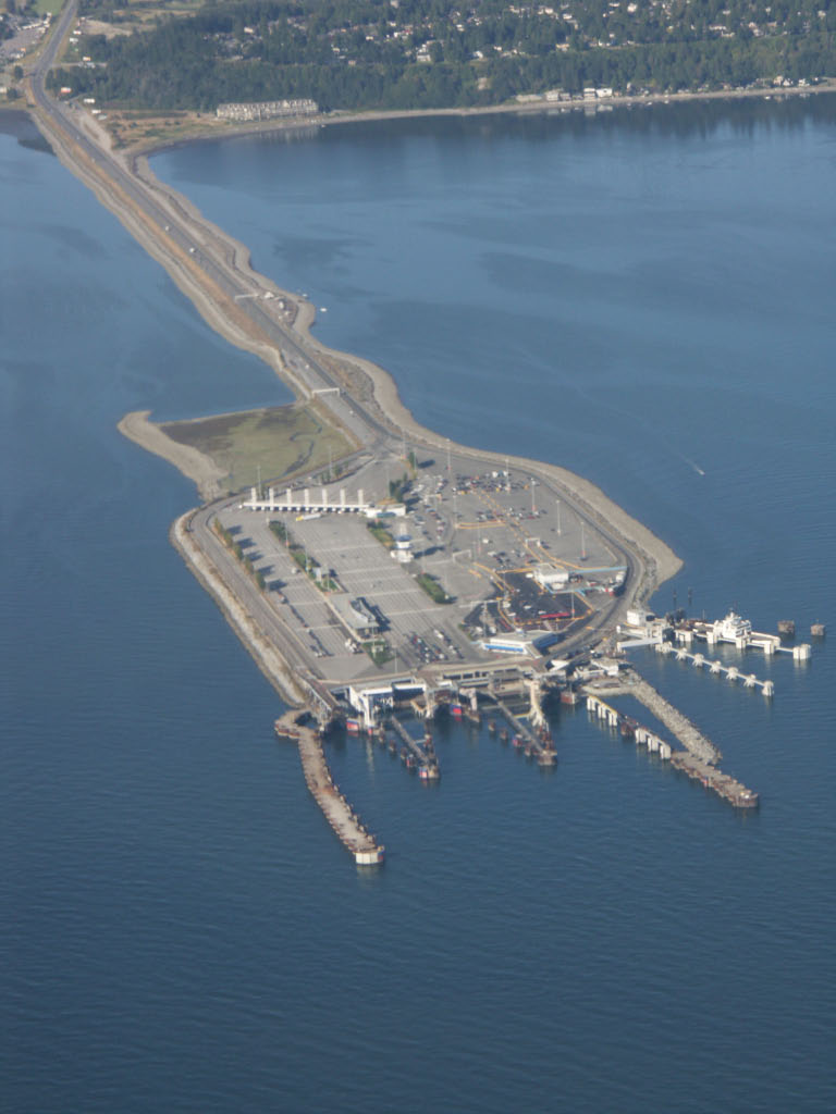
Buckley Bay is a geographical location on the east coast of Vancouver Island, located between Union Bay, British Columbia, Union Bay to the north and Fanny Bay, British Columbia, Fanny Bay to the south. It is the departure point for the BC Ferries crossing of Baynes Sound to Denman Island and on to Hornby Island. Buckley Bay is accessible from both the Old Island Highway (British Columbia Highway 19A, 19A) and from Exit 101 on the newer Inland Island Highway (British Columbia Highway 19, 19). The Island Rail Corridor also passes through Buckley Bay at Mile 126.2 of the Victoria Subdivision. The area has a population of 173, according to the 2006 Census. Populated places in the Comox Valley Regional District Unincorporated settlements in British Columbia Designated places in British Columbia Mid Vancouver Island {{BritishColumbia-geo-stub ... [...More Info...] [...Related Items...] OR: [Wikipedia] [Google] [Baidu] |
British Columbia
British Columbia (commonly abbreviated as BC) is the westernmost province of Canada, situated between the Pacific Ocean and the Rocky Mountains. It has a diverse geography, with rugged landscapes that include rocky coastlines, sandy beaches, forests, lakes, mountains, inland deserts and grassy plains, and borders the province of Alberta to the east and the Yukon and Northwest Territories to the north. With an estimated population of 5.3million as of 2022, it is Canada's third-most populous province. The capital of British Columbia is Victoria and its largest city is Vancouver. Vancouver is the third-largest metropolitan area in Canada; the 2021 census recorded 2.6million people in Metro Vancouver. The first known human inhabitants of the area settled in British Columbia at least 10,000 years ago. Such groups include the Coast Salish, Tsilhqotʼin, and Haida peoples, among many others. One of the earliest British settlements in the area was Fort Victoria, established in ... [...More Info...] [...Related Items...] OR: [Wikipedia] [Google] [Baidu] |
Denman Island
Denman Island, or Sla-dai-aich (Taystayic), its Indigenous name, is one of the Northern Gulf Islands and part of the Comox Valley Regional District of British Columbia, Canada. It is a member of the Islands Trust group of islands and is home to a small community of 1391 year-round residents. History Denman Island was first inhabited by Indigenous peoples including the Pentlatch and Sliammon as evidenced by middens, gravesites, and oral history. The site most recently occupied by Pentlatch people was previously named Village Point but is now called Denman Point. That village was occupied until the 1862 smallpox epidemic severely reduced its population and the survivors moved to join the K'ómoks people in nearby Comox. The Island was seen and mapped by Europeans during the 1791 voyage of the Spanish ship ''Santa Saturnina'', under Juan Carrasco and José María Narváez. It was named by Captain Richards in 1860 for Rear Admiral Joseph Denman who was commander of the Pac ... [...More Info...] [...Related Items...] OR: [Wikipedia] [Google] [Baidu] |
Unincorporated Settlements In British Columbia
Unincorporated may refer to: * Unincorporated area, land not governed by a local municipality * Unincorporated entity An unincorporated entity has not been granted formal corporate status by incorporation. An unincorporated entity will generally be a separate entity for accounting purposes, but may or may not be a separate legal entity. For example, partnership ..., a type of organization * Unincorporated territories of the United States, territories under U.S. jurisdiction, to which Congress has determined that only select parts of the U.S. Constitution apply * Unincorporated association, also known as voluntary association, groups organized to accomplish a purpose * ''Unincorporated'' (album), a 2001 album by Earl Harvin Trio {{disambig ... [...More Info...] [...Related Items...] OR: [Wikipedia] [Google] [Baidu] |
Populated Places In The Comox Valley Regional District
Population typically refers to the number of people in a single area, whether it be a city or town, region, country, continent, or the world. Governments typically quantify the size of the resident population within their jurisdiction using a census, a process of collecting, analysing, compiling, and publishing data regarding a population. Perspectives of various disciplines Social sciences In sociology and population geography, population refers to a group of human beings with some predefined criterion in common, such as location, race, ethnicity, nationality, or religion. Demography is a social science which entails the statistical study of populations. Ecology In ecology, a population is a group of organisms of the same species who inhabit the same particular geographical area and are capable of interbreeding. The area of a sexual population is the area where inter-breeding is possible between any pair within the area and more probable than cross-breeding with in ... [...More Info...] [...Related Items...] OR: [Wikipedia] [Google] [Baidu] |
Island Rail Corridor
The Island Rail Corridor, previously the Esquimalt & Nanaimo Railway (E&N Railway), is a railway operation on Vancouver Island and is the only remaining railway on Vancouver Island after the closure of the Englewood Railway in November 2017. The Island Corridor Foundation owns the former Esquimalt & Nanaimo Railway corridor. The railway line is in length from Victoria to Courtenay, known as the Victoria Subdivision, with a branch line from Parksville to Port Alberni known as the Port Alberni Subdivision at in length, for a total of mainline track. In 2006, the Island Corridor Foundation acquired the railway's ownership from the Canadian Pacific Railway. Both freight service and the crown corporation VIA Rail passenger service have been suspended due to deferred maintenance on the rail line. History Vancouver Island joining Canada The history of an island railway and a functioning island railway in perpetuity, started with the colony of Vancouver Island joining Britis ... [...More Info...] [...Related Items...] OR: [Wikipedia] [Google] [Baidu] |
British Columbia Highway 19
Highway 19 is the main north-south thoroughfare on Vancouver Island from Nanaimo to Port Hardy. A highway has existed on the Island since about 1912. Originally gravel and rough, the highway was an essential link together with the Esquimalt & Nanaimo Railway. The paved highway first opened in 1953, replacing a stretch of Highway 1 between Nanaimo and Campbell River, finally being extended to the northern tip of the island in the late 1970s. The total length of the highway is . Route description Highway 19's northern end is located at the Bear Cove ferry terminal, across the bay from Port Hardy. The highway proceeds southwest from the ferry dock for 5 km (3 mi) to a junction with the main road to the centre of Port Hardy, then turns southeast, travelling for 16 km (10 mi) to Highway 30, and then further east for 20 km (12 mi) to the main road to Port McNeill. The highway then follows the eastern shore of Nimpkish Lake and the Nimpkish River throug ... [...More Info...] [...Related Items...] OR: [Wikipedia] [Google] [Baidu] |
British Columbia Highway 19A
Highway 19A, known locally as the ''Oceanside Route'' or the Old Island Highway, is a provincial highway in British Columbia, Canada. It runs along two former sections of Highway 19 on Vancouver Island, within Nanaimo and between Craig's Crossing and Campbell River. The section of Highway 19A between Craig's Crossing and Campbell River is 136.89 km (85.06 mi) long, and the Nanaimo alignment covers 10.64 km (6.61 mi). The highway was established after Highway 19 was realigned to a new road between 1996 and 2001. Route description Nanaimo Highway 19A's Nanaimo alignment begins at Stewart Avenue (Trans-Canada Highway / Highway 1) at the entrance to the Departure Bay ferry terminal and proceeds up Brechin Road to Terminal Avenue. The highway then turns north and proceeds through the northern business district of the city to northern end of the Nanaimo Parkway (Highway 19). Terminal Avenue between Stewart Avenue and Brechin Road is signed as an alternate con ... [...More Info...] [...Related Items...] OR: [Wikipedia] [Google] [Baidu] |
Hornby Island
Hornby Island of British Columbia, Canada, is one of the two northernmost Gulf Islands, located near Vancouver Island's Comox Valley, the other being Denman Island. A small community of 1,016 residents (as of the 2016 census), Hornby is home to many artists, retired professionals, small business owners, remote workers, and young families who share a love of rural island life. Over the past 30 years, the island has become a coveted destination and its population easily quadruples in size during the summer months. The shoulder seasons are a preferred time for hiking, mountain biking, marine activities, weddings, and retreats. Most people reach the island by ferries from Buckley Bay, Vancouver Island. A growing number of private boats also visit through mooring at the Ford Cove Marina or anchoring at Tribune Bay. The closest airport is Comox Valley Airport in Comox, which provides regional, national, and international service. The primary destinations on Hornby are Tribune Bay Pro ... [...More Info...] [...Related Items...] OR: [Wikipedia] [Google] [Baidu] |
Baynes Sound
Baynes Sound is the channel between Denman Island and Vancouver Island, British Columbia, Canada. The sound is a narrow western offshoot of the Strait of Georgia that separates Vancouver Island from the mainland of British Columbia. The area is actively harvested by the local oyster industry, as is apparent by an abundance of oyster farms. It produces 39% of the oysters and 55% of the manila clams farmed in British Columbia. The sound is long and is wide at its widest point, although the average width is less than . The southern boundary lies around Chrome Island, a small island off Boyle Point, the southern tip of Denman. The northern boundary is less defined, but lies between Tree Island at the northern end of Denman and the Comox harbour. The sound is dotted with the small communities of (north to south) Royston, Union Bay, Buckley Bay, Mud Bay, Fanny Bay, and Deep Bay on Vancouver Island. The crossing is served by the British Columbia Ferry Services Inc. ship MV Baynes S ... [...More Info...] [...Related Items...] OR: [Wikipedia] [Google] [Baidu] |
Provinces And Territories Of Canada
Within the geographical areas of Canada, the ten provinces and three territories are sub-national administrative divisions under the jurisdiction of the Constitution of Canada, Canadian Constitution. In the 1867 Canadian Confederation, three provinces of British North America—New Brunswick, Nova Scotia, and the Province of Canada (which upon Confederation was divided into Ontario and Quebec)—united to form a federation, becoming a fully independent country over the next century. Over its history, Canada's international borders have changed several times as it has added territories and provinces, making it the List of countries and dependencies by area, world's second-largest country by area. The major difference between a Canadian province and a territory is that provinces receive their power and authority from the ''Constitution Act, 1867'' (formerly called the ''British North America Acts, British North America Act, 1867''), whereas territorial governments are creatures of ... [...More Info...] [...Related Items...] OR: [Wikipedia] [Google] [Baidu] |
BC Ferries
British Columbia Ferry Services Inc., operating as BC Ferries (BCF), is a former provincial Crown corporation, now operating as an independently managed, publicly owned Canadian company. BC Ferries provides all major passenger and vehicle ferry services for coastal and island communities in the Canadian province of British Columbia. Set up in 1960 to provide a similar service to that provided by the Black Ball Line and the Canadian Pacific Railway, which were affected by job action at the time, BC Ferries has become the largest passenger ferry line in North America, operating a fleet of 36 vessels with a total passenger and crew capacity of over 27,000, serving 47 locations on the B.C. coast. The federal and provincial governments subsidize BC Ferries to provide agreed service levels on essential links between the BC mainland, coastal islands, and parts of the mainland without road access. The inland ferries operating on British Columbia's rivers and lakes are not run by BC F ... [...More Info...] [...Related Items...] OR: [Wikipedia] [Google] [Baidu] |
Fanny Bay, British Columbia
Fanny Bay is a small hamlet in the Provinces and territories of Canada, Canadian province of British Columbia. It is located on Baynes Sound on the east coast of Vancouver Island. In 2001, its population was listed as 815. It is best known for its fine oysters. The area is served by the Island Highway and Island Rail Corridor. Origin of the name There is no consensus on the origin of the name Fanny Bay and none of the various explanations — comical, romantic, local or historical — can be considered without skepticism. The name first appeared on British Columbia maps in 1913 and was officially adopted by the government in 1923. This adoption was based on British Admiralty charts of the 1860s, taken from surveys by Royal Navy Captain George Henry Richards, G.H. Richards. However, if Capt. Richards knew who "Fanny" was, he did not record the information. Geographer A.B. McNeill wrote in his book ''Origin of Station Names, Esquimalt and Nanaimo Division'' that "...Fanny Bay was n ... [...More Info...] [...Related Items...] OR: [Wikipedia] [Google] [Baidu] |


