|
British Columbia Highway 19A
Highway 19A, known locally as the ''Oceanside Route'' or the Old Island Highway, is a provincial highway in British Columbia, Canada. It runs along two former sections of Highway 19 on Vancouver Island, within Nanaimo and between Craig's Crossing and Campbell River. The section of Highway 19A between Craig's Crossing and Campbell River is 136.89 km (85.06 mi) long, and the Nanaimo alignment covers 10.64 km (6.61 mi). The highway was established after Highway 19 was realigned to a new road between 1996 and 2001. Route description Nanaimo Highway 19A's Nanaimo alignment begins at Stewart Avenue (Trans-Canada Highway / Highway 1) at the entrance to the Departure Bay ferry terminal and proceeds up Brechin Road to Terminal Avenue. The highway then turns north and proceeds through the northern business district of the city to northern end of the Nanaimo Parkway (Highway 19). Terminal Avenue between Stewart Avenue and Brechin Road is signed as an alternate con ... [...More Info...] [...Related Items...] OR: [Wikipedia] [Google] [Baidu] |
Nanaimo
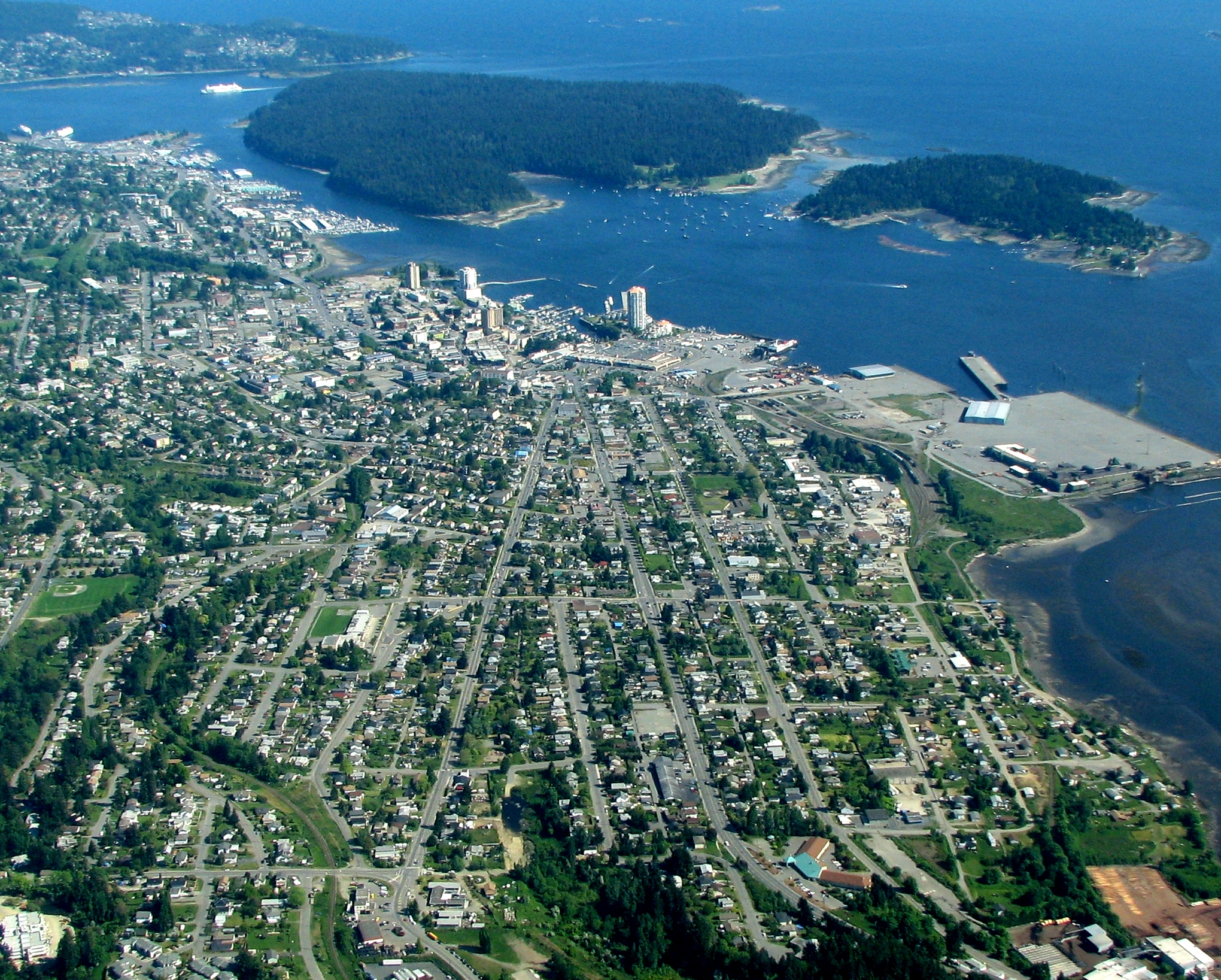
Nanaimo ( ) is a city on the east coast of Vancouver Island, in British Columbia, Canada. As of the Canada 2021 Census, 2021 census, it had a population of 99,863, and it is known as "The Harbour City." The city was previously known as the "Hub City," which was attributed to its original layout design, whose streets radiated from the shoreline like the spokes of a wagon wheel, and to its central location on Vancouver Island. Nanaimo is the headquarters of the Regional District of Nanaimo. Nanaimo is served by the coast-spanning Island Highway, the Island Rail Corridor, the BC Ferries system, and a local airport. History The Indigenous peoples of the area that is now known as Nanaimo are the Snuneymuxw. An anglicised spelling and pronunciation of that word gave the city its current name. The first Europeans known to reach Nanaimo Harbour were members of the 1791 Spanish voyage of Juan Carrasco (explorer), Juan Carrasco, under the command of Francisco de Eliza. They gave it ... [...More Info...] [...Related Items...] OR: [Wikipedia] [Google] [Baidu] |
Courtenay, British Columbia
Courtenay ( ) is a city on the east coast of Vancouver Island, in the Canadian province of British Columbia. It is the largest community and only city in the area commonly known as the Comox Valley, and the seat of the Comox Valley Regional District, which replaced the Comox-Strathcona Regional District. Courtenay is west of the town of Comox, northeast of the village of Cumberland, northwest of the unincorporated settlement of Royston, and northwest of Nanaimo. Along with Nanaimo and Victoria, it is home to The Canadian Scottish Regiment (Princess Mary's), a Primary Reserve infantry regiment of the Canadian Armed Forces. Courtenay and nearby Comox are served by the coast-spanning Island Highway, the Island Rail Corridor, and a local airport in Comox. History Early history Archaeological evidence suggests there was an active Coast Salish fishing settlement on the shores of the Courtenay River Estuary for at least 4,000 years. Due to its gentle climate, fertile soil and a ... [...More Info...] [...Related Items...] OR: [Wikipedia] [Google] [Baidu] |
Vancouver, British Columbia
Vancouver ( ) is a major city in western Canada, located in the Lower Mainland region of British Columbia. As the List of cities in British Columbia, most populous city in the province, the 2021 Canadian census recorded 662,248 people in the city, up from 631,486 in 2016. The Greater Vancouver, Greater Vancouver area had a population of 2.6million in 2021, making it the List of census metropolitan areas and agglomerations in Canada#List, third-largest metropolitan area in Canada. Greater Vancouver, along with the Fraser Valley Regional District, Fraser Valley, comprises the Lower Mainland with a regional population of over 3 million. Vancouver has the highest population density in Canada, with over 5,700 people per square kilometre, and fourth highest in North America (after New York City, San Francisco, and Mexico City). Vancouver is one of the most Ethnic origins of people in Canada, ethnically and Languages of Canada, linguistically diverse cities in Canada: 49.3 percent of ... [...More Info...] [...Related Items...] OR: [Wikipedia] [Google] [Baidu] |
Departure Bay Ferry Terminal
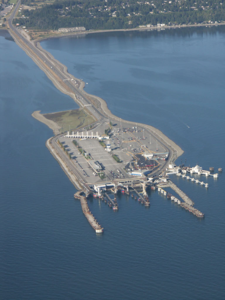
Departure Bay is a major ferry terminal in Nanaimo, British Columbia owned and operated by BC Ferries that provides ferry service across the Strait of Georgia to Horseshoe Bay in West Vancouver. The terminal is located at the southern end of Departure Bay. Unlike Nanaimo's other major ferry terminal (Duke Point), Departure Bay has public transit connections. History Beginning in 1951, the Black Ball Line originally ran its ferry service from Departure Bay to Horseshoe Bay using the ferries '' Kahloke'' and '' Chinook''. In November 1961, BC Ferries took over service by acquiring the Black Ball Line. Prior to the opening of the Duke Point ferry terminal in 1997, Departure Bay had regular ferry service to Tsawwassen Tsawwassen ( ) is a suburban, mostly residential community on a peninsula in the southwestern corner of the City of Delta in British Columbia, Canada. It provides the only road access to the American territory on the southern tip of the peninsul .... This chan ... [...More Info...] [...Related Items...] OR: [Wikipedia] [Google] [Baidu] |
British Columbia Highway 28
Highway 28 is an east-west highway on the northern part of Vancouver Island, within the Strathcona Regional District. It is the main link to the northern part of Strathcona Provincial Park and the remote logging communities of Gold River and Tahsis, on the northwest coast of the Island. The highway first opened in 1970. Before the section of Highway 19 from Campbell River to Port Hardy was opened in 1979, Highway 28 acted as the main access to Port Hardy and various other communities on the northern tip of the Island (in the Regional District of Mount Waddington The Regional District of Mount Waddington (RDMW) is a regional district in British Columbia. It takes in the lower Central Coast region centred on the Queen Charlotte Strait coast of northern Vancouver Island and the adjoining parts of mainland ...), aided by a system of local logging roads leading from the highway to the various north Island communities. History Originally a logging road that connected to High ... [...More Info...] [...Related Items...] OR: [Wikipedia] [Google] [Baidu] |
British Columbia Ferry Corporation
British Columbia Ferry Services Inc., operating as BC Ferries (BCF), is a former provincial Crown corporation, now operating as an independently managed, publicly owned Canadian company. BC Ferries provides all major passenger and vehicle ferry services for coastal and island communities in the Canadian province of British Columbia. Set up in 1960 to provide a similar service to that provided by the Black Ball Line and the Canadian Pacific Railway, which were affected by job action at the time, BC Ferries has become the largest passenger ferry line in North America, operating a fleet of 36 vessels with a total passenger and crew capacity of over 27,000, serving 47 locations on the B.C. coast. The federal and provincial governments subsidize BC Ferries to provide agreed service levels on essential links between the BC mainland, coastal islands, and parts of the mainland without road access. The inland ferries operating on British Columbia's rivers and lakes are not run by BC ... [...More Info...] [...Related Items...] OR: [Wikipedia] [Google] [Baidu] |
Oyster River, British Columbia
Oyster River is a small community on Vancouver Island, British Columbia, located between Campbell River ( to the north) and Black Creek ( to the south) mainly along or close to Highway 19A. Located just north of the estuary of the Oyster River, it is home to around 1,500 people and a very small commercial sector. Location Oyster River is named after the river that draws its southerly border with Black Creek, a community which is part of the Comox Valley Regional District. Three northbound bridges cross the river and signify the entrance into both Oyster River and the exit from Comox Valley Regional District. Between Oyster River's northerly boundary and the Campbell River city limits lies another small community called Stories Beach. Oyster River and Stories Beach collectively make up Strathcona Regional District 'Area D', an area which is independent of the Municipality of Campbell River, but which collaborates with the municipality frequently to provide residents with basi ... [...More Info...] [...Related Items...] OR: [Wikipedia] [Google] [Baidu] |
Black Creek, British Columbia
Black Creek is a community on the eastern side of Vancouver Island, British Columbia, Canada. It is approximately north of Courtenay, British Columbia, Courtenay. It is primarily an agricultural hamlet and bedroom community to Courtenay and Campbell River, British Columbia, Campbell River - approximately to the north. It is part of Electoral Area C in the Comox Valley Regional District. History Black Creek was the host to several logging camps in the early years of the 20th century such as the Comox Logging & Railway Camp #3 which was on what is now Endall Road. Endall Road public easement joins the dead end road with Hamm Road. Part of the camp bunkhouse is now adjoined to a local estate home. The area was made available to German speaking Mennonite settlers primarily from the USSR via Mexico or the Canadian Prairie provinces in the 1930s. They left a legacy of hard work, wresting dairy and fruit growing farms from stony ground that had once boasted some of the largest Douglas ... [...More Info...] [...Related Items...] OR: [Wikipedia] [Google] [Baidu] |
Merville, British Columbia
Merville is an unincorporated community in the Comox Valley between the City of Courtenay, Mount Washington, Dove Creek, and Black Creek near the east coast of Vancouver Island. It was named by soldiers returning to the Island after fighting in France for Canada in World War I who named it after the place in France, Merville-Franceville-Plage, where the Canadians had their first field headquarters. People from Merville * Emily St. John Mandel, novelist Twin Town Merville-Franceville-Plage Merville-Franceville-Plage () is a commune in the Calvados department in the Normandy region in northwestern France. Geography Merville-Franceville-Plage, more usually called Franceville, is situated on the Côte Fleurie, 6 km from Cabour ... References Populated places in the Comox Valley Regional District Unincorporated settlements in British Columbia Designated places in British Columbia {{BritishColumbia-geo-stub ... [...More Info...] [...Related Items...] OR: [Wikipedia] [Google] [Baidu] |
CFB Comox
Canadian Forces Base Comox , commonly referred to as CFB Comox or 19 Wing, is a Canadian Forces Base located north northeast of Comox, Vancouver Island, British Columbia. It is primarily operated as an air force base by the Royal Canadian Air Force (RCAF) and is one of two bases in the country using the CP-140 Aurora anti-submarine/maritime patrol and surveillance aircraft. Its primary RCAF lodger unit is 19 Wing, commonly referred to as 19 Wing Comox. CFB Comox's airfield is also used by civilian aircraft. The civilian passenger terminal building operations are called the Comox Valley Airport and are operated by the Comox Valley Airport Commission. The airport is classified as an airport of entry by Nav Canada and is staffed by the Canada Border Services Agency (CBSA). History Military air base operations The Royal Air Force (RAF) constructed the airfield at the strategic location of Comox in spring 1942. RAF Station Comox was built to guard against any possible Japanese t ... [...More Info...] [...Related Items...] OR: [Wikipedia] [Google] [Baidu] |
Little River, British Columbia
Little River is a community in the Comox Valley region of Vancouver Island, British Columbia, Canada. Its namesake, Little River, is a short stream of the same name which enters Little River Bay. The community lies to the east of the river's confluence with the bay. Comox Ferry Terminal There is a BC Ferries terminal at Little River which connects to Powell River ( Westview) on the upper Sunshine Coast. The ferry runs daily and the crossing time is 90 minutes. The terminal also provides service to Blubber Bay on Texada Island. The terminal has a single berth and is accessed via Ellenor Road. See also *Little River (Vancouver Island) * Little River (Cariboo River), a river in the Cariboo region of British Columbia *Little River (Little Shuswap Lake) The Little River, also known as the Little Shuswap River, is a river in the Shuswap Country region of British Columbia, Canada. It drains Shuswap Lake just below the mouth of the Adams River and feeds Little Shuswap Lake, w ... [...More Info...] [...Related Items...] OR: [Wikipedia] [Google] [Baidu] |


