|
Brough-on-Noe
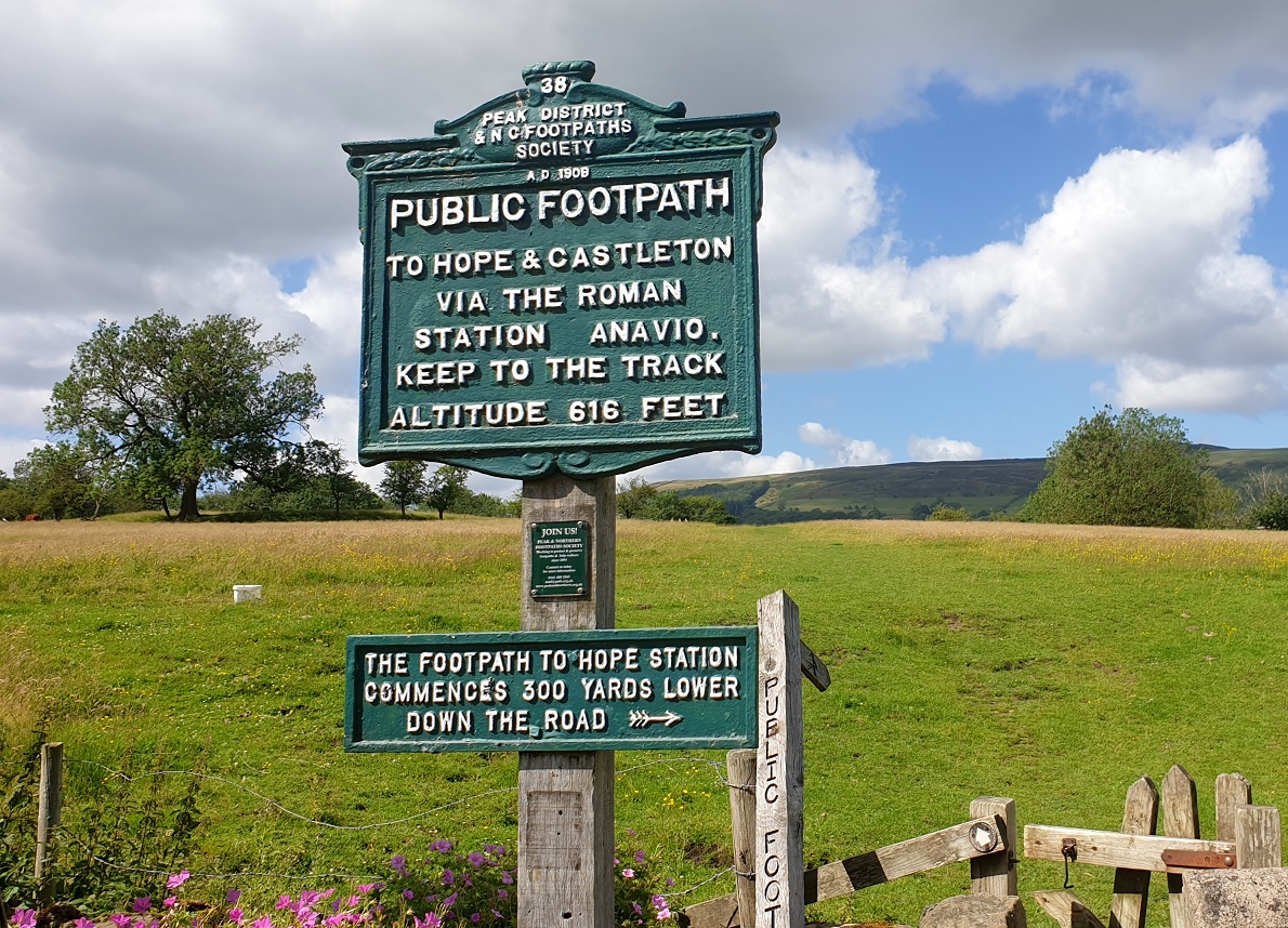
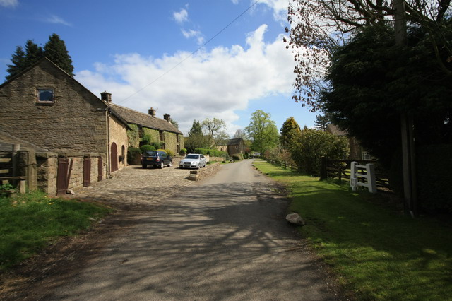
Brough and Shatton is a civil parish in Hope Valley in the High Peak district of Derbyshire, England. It is named for the two hamlets of Brough-on-Noe and Shatton. Brough is about 2 km, or just over 1 mile, west (upstream) of Shatton; both are on the River Noe, a tributary of the upper River Derwent. They lie within the Peak District National Park, about 15 miles west of Sheffield and 30 miles east of Manchester. According to the 2011 census, Brough and Shatton had a combined population of 136. There is a friendly rivalry between the two hamlets, which contest numerous sports competitions throughout the year. The remains of the Roman fort of Navio are close to Brough. Batham Gate, a Roman road connected Navio with the spa town of Buxton (Latin ''Aquae Arnemetiae'') and, via a now lost route Templebrough on the River Don. ''Gate'' means "road" in northern English dialects; the name therefore means "road to the bath town". See also *Listed buildings in Brough and Shat ... [...More Info...] [...Related Items...] OR: [Wikipedia] [Google] [Baidu] |
Navio Roman Fort
Navio Roman fort overlooks a tight bend of the River Noe at Brough-on-Noe near Hope, Derbyshire, in England. Navio fort and vicus (civilian settlement) is a Scheduled Monument. The town was recorded as ''Nauione'' in the Ravenna Cosmography's list of all known places in the world in about 700 AD. The entry is followed by places with which Navio had road connections: '' Aquis Arnemeza'' ( Buxton), ''Zerdotalia'' (Ardotalia, later called Melandra fort, near Glossop) and ''Mantio'' (Manchester). There is also an entry for the river ''Anava,'' next to the river ''Dorvantium'', which is considered to be the River Derwent. A Roman milestone was discovered in 1862 in the Silverlands district of Buxton. It is the oldest inscribed milestone found in Derbyshire. The inscription is:TRIB POT COS II P P A NAVIONE M P XI which means ‘With the tribune's power, twice consul, father of this country. From Navio 11 miles.' The milestone is on display in the Buxton Museum. ''Navio'' is Latin f ... [...More Info...] [...Related Items...] OR: [Wikipedia] [Google] [Baidu] |
River Noe
The River Noe is a tributary of the River Derwent in Derbyshire, England. It flows approximately 12 miles (19 km) from its source, the confluence of two streams running off Kinder Scout in the Peak District, east through Edale and then southeast through the village of Hope. The river's source is at Edale Head from where it runs down the clough alongside Jacob's Ladder footpath and through the Vale of Edale. The river flows into the River Derwent a kilometre south of Bamford. The entire length of the river is closely followed by the Hope Valley (Manchester to Sheffield) railway line. The portion of the river downstream of Hope, along with the valley of the River Noe's main tributary, Peakshole Water, is known as the Hope Valley. Derbyshire-peakdistrict.co.uk, accessed 25 November 2008 Like many rivers in Derbyshire, the N ... [...More Info...] [...Related Items...] OR: [Wikipedia] [Google] [Baidu] |
Batham Gate
Batham Gate is the medieval name for a Roman road in Derbyshire, England, which ran south-west from Templebrough on the River Don in South Yorkshire to Brough-on-Noe (Latin '' Navio'') and the spa town of Buxton (Latin ''Aquae Arnemetiae'') in Derbyshire. ''Gate'' means "road" in northern English dialects; the name therefore means "road to the bath town". The route of the road from Templebrough to the Roman signal station Navio is disputed. Hunter suggested the Long Causeway at Redmires as the route and it was shown as such on Ordnance Survey maps, but this is now known to be a medieval packhorse saltway. Roman road historian Ivan Donald Margary said that the Long Causeway had a slightly different route in Roman times. In his book ''Roman Roads In Britain'' he said that evidence is now available that shows that after the Redmires Reservoir the Roman road did not follow the medieval route to Stanedge Pole but kept to the line of the present-day track to Stanedge Lodge. Th ... [...More Info...] [...Related Items...] OR: [Wikipedia] [Google] [Baidu] |
Hope Valley, Derbyshire
The Hope Valley is a rural area centred on the village of Hope, Derbyshire, in the Peak District in the northern Midlands of England. The name also applies to the post town that includes the surrounding villages. Valley Although the Hope Valley appears to be a single valley, the name of the river changes several times. The head of the valley lies below Mam Tor at Castleton, widely regarded as the capital of the valley. From here, the Peakshole Water flows to Hope, where it enters the lower reaches of the River Noe, which has flowed from Edale. The Noe then flows to Shatton near Bamford, before entering the River Derwent, which has travelled about ten miles from Bleaklow. The valley is now technically the Derwent Valley, but the term "Hope Valley" is still used as the Derwent flows through Hathersage and Grindleford. Other streams in the area include the Burbage Brook, which runs down from Burbage Valley through Padley Gorge and into the River Derwent near Grindleford ... [...More Info...] [...Related Items...] OR: [Wikipedia] [Google] [Baidu] |
Listed Buildings In Brough And Shatton
Brough and Shatton is a civil parish in the High Peak district of Derbyshire, England. The parish contains six listed buildings that are recorded in the National Heritage List for England The National Heritage List for England (NHLE) is England's official database of protected heritage assets. It includes details of all English listed buildings, scheduled monuments, register of historic parks and gardens, protected shipwrecks, a .... All the listed buildings are designated at Grade II, the lowest of the three grades, which is applied to "buildings of national importance and special interest". The parish, which contains the small settlements of Brough-on-Noe and Shatton, is almost entirely rural. The listed buildings consist of houses, a cottage, outbuildings, and a bridge. __NOTOC__ Buildings References Citations Sources * * * * * * * {{DEFAULTSORT:Brough and Shatton Lists of listed buildings in Derbyshire ... [...More Info...] [...Related Items...] OR: [Wikipedia] [Google] [Baidu] |
Templebrough
Templeborough (historically Templebrough) is a suburb of Rotherham, South Yorkshire, England. The suburb falls within the Brinsworth and Catcliffe ward of Rotherham Metropolitan Borough Council. The area takes its name from the remains of the Roman fort found there which were mistakenly believed to be that of a Roman Temple. Roman fort A Roman fort was first built on the site in earth and wood in the first century AD (most likely between the years 43 to 68), and was later rebuilt in stone. It is thought to have been occupied until the Roman withdrawal from Britain , but its original name has never been ascertained. The Roman road called Icknield Street (sometimes Ryknild or Riknild Street) crossed the River Don at a ford close to the fort. There was also a road named Batham Gate that ran southwest from the fort to Navio a signal station at Brough-on-Noe in Derbyshire. The double bank that surrounded the fort was still visible in 1831 although it is believed that stone bloc ... [...More Info...] [...Related Items...] OR: [Wikipedia] [Google] [Baidu] |
Towns And Villages Of The Peak District
A town is a human settlement. Towns are generally larger than villages and smaller than cities, though the criteria to distinguish between them vary considerably in different parts of the world. Origin and use The word "town" shares an origin with the German word , the Dutch word , and the Old Norse . The original Proto-Germanic word, *''tūnan'', is thought to be an early borrowing from Proto-Celtic *''dūnom'' (cf. Old Irish , Welsh ). The original sense of the word in both Germanic and Celtic was that of a fortress or an enclosure. Cognates of ''town'' in many modern Germanic languages designate a fence or a hedge. In English and Dutch, the meaning of the word took on the sense of the space which these fences enclosed, and through which a track must run. In England, a town was a small community that could not afford or was not allowed to build walls or other larger fortifications, and built a palisade or stockade instead. In the Netherlands, this space was a garden, m ... [...More Info...] [...Related Items...] OR: [Wikipedia] [Google] [Baidu] |
River Don, South Yorkshire
The River Don (also called River Dun in some stretches) is a river in South Yorkshire and the East Riding of Yorkshire, England. It rises in the Pennines, west of Dunford Bridge, and flows for eastwards, through the Don Valley, via Penistone, Sheffield, Rotherham, Mexborough, Conisbrough, Doncaster and Stainforth. It originally joined the Trent, but was re-engineered by Cornelius Vermuyden as the ''Dutch River'' in the 1620s, and now joins the River Ouse at Goole. Don Valley is a UK parliamentary constituency near the Doncaster stretch of the river. Etymology The probable origin of the name was Brittonic ''Dānā'', from a root ''dān-'', meaning "water" or "river". The name Dôn (or Danu), a Celtic mother goddess, has the same origin. The river gave its name to the Don River, one of the principal rivers of Toronto, Canada. Geography The Don can be divided into sections by the different types of structures built to restrict its passage. The upper reaches, and thos ... [...More Info...] [...Related Items...] OR: [Wikipedia] [Google] [Baidu] |
Aquae Arnemetiae
Aquae Arnemetiae was a small town in the Roman province of Britannia. The settlement was based around its natural warm springs. Today it is the town of Buxton, Derbyshire in England. Aquae Arnemetiae means 'Waters of Arnemetia'. Arnemetia was the Romano-British goddess of the sacred grove (the name Arnemetia was derived from the Celtic for beside the sacred grove). The town was recorded as ''Aquis Arnemeza'' in the Ravenna Cosmography's list of all known places in the world in about 700 AD. The entry is between places with which the town had road connections: ''Nauione'' (Navio Roman fort at Brough)'','' ''Zerdotalia'' (Ardotalia, later called Melandra fort, near Glossop) and ''Mantio'' (Manchester). Roman settlement Baths Aquae Arnemetiae and Aquae Sulis (modern town of Bath in Somerset) were the only two Roman bath towns in Britain. The Romans built a bath at the location of the main thermal spring. In the late 17th-century Cornelius White operated bathing facilit ... [...More Info...] [...Related Items...] OR: [Wikipedia] [Google] [Baidu] |
Buxton
Buxton is a spa town in the Borough of High Peak, Derbyshire, England. It is England's highest market town, sited at some above sea level."Buxton – in pictures" , BBC Radio Derby, March 2008, accessed 3 June 2013. also claims this, but lacks a regular market. It lies close to to the west and to the south, on the edge of the [...More Info...] [...Related Items...] OR: [Wikipedia] [Google] [Baidu] |
High Peak, Derbyshire
High Peak is a local government district with borough status in Derbyshire, England. The borough compromises high moorland plateau in the Dark Peak area of the Peak District National Park. The district stretches from Holme Moss in the north to Sterndale Moor in the south, and from Hague Bar in the west to Bamford in the east. The population of the borough taken at the 2011 Census was 90,892. The borough is unusual in having two administrative centres for its council, High Peak Borough Council; the offices are based in both Buxton and Glossop. The borough also contains other towns including Chapel-en-le-Frith, Hadfield, New Mills and Whaley Bridge. High Peak was the name of a hundred of the ancient county of Derbyshire covering roughly the same area as the current district. It may have derived its name from the ancient Forest of High Peak, a royal hunting reserve administered by William Peverel, a favourite of William I, who was based at Peak Castle. High Peak co ... [...More Info...] [...Related Items...] OR: [Wikipedia] [Google] [Baidu] |
Roman Road
Roman roads ( la, viae Romanae ; singular: ; meaning "Roman way") were physical infrastructure vital to the maintenance and development of the Roman state, and were built from about 300 BC through the expansion and consolidation of the Roman Republic and the Roman Empire. They provided efficient means for the overland movement of armies, officials, civilians, inland carriage of official communications, and trade goods. Roman roads were of several kinds, ranging from small local roads to broad, long-distance highways built to connect cities, major towns and military bases. These major roads were often stone-paved and metaled, cambered for drainage, and were flanked by footpaths, bridleways and drainage ditches. They were laid along accurately surveyed courses, and some were cut through hills, or conducted over rivers and ravines on bridgework. Sections could be supported over marshy ground on rafted or piled foundations.Corbishley, Mike: "The Roman World", page 50. Warwick Pres ... [...More Info...] [...Related Items...] OR: [Wikipedia] [Google] [Baidu] |


.jpg)


