|
Alston, Cumbria
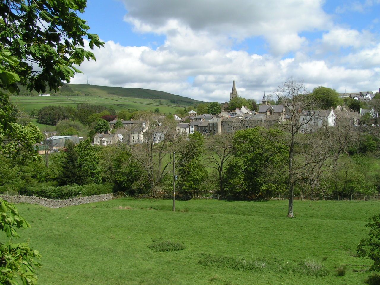
Alston is a town in Cumbria, England, within the civil parish of Alston Moor on the River South Tyne. It shares the title of the 'highest market town in England', at about above sea level, with Buxton, Derbyshire. Despite its altitude, the town is easily accessible via the many roads which link the town to Weardale, Teesdale, and towns in Cumbria such as Penrith via Hartside Pass, as well as Tynedale. Historically part of Cumberland, Alston lies within the North Pennines, a designated Area of Outstanding Natural Beauty. Much of the town centre is a designated Conservation Area which includes several listed buildings. Geography Alston lies within the North Pennines Area of Outstanding Natural Beauty, more than by road from the nearest town, Haltwhistle, and is surrounded by moorland. Nearby villages include Garrigill and Nenthead. It is around west of Newcastle upon Tyne, south east of Carlisle, north east of Penrith, and south west of Hexham. Situated at the crossroads/j ... [...More Info...] [...Related Items...] OR: [Wikipedia] [Google] [Baidu] |
Alston Moor
Alston Moor, formerly known as Alston with Garrigill, is a civil parish and electoral ward in Cumbria, England, based around the small town of Alston. It is set in the moorlands of the North Pennines, mostly at an altitude of over 1000 feet. The parish/ward had a population of 2,088 at the 2011 census. As well as the town of Alston, the parish includes the villages of Garrigill and Nenthead, along with the hamlets of Nenthall, Nentsberry, Galligill, Blagill, Ashgill, Leadgate, Bayles and Raise. Alston Moor is part of the North Pennines Area of Outstanding Natural Beauty (AONB), the second largest of the 40 AONBs in England and Wales. Under the Local Government Act 1894, the parish, then known as Alston with Garrigill, which had previously been a rural sanitary district on its own, became one of the few single-parish rural districts. This remained in existence until 1974 when it became part of the Eden district. On 18 June 1974 the parish was renamed from "Alston with Garri ... [...More Info...] [...Related Items...] OR: [Wikipedia] [Google] [Baidu] |
Limestone
Limestone ( calcium carbonate ) is a type of carbonate sedimentary rock which is the main source of the material lime. It is composed mostly of the minerals calcite and aragonite, which are different crystal forms of . Limestone forms when these minerals precipitate out of water containing dissolved calcium. This can take place through both biological and nonbiological processes, though biological processes, such as the accumulation of corals and shells in the sea, have likely been more important for the last 540 million years. Limestone often contains fossils which provide scientists with information on ancient environments and on the evolution of life. About 20% to 25% of sedimentary rock is carbonate rock, and most of this is limestone. The remaining carbonate rock is mostly dolomite, a closely related rock, which contains a high percentage of the mineral dolomite, . ''Magnesian limestone'' is an obsolete and poorly-defined term used variously for dolomite, for limes ... [...More Info...] [...Related Items...] OR: [Wikipedia] [Google] [Baidu] |
River South Tyne
The River Tyne is a river in North East England. Its length (excluding tributaries) is . It is formed by the North Tyne and the South Tyne, which converge at Warden Rock near Hexham in Northumberland at a place dubbed 'The Meeting of the Waters'. The Tyne Rivers Trust measure the whole Tyne catchment as , containing of waterways. Course North Tyne The North Tyne rises on the Scottish border, north of Kielder Water. It flows through Kielder Forest, and in and out of the border. It then passes through the village of Bellingham before reaching Hexham. South Tyne The South Tyne rises on Alston Moor, Cumbria and flows through the towns of Haltwhistle and Haydon Bridge, in a valley often called the Tyne Gap. Hadrian's Wall lies to the north of the Tyne Gap. Coincidentally, the source of the South Tyne is very close to those of the Tees and the Wear. The South Tyne Valley falls within the North Pennines Area of Outstanding Natural Beauty (AONB) – the second largest of th ... [...More Info...] [...Related Items...] OR: [Wikipedia] [Google] [Baidu] |
B6277 Road
B6 often refers to: * Vitamin B6, Vitamin B6 B6 may also refer to: Transportation Automobiles * A generation of Audi A4, manufactured from 2001 to 2005 * A fully armoured version of the Bentley Arnage Series Two RL * A member of the Mazda B engine#B6, Mazda B engine series Aircraft *Blackburn Shark, Blackburn B.6 Shark, a British 1930s torpedo bomber *Keystone B-6, a United States Army Air Corps bomber *Lohner B.VI, an Austro-Hungarian World War 1 reconnaissance biplane *Bréguet 14, Nakajima B-6, Nakajima designation for Bréguet 14 built under licence in Japan *Republic 2PA, Republic B 6, Swedish designation for Republic 2PA fighter Other vehicles * B6 (New York City bus), serving Brooklyn * Bavarian B VI, an 1863 German steam locomotive model * , a submarine of the Royal Navy * , a submarine of Norway Roads * B6 road (Cyprus), a road on the island of Cyprus * B6 (Zimbabwe), a Transport in Zimbabwe, road in Zimbabwe * Bundesstraße 6, a national highway in Germany Life scie ... [...More Info...] [...Related Items...] OR: [Wikipedia] [Google] [Baidu] |
A689 Road
The A689 is a road in northern England that runs east from the A595, to the west of Carlisle in Cumbria, to Hartlepool in County Durham. The road begins west of Carlisle, just outside the city at the A595. The initial stretch was recently constructed as part of the Carlisle Northern Development Route, a road bypassing Carlisle from west to north. Crossing the River Eden and the West Coast Main Line, the road intersects with Junction 44 of the M6 at Greymoorhill. From Junction 44 of the M6, the A689 runs roughly south-east to a roundabout, with the B6264. From here, the A689 heads east, and crosses the River Irthing at Ruleholme, then it meets the A69 at a roundabout junction. The A689 joins the route of the A69 around part of the Brampton bypass. Near the village of Milton, the A689 turns right, and continues through Milton and Hallbankgate before crossing the border into the county of Northumberland. The route continues roughly south-east, and re-enters the county o ... [...More Info...] [...Related Items...] OR: [Wikipedia] [Google] [Baidu] |
Hexham
Hexham ( ) is a market town and civil parishes in England, civil parish in Northumberland, England, on the south bank of the River Tyne, formed by the confluence of the North Tyne and the South Tyne at Warden, Northumberland, Warden nearby, and close to Hadrian's Wall. Hexham was the administrative centre for the Tynedale district from 1974 to 2009. In 2011, it had a population of 13,097. Smaller towns and villages around Hexham include Corbridge, Riding Mill, Stocksfield and Wylam to the east, Acomb, Northumberland, Acomb and Bellingham, Northumberland, Bellingham to the north, Allendale, Northumberland, Allendale to the south and Haydon Bridge, Bardon Mill and Haltwhistle to the west. Newcastle upon Tyne is to the east and Carlisle to the west. History Hexham Abbey originated as a monastery founded by Wilfrid in 674. The crypt of the original monastery survives, and incorporates many stones taken from nearby Roman ruins, probably Coria (Corbridge), Corbridge or Hadrian's ... [...More Info...] [...Related Items...] OR: [Wikipedia] [Google] [Baidu] |
Carlisle
Carlisle ( , ; from xcb, Caer Luel) is a city that lies within the Northern England, Northern English county of Cumbria, south of the Anglo-Scottish border, Scottish border at the confluence of the rivers River Eden, Cumbria, Eden, River Caldew, Caldew and River Petteril, Petteril. It is the administrative centre of the City of Carlisle district which, (along with Cumbria County Council) will be replaced by Cumberland (district), Cumberland Council in April 2023. The city became an established settlement during the Roman Empire to serve forts on Hadrian's Wall. During the Middle Ages, the city was an important military stronghold due to its proximity to the Kingdom of Scotland. Carlisle Castle, still relatively intact, was built in 1092 by William II of England, William Rufus, served as a prison for Mary, Queen of Scots in 1568 and now houses the Duke of Lancaster's Regiment and the Border Regiment Museum. In the early 12th century, Henry I of England, Henry I allowed a pri ... [...More Info...] [...Related Items...] OR: [Wikipedia] [Google] [Baidu] |
Newcastle Upon Tyne
Newcastle upon Tyne ( RP: , ), or simply Newcastle, is a city and metropolitan borough in Tyne and Wear, England. The city is located on the River Tyne's northern bank and forms the largest part of the Tyneside built-up area. Newcastle is also the most populous city of North East England. Newcastle developed around a Roman settlement called Pons Aelius and the settlement later took the name of a castle built in 1080 by William the Conqueror's eldest son, Robert Curthose. Historically, the city’s economy was dependent on its port and in particular, its status as one of the world's largest ship building and repair centres. Today, the city's economy is diverse with major economic output in science, finance, retail, education, tourism, and nightlife. Newcastle is one of the UK Core Cities, as well as part of the Eurocities network. Famous landmarks in Newcastle include the Tyne Bridge; the Swing Bridge; Newcastle Castle; St Thomas’ Church; Grainger Town including G ... [...More Info...] [...Related Items...] OR: [Wikipedia] [Google] [Baidu] |
Nenthead
Nenthead ( ) in the county of Cumbria is one of England's highest villages, at around . It was not built until the middle of the 18th century and was one of the earliest purpose-built industrial villages in Britain. History Nenthead was a major centre for lead and silver mining in the North Pennines of Britain. The first smelt mill was built at Nenthead in 1737 by George Liddle, and this was subsequently expanded by the London Lead Company. By 1882 the smelt mill was capable of smelting 8,000 bings, i.e., , of ore per annum. Nenthead village in 1861 had 2,000 people, mostly Methodist and employed by the Quaker-owned London Lead Company in the Nenthead Mines - some of the most productive in the country. The Quakers built housing, a school, a reading room, public baths and a wash-house for the miners and their families. Nenthead has accessible mines remaining, horse whims and a engine shaft in Rampghill. The mines closed in 1961 and there is a heritage centre displaying the ... [...More Info...] [...Related Items...] OR: [Wikipedia] [Google] [Baidu] |
Garrigill
Garrigill, Cumbria is a small village in the North Pennine region of the UK, situated on the banks and close to the source of the River South Tyne. Historically part of Cumberland, today it is within the Garrigill ward of the civil parish of Alston Moor within the district of Eden. In 1870-72 the chapelry had a population of 1447. The village's name should not be confused with the hamlet of Galligill in the Nent valley, also within Alston Moor. The village's former name is Garrigill-Gate and it was earlier known as Gerard's Gill. (Gill is a Norse word for a steep-sided valley). At its peak Garrigill was home to 1,000 people, mainly employed in the lead mining industry; now its population numbers less than 200. While villagers were at one time mainly employed in local livestock farming, these days the population is fairly evenly divided between those in local employment, the self-employed and retirees. Garrigill Post Office is a traditional village store which has not chang ... [...More Info...] [...Related Items...] OR: [Wikipedia] [Google] [Baidu] |


