|
Bovec
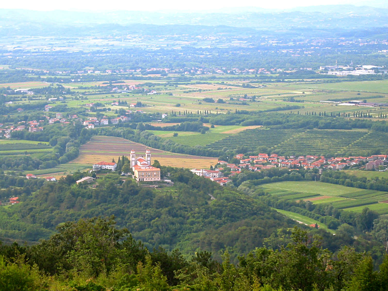
Bovec ( or ; , german: Flitsch, fur, Plèz) is a town in the Littoral region in northwestern Slovenia, close to the border with Italy. It is the central settlement of the Municipality of Bovec. Geography Bovec is located from the capital Ljubljana, at an elevation of . The settlement lies in the Bovec Basin of the upper Soča (''Isonzo'') River, below the eastern slopes of Mount Kanin in the Julian Alps, forming the border with Italy. The adjacent Trenta Valley in the northwest leads into Triglav National Park. It has been traditionally part of the historic Goriška region, but today locals prefer to identify with the wider region of the Slovene Littoral. Name Bovec was attested in written sources in 1070 as and (and as in 1181–96, in 1257, and in 1377).Snoj, Marko. 2009. ''Etimološki slovar slovenskih zemljepisnih imen''. Ljubljana: Modrijan and Založba ZRC, pp. 72–73. During the 12th and 13th centuries, the name designated not only the settlement itself, but also ... [...More Info...] [...Related Items...] OR: [Wikipedia] [Google] [Baidu] |
Municipality Of Bovec
The Municipality of Bovec ( or ; sl, Občina Bovec) is a municipality in northwestern Slovenia. Its center is the town of Bovec. , its mayor is Valter Mlekuž. Geography The northern parts of the municipality up the Trenta Valley to the peaks of Mts. Mangart, Jalovec, and Triglav is located within Triglav National Park, but not Bovec itself. Two of the most important mountain passes in the Julian Alps are located in the Municipality of Bovec: the Predil Pass on the border between Slovenia and Italy in the northwest, and the Vršič Pass in the northeast, which connects the Soča Valley to Kranjska Gora in the neighbouring Slovenian region of Upper Carniola. In the southwest the Učja (Uccea) Pass connects Bovec with the Resia Valley in Italy. Settlements In addition to the municipal seat of Bovec, the municipality also includes the following settlements: * Bavšica * Čezsoča * Kal–Koritnica * Lepena * Log Čezsoški * Log pod Mangartom * Plužna * Soča * Srpenica * ... [...More Info...] [...Related Items...] OR: [Wikipedia] [Google] [Baidu] |
Trenta (valley)
The Trenta Valley () is a valley in the Julian Alps in the northern part of the traditional Gorizia region ( sl, Goriška) of Slovenia. Geography The source of the Soča River and the settlements of Soča, Lepena, and Trenta are located in the Trenta Valley. The Vršič Pass connects the valley with Upper Carniola to the east. The Soča flows generally southwest through the valley and then onwards to Bovec Bovec ( or ; , german: Flitsch, fur, Plèz) is a town in the Littoral region in northwestern Slovenia, close to the border with Italy. It is the central settlement of the Municipality of Bovec. Geography Bovec is located from the capital Ljublj .... Name The name ''Trenta'' is of Friulian origin and was borrowed into Slovene. The name developed from ''*Tridenta'', meaning 'three-tooth' or 'divided into three teeth'. This reflects the geography because the valley splits into the Soča and Zadnjica valleys, and the latter is soon split again by White Creek (''Beli Potok'' ... [...More Info...] [...Related Items...] OR: [Wikipedia] [Google] [Baidu] |
Gorizia Statistical Region
The Gorizia Statistical Region ( sl, Goriška statistična regija) is a statistical region in western Slovenia, along the border with Italy. It is named after the Italian town of Gorizia (the feminine adjective ''goriška'' comes from the Slovenian name for Gorizia: ''Gorica''). The Julian Alps, the Soča River, and the Vipava Valley are the most prominent natural features of this region. It contributed just over 5% to total national GDP in 2012, but in terms of GDP per capita it ranked fourth in the country. In the same year, disposable income per capita in the region the highest, in second place behind the Central Slovenia Statistical Region. Housing stock estimates indicate that at the end of 2013 the region had the highest share of dwellings with three or more rooms (around 70%). The share of single-room dwellings was less than 10%. Dwellings here are larger than the Slovenian average, with 37 m² of usable floor space per person on average. The number of cars per 1,000 popul ... [...More Info...] [...Related Items...] OR: [Wikipedia] [Google] [Baidu] |
Municipalities Of Slovenia
Slovenia is divided into 212 municipalities ( Slovene: ''občine'', singular'' občina''), of which 12 have urban (metropolitan) status. Municipalities are further divided into local communities and districts. Slovene is an official language of all the municipalities. Hungarian is a second official language of three municipalities in Prekmurje: Dobrovnik/Dobronak, Hodoš/Hodos, and Lendava/Lendva. Italian is a second official language of four municipalities (of which one has urban status) in the Slovene Littoral The Slovene Littoral ( sl, Primorska, ; it, Litorale; german: Küstenland) is one of the five traditional regions of Slovenia. Its name recalls the former Austrian Littoral (''Avstrijsko Primorje''), the Habsburg possessions on the upper Adria ...: Ankaran/Ancarano, Izola/Isola, Koper/Capodistria, and Piran/Pirano. In the EU statistics, the municipalities of Slovenia are classified as "local administrative unit 2" (LAU 2), below 58 administrative units ('), which ... [...More Info...] [...Related Items...] OR: [Wikipedia] [Google] [Baidu] |
Predil Pass
The Predil Pass or Predel Pass ( it, Passo di Predil; sl, Predel, ) (el. 1156 m) is a high mountain pass on the border between Italy and Slovenia. Geography The pass is located in the Julian Alps, between the peaks of Mount Mangart to the north and Mount Kanin to the south. It connects Cave del Predil, part of the Italian municipality of Tarvisio in the northwest, with the Municipality of Bovec in the Upper Soča (Isonzo) Valley in Slovenia. On the Italian side, state highway no. 54 (''del Friuli'') leads from Tarvisio and the Canal Valley along Slizza Creek to Lake Predil, where the route to the Sella Nevea Pass in the south branches off, and uphill to the Predil crest. On the Slovenian side, road no. 203 runs downhill to Log pod Mangartom and continues to Bovec. The village of Strmec na Predelu lies just below the border crossing. History The road was built from 1319 onwards by the citizens of Cividale in the Patriarchate of Aquileia with the consent of the Prince ... [...More Info...] [...Related Items...] OR: [Wikipedia] [Google] [Baidu] |
Soča
The Soča ( in Slovene) or Isonzo ( in Italian; other names fur, Lusinç, german: Sontig, la, Aesontius or ') is a long river that flows through western Slovenia () and northeastern Italy (). An Alpine river in character, its source lies in the Trenta Valley in the Julian Alps in northwestern Slovenia, at an elevation of . The river runs past the towns of Bovec, Kobarid, Tolmin, Kanal ob Soči, Nova Gorica (where it is crossed by the Solkan Bridge), and Gorizia, entering the Adriatic Sea close to the town of Monfalcone. It has a nival-pluvial regime in its upper course and pluvial-nival in its lower course. Prior to the First World War, the river ran parallel to the border between Kingdom of Italy and the Austro-Hungarian Empire. During World War I, it was the scene of bitter fighting between the two countries, culminating in the Battle of Caporetto in 1917. Name The river was recorded in antiquity as ''Aesontius'', ''Sontius'', and ''Isontius''. Later attestations inc ... [...More Info...] [...Related Items...] OR: [Wikipedia] [Google] [Baidu] |
Goriška
Goriška is a historical region in western Slovenia on the border with Italy. It comprises the northern part of the wider traditional region of the Slovenian Littoral (''Primorska''). The name ''Goriška'' is an adjective referring to the city of Gorizia,Merkù, Pavle. 1999. ''Slovenska krajevna imena v Italiji. Priročnik''. Trieste: Mladika, p. 33. its historical and cultural centre. Geography The region stretches from the Julian Alps (Triglav) in the north down the Soča River to Nova Gorica and the Karst Plateau in the hinterland of Trieste. It encompasses the following municipalities (from north to south): It is entirely included in the Gorizia Statistical Region, except for the southernmost municipalities of Komen and Sežana, which are part of the Coastal–Karst Statistical Region. Goriška borders on Upper Carniola in the northeast and Inner Carniola in the east. In the south, it is confined by Slovenian Istria and the Trieste city limits. Together with the adjacent Ita ... [...More Info...] [...Related Items...] OR: [Wikipedia] [Google] [Baidu] |
Slovenia
Slovenia ( ; sl, Slovenija ), officially the Republic of Slovenia (Slovene: , abbr.: ''RS''), is a country in Central Europe. It is bordered by Italy to the west, Austria to the north, Hungary to the northeast, Croatia to the southeast, and the Adriatic Sea to the southwest. Slovenia is mostly mountainous and forested, covers , and has a population of 2.1 million (2,108,708 people). Slovenes constitute over 80% of the country's population. Slovene, a South Slavic language, is the official language. Slovenia has a predominantly temperate continental climate, with the exception of the Slovene Littoral and the Julian Alps. A sub-mediterranean climate reaches to the northern extensions of the Dinaric Alps that traverse the country in a northwest–southeast direction. The Julian Alps in the northwest have an alpine climate. Toward the northeastern Pannonian Basin, a continental climate is more pronounced. Ljubljana, the capital and largest city of Slovenia, is geogr ... [...More Info...] [...Related Items...] OR: [Wikipedia] [Google] [Baidu] |
Julian Alps
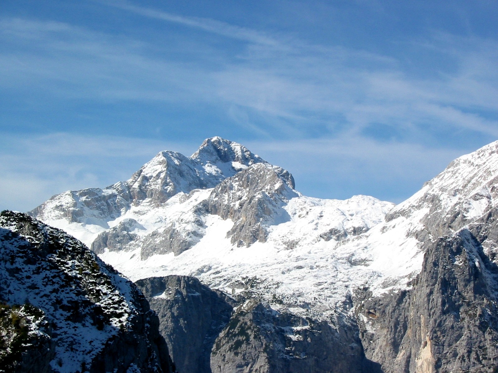
The Julian Alps ( sl, Julijske Alpe, it, Alpi Giulie, , ) are a mountain range of the Southern Limestone Alps that stretch from northeastern Italy to Slovenia, where they rise to 2,864 m at Mount Triglav, the highest peak in Slovenia. A large part of the Julian Alps is included in Triglav National Park. The second highest peak of the range, the 2,755 m high Jôf di Montasio, lies in Italy. The Julian Alps cover an estimated 4,400 km2 (of which 1,542 km2 lies in Italy). They are located between the Sava Valley and Canale Valley. They are divided into the Eastern and Western Julian Alps. Name The Julian Alps were known in antiquity as ''Alpe Iulia'', and also attested as ''Alpes Juliana'' AD 670, ''Alpis Julia'' 734, and ''Alpes Iulias'' in 1090. Like the municipium of ''Forum Julii'' (now Cividale del Friuli) at the foot of the mountains, the range was named after Julius Caesar of the Julian clan, perhaps due to a road built by Julius Caesar and completed by Aug ... [...More Info...] [...Related Items...] OR: [Wikipedia] [Google] [Baidu] |
Kanin (mountain)
280px, Big Mount Kanin The Kanin Mountains or the Canin Mountains (Resian: ''Ćanen'', fur, Mont Cjanine), mostly simply Kanin or Canin, are a mountain range in the Western Julian Alps, on the border of Slovenia and Italy. Their highest summit, High Kanin ( sl, Visoki Kanin, it, Monte Canin Alto) is 2,587 m above sea level. They separate the upper Soča Valley in Slovenia from the Resia Valley in Italy. On the Slovenian side of the mountain range, which is part of the Municipality of Bovec, lies a major ski resort, the highest in the country. Among a number of shafts, Vrtoglavica Cave holds the record for having the deepest single vertical drop ( pitch) of any cave on earth, at a depth of . The Kanin Mountains are an important identity symbol of the people of the Resia Valley, and several popular songs in the Resian dialect are dedicated to this group, which the locals call ''Höra ta Ćanïnawa'', or simply ''Ćanen''. Routes * 2½ hrs From D Postaja (The D-station o ... [...More Info...] [...Related Items...] OR: [Wikipedia] [Google] [Baidu] |
Italy (Roman Empire)
Roman Italy (called in both the Latin and Italian languages referring to the Italian Peninsula) was the homeland of the ancient Romans and of the Roman empire. According to Roman mythology, Italy was the ancestral home promised by Jupiter to Aeneas of Troy and his descendants, Romulus and Remus, who were the founders of Rome. Aside from the legendary accounts, Rome was an Italic city-state that changed its form of government from Kingdom to Republic and then grew within the context of a peninsula dominated by the Gauls, Ligures, Veneti, Camunni and Histri in the North, the Etruscans, Latins, Falisci, Picentes and Umbri tribes (such as the Sabines) in the Centre, and the Iapygian tribes (such as the Messapians), the Oscan tribes (such as the Samnites) and Greek colonies in the South. The consolidation of Italy into a single entity occurred during the Roman expansion in the peninsula, when Rome formed a permanent association with most of the local tribes and cities. The stre ... [...More Info...] [...Related Items...] OR: [Wikipedia] [Google] [Baidu] |
Flag Of Slovenia
The national flag of Slovenia ( sl, zastava Slovenije) features three equal horizontal bands of white (top), blue, and red, with the Coat of arms of Slovenia located in the upper hoist side of the flag centered in the white and blue bands. The coat of arms is a shield with the image of Mount Triglav, Slovenia's highest peak, in white against a blue background at the center; beneath it are two wavy blue lines representing the Adriatic Sea and local rivers, and above it are three six-pointed golden stars arranged in an inverted triangle which are taken from the coat of arms of the Counts of Celje, the great Slovene dynastic house of the late 14th and early 15th centuries. The flag's colors are considered to be Pan-Slavism, Pan-Slavic, but they actually come from the Middle Ages, medieval coat of arms of the Duchy of Carniola, consisting of 3 stars, a mountain, and three colors (red, blue, yellow). crescent. The existing Slovene tricolor was raised for the first time in history duri ... [...More Info...] [...Related Items...] OR: [Wikipedia] [Google] [Baidu] |


