|
Botusfleming
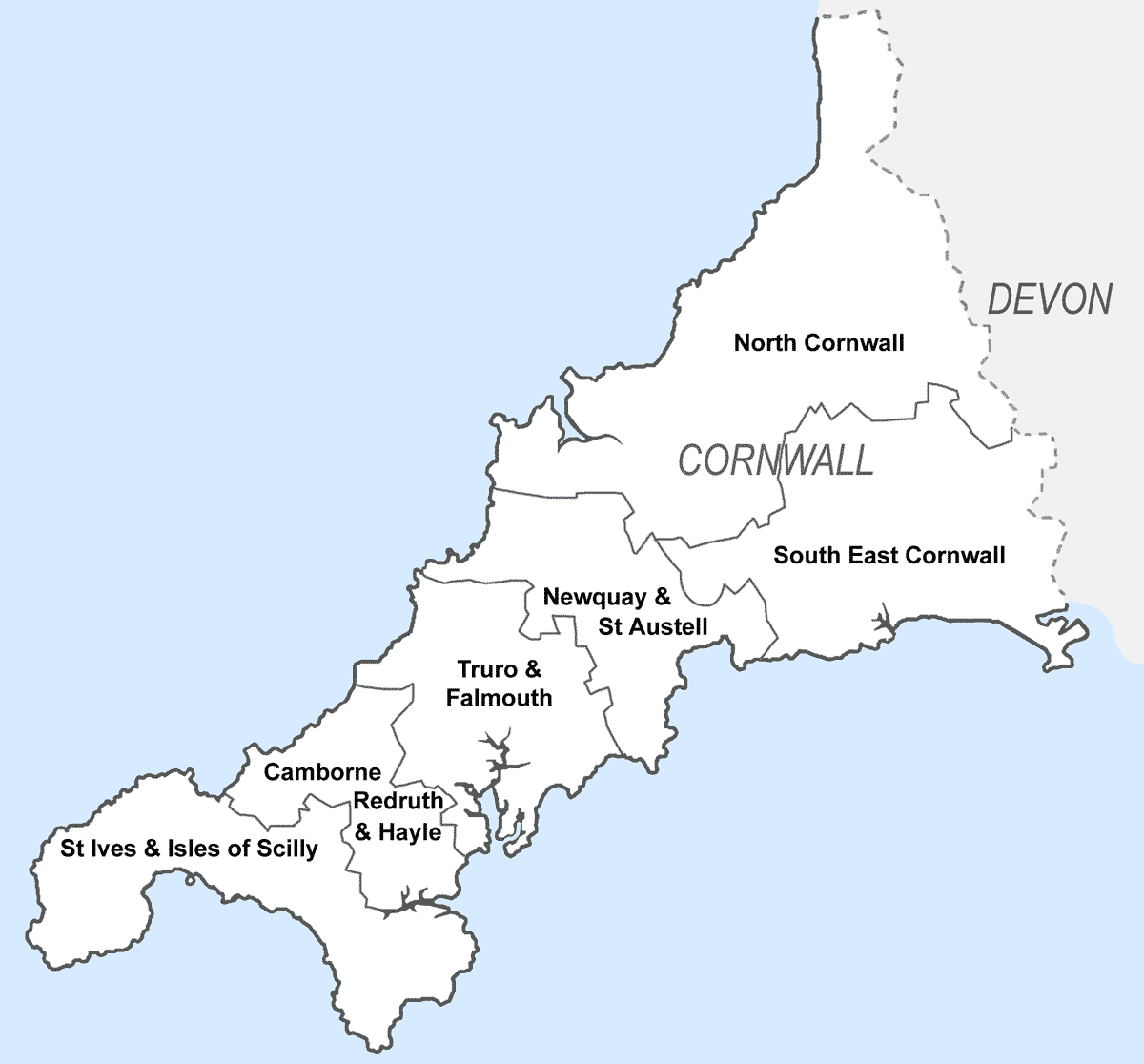
Botusfleming or Botus Fleming ( kw, Bosflumyes) is a village and civil parish in southeast Cornwall, England, United Kingdom. The 2001 census gives the parish population as 783,which decreased to 771 at the 2011 census. The village is about three miles north-west of Saltash at . There is a public house (the Rising Sun), a market garden and a small colony of artists, but the village is mostly a dormitory area for Plymouth. Parish church The parish church is dedicated to St Mary and has a western tower and a fine arcade between the nave and the north aisle. The church was restored in 1872 by Henry Eliott; this restoration included new roofs, floors, pews and glazing. The font is of Polyphant stone, probably 14th century in date. In a field near the church is an obelisk in memory of William Martyn built in 1762. In the church is a stone effigy of a knight in armour; he is thought to be Stephen le Fleming who was a medieval Crusader and perhaps left his name to the place. Other ... [...More Info...] [...Related Items...] OR: [Wikipedia] [Google] [Baidu] |
Michael Loam
Michael Loam (1 November 1797 – 14 July 1871) was an English engineer who introduced the first man engine (a device to carry men up and down the shaft of a mine) into the UK. In 1834, concerned for the health of miners and for the loss in profits incurred by their long, slow climbs by ladders, the Royal Cornwall Polytechnic Society announced a prize for the design of a better system of transporting miners in and out of the deep mines in the county. Michael Loam won this prize in 1841 for his man engine, despite evidence that it was already in use in the Hartz Mountains in Germany. Inspired by the German designs and constructed of a series of moving platforms, the first man engine was installed in 1842 at Tresavean Mine—one of the deepest in Cornwall at the time. Its adoption was encouraged by the mine's owner, John Rogers. Loam was trained as an engineer at Wheal Abraham Wheal may refer to: * Wheals, a type of skin lesion * Brad Wheal (born 1996), British cricketer * ... [...More Info...] [...Related Items...] OR: [Wikipedia] [Google] [Baidu] |
United Kingdom Census 2011
A Census in the United Kingdom, census of the population of the United Kingdom is taken every ten years. The 2011 census was held in all countries of the UK on 27 March 2011. It was the first UK census which could be completed online via the Internet. The Office for National Statistics (ONS) is responsible for the census in England and Wales, the General Register Office for Scotland (GROS) is responsible for the census in Scotland, and the Northern Ireland Statistics and Research Agency (NISRA) is responsible for the census in Northern Ireland. The Office for National Statistics is the executive office of the UK Statistics Authority, a non-ministerial department formed in 2008 and which reports directly to Parliament. ONS is the UK Government's single largest statistical producer of independent statistics on the UK's economy and society, used to assist the planning and allocation of resources, policy-making and decision-making. ONS designs, manages and runs the census in England an ... [...More Info...] [...Related Items...] OR: [Wikipedia] [Google] [Baidu] |
Cornwall Council
Cornwall Council ( kw, Konsel Kernow) is the unitary authority for Cornwall in the United Kingdom, not including the Isles of Scilly, which has its own unitary council. The council, and its predecessor Cornwall County Council, has a tradition of large groups of independent councillors, having been controlled by independents in the 1970s and 1980s. Since the 2021 elections, it has been under the control of the Conservative Party. Cornwall Council provides a wide range of services to the approximately half a million people who live in Cornwall. In 2014 it had an annual budget of more than £1 billion and was the biggest employer in Cornwall with a staff of 12,429 salaried workers. It is responsible for services including: schools, social services, rubbish collection, roads, planning and more. History Establishment of the unitary authority On 5 December 2007, the Government confirmed that Cornwall was one of five councils that would move to unitary status. This was enacted by st ... [...More Info...] [...Related Items...] OR: [Wikipedia] [Google] [Baidu] |
Cornwall
Cornwall (; kw, Kernow ) is a historic county and ceremonial county in South West England. It is recognised as one of the Celtic nations, and is the homeland of the Cornish people. Cornwall is bordered to the north and west by the Atlantic Ocean, to the south by the English Channel, and to the east by the county of Devon, with the River Tamar forming the border between them. Cornwall forms the westernmost part of the South West Peninsula of the island of Great Britain. The southwesternmost point is Land's End and the southernmost Lizard Point. Cornwall has a population of and an area of . The county has been administered since 2009 by the unitary authority, Cornwall Council. The ceremonial county of Cornwall also includes the Isles of Scilly, which are administered separately. The administrative centre of Cornwall is Truro, its only city. Cornwall was formerly a Brythonic kingdom and subsequently a royal duchy. It is the cultural and ethnic origin of the Cornish dias ... [...More Info...] [...Related Items...] OR: [Wikipedia] [Google] [Baidu] |
South East Cornwall (UK Parliament Constituency)
South East Cornwall is a constituency represented in the House of Commons of the UK Parliament since 2010 by Sheryll Murray, a Conservative. Boundaries 1983–2010: The District of Caradon, the Borough of Restormel wards of Fowey, Lostwithiel, St Blaise, and Tywardreath, and the District of North Cornwall ward of Stoke Climsland. 2010–present: The District of Caradon, and the Borough of Restormel ward of Lostwithiel. History The predecessor county division, Bodmin, serving the area from 1885 until 1983 had (during those 98 years) 15 members (two of whom had broken terms of office serving the area), seeing twelve shifts of preference between the Liberal, Liberal Unionist and Conservative parties, spread quite broadly throughout that period. Consistent with this, since 1983 the preference for an MP has alternated between Liberal Democrats and Conservatives. The current constituency territory contains the location of several former borough constituencies which were abol ... [...More Info...] [...Related Items...] OR: [Wikipedia] [Google] [Baidu] |
Neale(1818) P1
Neale may refer to: * Neale (surname) * Neale, County Mayo * Neale (electric car) See also * Neil, containing Neale as a given name {{disambig ... [...More Info...] [...Related Items...] OR: [Wikipedia] [Google] [Baidu] |
Civil Parishes In England
In England, a civil parish is a type of Parish (administrative division), administrative parish used for Local government in England, local government. It is a territorial designation which is the lowest tier of local government below districts of England, districts and metropolitan and non-metropolitan counties of England, counties, or their combined form, the Unitary authorities of England, unitary authority. Civil parishes can trace their origin to the ancient system of Parish (Church of England), ecclesiastical parishes, which historically played a role in both secular and religious administration. Civil and religious parishes were formally differentiated in the 19th century and are now entirely separate. Civil parishes in their modern form came into being through the Local Government Act 1894, which established elected Parish councils in England, parish councils to take on the secular functions of the vestry, parish vestry. A civil parish can range in size from a sparsely ... [...More Info...] [...Related Items...] OR: [Wikipedia] [Google] [Baidu] |
Saltash
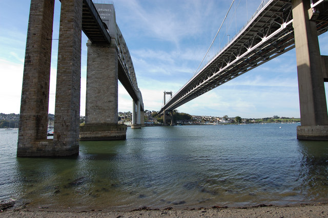
Saltash (Cornish: Essa) is a town and civil parish in south Cornwall, England, United Kingdom. It had a population of 16,184 in 2011 census. Saltash faces the city of Plymouth over the River Tamar and is popularly known as "the Gateway to Cornwall". Saltash’s landmarks include the Tamar Bridge which connects Plymouth to Cornwall by road, and the Royal Albert Bridge. The area of Latchbrook is part of the town. Description Saltash is the location of Isambard Kingdom Brunel's Royal Albert Bridge, opened by Prince Albert on 2 May 1859. It takes the railway line across the River Tamar. Alongside it is the Tamar Bridge, a toll bridge carrying the A38 trunk road, which in 2001 became the first suspension bridge to be widened whilst remaining open to traffic. Saltash railway station, which has a regular train service, with some routes between London Paddington station is close to the town centre. Stagecoach South West, Plymouth Citybus, and Go Cornwall Bus operate bus service ... [...More Info...] [...Related Items...] OR: [Wikipedia] [Google] [Baidu] |
Plymouth, Devon
Plymouth () is a port city and unitary authority in South West England. It is located on the south coast of Devon, approximately south-west of Exeter and south-west of London. It is bordered by Cornwall to the west and south-west. Plymouth's early history extends to the Bronze Age when a first settlement emerged at Mount Batten. This settlement continued as a trading post for the Roman Empire, until it was surpassed by the more prosperous village of Sutton founded in the ninth century, now called Plymouth. In 1588, an English fleet based in Plymouth intercepted and defeated the Spanish Armada. In 1620, the Pilgrim Fathers departed Plymouth for the New World and established Plymouth Colony, the second English settlement in what is now the United States of America. During the English Civil War, the town was held by the Parliamentarians and was besieged between 1642 and 1646. Throughout the Industrial Revolution, Plymouth grew as a commercial shipping port, handling imports an ... [...More Info...] [...Related Items...] OR: [Wikipedia] [Google] [Baidu] |
Polyphant Stone
Elvan is a name used in Cornwall and Devon for the native varieties of quartz-porphyry. They are dispersed irregularly in the Devonian series of rocks and some of them make very fine building stones (e.g. Pentewan stone, Polyphant stone and Catacleuse stone). Greenstone is another name for this stone and it is often used for parts of buildings such as doorways so they can be finely carved. Most of the elvan quarries are now disused. Others are quarried in bulk for aggregates commonly used for road-building. More precisely there are two types of rock in this category: one is "white elvan" and the other is "blue elvan". "White elvans" are a group of fine-grained, acid igneous rocks, while "blue elvans" or "greenstones" are various unusual basic igneous rocks. "White elvan" comes from various different locations and is often known as Pentewan stone (or by other names based on the location). Some older descriptions of building stones have called "white elvans" limestone, e.g. in ... [...More Info...] [...Related Items...] OR: [Wikipedia] [Google] [Baidu] |
Georgian Architecture
Georgian architecture is the name given in most English-speaking countries to the set of architectural styles current between 1714 and 1830. It is named after the first four British monarchs of the House of Hanover—George I, George II, George III, and George IV—who reigned in continuous succession from August 1714 to June 1830. The so-called great Georgian cities of the British Isles were Edinburgh, Bath, pre-independence Dublin, and London, and to a lesser extent York and Bristol. The style was revived in the late 19th century in the United States as Colonial Revival architecture and in the early 20th century in Great Britain as Neo-Georgian architecture; in both it is also called Georgian Revival architecture. In the United States the term "Georgian" is generally used to describe all buildings from the period, regardless of style; in Britain it is generally restricted to buildings that are "architectural in intention", and have stylistic characteristics that are typical o ... [...More Info...] [...Related Items...] OR: [Wikipedia] [Google] [Baidu] |
Listed Building
In the United Kingdom, a listed building or listed structure is one that has been placed on one of the four statutory lists maintained by Historic England in England, Historic Environment Scotland in Scotland, in Wales, and the Northern Ireland Environment Agency in Northern Ireland. The term has also been used in the Republic of Ireland, where buildings are protected under the Planning and Development Act 2000. The statutory term in Ireland is " protected structure". A listed building may not be demolished, extended, or altered without special permission from the local planning authority, which typically consults the relevant central government agency, particularly for significant alterations to the more notable listed buildings. In England and Wales, a national amenity society must be notified of any work to a listed building which involves any element of demolition. Exemption from secular listed building control is provided for some buildings in current use for worship, ... [...More Info...] [...Related Items...] OR: [Wikipedia] [Google] [Baidu] |
_p1.168_-_Moditonham_House%2C_Cornwall.jpg)


_(FindID_258401).jpg)

