|
Boswil
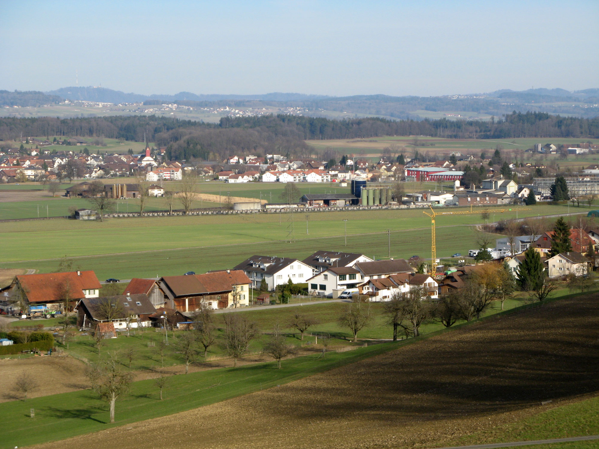
Boswil is a municipality in the district of Muri in the canton of Aargau in Switzerland. The village lies in the Bünztal valley at the foot of the Lindenberg mountain. The hamlet Wissenbach and Sentenhof (a former estate of the Benedictine Muri Abbey) belong to the municipality. History During Neolithic times, between 10000 and 8000 BCE, settlements were first established near the fish-rich Bünzersee (a small lake). In 1930, a cemetery, dated to have been from between 350-325 BCE, was discovered north of Boswil, and is seen as evidence that the area was occupied by Celtic peoples during the same time period. Various wall remains of farm estates and mansions from Roman times lie nearby. Boswil was first mentioned as ''Bozuuila'' in a document found in the Grossmünster church in Zürich. Although this document is not dated, recent research places the document's origin between 874 and 887 CE. Boswil and the surrounding regions were ruled by successions of counts and duke ... [...More Info...] [...Related Items...] OR: [Wikipedia] [Google] [Baidu] |
Kallern
Kallern is a municipality in the district of Muri in the canton of Aargau in Switzerland. History Kallern is first mentioned around 1303-08 as ''Kaltherren''. During the Late Middle Ages, the major landowners in Kallern were Muri Abbey and Hilfikon. After 1415, the village belonged to Muri. Then, after 1435 it belonged to the district of Boswil in the ''Freie Ämter''. Under the Helvetic Republic it was part of the Canton of Baden. Kallern, Ober- and Unterhöll and Uezwil formed a collective community. Niesenberg was connected to Bettwil. The Act of Mediation in 1803 led to the current community. In 1962, a chapel was built in Oberniesenberg, and in 1975 a school and multipurpose room were finished. In 1969, electric street lights came to the village and in 1970, a central water supply was added. In 1980 Hinterbühl was developed as a residential area, and in 1984 it was connected to the sewage treatment plant at Bünzen. In 2000 a quarter of the economically acti ... [...More Info...] [...Related Items...] OR: [Wikipedia] [Google] [Baidu] |
Muri (district)
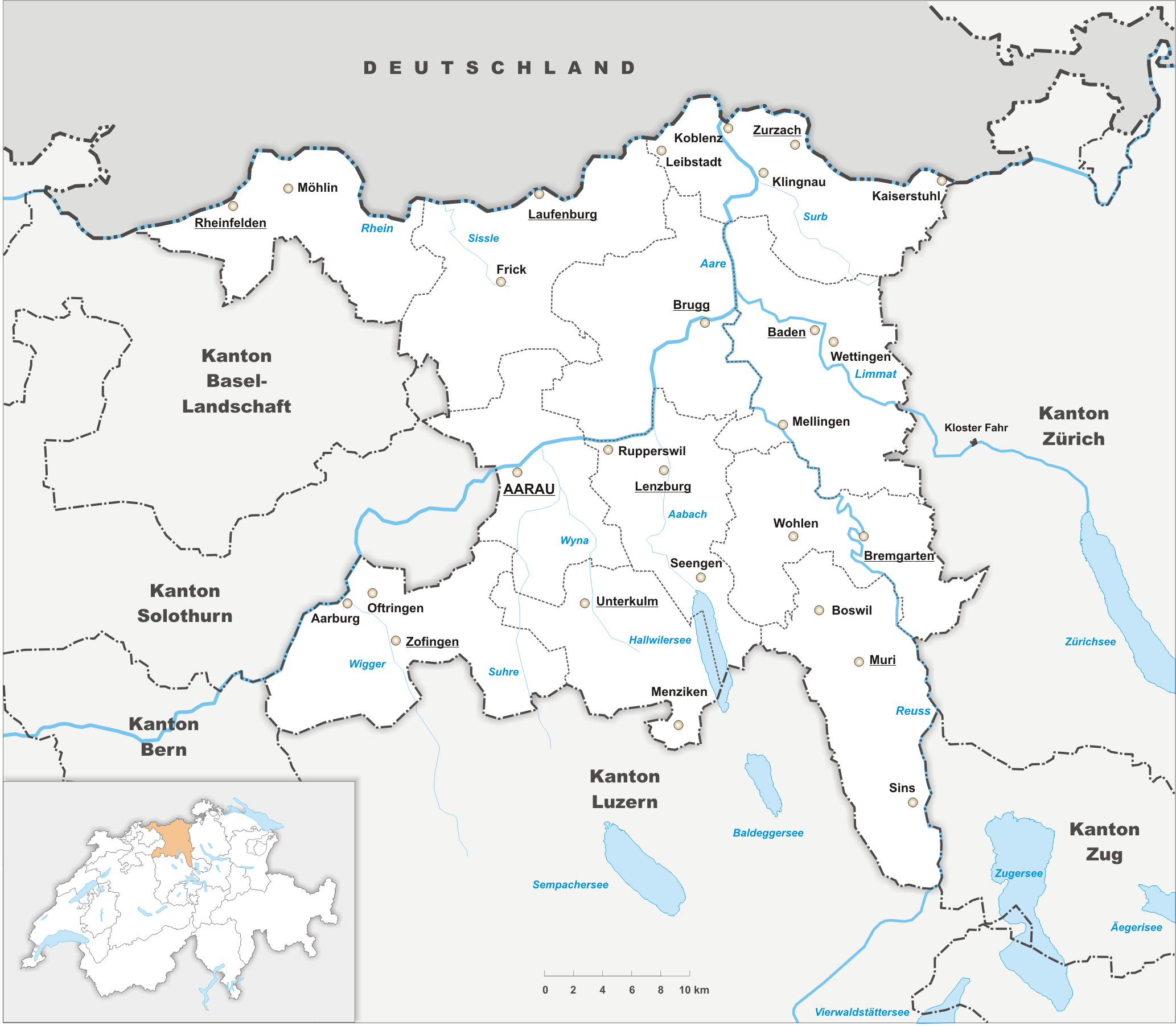
Muri District is a district in the Swiss Canton of Aargau with the administrative capital of Muri. It covers the central and southern part of Freiamt and has a population of (as of ). Geography The Muri district has an area, , of . Of this area, or 68.8% is used for agricultural purposes, while or 19.3% is forested. Of the rest of the land, or 9.8% is settled (buildings or roads). Coat of arms The blazon of the district coat of arms is ''Gules a Wall in fess embattled Argent masoned Sable..'' Demographics The Muri district has a population () of . , 13.2% of the population are foreign nationals.Statistical Department of Canton Aargau -Bereich 01 -Bevölkerung accessed 20 January 2010 Economy there were 15,053 workers who lived in the district. Of these, 10,391 or about 69 ...[...More Info...] [...Related Items...] OR: [Wikipedia] [Google] [Baidu] |
Besenbüren
Besenbüren is a municipality in the district of Muri in the canton of Aargau in Switzerland. History The first indication of human settlement near Besenbüren are paleo- and mesolithic items that were discovered in the ''Forenmoos''. The modern municipality of Besenbüren is first mentioned in the Acta Murensia, which was first drawn up in 1160 but included a number of various older documents, as ''Besenbürren''. The major landholders in the Middle Ages in Besenbüren were Muri and Engelberg Abbeys. Under the Habsburgs it belonged to the Muri district. After 1415 it belonged to the Boswil district. The rights that the Hermann of Heidegg received after the conquest of the Aargau by the Swiss Conderation remained with his family until 1617, when they were transferred to Muri Abbey. In the 19th century, agricultural employment and the straw plaiting industry provided nearly all the jobs in the municipality. In the second half of the 19th century the population decr ... [...More Info...] [...Related Items...] OR: [Wikipedia] [Google] [Baidu] |
Muri, Aargau
Muri, formerly known as Muri (Freiamt), is a municipality in southeastern Swiss Canton Aargau and is the capital of same district. The present municipality of Muri was created in 1816 from the merging of the four municipalities Langdorf, Egg, Hasli and Wey. Geography The community consists of three districts. Immediately west of the monastery lies the community of Wey, slightly more than a kilometer south of the district Langdorf (formerly known as Dorfmuri). East of the railway line, at a distance of half a kilometer of the village is Egg. There are also several hamlets: Hasli is located one kilometer north of the monastery, Vili one kilometer in a northwesterly direction, and Langenmatt one kilometer to the west. Türmelen, a hamlet, which lies directly on the eastern boundary of the municipality, is now merged with Egg. There are also numerous isolated farms scattered throughout the area. Muri is located in the upper end of the Bünztal at the foot of Lindenberg, Covering all ... [...More Info...] [...Related Items...] OR: [Wikipedia] [Google] [Baidu] |
Bettwil
Bettwil () is a municipality in the district of Muri in the canton of Aargau in Switzerland. History The first traces of human settlement are some scattered, Roman era artifacts. The modern municipality of Bettwil is first mentioned in 924 as ''Petiwilare''. The tithes of the village were split between Einsiedeln Abbey and the hospital in Bremgarten. From 1200 until 1412, when it was used to pay a ransom, it was in the possession of the Lords of Heidegg. The current municipal borders were set in 1415 when it came under Swiss Confederation control. The village of law of 1547 confirmed the right of free choice of deputy vogt and all the village officials. Since 1770 there is a village school. Until 1799 it was part of the Sarmenstorf church parish, then it became an independent parish. The Chapel of St. Othmar, was inaugurated in 1496 and demolished in 1789. It was replaced by the Church of St. Joseph. Agriculture remains important (in 1990, 35% of the local workers wer ... [...More Info...] [...Related Items...] OR: [Wikipedia] [Google] [Baidu] |
Buttwil
Buttwil is a municipality in the district of Muri in the canton of Aargau in Switzerland. The village is west of Muri. History Buttwil is first mentioned in 1160 as ''Butwile''. From its founding the Benedictine Muri Abbey possessed extensive real estate in the village. With the conquest of Aargau in 1415 the high court right, which had been held by the Habsburgs, went to the Swiss Confederation. The low court right remained at the Abbey. The chapel of St. James was built in 1666 and was a chapel of ease in the Muri parish. This former farming village showed, up about 1950, a steady population decline. This was followed by a sharp increase since 1970 is due to the virtually fog-free area and the short commutes on the train to Zurich and Lucerne. Since 1984 there has been a bus connection to Muri. Geography Buttwil has an area, , of . Of this area, or 64.6% is used for agricultural purposes, while or 22.8% is forested. Of the rest of the land, or 12.4% is ... [...More Info...] [...Related Items...] OR: [Wikipedia] [Google] [Baidu] |
Waltenschwil
Waltenschwil is a municipality in the district of Muri in the canton of Aargau in Switzerland. Geography Waltenschwil has an area, , of . Of this area, or 56.6% is used for agricultural purposes, while or 20.8% is forested. Of the rest of the land, or 22.6% is settled (buildings or roads), or 0.4% is either rivers or lakes.Swiss Federal Statistical Office-Land Use Statistics 2009 data accessed 25 March 2010 Of the built up area, industrial buildings made up 3.1% of the total area while housing and buildings made up 12.5% and transportation infrastructure made up 4.8%. while parks, green belts and sports fields made up 1.3%. Out of the forested land, 19.5% of the total land area is heavily forested and 1.3% is covered with orchards or small clust ... [...More Info...] [...Related Items...] OR: [Wikipedia] [Google] [Baidu] |
Aristau
Aristau is a municipality in the district of Muri in the canton of Aargau in Switzerland. History The first traces of human settlement around Aristau are scattered La Tène culture artifacts. The modern municipality of Aristau is made up of three separate sections or villages. The three sections that make up the municipality were first mentioned in 1153 as ''Arnestowo, Althusern'' and ''Birchi''. It was originally the seat of a vassal of the Lanzburg family. During the Late Middle Ages it was the possession of the lords of Baar and Muri Abbey. After 1285, the Abbey also owned the rights to hold courts and to collect tithes. In 1351 Catherine of Baar sold the rights and property in Aristau to Hartmann Heidegg. After the destruction of his tower in 1386 by troops from Lucerne and Zurich, the orchard at the foot of the tower was sold to the monastery of Hermetschwil. The remaining property was sold to Muri Abbey. The ruins of Werd Castle (of which no records exist) ... [...More Info...] [...Related Items...] OR: [Wikipedia] [Google] [Baidu] |
Aargau
Aargau, more formally the Canton of Aargau (german: Kanton Aargau; rm, Chantun Argovia; french: Canton d'Argovie; it, Canton Argovia), is one of the 26 cantons forming the Swiss Confederation. It is composed of eleven districts and its capital is Aarau. Aargau is one of the most northerly cantons of Switzerland. It is situated by the lower course of the Aare River, which is why the canton is called ''Aar- gau'' (meaning "Aare province"). It is one of the most densely populated regions of Switzerland. History Early history The area of Aargau and the surrounding areas were controlled by the Helvetians, a member of the Celts, as far back as 200 BC. It was eventually occupied by the Romans and then by the 6th century, the Franks. The Romans built a major settlement called Vindonissa, near the present location of Brugg. Medieval Aargau The reconstructed Old High German name of Aargau is ''Argowe'', first unambiguously attested (in the spelling ''Argue'') in 795. The term ... [...More Info...] [...Related Items...] OR: [Wikipedia] [Google] [Baidu] |
Freie Ämter
The Freiamt or ''Freie Ämter'' ( en, Free Office or ''Free Administrative Unit'', though it is not usually translated into English) is a region in Switzerland and is located in the southeast of Canton of Aargau. It comprises the area between the Lindenberg and Heitersberg and from the terminal moraine at Othmarsingen to Reuss river in Dietwil. Today the area of the Bremgarten and Muri Districts are called the Freiamt. Previously, the area around Affoltern District in the canton of Zurich was called the (Zurich) Freiamt. Bremgarten, Muri, Sins, Villmergen and Wohlen are among the main towns of the Freiamt. The metropolitan area around the Mutschellen pass is another important population center. According to statistical criteria, there is only one city, Wohlen. During the Middle Ages, Bremgarten had city rights, but it is not currently classed as a city. The Freiamt lies in a central position in the Swiss plateau. The large cities of Zurich, Zug and Lucerne are a ... [...More Info...] [...Related Items...] OR: [Wikipedia] [Google] [Baidu] |
Old Swiss Confederacy
The Old Swiss Confederacy or Swiss Confederacy (German language, Modern German: ; historically , after the Swiss Reformation, Reformation also , "Confederation of the Swiss") was a loose confederation of independent small states (, German or In the charters of the 14th century described as "communities" (, ), the German term ''Orte'' becomes common in the early 15th century, used alongside "estate" after the Reformation. The French term is used in Fribourg in 1475, and after 1490 is increasingly used in French and Italian documents. It only enters occasional German usage after 1648, and only gains official status as synonym of with the Act of Mediation of 1803. ), initially within the Holy Roman Empire. It is the precursor of the modern state of Switzerland. It formed during the 14th century, from a foundation of the Old Swiss Confederacy, nucleus in what is now Central Switzerland, growth of the Old Swiss Confederacy, expanding to include the cities of Zürich and Bern by ... [...More Info...] [...Related Items...] OR: [Wikipedia] [Google] [Baidu] |
Habsburg
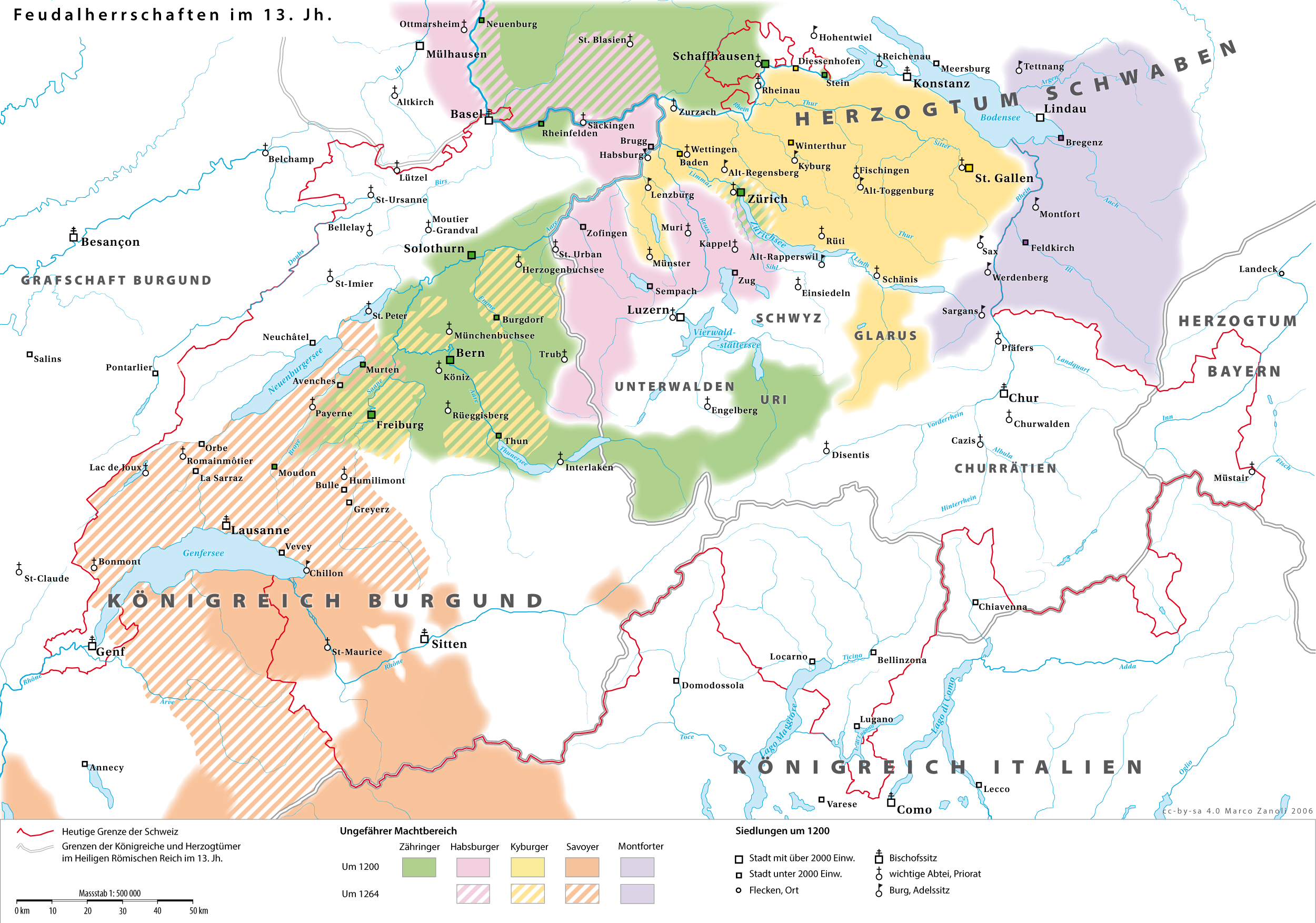
The House of Habsburg (), alternatively spelled Hapsburg in Englishgerman: Haus Habsburg, ; es, Casa de Habsburgo; hu, Habsburg család, it, Casa di Asburgo, nl, Huis van Habsburg, pl, dom Habsburgów, pt, Casa de Habsburgo, la, Domus Habsburg, french: Maison des Habsbourg and also known as the House of Austriagerman: link=no, Haus Österreich, ; es, link=no, Casa de Austria; nl, Huis van Oostenrijk, pl, dom Austrii, la, Domus Austriæ, french: Maison d'Autriche; hu, Ausztria Háza; it, Casa d'Austria; pt, Casa da Áustria is one of the most prominent and important dynasties in European history. The house takes its name from Habsburg Castle, a fortress built in the 1020s in present-day Switzerland by Radbot of Klettgau, who named his fortress Habsburg. His grandson Otto II, Count of Habsburg, Otto II was the first to take the fortress name as his own, adding "Count of Habsburg" to his title. In 1273, Count Radbot's seventh-generation descendant Rudolph I of German ... [...More Info...] [...Related Items...] OR: [Wikipedia] [Google] [Baidu] |


.jpg)

_301.jpg)


