|
Boltigen
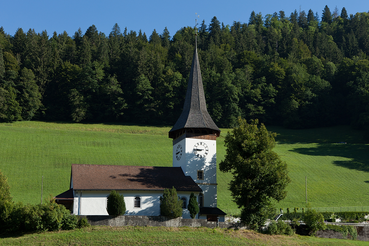
Boltigen is a municipality in the Obersimmental-Saanen administrative district in the canton of Bern in Switzerland. Boltigen is a mixed community, with traits both of a burgess community and a village community. Beside it, there is also a reformed evangelical Church community. The history of the community goes back to 1386 and the so-called ''Freiheitsbrief von 1386''. The community president is Hermann Maurer, since 1 January 2005. History Boltigen is first mentioned in 1276. The oldest trace of a settlement in the area is the mesolithic shelter in the ''Ranggiloch'' cave. A few Bronze Age artifacts have also been found. During the Middle Ages there were forts or castles at Simmenegg, Eichstalden and Laubegg though all three have fallen into ruin. Many of the villages and '' Bäuerten'' were founded in the Early Middle Ages and grew slowly over the following centuries. The villages and farm lands came under Bernese control partly in 1386 and completely in 1391. When Ber ... [...More Info...] [...Related Items...] OR: [Wikipedia] [Google] [Baidu] |
Boltigen 068
Boltigen is a Municipalities of Switzerland, municipality in the Obersimmental-Saanen (administrative district), Obersimmental-Saanen administrative district in the canton of Bern in Switzerland. Boltigen is a mixed community, with traits both of a burgess community and a village community. Beside it, there is also a reformed evangelical Church community. The history of the community goes back to 1386 and the so-called ''Freiheitsbrief von 1386''. The community president is Hermann Maurer, since 1 January 2005. History Boltigen is first mentioned in 1276. The oldest trace of a settlement in the area is the mesolithic shelter in the ''Ranggiloch'' cave. A few Bronze Age artifacts have also been found. During the Middle Ages there were forts or castles at Simmenegg, Eichstalden and Laubegg though all three have fallen into ruin. Many of the villages and ''Bäuerten'' were founded in the Early Middle Ages and grew slowly over the following centuries. The villages and farm land ... [...More Info...] [...Related Items...] OR: [Wikipedia] [Google] [Baidu] |
Obersimmental-Saanen (administrative District)
Obersimmental-Saanen District in the Canton of Bern The canton of Bern or Berne (german: Kanton Bern; rm, Chantun Berna; french: canton de Berne; it, Canton Berna) is one of the 26 cantons forming the Swiss Confederation. Its capital city, Bern, is also the ''de facto'' capital of Switzerland. ... was created on 1 January 2010. It is part of the Oberland administrative region. It contains 7 municipalities with an area of and a population () of 16,784. References {{coord, 46, 29, N, 7, 16, E, source:kolossus-eowiki, display=title Districts of the canton of Bern ... [...More Info...] [...Related Items...] OR: [Wikipedia] [Google] [Baidu] |
Jaun
Jaun (french: Bellegarde; frp, Bèlagouàrda ) is a municipality in the district of Gruyère in the canton of Fribourg in Switzerland. It is the only German-speaking municipality in Gruyère. History Jaun is first mentioned in 1228 as ''Balavarda''. In 1397 it was mentioned as ''Youn''. Geography Jaun has an area, , of . Of this area, or 42.5% is used for agricultural purposes, while or 38.9% is forested. Of the rest of the land, or 1.7% is settled (buildings or roads), or 0.8% is either rivers or lakes and or 16.1% is unproductive land.Swiss Federal Statistical Office-Land Use Statistics 2009 data accessed 25 March 2010 Of the built up area, housing and buildings made up 0.5% and transportation infrastructure made up 1.0%. Out of the for ... [...More Info...] [...Related Items...] OR: [Wikipedia] [Google] [Baidu] |
Stedelen
Stedelen (dead c. 1400) was a man who was accused of being a witch in Boltigen, Switzerland between 1397 and 1406. Background After the harvest had failed at his village, Stedelen was accused of using black magic to destroy the crops, killing cattle and also sacrificing a black rooster on the Sabbath at a crossroad and placing a lizard under the doorway of a local church. Peter von Greyerz, the judge of Simmental between 1398–1406, was a firm believer in witchcraft, which he believed had been introduced in Simmental by a noble man called Scavius in 1375, who claimed he could transform himself to a mouse (as recorded in Johannes Nider's seminal work ''Formicarius''). Scavius was slaughtered by his enemies, but he had a student, Hoppo, who, according to Greyerz, had been the tutor of Stedelen. There are no records about Hoppo, but Stedelen from Boltigen had allegedly been made an expert on magic by Hoppo, and supposedly learned to steal manure, hay and such from others' fields ... [...More Info...] [...Related Items...] OR: [Wikipedia] [Google] [Baidu] |
Saanen
Saanen (french: Gessenay; Highest Alemannic German, Highest Alemannic: ''Saanä'') is a municipalities of Switzerland, municipality in the Cantons of Switzerland, canton of Bern (canton), Bern in Switzerland. It is the capital of the Obersimmental-Saanen (administrative district), Obersimmental-Saanen administrative district. History The village was first mentioned in 1228 as ''Gissinay''. In 1340 it was mentioned as ''Sanon''. During the Bronze Age there was a hill fort on the Cholis Grind near the modern village of Saanen. The region was occupied by the Gallo-Roman culture, Gallo-Romans until the 10th or 11th century when the Alamanni began to drive them out. This migration created the modern language borders in Switzerland. During the Middle Ages several forts were built to guard the mule trails into the Valais and Vaud. These included the Kramburg (which was first mentioned in 1331 but is now covered by later construction), the Swabia Ried tower (11th-12th century) and the ... [...More Info...] [...Related Items...] OR: [Wikipedia] [Google] [Baidu] |
Jaun Pass
Jaun Pass (German: ''Jaunpass'', French: ''col de Bellegarde'') is a high mountain pass (el. 1509 m.) in the Swiss Alps linking Charmey and Jaun in the canton of Fribourg with Reidenbach (part of the municipality of Boltigen) in the canton of Bern. The pass itself is located within the canton of Berne. The pass road was completed in 1878. See also * List of highest paved roads in Europe * List of mountain passes *List of the highest Swiss passes This is a list of the highest road passes in Switzerland. It includes passes in the Alps and the Jura Mountains that are over above sea level. All the listed passes are crossed by paved roads. These are popular with drivers, bikers and cyclists ... References External links Profile on climbbybike.com with tourist information, webcam [...More Info...] [...Related Items...] OR: [Wikipedia] [Google] [Baidu] |
Diemtigen
Diemtigen is a village and a municipality of the Frutigen-Niedersimmental administrative district in the canton of Bern in Switzerland. It is located at the northern end of the Diemtigtal elevated on a plateau west above the creek Chirel. In 1986, the community was awarded the Wakker Prize for preservation of its architectural heritage. History Diemtigen is first mentioned in 1257 as ''Diemtingen''. The Diemtigen area was inhabited during the Bronze Age and possibly during the Mesolithic Era. It was permanently inhabited and fortified by the High Middle Ages. The heights above the valleys are home to several castles or castle ruins. No records exist and very little is known about the ruins of Kronegg Castle, above Eggwald, and Grafenstein Castle, above Oey. The third castle, Hasenburg near Diemtigen was first mentioned in 1257 as castrum de Diemtingen and in the 12th and 13th centuries was the seat of the Freiherr von Strättligen. After the 12th century the castle a ... [...More Info...] [...Related Items...] OR: [Wikipedia] [Google] [Baidu] |
Obersimmental
Obersimmental District was one of the 26 administrative districts in the Canton of Bern, Switzerland. Its capital was Blankenburg in the municipality of Zweisimmen. The district had an area of 334 km² and consisted of 4 municipalities A municipality is usually a single administrative division having corporate status and powers of self-government or jurisdiction as granted by national and regional laws to which it is subordinate. The term ''municipality'' may also mean the go ...: External links Official website of Zweisimmen References Former districts of the canton of Bern {{Berne-geo-stub ... [...More Info...] [...Related Items...] OR: [Wikipedia] [Google] [Baidu] |
Jaunpass
Jaun Pass (German: ''Jaunpass'', French: ''col de Bellegarde'') is a high mountain pass (el. 1509 m.) in the Swiss Alps linking Charmey and Jaun in the canton of Fribourg with Reidenbach (part of the municipality of Boltigen) in the canton of Bern. The pass itself is located within the canton of Berne. The pass road was completed in 1878. See also * List of highest paved roads in Europe * List of mountain passes *List of the highest Swiss passes This is a list of the highest road passes in Switzerland. It includes passes in the Alps and the Jura Mountains that are over above sea level. All the listed passes are crossed by paved roads. These are popular with drivers, bikers and cyclists ... References External links Profile on climbbybike.com with tourist information, webcam [...More Info...] [...Related Items...] OR: [Wikipedia] [Google] [Baidu] |
Bernese Oberland
The Bernese Oberland ( en, Bernese Highlands, german: Berner Oberland; gsw, Bärner Oberland; french: Oberland bernois), the highest and southernmost part of the canton of Bern, is one of the canton's five administrative regions (in which context it is referred to as ''Oberland'' without further specification). It constitutes the Alpine region of the canton and the northern side of the Bernese Alps, including many of its highest peaks, among which the Finsteraarhorn (), the highest in both range and canton. The region essentially coincides with the upper basin of the Aare, the latter notably comprehending Lake Thun and Lake Brienz, the two large lakes of the region. On the banks of the lakes or the Aare are the main settlements of Thun, Spiez, Interlaken, Brienz and Meiringen. The numerous side valleys of the Bernese Oberland include a large number of Alpine villages, many of them being tourist resorts and connected by mountain railways to Spiez and Interlaken. The Lötschbe ... [...More Info...] [...Related Items...] OR: [Wikipedia] [Google] [Baidu] |
Zweisimmen
Zweisimmen is a municipality in the Obersimmental-Saanen administrative district in the canton of Bern in Switzerland. History Zweisimmen is first mentioned in 1228 as ''Duessimenes''. In 1257 it was mentioned as ''Zweinlixhenun''. The oldest trace of a settlement in the area are some scattered mesolithic artifacts from Mannenberg-Riedli. The remains of a Roman era settlement were found at Mannried. During the Middle Ages a significant trade route over the Alps to Valais and Lake Geneva passed through the Zweisimmen region. A number of farming villages probably existed in the area during the Middle Ages. In the 13th and 14th centuries, local nobles built several castles, Upper Mannenberg and Lower Mannenberg, Reichenstein-Terenstein, Blankenburg and Steinegg Castles, to protect and collect taxes from the roads. The villages and castles passed through several noble families until 1378 when the Lord of Düdingen sold the lands to Fribourg following an uprising. After the ... [...More Info...] [...Related Items...] OR: [Wikipedia] [Google] [Baidu] |
Canton Of Bern
The canton of Bern or Berne (german: Kanton Bern; rm, Chantun Berna; french: canton de Berne; it, Canton Berna) is one of the 26 cantons forming the Swiss Confederation. Its capital city, Bern, is also the ''de facto'' capital of Switzerland. The bear is the heraldic symbol of the canton, displayed on a red-yellow background. Comprising ten districts, Bern is the second-largest canton by both surface area and population. Located in west-central Switzerland, it is surrounded by eleven cantons. It borders the canton of Jura and the canton of Solothurn to the north. To the west lie the canton of Neuchâtel, the canton of Fribourg and canton of Vaud. To the south lies the canton of Valais. East of the canton of Bern lie the cantons of Uri, Nidwalden, Obwalden, Lucerne and Aargau. The geography of the canton includes a large share of all three natural regions of Switzerland: the Jura Mountains (the Bernese Jura), the Swiss Plateau (the Bernese Mittelland) and the Alps (th ... [...More Info...] [...Related Items...] OR: [Wikipedia] [Google] [Baidu] |


