|
Bindusara River
Bindusara (also called Bendsura) is a small river situated in the district of Beed in Maharashtra state of India. It is a tributary river of Sindphana and a sub-tributary of Godavari river. Bindusara originates in the hills of Balaghat near the village Waghira, in south of district Beed in Patoda taluqa. It is a hilly area. Various small streams contributes to the river. The city of Beed is situated on the banks of Bindusara river. Bendsura is a rapid and seasonal river. A reservoir; Bendsura Project (capacity 7.106 million cubic metres) was constructed on the river in 1955 near the village of Pāli, about 10 km south of Beed. At some places the river is narrow and looks like a stream. The lack of vegetation and rocky and undulating terrain contributes to violent floods in heavy rains. These have repeatedly caused substantial loss of property and life in the history of Beed town, most recently on July 23, 1989, when a massive flooding of three habitations in the town c ... [...More Info...] [...Related Items...] OR: [Wikipedia] [Google] [Baidu] |
India
India, officially the Republic of India (Hindi: ), is a country in South Asia. It is the seventh-largest country by area, the second-most populous country, and the most populous democracy in the world. Bounded by the Indian Ocean on the south, the Arabian Sea on the southwest, and the Bay of Bengal on the southeast, it shares land borders with Pakistan to the west; China, Nepal, and Bhutan to the north; and Bangladesh and Myanmar to the east. In the Indian Ocean, India is in the vicinity of Sri Lanka and the Maldives; its Andaman and Nicobar Islands share a maritime border with Thailand, Myanmar, and Indonesia. Modern humans arrived on the Indian subcontinent from Africa no later than 55,000 years ago., "Y-Chromosome and Mt-DNA data support the colonization of South Asia by modern humans originating in Africa. ... Coalescence dates for most non-European populations average to between 73–55 ka.", "Modern human beings—''Homo sapiens''—originated in Africa. Then, int ... [...More Info...] [...Related Items...] OR: [Wikipedia] [Google] [Baidu] |
Maharashtra
Maharashtra (; , abbr. MH or Maha) is a states and union territories of India, state in the western India, western peninsular region of India occupying a substantial portion of the Deccan Plateau. Maharashtra is the List of states and union territories of India by population, second-most populous state in India and the second-most populous country subdivision globally. It was formed on 1 May 1960 by splitting the bilingual Bombay State, which had existed since 1956, into majority Marathi language, Marathi-speaking Maharashtra and Gujarati language, Gujarati-speaking Gujarat. Maharashtra is home to the Marathi people, the predominant ethno-linguistic group, who speak the Marathi language, Marathi language, the official language of the state. The state is divided into 6 Divisions of Maharashtra, divisions and 36 List of districts of Maharashtra, districts, with the state capital being Mumbai, the List of million-plus urban agglomerations in India, most populous urban area in India ... [...More Info...] [...Related Items...] OR: [Wikipedia] [Google] [Baidu] |
Beed
Beed (Marathi pronunciation: iːɖ is a city in Marathwada region of Maharashtra state in India. It is the administrative headquarters in Beed district. History Beed is a historical city of possibly medieval origin. Its early history is obscure. Historians speculate, based on archaeological remains, that the city might have been founded by the Yadava rulers (1173–1317) of Devagiri ( Daulatabad). Beed was later governed by the Nizams during the period of British India. Operation Polo, the code name of the Hyderabad "Police Action", was a military operation in September 1948 in which the Indian Armed Forces invaded the State of Hyderabad and overthrew its Nizam, annexing the state into India. Beed remained in annexed Hyderabad state until 1956 when it was included in Bombay Presidency. On 1 May 1960 Maharashtra state was created on a linguistic basis, and Marathi- & Muslim-dominated Beed district became part of Maharashtra. Foundation and name The early history of Beed is u ... [...More Info...] [...Related Items...] OR: [Wikipedia] [Google] [Baidu] |
Godavari
The Godavari ( IAST: ''Godāvarī'' �od̪aːʋəɾiː is India's second longest river after the Ganga river and drains into the third largest basin in India, covering about 10% of India's total geographical area. Its source is in Trimbakeshwar, Nashik, Maharashtra. It flows east for , draining the states of Maharashtra (48.6%), Telangana (18.8%), Andhra Pradesh (4.5%), Chhattisgarh (10.9%) and Odisha (5.7%). The river ultimately empties into the Bay of Bengal through an extensive network of tributaries. Measuring up to , it forms one of the largest river basins in the Indian subcontinent, with only the Ganga and Indus rivers having a larger drainage basin. In terms of length, catchment area and discharge, the Godavari is the largest in peninsular India, and had been dubbed as the Dakshina Ganga (Ganges of the South). The river has been revered in Hindu scriptures for many millennia and continues to harbour and nourish a rich cultural heritage. In the past few decades, th ... [...More Info...] [...Related Items...] OR: [Wikipedia] [Google] [Baidu] |
Balaghat
Balaghat is a city and a municipality in Balaghat district, in the state of Madhya Pradesh, India. It is the administrative headquarters of Balaghat District. Wainganga River flows beside the town. Geography Balaghat is located at . It has an average elevation of 288 metres (944 feet). Demographics As of the 2011 Census of India The 2011 Census of India or the 15th Indian Census was conducted in two phases, house listing and population enumeration. The House listing phase began on 1 April 2010 and involved the collection of information about all buildings. Information ..., Balaghat had a population of 84,216. Males constitute 51% of the population and females 49%. 11% of the population is under 6 years of age. References Further reading {{Authority control Cities and towns in Balaghat district sv:Balaghat (distrikt) ... [...More Info...] [...Related Items...] OR: [Wikipedia] [Google] [Baidu] |
Million Cubic Metre
The cubic metre (in Commonwealth English and international spelling as used by the International Bureau of Weights and Measures) or cubic meter (in American English) is the unit of volume in the International System of Units (SI). Its symbol is m3. Bureau International de Poids et Mesures.Derived units expressed in terms of base units". 2014. Accessed 7 August 2014. It is the volume of a cube with edges one metre in length. An alternative name, which allowed a different usage with metric prefixes, was the stère, still sometimes used for dry measure (for instance, in reference to wood). Another alternative name, no longer widely used, was the kilolitre. Conversions : A cubic metre of pure water at the temperature of maximum density (3.98 °C) and standard atmospheric pressure (101.325 kPa) has a mass of , or one tonne. At 0 °C, the freezing point of water, a cubic metre of water has slightly less mass, 999.972 kilograms. A cubic metre is sometimes abbreviated ... [...More Info...] [...Related Items...] OR: [Wikipedia] [Google] [Baidu] |
Cloudy Evening At Bendsura Project1
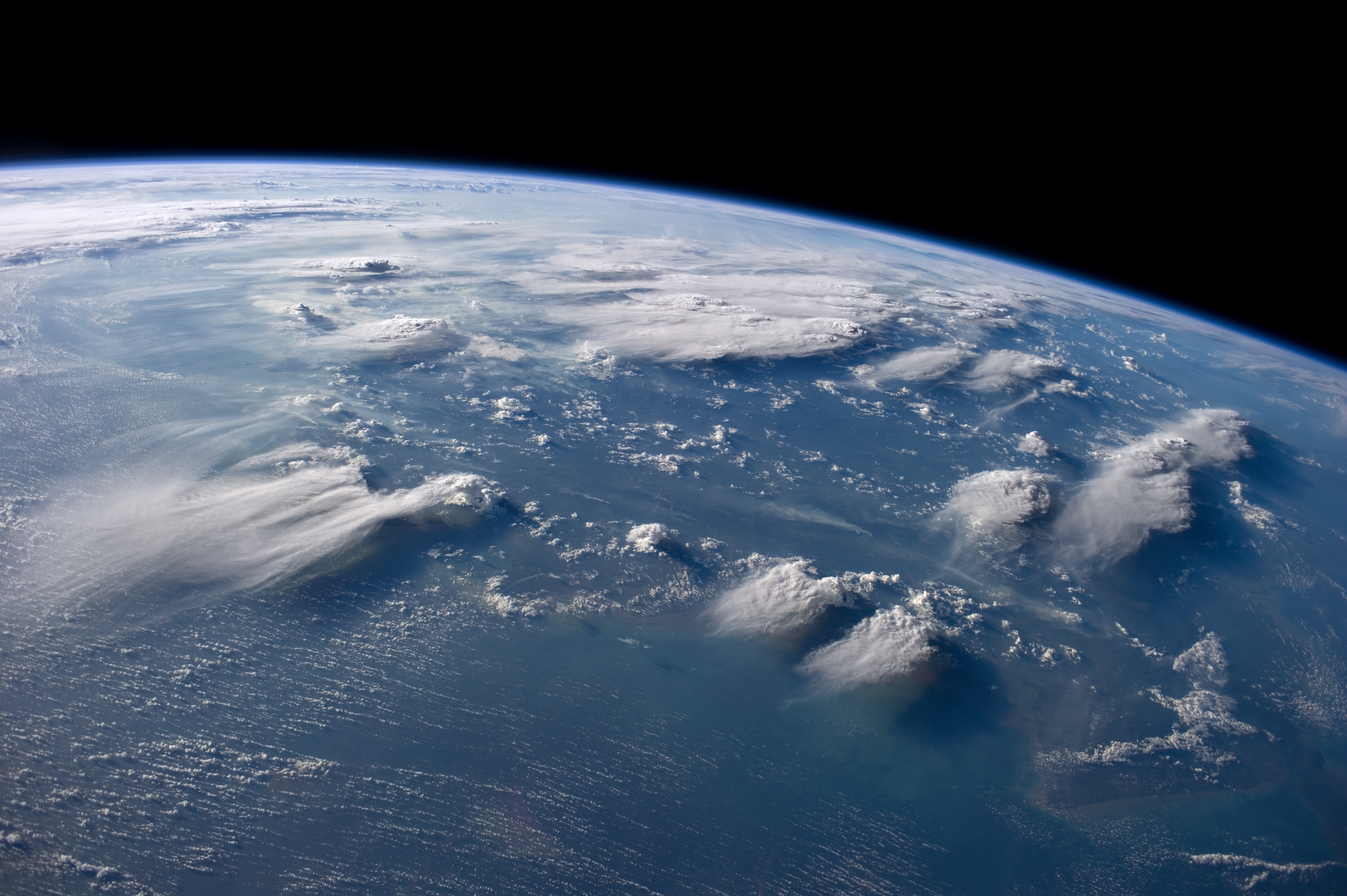
In meteorology, a cloud is an aerosol consisting of a visible mass of miniature liquid droplets, frozen crystals, or other particles suspended in the atmosphere of a planetary body or similar space. Water or various other chemicals may compose the droplets and crystals. On Earth, clouds are formed as a result of saturation of the air when it is cooled to its dew point, or when it gains sufficient moisture (usually in the form of water vapor) from an adjacent source to raise the dew point to the ambient temperature. They are seen in the Earth's homosphere, which includes the troposphere, stratosphere, and mesosphere. Nephology is the science of clouds, which is undertaken in the cloud physics branch of meteorology. There are two methods of naming clouds in their respective layers of the homosphere, Latin and common name. Genus types in the troposphere, the atmospheric layer closest to Earth's surface, have Latin names because of the universal adoption of Luke Howard's nomenc ... [...More Info...] [...Related Items...] OR: [Wikipedia] [Google] [Baidu] |
List Of Rivers Of India
This is a list of rivers of India, starting in the west and moving along the Indian coast southward, then northward. Tributary rivers are listed hierarchically in upstream order: the lower in the list, the more upstream. The overall discharge of rivers in India or passing/originating in India : List of rivers of India by discharge The major rivers of India are: * Flowing into the Arabian Sea: Narmada, Tapi, Sindhu, Sabarmati, Mahi, Purna * Flowing into the Bay of Bengal: Brahmaputra, Yamuna, Ganga, Meghna, Mahanadi, Godavari, Krishna, Kaveri, Penna River Mizoram and Bangladesh. Meghna River Basin The Meghna-Surma-Barak River System is located in India and Bangladesh. * Meghna River (in the Bangladesh) ** ** Dhaleshwari River ** Dakatia River ** Gumti River ** Feni River ** Tista River, also called the Haora River ** Surma River *** Kangsha River **** Someshwari River ** Kushiyara River *** Manu River ** Barak River *** Tuivai River *** Irang River Ganges River Ba ... [...More Info...] [...Related Items...] OR: [Wikipedia] [Google] [Baidu] |
List Of Major Rivers Of India
The rivers in India play an important role in the lives of its people. They provide potable water, cheap transportation, electricity, and the livelihood for many people nationwide. This easily explains why nearly all the major cities of India are located by the banks of rivers. The rivers also have an important role in Hindu Religion and are considered holy by many Hindus in the country. Seven major rivers along with their numerous tributaries make up the river system of India. The largest basin system pours its waters into the Bay of Bengal; however, some of the rivers whose courses take them through the western part of the country and towards the east of the state of Himachal Pradesh empty into the Arabian Sea. Parts of Ladakh, northern parts of the Aravalli range and the arid parts of the Thar Desert have inland drainage. All major rivers of India originate from one of the following main watersheds: #Aravalli range #Himalaya and Karakoram ranges # Sahyadri or Western Ghats in ... [...More Info...] [...Related Items...] OR: [Wikipedia] [Google] [Baidu] |
Rivers Of Maharashtra
A river is a natural flowing watercourse, usually freshwater, flowing towards an ocean, sea, lake or another river. In some cases, a river flows into the ground and becomes dry at the end of its course without reaching another body of water. Small rivers can be referred to using names such as creek, brook, rivulet, and rill. There are no official definitions for the generic term river as applied to geographic features, although in some countries or communities a stream is defined by its size. Many names for small rivers are specific to geographic location; examples are "run" in some parts of the United States, "burn" in Scotland and northeast England, and "beck" in northern England. Sometimes a river is defined as being larger than a creek, but not always: the language is vague. Rivers are part of the water cycle. Water generally collects in a river from precipitation through a drainage basin from surface runoff and other sources such as groundwater recharge, springs, a ... [...More Info...] [...Related Items...] OR: [Wikipedia] [Google] [Baidu] |


