|
Bilikol
Bilikol ( kk, Билікөл; russian: Биликоль) is a freshwater lake in the Zhambyl Region, Kazakhstan. The lake lies northwest of the city of Taraz. Its waters are used by the surrounding communities to irrigate crops. Geography Lake Bilikol has a shape that roughly reminds of an hourglass. Lying in a tectonic depression on the northern slope of the Karatau Mountains, it is part of the Talas basin. The Asa river flows through the lake entering it from the east and flowing out from the north. The shores of the lake are sandy in places.Асса '''' in 30 vols. — Ch. ed. |
Lake Akkol
Akkol ( zh, 阿科尔) is a lake in the Talas District, Zhambyl Region, southern Kazakhstan. It is located close to the southwest of Akkol village. In the summer the lakeshores are a vacation spot. Geography The lake is roughly by and lies at an altitude of above sea level. Its depth ranges from to . Ashchykol lies to the northwest. The Asa River flows into Akkol, after flowing out of lake Bilikol located to the south of the lake. Lake Akkol freezes from late December to late March.Google Earth History There are two ways to translate the toponym: most often its meaning is "White lake" in the Kazakh language. Fauna The main fish species in the lake are bream, zander, carp, crucian carp and roach.''Kazakhstan National encyclopedia'' / Chief editor A. Nysanbayev - Almaty, "Kazakh encyclopedia" General editor, 1998, ISBN 5-89800-123-9 , Volume II References External linksMaryashev Monuments of Semirechye archeology and their use in excursions-Almaty, 2002{{Lakes of Ka ... [...More Info...] [...Related Items...] OR: [Wikipedia] [Google] [Baidu] |
Asa (Kazakhstan)
The Asa ( kk, Аса, ''Asa'') is a river of Kazakhstan. Course The river has its source in the Karatau Mountains. It flows through lakes Bilikol and Akkol. Further downstream it vanishes in the Muyunkum Desert before reaching the river Talas. The river is long and has a basin area of . Great Soviet Encyclopedia
The ''Great Soviet Encyclopedia'' (GSE; ) is one of the largest Russian-language encyclopedias, published in the Soviet Union from 1926 to 1990. After 2002, the encyclopedia's data was partially included into the later ''Bolshaya rossiyskaya e ...
References [...More Info...] [...Related Items...] OR: [Wikipedia] [Google] [Baidu] |
Google Earth
Google Earth is a computer program that renders a 3D computer graphics, 3D representation of Earth based primarily on satellite imagery. The program maps the Earth by superimposition, superimposing satellite images, aerial photography, and geographic information system, GIS data onto a 3D globe, allowing users to see cities and landscapes from various angles. Users can explore the globe by entering addresses and coordinates, or by using a Computer keyboard, keyboard or computer mouse, mouse. The program can also be downloaded on a smartphone or Tablet computer, tablet, using a touch screen or stylus to navigate. Users may use the program to add their own data using Keyhole Markup Language and upload them through various sources, such as forums or blogs. Google Earth is able to show various kinds of images overlaid on the surface of the earth and is also a Web Map Service client. In 2019, Google has revealed that Google Earth now covers more than 97 percent of the world, and has c ... [...More Info...] [...Related Items...] OR: [Wikipedia] [Google] [Baidu] |
List Of Lakes Of Kazakhstan ...
Excluding the northernmost districts, Kazakhstan consists of endorheic basins, where rivers flow into one of the numerous lakes. The most important drainage system is known as Yedisu, meaning "seven rivers" in Turkic languages. Below is the list of the more important lakes, some of which are shared (Caspian Sea, Lake Aral, Lake Aike, etc.) with the neighbouring countries. References {{Europe topic, List of lakes of * Lakes Kazakhstan Kazakhstan, officially the Republic of Kazakhstan, is a transcontinental country located mainly in Central Asia and partly in Eastern Europe. It borders Russia to the north and west, China to the east, Kyrgyzstan to the southeast, Uzbeki ... [...More Info...] [...Related Items...] OR: [Wikipedia] [Google] [Baidu] |
Almaty
Almaty (; kk, Алматы; ), formerly known as Alma-Ata ( kk, Алма-Ата), is the List of most populous cities in Kazakhstan, largest city in Kazakhstan, with a population of about 2 million. It was the capital of Kazakhstan from 1929 to 1936 as an Kazakh Autonomous Soviet Socialist Republic, autonomous republic as part of the Soviet Union, then from 1936 to 1991 as a Kazakh Soviet Socialist Republic, union republic and finally from 1991 as an independent state to 1997 when the government relocated the capital to Astana, Akmola (renamed Astana in 1998, Nur-Sultan in 2019, and back to Astana in 2022). Almaty is still the major commercial, financial, and cultural centre of Kazakhstan, as well as its most populous and most cosmopolitan city. The city is located in the mountainous area of southern Kazakhstan near the border with Kyrgyzstan in the foothills of the Trans-Ili Alatau at an elevation of 700–900 m (2,300–3,000 feet), where the Large and Small Almatinka rivers r ... [...More Info...] [...Related Items...] OR: [Wikipedia] [Google] [Baidu] |
Grass Carp
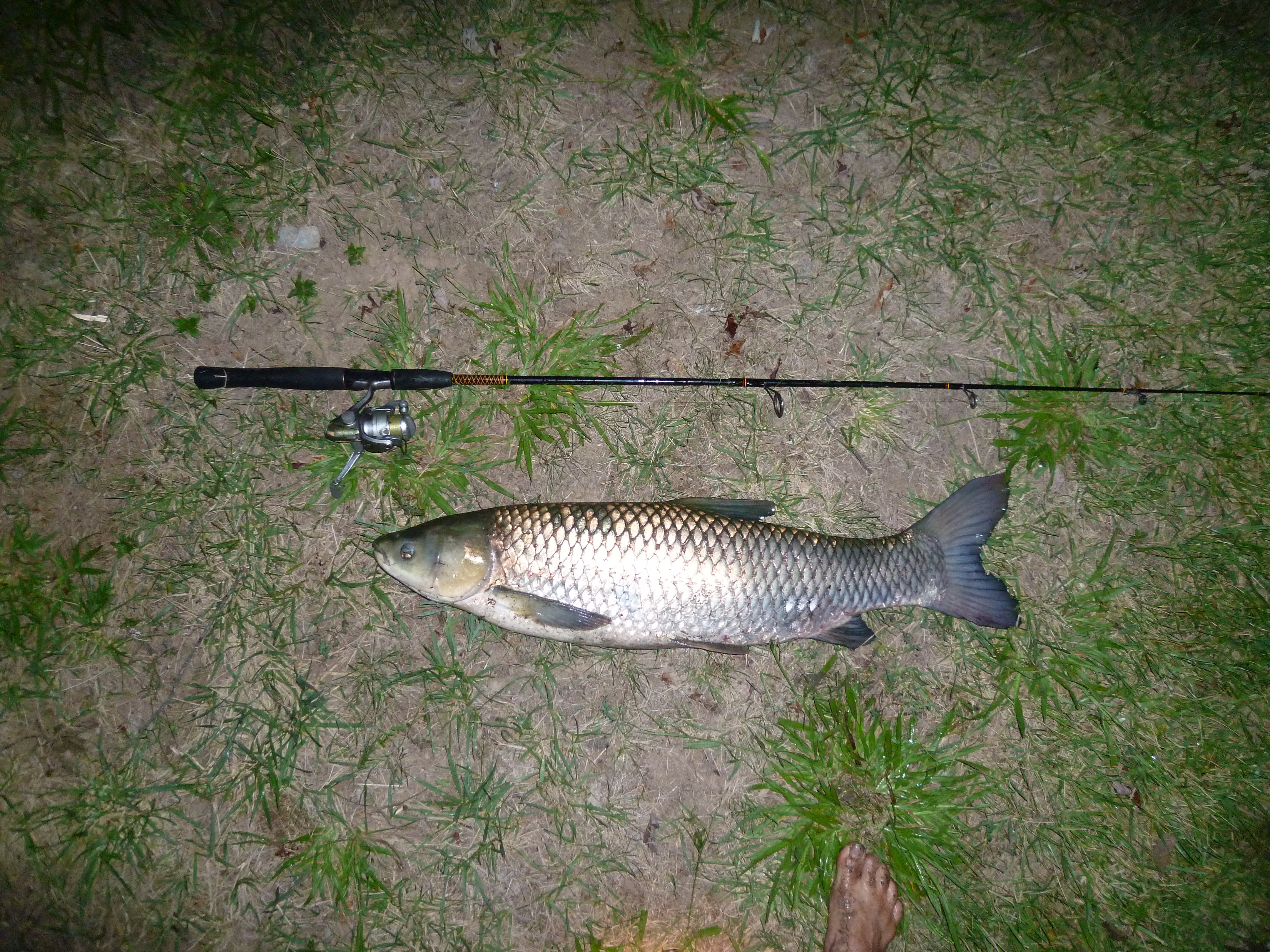
The grass carp (''Ctenopharyngodon idella'') is a species of large herbivorous freshwater fish in the family Cyprinidae, native to the Pacific Far East, with a native range stretching from northern Vietnam to the Amur River on the Sino-Russian border.Mandrak and Cudmore. 2004''Biological Synopsis of Grass Carp (Ctenopharyngodon idella)''. This Asian carp is the only species of the genus ''Ctenopharyngodon''. Grass carp are resident fish of large turbid rivers and associated floodplain lakes/wetlands with a wide range of temperature tolerance, and spawn at temperatures of . It is cultivated as a food fish in China for centuries, but was introduced in Europe and the United States for aquatic weed control, becoming the fish species with the largest reported farmed production globally, over five million tonnes per year. [...More Info...] [...Related Items...] OR: [Wikipedia] [Google] [Baidu] |
Common Bream
The common bream, freshwater bream, bream, bronze bream, carp bream or sweaty bream (''Abramis brama''), is a European species of freshwater fish in the family Cyprinidae. It is now considered to be the only species in the genus ''Abramis''. Range and habitat The common bream's home range is Europe north of the Alps and Pyrenees, as well as the Balkans. They are found as far east as the Caspian Sea, the Black Sea, and the Aral Sea. The common bream lives in ponds, lakes, canals, and slow-flowing rivers. Description The bream is usually long, though some specimens of have been recorded; it usually weighs . Its maximum length is 90 cm (35.5 in),the recorded weight is around 9.1 kg (20 lb). The common bream has a laterally flattened and high-backed body and a slightly undershot mouth. It is a silvery grey colour, though older fish can be bronze-coloured, especially in clear waters. The fins are greyish to black, but never reddish. Similar-looking fish Th ... [...More Info...] [...Related Items...] OR: [Wikipedia] [Google] [Baidu] |
Carp
Carp are various species of oily freshwater fish from the family Cyprinidae, a very large group of fish native to Europe and Asia. While carp is consumed in many parts of the world, they are generally considered an invasive species in parts of Africa, Australia and most of the United States. Biology The cypriniformes (family Cyprinidae) are traditionally grouped with the Characiformes, Siluriformes, and Gymnotiformes to create the superorder Ostariophysi, since these groups share some common features. These features include being found predominantly in fresh water and possessing Weberian ossicles, an anatomical structure derived from the first five anterior-most vertebrae, and their corresponding ribs and neural crests. The third anterior-most pair of ribs is in contact with the extension of the labyrinth and the posterior with the swim bladder. The function is poorly understood, but this structure is presumed to take part in the transmission of vibrations from the swim bl ... [...More Info...] [...Related Items...] OR: [Wikipedia] [Google] [Baidu] |
Phragmites
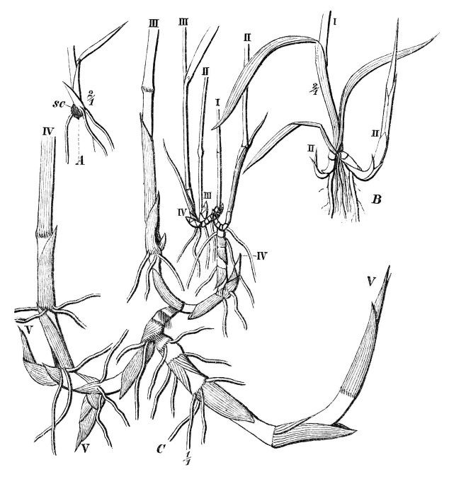
''Phragmites'' () is a genus of four species of large perennial reed grasses found in wetlands throughout temperate and tropical regions of the world. Taxonomy The World Checklist of Selected Plant Families, maintained by Kew Garden in London, accepts the following four species: * ''Phragmites australis'' ( Cav.) Trin. ex Steud. – cosmopolitan * ''Phragmites japonicus'' Steud. – Japan, Korea, Ryukyu Islands, Russian Far East * ''Phragmites karka'' ( Retz.) Trin. ex Steud. – tropical Africa, southern Asia, Australia, some Pacific Islands, invasive in New Zealand * ''Phragmites mauritianus'' Kunth – central + southern Africa, Madagascar, Mauritius The cosmopolitan common reed has the generally accepted botanical name ''Phragmites australis''. (Cav.) Trin. ex Steud. About 130 other synonyms have been proposed. Examples include ''Phragmites communis'' Trin., ''Arundo phragmites'' L., and ''Phragmites vulgaris'' (Lam.) Crép. (illegitimate name). Wildlife in reed beds ... [...More Info...] [...Related Items...] OR: [Wikipedia] [Google] [Baidu] |
Karatau Mountains
The Karatau or Qaratau ( kk, Қаратау жотасы, Qarataw jotasy) is a mountain range located in southern Kazakhstan. The name Karatau means ''Black Mountain'' in the Kazakh language. The mountains have deposits of phosphorite, lead and zinc. Geography The range extends for about in a roughly NW/SE direction just north of the Syrdaria River. The Muyunkum Desert lies to the north of the range. The Karatau is the westernmost prolongation of the Tian Shan. The summits of the mountains are smooth and the slopes are cut by snow-fed rivers. The Shabakty, Ushbas, Bugun and Asa, are among the rivers having their sources in the range. World Heritage Status There are numerous ancient archaeological sites in the range that display the stages of cultural evolution from the early Paleolithic Age (1 million BP) to the Neolithic Age (6500 BP). This site was added to the UNESCO World Heritage Tentative List on September 24, 1998 in the Cultural category. Nature Reserve The Karatau ... [...More Info...] [...Related Items...] OR: [Wikipedia] [Google] [Baidu] |
Fluvial Lake
A lake is an area filled with water, localized in a basin, surrounded by land, and distinct from any river or other outlet that serves to feed or drain the lake. Lakes lie on land and are not part of the ocean, although, like the much larger oceans, they do form part of the Earth's water cycle. Lakes are distinct from lagoons, which are generally coastal parts of the ocean. Lakes are typically larger and deeper than ponds, which also lie on land, though there are no official or scientific definitions. Lakes can be contrasted with rivers or streams, which usually flow in a channel on land. Most lakes are fed and drained by rivers and streams. Natural lakes are generally found in mountainous areas, rift zones, and areas with ongoing glaciation. Other lakes are found in endorheic basins or along the courses of mature rivers, where a river channel has widened into a basin. Some parts of the world have many lakes formed by the chaotic drainage patterns left over from the last ... [...More Info...] [...Related Items...] OR: [Wikipedia] [Google] [Baidu] |
Great Soviet Encyclopedia
The ''Great Soviet Encyclopedia'' (GSE; ) is one of the largest Russian-language encyclopedias, published in the Soviet Union from 1926 to 1990. After 2002, the encyclopedia's data was partially included into the later ''Bolshaya rossiyskaya entsiklopediya'' (or '' Great Russian Encyclopedia'') in an updated and revised form. The GSE claimed to be "the first Marxist–Leninist general-purpose encyclopedia". Origins The idea of the ''Great Soviet Encyclopedia'' emerged in 1923 on the initiative of Otto Schmidt, a member of the Russian Academy of Sciences. In early 1924 Schmidt worked with a group which included Mikhail Pokrovsky, (rector of the Institute of Red Professors), Nikolai Meshcheryakov (Former head of the Glavit, the State Administration of Publishing Affairs), Valery Bryusov (poet), Veniamin Kagan (mathematician) and Konstantin Kuzminsky to draw up a proposal which was agreed to in April 1924. Also involved was Anatoly Lunacharsky, People's Commissar of Education ... [...More Info...] [...Related Items...] OR: [Wikipedia] [Google] [Baidu] |


