|
Biddulph Moor
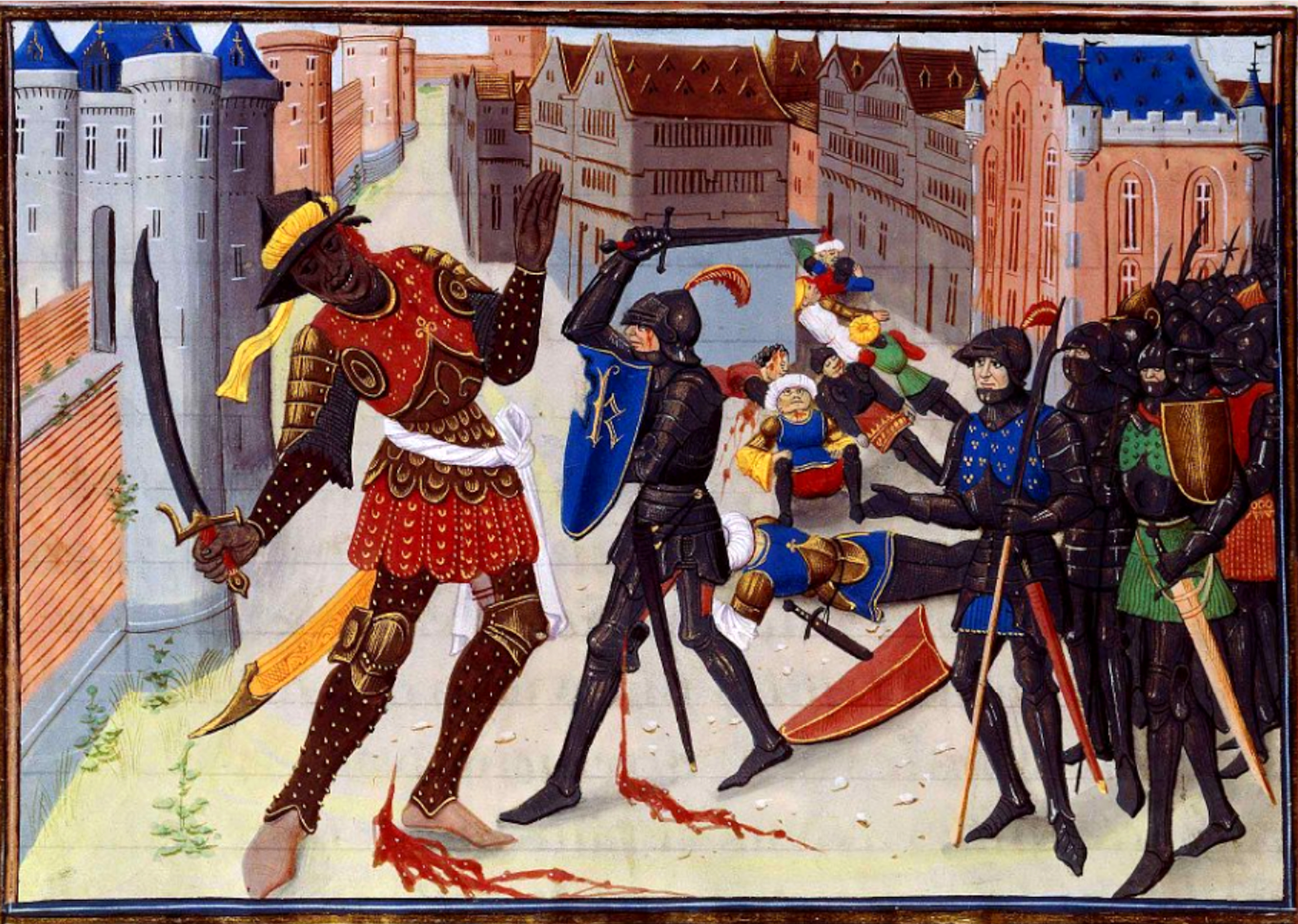
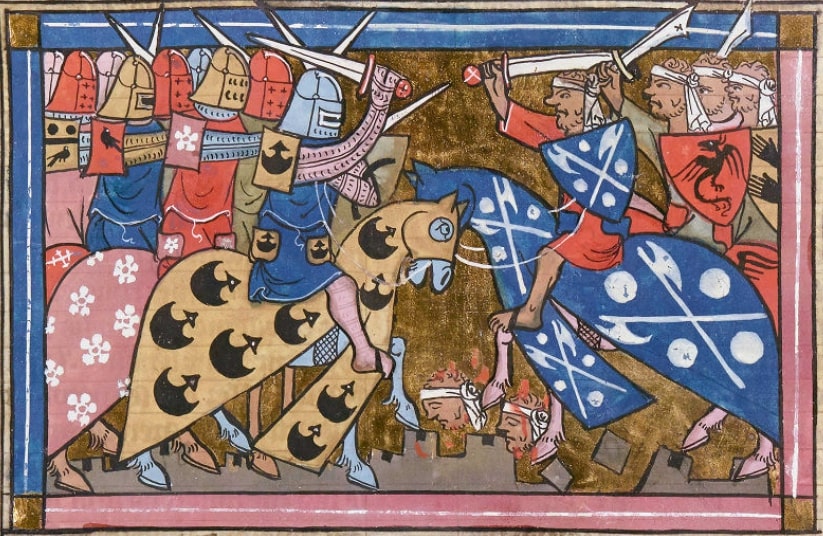
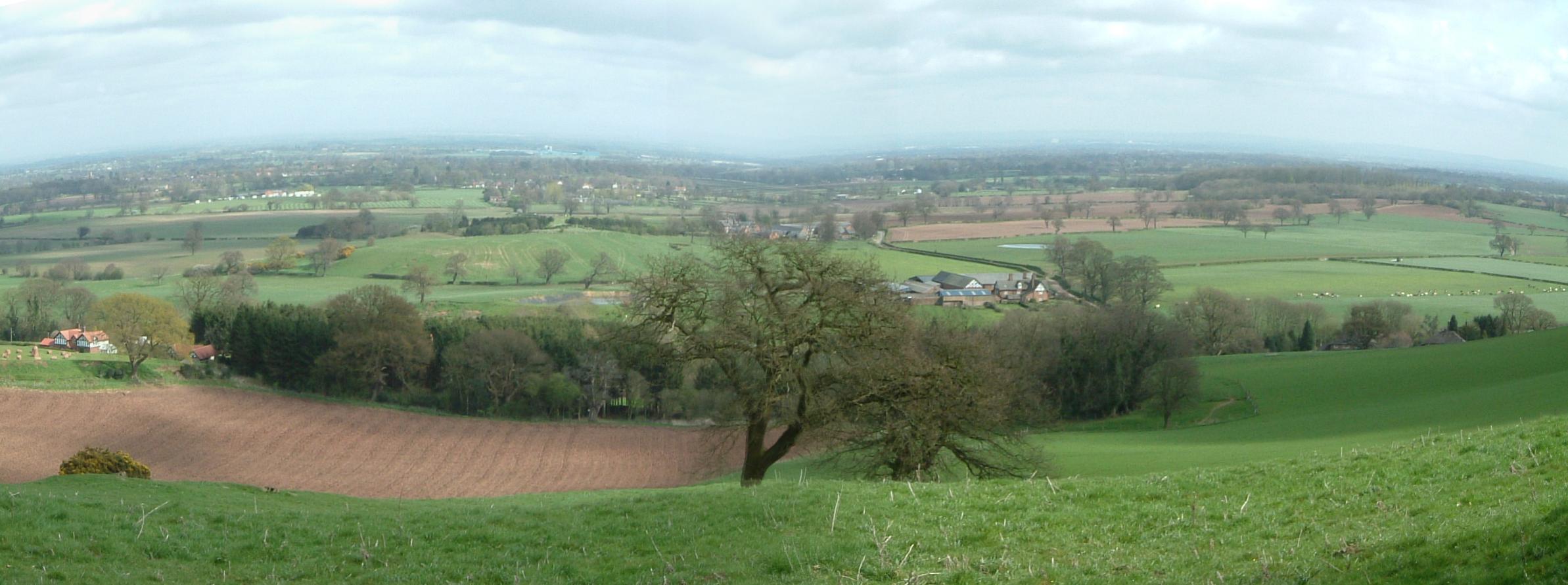
Biddulph Moor is a village located on the hill which bears the same name. It is in Biddulph parish and is a part of the Staffordshire Moorlands district in England. It is very similar to Mow Cop which is located on the other side of the valley of Biddulph. It is semi-rural and is the source of the River Trent. In Legend Legend has it, that the people of Biddulph Moor are descended from Saracen warriors captured during the Crusades The Crusades were a series of religious wars initiated, supported, and sometimes directed by the Latin Church in the medieval period. The best known of these Crusades are those to the Holy Land in the period between 1095 and 1291 that were in .... Geography The highest point is over 300 metres above sea level and it enjoys views over the Staffordshire and Cheshire plains and on a clear day the Welsh mountains are visible. The nearest railway station is Congleton which is 4 miles away. The nearest city is Stoke on Trent which is approximatel ... [...More Info...] [...Related Items...] OR: [Wikipedia] [Google] [Baidu] |
Biddulph
Biddulph is a town in Staffordshire, England, north of Stoke-on-Trent and south-east of Congleton, Cheshire. Origin of the name Biddulph's name may come from Anglo-Saxon/Old English ''bī dylfe'' = "beside the pit or quarry". It may also stem from a corruption of the Saxon/Old English Bidulfe, meaning "wolf slayer", and as a result the Biddulph family crest is a wolf rampant. In the days of coal and iron, Biddulph was actually called Bradley Green, with the original site of Biddulph being the area in which the parish church, Grange House, and the ruins of Biddulph Old Hall stand. It was not until 1930 that the town was marked on Ordnance Survey maps as 'Biddulph'. Geography Biddulph is located in a valley between the ridges of Mow Cop and Biddulph Moor to the east and west respectively. Biddulph also encompasses the hamlets of Gillow Heath, Knypersley and Brown Lees. Education In common with other parts of the area administered by Staffordshire LEA, the Middle School s ... [...More Info...] [...Related Items...] OR: [Wikipedia] [Google] [Baidu] |
Staffordshire
Staffordshire (; postal abbreviation Staffs.) is a landlocked county in the West Midlands region of England. It borders Cheshire to the northwest, Derbyshire and Leicestershire to the east, Warwickshire to the southeast, the West Midlands County and Worcestershire to the south and Shropshire to the west. The largest settlement in Staffordshire is Stoke-on-Trent, which is administered as an independent unitary authority, separately from the rest of the county. Lichfield is a cathedral city. Other major settlements include Stafford, Burton upon Trent, Cannock, Newcastle-under-Lyme, Rugeley, Leek, and Tamworth. Other towns include Stone, Cheadle, Uttoxeter, Hednesford, Brewood, Burntwood/Chasetown, Kidsgrove, Eccleshall, Biddulph and the large villages of Penkridge, Wombourne, Perton, Kinver, Codsall, Tutbury, Alrewas, Barton-under-Needwood, Shenstone, Featherstone, Essington, Stretton and Abbots Bromley. Cannock Chase AONB is within the county as well as parts of the ... [...More Info...] [...Related Items...] OR: [Wikipedia] [Google] [Baidu] |
Stoke-on-Trent
Stoke-on-Trent (often abbreviated to Stoke) is a city and Unitary authorities of England, unitary authority area in Staffordshire, England, with an area of . In 2019, the city had an estimated population of 256,375. It is the largest settlement in Staffordshire and is surrounded by the towns of Newcastle-under-Lyme, Alsager, Kidsgrove, Biddulph and Stone, Staffordshire, Stone, which form a conurbation around the city. Stoke is wikt:polycentric, polycentric, having been formed by Federation of Stoke-on-Trent, the federation of six towns in 1910. It took its name from Stoke-upon-Trent where the main centre of government and the principal Stoke-on-Trent railway station, railway station in the district were located. Hanley, Staffordshire, Hanley is the primary commercial centre; the other four towns which form the city are Burslem, Tunstall, Staffordshire, Tunstall, Longton, Staffordshire, Longton and Fenton, Staffordshire, Fenton. Stoke-on-Trent is the home of the pottery industr ... [...More Info...] [...Related Items...] OR: [Wikipedia] [Google] [Baidu] |
Staffordshire Moorlands
Staffordshire Moorlands is a Non-metropolitan district, local government district in Staffordshire, England. Its council, Staffordshire Moorlands District Council, is based in Leek, Staffordshire, Leek and is located between the city of Stoke-on-Trent and the Peak District National Park. The 2001 census recorded the population as 94,489. Principal industries are agriculture, fashion and tourism. The area's three towns are Leek, Cheadle, Staffordshire, Cheadle and Biddulph. Visitor attractions include the National Trust for Places of Historic Interest or Natural Beauty, National Trust property Biddulph Grange, the Churnet Valley Railway, the UK's largest theme park Alton Towers Resort, and the annual Leek Arts Festival. There are also a variety of outdoor pursuits such as rock climbing (The Roaches), sailing (Rudyard Lake) and cycling (Waterhouses, Staffordshire, Waterhouses). Governance The district was formed on 1 April 1974, under the Local Government Act 1972, as a merger of ... [...More Info...] [...Related Items...] OR: [Wikipedia] [Google] [Baidu] |
England
England is a country that is part of the United Kingdom. It shares land borders with Wales to its west and Scotland to its north. The Irish Sea lies northwest and the Celtic Sea to the southwest. It is separated from continental Europe by the North Sea to the east and the English Channel to the south. The country covers five-eighths of the island of Great Britain, which lies in the North Atlantic, and includes over 100 smaller islands, such as the Isles of Scilly and the Isle of Wight. The area now called England was first inhabited by modern humans during the Upper Paleolithic period, but takes its name from the Angles, a Germanic tribe deriving its name from the Anglia peninsula, who settled during the 5th and 6th centuries. England became a unified state in the 10th century and has had a significant cultural and legal impact on the wider world since the Age of Discovery, which began during the 15th century. The English language, the Anglican Church, and Engli ... [...More Info...] [...Related Items...] OR: [Wikipedia] [Google] [Baidu] |
Mow Cop
Mow Cop is a village split between Cheshire and Staffordshire, and therefore divided between the North West England, North West and West Midlands (region), West Midlands regions of England. It is south of Manchester and north of Stoke-on-Trent, on a steep hill of the same name rising up to above sea level. The village is at the edge of the southern Pennines, with the Cheshire Plain directly to the west. For population details taken at the United Kingdom Census 2011, 2011 census, see Kidsgrove. The Cheshire section is the highest settlement within the county of Cheshire. Geography The hill on which the village lies upon is a moorland ridge composed of sandstone and Millstone Grit rising eastwards above the Cheshire Plain. It is at the western edge of the Staffordshire Moorlands, forming the upland fringe of the southern Pennines, most of which are in the Peak District, Peak District National Park to the east. On a clear day, the hill offers views extending to the West Pennine ... [...More Info...] [...Related Items...] OR: [Wikipedia] [Google] [Baidu] |
River Trent
The Trent is the Longest rivers of the United Kingdom, third-longest river in the United Kingdom. Its Source (river or stream), source is in Staffordshire, on the southern edge of Biddulph Moor. It flows through and drains the North Midlands. The river is known for dramatic flooding after storms and spring snowmelt, which in the past often caused the river to change course. The river passes through Stoke-on-Trent, Stone, Staffordshire , Stone, Rugeley, Burton upon Trent and Nottingham before joining the River Ouse, Yorkshire, River Ouse at Trent Falls to form the Humber Estuary, which empties into the North Sea between Kingston upon Hull, Hull in Yorkshire and Immingham in Lincolnshire. The wide Humber estuary has often been described as the boundary between the Midlands and the north of England. Name The name "Trent" is possibly from a Romano-British word meaning "strongly flooding". More specifically, the name may be a contraction of two Romano-British words, ''tros'' (" ... [...More Info...] [...Related Items...] OR: [Wikipedia] [Google] [Baidu] |
Saracen
upright 1.5, Late 15th-century German woodcut depicting Saracens Saracen ( ) was a term used in the early centuries, both in Greek and Latin writings, to refer to the people who lived in and near what was designated by the Romans as Arabia Petraea and Arabia Deserta. The term's meaning evolved during its history of usage. During the Early Middle Ages, the term came to be associated with the tribes of Arabia. The oldest known source mentioning "Saracens" in relation to Islam dates back to the 7th century, in the Greek-language Christian tract ''Doctrina Jacobi''. Among other major events, the tract discusses the Muslim conquest of the Levant, which occurred after the rise of the Rashidun Caliphate following the death of the Islamic prophet Muhammad. The Roman-Catholic church and European Christian leaders used the term during the Middle Ages to refer to Muslims—usually Arabs, Turks, and Iranians. By the 12th century, "Saracen" had become synonymous with "Muslim" in Medieva ... [...More Info...] [...Related Items...] OR: [Wikipedia] [Google] [Baidu] |
The Crusades
The Crusades were a series of religious wars initiated, supported, and sometimes directed by the Latin Church in the medieval period. The best known of these Crusades are those to the Holy Land in the period between 1095 and 1291 that were intended to recover Jerusalem and its surrounding area from Islamic rule. Beginning with the First Crusade, which resulted in the recovery of Jerusalem in 1099, dozens of Crusades were fought, providing a focal point of European history for centuries. In 1095, Pope Urban II proclaimed the First Crusade at the Council of Clermont. He encouraged military support for Byzantine emperor AlexiosI against the Seljuk Turks and called for an armed pilgrimage to Jerusalem. Across all social strata in western Europe, there was an enthusiastic response. The first Crusaders had a variety of motivations, including religious salvation, satisfying feudal obligations, opportunities for renown, and economic or political advantage. Later crusades were cond ... [...More Info...] [...Related Items...] OR: [Wikipedia] [Google] [Baidu] |
Cheshire Plain
The Cheshire Plain is a relatively flat expanse of lowland within the county of Cheshire in North West England but extending south into Shropshire. It extends from the Mersey Valley in the north to the Shropshire Hills in the south, bounded by the hills of North Wales to the west and the foothills of the Pennines to the north-east. The Wirral Peninsula lies to the north-west whilst the plain merges with the South Lancashire Plain in the embayment occupied by Manchester to the north. In detail, the plain comprises two areas with distinct characters, the one to the west of the Mid Cheshire Ridge and the other, larger part, to its east. The plain is the surface expression of the Cheshire Basin, a deep sedimentary basin that extends north into Lancashire and south into Shropshire. It assumed its current form as the ice-sheets of the last glacial period melted away between 20,000 and 15,000 years ago leaving behind a thick cover of glacial till and extensive tracts of glacio-flu ... [...More Info...] [...Related Items...] OR: [Wikipedia] [Google] [Baidu] |
Stoke On Trent
Stoke-on-Trent (often abbreviated to Stoke) is a city and Unitary authorities of England, unitary authority area in Staffordshire, England, with an area of . In 2019, the city had an estimated population of 256,375. It is the largest settlement in Staffordshire and is surrounded by the towns of Newcastle-under-Lyme, Alsager, Kidsgrove, Biddulph and Stone, Staffordshire, Stone, which form a conurbation around the city. Stoke is wikt:polycentric, polycentric, having been formed by Federation of Stoke-on-Trent, the federation of six towns in 1910. It took its name from Stoke-upon-Trent where the main centre of government and the principal Stoke-on-Trent railway station, railway station in the district were located. Hanley, Staffordshire, Hanley is the primary commercial centre; the other four towns which form the city are Burslem, Tunstall, Staffordshire, Tunstall, Longton, Staffordshire, Longton and Fenton, Staffordshire, Fenton. Stoke-on-Trent is the home of the pottery industr ... [...More Info...] [...Related Items...] OR: [Wikipedia] [Google] [Baidu] |
Villages In Staffordshire
A village is a clustered human settlement or community, larger than a hamlet but smaller than a town (although the word is often used to describe both hamlets and smaller towns), with a population typically ranging from a few hundred to a few thousand. Though villages are often located in rural areas, the term urban village is also applied to certain urban neighborhoods. Villages are normally permanent, with fixed dwellings; however, transient villages can occur. Further, the dwellings of a village are fairly close to one another, not scattered broadly over the landscape, as a dispersed settlement. In the past, villages were a usual form of community for societies that practice subsistence agriculture, and also for some non-agricultural societies. In Great Britain, a hamlet earned the right to be called a village when it built a church. [...More Info...] [...Related Items...] OR: [Wikipedia] [Google] [Baidu] |


