|
Beltie Burn
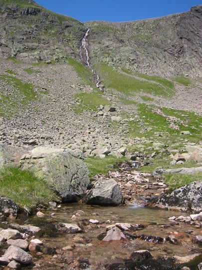
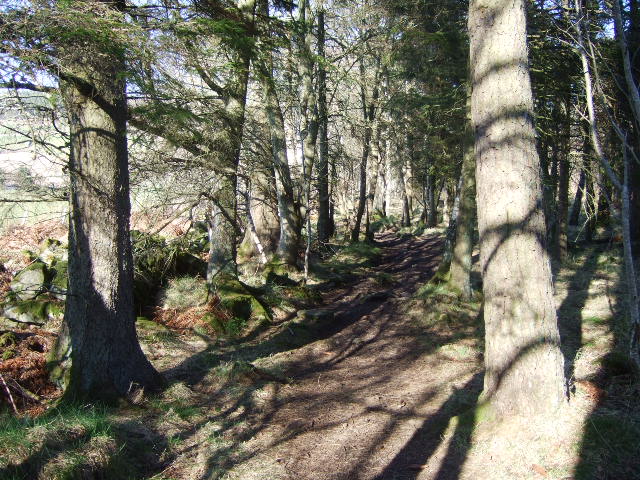
The Beltie Burn is a burn in Aberdeenshire, Scotland, which below Torphins and Glassel is known as the Burn of Canny. It begins in the hill of Benaquhallie, and flows for 25 km (15.5 miles) south-east through Torphins before joining the River Dee about 4 kilometres (2.5 miles) west of Banchory. The burn's course was altered in the area south of Torphins to clear space for farming and railways, which affected the local wildlife and caused the stream to flood often. However, in September 2020 a project was launched to help restore the area's biodiversity by rerouting the burn to a more natural course, and creating wetland and habitats for many animals such as Atlantic salmon The Atlantic salmon (''Salmo salar'') is a species of ray-finned fish in the family Salmonidae. It is the third largest of the Salmonidae, behind Siberian taimen and Pacific Chinook salmon, growing up to a meter in length. Atlantic salmon are .... The project was successful, and many species have ... [...More Info...] [...Related Items...] OR: [Wikipedia] [Google] [Baidu] |
River Dee, Aberdeenshire
The River Dee ( gd, Uisge Dhè) is a river in Aberdeenshire, Scotland. It rises in the Cairngorms and flows through southern Aberdeenshire to reach the North Sea at Aberdeen. The area it passes through is known as Deeside, or Royal Deeside in the region between Braemar and Banchory because Queen Victoria came for a visit there in 1848 and greatly enjoyed herself. She and her husband, Prince Albert, built Balmoral Castle there which replaced an older castle. Deeside is a popular area for tourists, due to the combination of scenic beauty and historic and royal associations. It is part of the Cairngorms National Park, and the Deeside and Lochnagar National Scenic Area. The Dee is popular with anglers and is one of the most famous salmon fishing rivers in the world. The New Statistical Account of Scotland attributed the name Dee as having been used as early as the second century AD in the work of the Alexandrian geographer Claudius Ptolemy, as ''Δηοῦα'' (=Deva), meaning ... [...More Info...] [...Related Items...] OR: [Wikipedia] [Google] [Baidu] |
Burn (stream)
In local usage, a burn is a kind of watercourse. The term applies to a large stream or a small river. The word is used in Scotland and England (especially North East England) and in parts of Ulster, Australia and New Zealand. Etymology The cognate of ''burn'' in standard English is "bourn", "bourne", "borne", "born", which is retained in placenames like ''Bournemouth'', ''King's Somborne'', ''Holborn'', ''Melbourne''. A cognate in German is ''Born'' (contemp. ''Brunnen''), meaning "well", "spring" or "source", which is retained in placenames like ''Paderborn'' in Germany. Both the English and German words derive from the same Proto-Germanic root. Scots Gaelic has the word ''bùrn'', also cognate, but which means "fresh water"; the actual Gaelic for a "burn" is ''allt'' (sometimes anglicised as "ault" or "auld" in placenames.) Examples *Blackburn *Broxburn * Bucks Burn * Burnside *Braid Burn *Dighty Burn *Burn Dale, East Donegal * Burnfoot, Inishowen *Burn of Elsick *Burn of P ... [...More Info...] [...Related Items...] OR: [Wikipedia] [Google] [Baidu] |
Aberdeenshire
Aberdeenshire ( sco, Aiberdeenshire; gd, Siorrachd Obar Dheathain) is one of the 32 Subdivisions of Scotland#council areas of Scotland, council areas of Scotland. It takes its name from the County of Aberdeen which has substantially different boundaries. The Aberdeenshire Council area includes all of the area of the Counties of Scotland, historic counties of Aberdeenshire and Kincardineshire (except the area making up the City of Aberdeen), as well as part of Banffshire. The county boundaries are officially used for a few purposes, namely land registration and Lieutenancy areas of Scotland, lieutenancy. Aberdeenshire Council is headquartered at Woodhill House, in Aberdeen, making it the only Scottish council whose headquarters are located outside its jurisdiction. Aberdeen itself forms a different council area (Aberdeen City). Aberdeenshire borders onto Angus, Scotland, Angus and Perth and Kinross to the south, Highland (council area), Highland and Moray to the west and Aber ... [...More Info...] [...Related Items...] OR: [Wikipedia] [Google] [Baidu] |
Scotland
Scotland (, ) is a country that is part of the United Kingdom. Covering the northern third of the island of Great Britain, mainland Scotland has a border with England to the southeast and is otherwise surrounded by the Atlantic Ocean to the north and west, the North Sea to the northeast and east, and the Irish Sea to the south. It also contains more than 790 islands, principally in the archipelagos of the Hebrides and the Northern Isles. Most of the population, including the capital Edinburgh, is concentrated in the Central Belt—the plain between the Scottish Highlands and the Southern Uplands—in the Scottish Lowlands. Scotland is divided into 32 administrative subdivisions or local authorities, known as council areas. Glasgow City is the largest council area in terms of population, with Highland being the largest in terms of area. Limited self-governing power, covering matters such as education, social services and roads and transportation, is devolved from the Scott ... [...More Info...] [...Related Items...] OR: [Wikipedia] [Google] [Baidu] |
Torphins
Torphins ( ; gd, Tòrr Fionn) is a village in Royal Deeside, Aberdeenshire, Scotland which lies about west of Aberdeen. It is situated on the A980, about north-west of Banchory, and was once served by the Great North of Scotland Railway. With a population of around 1,400, it is one of the larger villages in Deeside. Toponymy The name ''Torphins'' may come from the Gaelic ''Torr Fionn'', meaning fair/white hill, or as a corruption of ''Tor Feithachan'', meaning hill of the bogs. Another less likely namesake is Thorfinn Sigurdsson, Earl of Orkney, who might have passed through the area due to his partnership with Macbeth. It appeared on maps in 1750 under the name ''Turfins''. Amenities The village has many facilities including a primary school (with about 250 pupils attending each year), a large park with play area, a car dealer, a hairdressers, two tennis courts, a bowling green and a doctor's surgery. There are also a variety of shops in Torphins including a charity ... [...More Info...] [...Related Items...] OR: [Wikipedia] [Google] [Baidu] |
Glassel, Aberdeenshire
Glassel railway station is a disused railway station in Britain. It served Glassel House, the Mill of Beltie and the local farms and the inhabitants of this rural area from 1859 to 1966 on the Deeside Railway that ran from Aberdeen (Joint) to Ballater. History The station was opened in 1859 on the Deeside branch by the Aboyne Extension Railway and at first its services were operated by the Deeside Railway. Later it became part of the GNoSR and at grouping merged with the London and North Eastern Railway. It stood 21.5 miles (34.5 km) from Aberdeen and 22.75 miles (36.5 km) from Ballater. It was closed to passengers on 28 February 1966. The line has been lifted and sections form part of the Deeside Way long-distance footpath. The station was unstaffed from circa 1964 when goods services were withdrawn. Infrastructure The station had a single platform and a waiting room and ticket office similar to those at Torphins, Lumphanan and elsewhere on the line, consi ... [...More Info...] [...Related Items...] OR: [Wikipedia] [Google] [Baidu] |
Banchory
Banchory (, sco, Banchry, gd, Beannchar) is a burgh or town in Aberdeenshire, Scotland. It is about west of Aberdeen, near where the Feugh River meets the River Dee. Prehistory and archaeology In 2009, a farmer discovered a short cist burial to the east of the town. Archaeologists were called into excavate it and they found that it was a burial from the Beaker culture. Radiocarbon dating put the burial at sometime between 2330 and 2040 BC. Stable isotope analysis of the human remains indicated that he or she grew up on basalt geology, like that of the region, or on chalk, meaning they were either local or could have come from another place, like Yorkshire. Residue analysis of the Beaker pot found in the burial established that it had held either butter or milk. History The name is thought to be derived from an early Christian settlement founded by St Ternan. It is claimed that Ternan was a follower of St Ninian. Tradition has it that he established his settlement o ... [...More Info...] [...Related Items...] OR: [Wikipedia] [Google] [Baidu] |
Riparian-zone Restoration
Riparian-zone restoration is the ecological restoration of riparian-zone habitats of streams, rivers, springs, lakes, floodplains, and other hydrologic ecologies. A riparian zone or riparian area is the interface between land and a river or stream. ''Riparian'' is also the proper nomenclature for one of the fifteen terrestrial biomes of the earth; the habitats of plant and animal communities along the margins and river banks are called riparian vegetation, characterized by Aquatic plants and animals that favor them. Riparian zones are significant in ecology, environmental management, and civil engineering because of their role in soil conservation, their habitat biodiversity, and the influence they have on fauna and aquatic ecosystems, including grassland, woodland, wetland or sub-surface features such as water tables. In some regions the terms ''riparian woodland'', '' riparian forest'', ''riparian buffer zone,'' or ''riparian strip'' are used to characterize a riparian zo ... [...More Info...] [...Related Items...] OR: [Wikipedia] [Google] [Baidu] |
Atlantic Salmon
The Atlantic salmon (''Salmo salar'') is a species of ray-finned fish in the family Salmonidae. It is the third largest of the Salmonidae, behind Siberian taimen and Pacific Chinook salmon, growing up to a meter in length. Atlantic salmon are found in the northern Atlantic Ocean and in rivers that flow into it. Most populations are anadromous, hatching in streams and rivers but moving out to sea as they grow where they mature, after which the adults seasonally move upstream again to spawn. When the mature fish re-enter rivers to spawn, they change in colour and appearance. Some populations of this fish only migrate to large lakes, and are "landlocked", spending their entire lives in freshwater. Such populations are found throughout the range of the species. Unlike Pacific species of salmon, ''S. salar'' is iteroparous, which means it can survive spawning and return to sea to repeat the process again in another year. Such individuals can grow to extremely large sizes, althoug ... [...More Info...] [...Related Items...] OR: [Wikipedia] [Google] [Baidu] |
The James Hutton Institute
The James Hutton Institute is an interdisciplinary scientific research institute in Scotland established in 2011, through the merger of Scottish Crop Research Institute (SCRI) and the Macaulay Land Use Research Institute. The institute, named after Scottish geologist James Hutton, one of the leading figures of the Scottish Enlightenment, combines existing Scottish expertise in agricultural research, soils and land use, and works in fields including food and energy security, biodiversity, and climate change. With more than 600 employees, the institute is among the largest research centres in the UK. It is a registered charity under Scottish law. The institute has its main offices in Aberdeen and Dundee with farms and field research stations at Glensaugh and Balruddery. The Dundee site also hosts the Plant Sciences department of the University of Dundee. The James Hutton Institute also formally contains Biomathematics and Statistics Scotland (BioSS) which has staff base ... [...More Info...] [...Related Items...] OR: [Wikipedia] [Google] [Baidu] |
Eurasian Otter
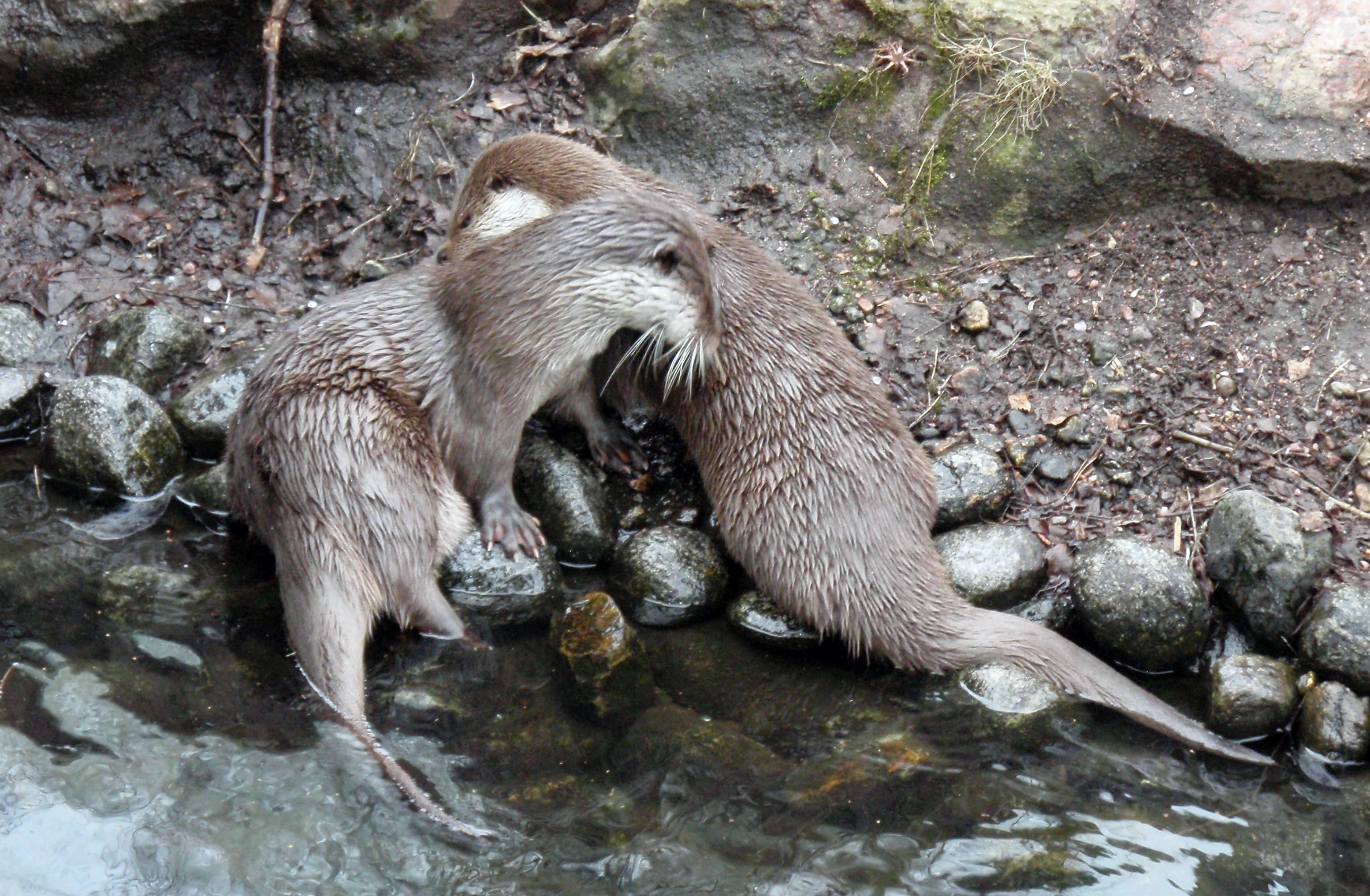
The Eurasian otter (''Lutra lutra''), also known as the European otter, Eurasian river otter, common otter, and Old World otter, is a semiaquatic mammal native to Eurasia. The most widely distributed member of the otter subfamily (Lutrinae) of the weasel family (Mustelidae), it is found in the waterways and coasts of Europe, many parts of Asia, and parts of northern Africa. The Eurasian otter has a diet mainly of fish, and is strongly territorial. It is endangered in some parts of its range, but is recovering in others. Description The Eurasian otter is a typical species of the otter subfamily. Brown above and cream below, these long, slender creatures are well-equipped for their aquatic habits. Their bones show osteosclerosis, increasing their density to reduce buoyancy. This otter differs from the North American river otter by its shorter neck, broader visage, the greater space between the ears and its longer tail. However, the Eurasian otter is the only otter in much of its ... [...More Info...] [...Related Items...] OR: [Wikipedia] [Google] [Baidu] |


.jpg)


