|
Bellshill
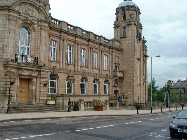
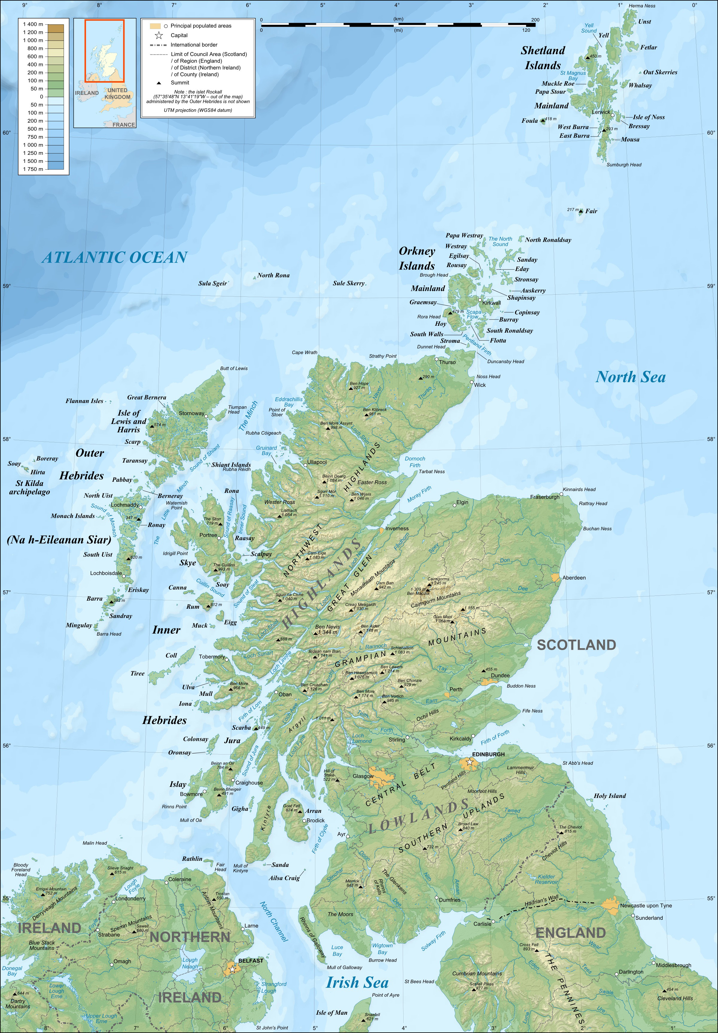
Bellshill (pronounced "Bells hill") is a town in North Lanarkshire in Scotland, southeast of Glasgow city centre and west of Edinburgh. Other nearby localities are Motherwell to the south, Hamilton, South Lanarkshire, Hamilton to the southwest, Viewpark to the west, Holytown to the east and Coatbridge to the north. The town of Bellshill itself (including the villages of Orbiston and Mossend) has a population of about 20,650. From 1996 to 2016, it was considered to be part of the Greater Glasgow metropolitan area; since then it is counted as part of a continuous List of towns and cities in Scotland, suburban settlement anchored by Motherwell with a total population of around 125,000. History The earliest record of Bellshill's name is handwritten on a map by Timothy Pont dated 1596 although the letters are difficult to distinguish. It's possible it reads Belſsill with the first s being an old-fashioned long s. The site is recorded as being east of "Uddingston, Vdinſtoun ... [...More Info...] [...Related Items...] OR: [Wikipedia] [Google] [Baidu] |
Coatbridge, Chryston And Bellshill (UK Parliament Constituency)
Coatbridge, Chryston and Bellshill is a constituency of the House of Commons of the Parliament of the United Kingdom. It elects one Member of Parliament (MP) using the first-past-the-post voting system. It was created for the 2005 general election, covering the whole area of the Coatbridge and Chryston constituency and parts of the Hamilton North and Bellshill seat. A small area in the eastern side of Coatbridge lies within the Airdrie and Shotts constituency. Traditionally, the area served by the seat and its predecessors was the safest Labour area in Scotland. Its previous MP was Hugh Gaffney of the Labour Party who gained the seat at the 2017 general election, succeeding SNP MP Phil Boswell who had held the seat since the SNP landslide victory in 2015. It was retaken by the SNP's Steven Bonnar at the 2019 general election. Boundaries The constituency covers the west of the North Lanarkshire council area, and is predominantly urban. Coatbridge lies in the south of the s ... [...More Info...] [...Related Items...] OR: [Wikipedia] [Google] [Baidu] |
Uddingston And Bellshill (Scottish Parliament Constituency)
Uddingston and Bellshill is a constituency of the Scottish Parliament ( Holyrood) covering part of the council areas of North Lanarkshire and South Lanarkshire. It elects one Member of the Scottish Parliament (MSP) by the plurality (first past the post) method of election. It is also one of nine constituencies in the Central Scotland electoral region, which elects seven additional members, in addition to nine constituency MSPs, to produce a form of proportional representation for the region as a whole. The constituency was formed for the 2011 Scottish Parliament election, and comprises parts of the former seat of Hamilton North and Bellshill, along with areas that were formerly in the seat of Motherwell and Wishaw. The seat has been held by Stephanie Callaghan of the Scottish National Party since the 2021 Scottish Parliament election. Electoral region The other nine constituencies of the Central Scotland region are Airdrie and Shotts, Coatbridge and Chryston, Cu ... [...More Info...] [...Related Items...] OR: [Wikipedia] [Google] [Baidu] |
Uddingston
Uddingston ( sco, Uddinstoun, gd, Baile Udain) is a small town in South Lanarkshire, Scotland. It is on the north side of the River Clyde, south-east of Glasgow city centre, and acts as a dormitory suburb for the city. Geography and boundaries Uddingston is located to the south-east of Glasgow city centre and approximately east of the Glasgow City Council boundary (ending at the former Glasgow Zoo at Broomhouse - part of Baillieston). It is bounded to the south-west by the River Clyde as it flows north-west towards Glasgow, separating Uddingston, along with some woodland, from the neighbouring towns of Blantyre to the south and Cambuslang to the west. As such, the Clyde Walkway and National Cycle Route 75 both traverse the town. The nearest settlement to Uddingston is the large village of Bothwell, almost contiguous to the south-east; the two main streets are apart. The village of Uddingston, which is contained exclusively within the boundaries of South Lanarkshire, hous ... [...More Info...] [...Related Items...] OR: [Wikipedia] [Google] [Baidu] |
North Lanarkshire
North Lanarkshire ( sco, North Lanrikshire; gd, Siorrachd Lannraig a Tuath) is one of 32 council areas of Scotland. It borders the northeast of the City of Glasgow and contains many of Glasgow's suburbs and commuter towns and villages. It also borders East Dunbartonshire, Falkirk (council area), Falkirk, Stirling (council area), Stirling, South Lanarkshire and West Lothian. The council covers parts of the shires of Scotland, traditional counties of Dunbartonshire, Lanarkshire and Stirlingshire. The area was formed in 1996, from the districts (within Strathclyde region) of Cumbernauld and Kilsyth (district), Cumbernauld and Kilsyth, Motherwell (district), Motherwell, and Monklands (district), Monklands, as well as part of the Strathkelvin district (Chryston and Auchinloch), which operated between 1975 and 1996. As a new single-tier authority, North Lanarkshire became responsible for all functions previously performed by both the regional council and the district councils. Histor ... [...More Info...] [...Related Items...] OR: [Wikipedia] [Google] [Baidu] |
Holytown
Holytown ( sco, 'Holy-Town' - Holytown, gd, Baile a' Chuilinn) is a village situated to the east of Bellshill and north of Motherwell in , Scotland. Most local amenities are shared with the adjacent villages of , Newarthill and |
Viewpark
Viewpark is an area in North Lanarkshire, Scotland. Situated immediately north-east of Uddingston (but on the other side of the M74 motorway), Viewpark is west of Bellshill. It has an estimated population of 13,916 in 2016, a figure which also includes the smaller adjoining neighbourhoods of Birkenshaw, Bellziehill, Calderbraes, Fallside and Tannochside under the Thorniewood ward of the local council. History Viewpark takes its name from a rural estate of that name,Viewpark House CanmoreViewpark House and Gardens Viewpark Conservation Group located ... [...More Info...] [...Related Items...] OR: [Wikipedia] [Google] [Baidu] |
Hamilton, South Lanarkshire
Hamilton ( sco, Hamiltoun; gd, Baile Hamaltan ) is a large town in South Lanarkshire, Scotland. It serves as the main administrative centre of the South Lanarkshire council area. It sits south-east of Glasgow, south-west of Edinburgh and north of Carlisle. It is situated on the south bank of the River Clyde at its confluence with the Avon Water. Hamilton is the county town of the historic county of Lanarkshire and is the location of the headquarters of the modern local authority of South Lanarkshire. The town itself has a population of around 55,000, which makes it the 8th largest settlement in Scotland. It forms a large urban area with nearby towns of Blantyre, Motherwell, Larkhall and Wishaw. History The town of Hamilton was originally known as Cadzow or CadyouHamilton's royal past ... [...More Info...] [...Related Items...] OR: [Wikipedia] [Google] [Baidu] |
Coatbridge
Coatbridge ( sco, Cotbrig or Coatbrig, gd, Drochaid a' Chòta) is a town in North Lanarkshire, Scotland, about east of Glasgow city centre, set in the central Lowlands. Along with neighbouring town Airdrie, Coatbridge forms the area known as the Monklands (population approximately 90,000 including outlying settlements), often considered to be part of the Greater Glasgow urban area – although officially they have not been included in population figures since 2016 due to small gaps between the Monklands and Glasgow built-up areas. In the last years of the 18th century, the area developed from a loose collection of hamlets into the town of Coatbridge. The town's development and growth have been intimately connected with the technological advances of the Industrial Revolution, and in particular with the hot blast process. Coatbridge was a major Scottish centre for iron works and coal mining during the 19th century and was then described as 'the industrial heartland of Scotland' ... [...More Info...] [...Related Items...] OR: [Wikipedia] [Google] [Baidu] |
List Of Towns And Cities In Scotland
This is a list of towns and cities in Scotland with a population of more than 15,000, ordered by population, as defined and compiled by the National Records of Scotland organisation. Glasgow is the largest city in Scotland by both area and population, whilst the countries capital city, Edinburgh, is the second largest by population and area. The city of Stirling has the smallest population amongst Scotland's cities, with an estimate population of just over 37,000 inhabitants. In total, Scotland consists of eight cities, with multiple larger towns, the largest town being Paisley. This article is divided into two sections. The first section of this article ("Localities") contains a list of basic populated areas ordered by population. The second section of this article ("Settlements") is a list of populated urban areas, some of which are composed of more than one locality, and which may span across the boundaries of more than one council area. All localities are either settlement ... [...More Info...] [...Related Items...] OR: [Wikipedia] [Google] [Baidu] |
Motherwell And Wishaw (UK Parliament Constituency)
Motherwell and Wishaw is a burgh constituency of the House of Commons of the Parliament of the United Kingdom. It was created in 1974, mostly from the former Motherwell constituency. In 1983, it was split into two constituencies, Motherwell North and Motherwell South; but these were amalgamated in 1997 to recreate the old Motherwell and Wishaw constituency. The corresponding Scottish Parliamentary seat of the same name Motherwell and Wishaw was held by Jack McConnell, the former First Minister of Scotland from November 2001 until May 2007. Constituency profile The seat is situated in the south-west of the North Lanarkshire council area, and is dominated by the towns of Motherwell and Wishaw. Residents' wealth and health are around average for the UK. Boundaries 1974–1983: The burgh of Motherwell and Wishaw. 1997–2005: The Motherwell District electoral divisions of Clydevale, Dalziel, and Wishaw. 2005–present: The North Lanarkshire electoral divisions of: *In ful ... [...More Info...] [...Related Items...] OR: [Wikipedia] [Google] [Baidu] |
Motherwell
Motherwell ( sco, Mitherwall, gd, Tobar na Màthar) is a town and former burgh in North Lanarkshire, Scotland, United Kingdom, south east of Glasgow. It has a population of around 32,120. Historically in the parish of Dalziel and part of Lanarkshire, Motherwell is the headquarters for North Lanarkshire Council. Geographically the River Clyde separates Motherwell from Hamilton to the west whereas the South Calder Water separates Motherwell from Carfin to the north-east and New Stevenston and Bellshill towards the north. Motherwell is also geographically attached to Wishaw and the two towns form a large urban area in North Lanarkshire, with both towns having similar populations and strong community ties. History A Roman road through central Scotland ran along Motherwell's side of the River Clyde, crossing the South Calder Water near Bothwellhaugh. At this crossing a fort and bath house were erected, but the Roman presence in Scotland did not last much later than this. Motherwe ... [...More Info...] [...Related Items...] OR: [Wikipedia] [Google] [Baidu] |
Mossend
Mossend is a small town in North Lanarkshire, Scotland, located on the A775 road to the immediate east of its 'sister town' Bellshill, west of the villages of Holytown and New Stevenston, north of the larger town of Motherwell and south of the Eurocentral industrial park and the M8 motorway. Along with Holytown, it forms a council ward which had a population of 13,480 in 2019, Mossend's estimated population being around half of that total. The town is the site of two railway freight terminals: Mossend International Railfreight Park and Mossend EuroTerminal. The yard is primarily used by DB Cargo UK. Mossend formed around the steel industry, with Clydesdale Steel Works once dominating the east end of the town. It is also home to the Mossend Football Club, a local community football club for children from the age of 6 to 21 years old. Early map references Mossend first appears on an early Timothy Pont map at the end of the 16th century as Mossid (Moss-Side), but the name most ... [...More Info...] [...Related Items...] OR: [Wikipedia] [Google] [Baidu] |


