|
Bele Vode
Bele Vode ( sr-cyr, Беле воде, lit. "White Waters") is an urban neighborhood of Belgrade, the capital of Serbia. It is located in Belgrade's municipality of Čukarica. Location Bele Vode is located in the southwestern part of Belgrade, as a western sub-neighborhood of Žarkovo. It is located west of the Ibarska magistrala (Highway of Ibar), bounded by Žarkovo from the north, Cerak from the east, Rupčine from the south and Makiš from the west. Bele Vode is known for the central Belgrade waterworks plant located there, including the 'water factory'. Name of the neighborhood in Serbian means ''white waters''. The local community (''mesna zajednica'') of Bele Vode within the municipality of Čukarica had a population of 14,255 in 2002, before it was incorporated into the local community of Žarkovo. Military Technical Institute Belgrade (former Aeronautical Technical Institute – ''VTI Žarkovo'') is located in the neighborhood. There is an elementary school within ... [...More Info...] [...Related Items...] OR: [Wikipedia] [Google] [Baidu] |
List Of Belgrade Neighbourhoods And Suburbs
Belgrade, the capital city of Serbia, is divided into seventeen Subdivisions of Belgrade, municipalities, of which ten are Urban area, urban and seven Suburban area, suburban. In this list, each neighbourhood or suburb is categorised by the municipality in which it is situated. Six of these ten urban municipalities are completely within the bounds of Belgrade City Proper, while the remaining four have both urban and suburban parts. The seven suburban municipalities, on the other hand, are completely located within suburban bounds. Municipalities of the City of Belgrade are officially divided into local communities (Serbian language, Serbian: месна заједница / ''mesna zajednica''). These are arbitrary administrative units which on occasion correspond to the neighbourhoods and suburbs located in a municipality, though usually they don't. Their boundaries often change as the communities merge with each other, split from one another, or change names, so the historical a ... [...More Info...] [...Related Items...] OR: [Wikipedia] [Google] [Baidu] |
Cerak
Cerak is an urban neighborhood of Belgrade, the capital of Serbia. It is located in Belgrade's municipality of Čukarica. Characteristics The name of the neighborhood, Cerak, in Serbian means ''Turkey oak forest''. Main traffic street is Jablanicka street, from which many smaller, residential streets and cul-de-sacs radiate. One of the borders of Cerak is the Ibar transite. The Neighborhood is of a mixed residential type, with both single-family houses (mostly row- or semi-detached houses), multi-family low-rises (ground+2 floors) and a few higher residential buildings (g+5/6 floors). The latest construction next to the southern edge (lining Ibarska magistrala) are all apartment blocks. Cerak, like Cerak Vinogradi, is extensively planted with trees and decorative shrubbery, which, combined with relatively low traffic density makes it a very livable area. Being the oldest neighborhood of the "Cerak" area (Cerak, Cerak Vinogradi, Cerak 2), Cerak hosts the area's post office, on ... [...More Info...] [...Related Items...] OR: [Wikipedia] [Google] [Baidu] |
Germany
Germany,, officially the Federal Republic of Germany, is a country in Central Europe. It is the second most populous country in Europe after Russia, and the most populous member state of the European Union. Germany is situated between the Baltic and North seas to the north, and the Alps to the south; it covers an area of , with a population of almost 84 million within its 16 constituent states. Germany borders Denmark to the north, Poland and the Czech Republic to the east, Austria and Switzerland to the south, and France, Luxembourg, Belgium, and the Netherlands to the west. The nation's capital and most populous city is Berlin and its financial centre is Frankfurt; the largest urban area is the Ruhr. Various Germanic tribes have inhabited the northern parts of modern Germany since classical antiquity. A region named Germania was documented before AD 100. In 962, the Kingdom of Germany formed the bulk of the Holy Roman Empire. During the 16th ce ... [...More Info...] [...Related Items...] OR: [Wikipedia] [Google] [Baidu] |
Vojvodina
Vojvodina ( sr-Cyrl, Војводина}), officially the Autonomous Province of Vojvodina, is an autonomous province that occupies the northernmost part of Serbia. It lies within the Pannonian Basin, bordered to the south by the national capital Belgrade and the Sava and Danube Rivers. The administrative center, Novi Sad, is the second-largest city in Serbia. The historic regions of Banat, Bačka, and Syrmia overlap the province. Modern Vojvodina is multi-ethnic and multi-cultural, with some 26 ethnic groups and six official languages. About two million people, nearly 27% of Serbia's population, live in the province. Naming ''Vojvodina'' is also the Serbian word for voivodeship, a type of duchy overseen by a voivode. The Serbian Voivodeship, a precursor to modern Vojvodina, was an Austrian province from 1849 to 1860. Its official name is the Autonomous Province of Vojvodina. Its name in the province's six official languages is: * Croatian: ''Autonomna Pokrajina Vojvodina'' * ... [...More Info...] [...Related Items...] OR: [Wikipedia] [Google] [Baidu] |
Ruma
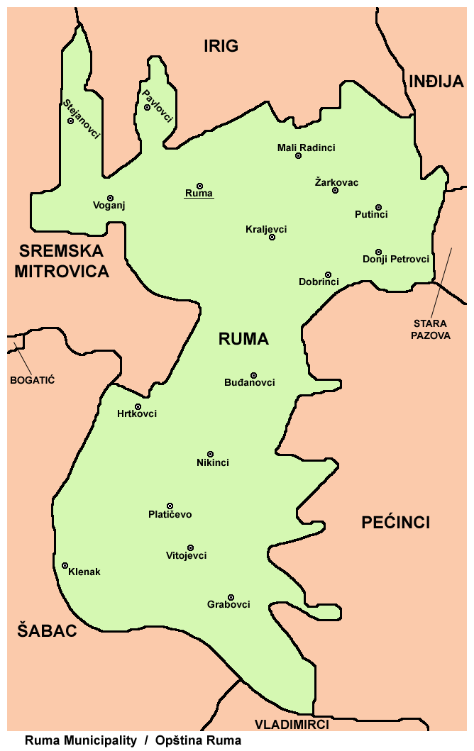
Ruma (; hu, Árpatarló) is a town and municipality in the Srem District of the Autonomous Province of Vojvodina, Serbia. As of 2011, the town has a population of 30,076, while the municipality has a population of 54,339. History Traces of organized human life on the territory of Ruma municipality date back as far as prehistory. The most important archaeological locality in the municipality is Bronze Age Gomolava near Hrtkovci, with two exclusive tombs of Bosut culture dating to the 9th century BC and 3000BC Vučedol culture pottery. The first known inhabitants of this area were various peoples of Illyrian and Celtic origin, such as the Amantini, Breuci, Scordisci, etc. During the Roman rule, local inhabitants lost their ethnic character and adopted Roman culture. There were no larger Roman settlements on the territory of Ruma, but a certain number of agricultural estates known as " villae rusticae" were located there. Migrations of Huns, Germanic peoples, Avars and Slavs ... [...More Info...] [...Related Items...] OR: [Wikipedia] [Google] [Baidu] |
Asbestos
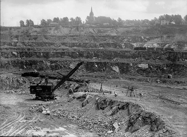
Asbestos () is a naturally occurring fibrous silicate mineral. There are six types, all of which are composed of long and thin fibrous crystals, each fibre being composed of many microscopic "fibrils" that can be released into the atmosphere by abrasion and other processes. Inhalation of asbestos fibres can lead to various dangerous lung conditions, including mesothelioma, asbestosis, and lung cancer, so it is now notorious as a serious health and safety hazard. Archaeological studies have found evidence of asbestos being used as far back as the Stone Age to strengthen ceramic pots, but large-scale mining began at the end of the 19th century when manufacturers and builders began using asbestos for its desirable physical properties. Asbestos is an excellent electrical insulator and is highly fire-resistant, so for much of the 20th century it was very commonly used across the world as a building material, until its adverse effects on human health were more widely acknowledg ... [...More Info...] [...Related Items...] OR: [Wikipedia] [Google] [Baidu] |
Cancerous
Cancer is a group of diseases involving abnormal cell growth with the potential to invade or spread to other parts of the body. These contrast with benign tumors, which do not spread. Possible signs and symptoms include a lump, abnormal bleeding, prolonged cough, unexplained weight loss, and a change in bowel movements. While these symptoms may indicate cancer, they can also have other causes. Over 100 types of cancers affect humans. Tobacco use is the cause of about 22% of cancer deaths. Another 10% are due to obesity, poor diet, lack of physical activity or excessive drinking of alcohol. Other factors include certain infections, exposure to ionizing radiation, and environmental pollutants. In the developing world, 15% of cancers are due to infections such as ''Helicobacter pylori'', hepatitis B, hepatitis C, human papillomavirus infection, Epstein–Barr virus and human immunodeficiency virus (HIV). These factors act, at least partly, by changing the genes of a cell. ... [...More Info...] [...Related Items...] OR: [Wikipedia] [Google] [Baidu] |
Politika
''Politika'' ( sr-Cyrl, Политика; ''Politics'') is a Serbian daily newspaper, published in Belgrade. Founded in 1904 by Vladislav F. Ribnikar, it is the oldest daily newspaper still in circulation in the Balkans. Publishing and ownership ''Politika'' is published by Politika novine i magazini (PNM), a joint venture between Politika AD and ''East Media Group''. The current director of PNM is Mira Glišić Simić. PNM also publishes: *''Sportski žurnal'' *'' Politikin zabavnik'' *''Svet kompjutera'' *''Ilustrovana politika'' *''Bazar'' Editorial history *Vladislav F. Ribnikar (1904–1915) *Miomir Milenović i Jovan Tanović (1915–1941) *Živorad Minović (1985–1991) *Aleksandar Prlja (1991–1994) *Boško Jakšić (1994) *Dragan Hadži Antić (1994–2000) *Vojin Partonić (2000–2001) *Milan Mišić (2001–2005) *Ljiljana Smajlović (2005–2008) *Radmilo Kljajić (2008) *Dragan Bujošević (2008–2013) *Ljiljana Smajlović (2013–2016) *Žarko Rakić (2016-2 ... [...More Info...] [...Related Items...] OR: [Wikipedia] [Google] [Baidu] |
Aeronautical Technical Institute
Aeronautical Technical Institute ( sr, Ваздухопловнотехнички институт, Vazduhoplovnotehnički institut) was a Yugoslav design bureau for aeronautical research and design of military aircraft. It was established on August 10, 1946, by an order of the Supreme Commander of the Armed Forces of Yugoslavia, and was located in Žarkovo, Belgrade. It existed from 1946 to 1992 and was responsible for the design of the majority of Yugoslav military aircraft. Aircraft designed by the institute include the J-20 Kraguj, the G-2 Galeb, the G-4 Super Galeb, the J-22 Orao, the Lasta and the (cancelled) Novi Avion. After the dissolution of Yugoslavia and the Yugoslav People's Army (JNA), the Aeronautical Technical Institute was dissolved and assimilated into the Military Technical Institute ( sr, Војнотехнички институт, Vojnotehnički institut; abbr. {{lang, sr-Latn, VTI) in an effort to reduce developing cost and maintenance since both institute ... [...More Info...] [...Related Items...] OR: [Wikipedia] [Google] [Baidu] |
Military Technical Institute Belgrade
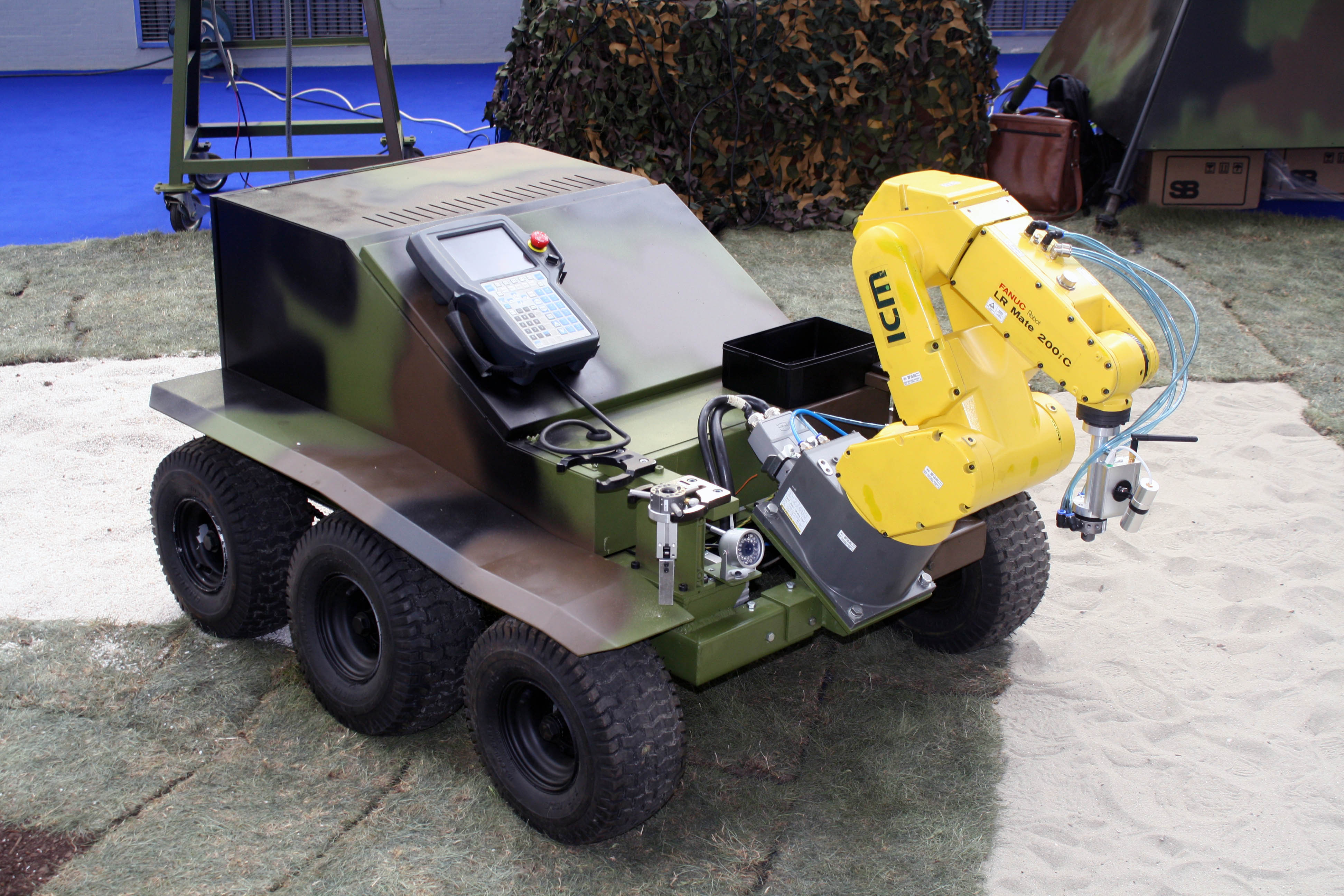
Military Technical Institute ( sr, Војнотехнички институт, Vojnotehnički institut; abbr. ) is a Serbian weapons and aircraft design institute, headquartered in Belgrade, and governed by the Serbian Ministry of Defence. It is a top-level military scientific research institution in Serbia, dealing with research and development (R&D) of new weaponry and military equipment as well as with upgrade of the inventory for both branches of the Serbian Armed Forces: Army (including River Flotilla) and Air Force and Defence. Institute history After the World War II, Federal People's Republic of Yugoslavia had a need to independently develop military technology and reduce dependence from foreign supply with given political situation of that time and future political course. By a decision of the Secretary of Defense and a proclamation by the Yugoslav president Josip Broz Tito, VTI was founded in 1948 as the Military Technical Institute of the Land Forces ( sr-Latn, Vojn ... [...More Info...] [...Related Items...] OR: [Wikipedia] [Google] [Baidu] |
Makiš
Makiš ( sr, Макиш) is a forest and an urban neighborhood of Belgrade, the capital of Serbia. It is located in Belgrade's municipality of Čukarica. Location Makiš is bordered by the Sava river and Sava Lake to the west and north, Čukarica and Čukarička Padina to the northeast, Julino Brdo, Žarkovo, Bele Vode and Rupčine to the east, Železnik to the south and Ostružnica to the southwest. Geography For the most part, Makiš is a marshy forest, crossed by many small streams and canals, most notably the ''Marevica''. Northern part is known as ''Jedek'', western as ''Aščinica'' and central as ''Veliko Okno''. Part of the Sava's alluvial plane, the main section of the area, which covers several hundreds of hectares, is covered with gravel and sand which are 10,000 years old. In time, a plentiful water source formed. As the Sava river reaches the bend at Makiš, some water continues in the straight direction, penetrating the ground in the fan-shaped manner, witho ... [...More Info...] [...Related Items...] OR: [Wikipedia] [Google] [Baidu] |


