|
Bayt Mahsir
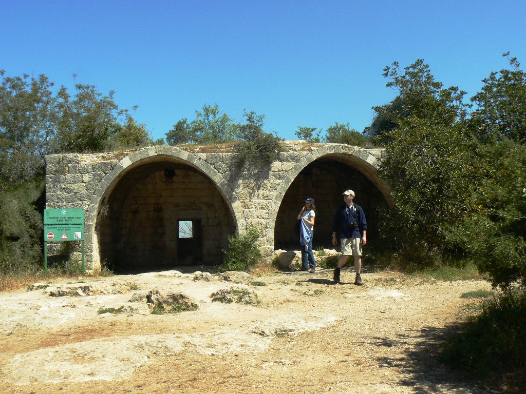
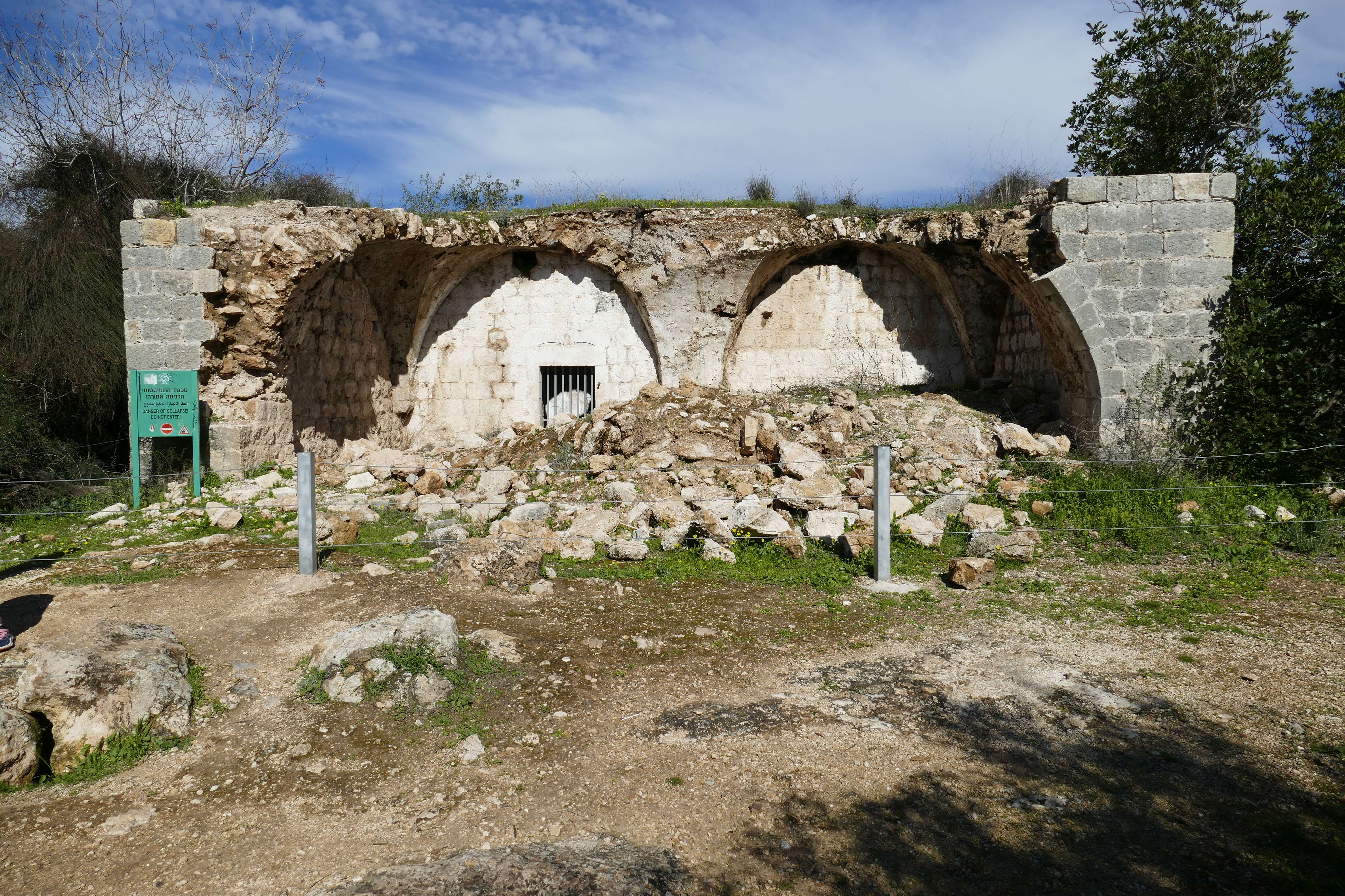
Bayt Mahsir ( ar, بيت محسير) was a Palestinian Arab village in the Jerusalem Subdistrict. It was depopulated during the 1947–48 Civil War in Mandatory Palestine on May 10, 1948, by the Harel Brigade of Operation Makkabi. It was located 9 km west of Jerusalem. History A large medieval oil press, about 10 x 35 meters, was recorded NW of the village in 1947 by representatives from the Palestine Antiquities Department. The representative thought it was from the Ayyubid or Crusader era, later examination of surviving pictures by D. Pringle determined them to be from the Crusader era. It has since been destroyed. Ottoman era In 1838 Beit Mahsir was noted as a Muslim village, located in the District of Beni Malik, west of Jerusalem. An Ottoman village list from about 1870 found 50 houses and a population of 130, though that population count included men only.Socin, 1879, p146/ref> In 1883, the PEF's ''Survey of Western Palestine'' (SWP) described Beit Mahsir as "a ... [...More Info...] [...Related Items...] OR: [Wikipedia] [Google] [Baidu] |
Mandatory Palestine
Mandatory Palestine ( ar, فلسطين الانتدابية '; he, פָּלֶשְׂתִּינָה (א״י) ', where "E.Y." indicates ''’Eretz Yiśrā’ēl'', the Land of Israel) was a geopolitical entity established between 1920 and 1948 in the region of Palestine under the terms of the League of Nations Mandate for Palestine. During the First World War (1914–1918), an Arab uprising against Ottoman rule and the British Empire's Egyptian Expeditionary Force under General Edmund Allenby drove the Ottoman Turks out of the Levant during the Sinai and Palestine Campaign. The United Kingdom had agreed in the McMahon–Hussein Correspondence that it would honour Arab independence if the Arabs revolted against the Ottoman Turks, but the two sides had different interpretations of this agreement, and in the end, the United Kingdom and France divided the area under the Sykes–Picot Agreementan act of betrayal in the eyes of the Arabs. Further complicating the issue was t ... [...More Info...] [...Related Items...] OR: [Wikipedia] [Google] [Baidu] |
Palestine Exploration Fund
The Palestine Exploration Fund is a British society based in London. It was founded in 1865, shortly after the completion of the Ordnance Survey of Jerusalem, and is the oldest known organization in the world created specifically for the study of the Levant region, also known as Palestine. Often simply known as the PEF, its initial objective was to carry out surveys of the topography and ethnography of Ottoman Palestine – producing the PEF Survey of Palestine – with a remit that fell somewhere between an expeditionary survey and military intelligence gathering. It had a complex relationship with Corps of Royal Engineers, and its members sent back reports on the need to salvage and modernise the region.Ilan Pappé (2004) A history of modern Palestine: one land, two peoples Cambridge University Press, pp 34-35 History Following the completion of the Ordnance Survey of Jerusalem, the Biblical archaeologists and clergymen who supported the survey financed the creation of t ... [...More Info...] [...Related Items...] OR: [Wikipedia] [Google] [Baidu] |
Operation Harel
Operation Harel ( he, מבצע הראל) was a 1948 IDF operation that was conducted by the Palmach. Its two objectives were to bring food and supplies to besieged Jerusalem, and to transport troops near the city. The operation took place between 16 and 21 April as a continuation to Operation Nachshon and was commanded by Yitzhak Rabin. It brought three convoys of over 600 trucks. It also resulted in the formation of Palmach battalions into the Harel Brigade. The supplying of Jerusalem with food, medicine, arms, and fuel, enabled the city to withstand the siege, a siege which continued for the next two months, until the opening of the Burma Road The Burma Road () was a road linking Burma (now known as Myanmar) with southwest China. Its terminals were Kunming, Yunnan, and Lashio, Burma. It was built while Burma was a British colony to convey supplies to China during the Second Sino ... in mid-June. References Harel April 1948 events in Asia {{Israel-stub ... [...More Info...] [...Related Items...] OR: [Wikipedia] [Google] [Baidu] |
Operation Nachshon
Operation Nachshon ( he, מבצע נחשון, ''Mivtza Nahshon'') was a Jewish military operation during the 1948 war. Lasting from 5–16 April 1948, its objective was to break the Siege of Jerusalem by opening the Tel Aviv – Jerusalem road blockaded by Palestinian Arabs and to supply food and weapons to the isolated Jewish community of Jerusalem. The operation was also known as "The operation to take control of the Jerusalem road,", following which participating units later broke off to form the Harel Brigade. Nachshon was the first major Haganah operation and the first step of Plan Dalet, The plan was a set of guidelines for taking control of the territory allotted to Palestinian Jews by the 1947 UN Partition Plan, and defending its borders and people, including the Palestinian Jewish population outside the borders, 'before, and in anticipation of' the invasion by regular Arab armies. According to the Israeli Yehoshafat Harkabi, "Plan Dalet" called for the conquest of Arab ... [...More Info...] [...Related Items...] OR: [Wikipedia] [Google] [Baidu] |
Bayt Mahsir
Bayt Mahsir ( ar, بيت محسير) was a Palestinian Arab village in the Jerusalem Subdistrict. It was depopulated during the 1947–48 Civil War in Mandatory Palestine on May 10, 1948, by the Harel Brigade of Operation Makkabi. It was located 9 km west of Jerusalem. History A large medieval oil press, about 10 x 35 meters, was recorded NW of the village in 1947 by representatives from the Palestine Antiquities Department. The representative thought it was from the Ayyubid or Crusader era, later examination of surviving pictures by D. Pringle determined them to be from the Crusader era. It has since been destroyed. Ottoman era In 1838 Beit Mahsir was noted as a Muslim village, located in the District of Beni Malik, west of Jerusalem. An Ottoman village list from about 1870 found 50 houses and a population of 130, though that population count included men only.Socin, 1879, p146/ref> In 1883, the PEF's ''Survey of Western Palestine'' (SWP) described Beit Mahsir as "a ... [...More Info...] [...Related Items...] OR: [Wikipedia] [Google] [Baidu] |
Al-Azhar University
, image = جامعة_الأزهر_بالقاهرة.jpg , image_size = 250 , caption = Al-Azhar University portal , motto = , established = *970/972 first foundation: fatimid era *1961 – university status , type = Public , endowment = , president = Dr. Mohamed Hussin , head_label = , head = , students = , undergrad = , postgrad = , doctoral = , address = , city = Cairo , country = Egypt , campus = Urban , religious_affiliation = Sunni Islam (always - Ash'aari, Maturridi.) , calendar = , faculty = , divinity = , profess = , coordinates = , affiliations = , logo ... [...More Info...] [...Related Items...] OR: [Wikipedia] [Google] [Baidu] |
Mosque
A mosque (; from ar, مَسْجِد, masjid, ; literally "place of ritual prostration"), also called masjid, is a place of prayer for Muslims. Mosques are usually covered buildings, but can be any place where prayers ( sujud) are performed, including outdoor courtyards. The first mosques were simple places of prayer for Muslims, and may have been open spaces rather than buildings. In the first stage of Islamic architecture, 650-750 CE, early mosques comprised open and closed covered spaces enclosed by walls, often with minarets from which calls to prayer were issued. Mosque buildings typically contain an ornamental niche ('' mihrab'') set into the wall that indicates the direction of Mecca (''qiblah''), Wudu, ablution facilities. The pulpit (''minbar''), from which the Friday (jumu'ah) sermon (''khutba'') is delivered, was in earlier times characteristic of the central city mosque, but has since become common in smaller mosques. Mosques typically have Islam and gender se ... [...More Info...] [...Related Items...] OR: [Wikipedia] [Google] [Baidu] |
Imam
Imam (; ar, إمام '; plural: ') is an Islamic leadership position. For Sunni Muslims, Imam is most commonly used as the title of a worship leader of a mosque. In this context, imams may lead Islamic worship services, lead prayers, serve as community leaders, and provide religious guidance. Thus for Sunnis, anyone can study the basic Islamic sciences and become an Imam. For most Shia Muslims, the Imams are absolute infallible leaders of the Islamic community after the Prophet. Shias consider the term to be only applicable to the members and descendents of the '' Ahl al-Bayt'', the family of the Islamic prophet Muhammad. In Twelver Shiasm there are 14 infallibles, 12 of which are Imams, the final being Imam Mahdi who will return at the end of times. The title was also used by the Zaidi Shia Imams of Yemen, who eventually founded the Mutawakkilite Kingdom of Yemen (1918–1970). Sunni imams Sunni Islam does not have imams in the same sense as the Shi'a, an importan ... [...More Info...] [...Related Items...] OR: [Wikipedia] [Google] [Baidu] |
Dunam
A dunam ( Ottoman Turkish, Arabic: ; tr, dönüm; he, דונם), also known as a donum or dunum and as the old, Turkish, or Ottoman stremma, was the Ottoman unit of area equivalent to the Greek stremma or English acre, representing the amount of land that could be ploughed by a team of oxen in a day. The legal definition was "forty standard paces in length and breadth", but its actual area varied considerably from place to place, from a little more than in Ottoman Palestine to around in Iraq.Λεξικό της κοινής Νεοελληνικής (Dictionary of Modern Greek), Ινστιτούτο Νεοελληνικών Σπουδών, Θεσσαλονίκη, 1998. The unit is still in use in many areas previously ruled by the Ottomans, although the new or metric dunam has been redefined as exactly one decare (), which is 1/10 hectare (1/10 × ), like the modern Greek royal stremma. History The name dönüm, from the Ottoman Turkish ''dönmek'' (, "to turn"), appears ... [...More Info...] [...Related Items...] OR: [Wikipedia] [Google] [Baidu] |
Village Statistics, 1945
Village Statistics, 1945 was a joint survey work prepared by the Government Office of Statistics and the Department of Lands of the British Mandate Government for the Anglo-American Committee of Inquiry on Palestine which acted in early 1946. The data were calculated as of April 1, 1945, and was later published and also served the UNSCOP committee that operated in 1947. History Previous versions of the report were prepared in 1938 and 1943. The report found the grand total of the population of Palestine was 1,764,520; 1,061,270 Muslims, 553,600 Jews, 135,550 Christians and 14,100 classified as "others" (typically Druze).Department of Statistics, 1945, p3/ref> Regarding the accuracy of its statistics, the report said: The last population census taken in Palestine was that of 1931. Since that year, the population has grown considerably both as a consequence of Jewish immigration and of the high rate of natural increase among all sections of the population. The rapidity of the c ... [...More Info...] [...Related Items...] OR: [Wikipedia] [Google] [Baidu] |
1931 Census Of Palestine
The 1931 census of Palestine was the second census carried out by the authorities of the British Mandate for Palestine. It was carried out on 18 November 1931 under the direction of Major E. Mills after the 1922 census of Palestine. * Census of Palestine 1931, Volume I. Palestine Part I, Report. Alexandria, 1933 (349 pages). * Census of Palestine 1931, Volume II. Palestine, Part II, Tables. Alexandria, 1933 (595 pages). References Further reading * Miscellaneous short extracts from the census reports at Emory University * J. McCarthy, The Population of Palestine, Columbia University Press (1988). This contains many pages of tables extracted from the census reports. {{Authority control Censuses in Mandatory Palestine Census Of Palestine, 1931 Documents of Mandatory Palestine Palestine November 1931 events 1931 documents ... [...More Info...] [...Related Items...] OR: [Wikipedia] [Google] [Baidu] |


.jpg)
