|
Barton (Kettering BC Ward)
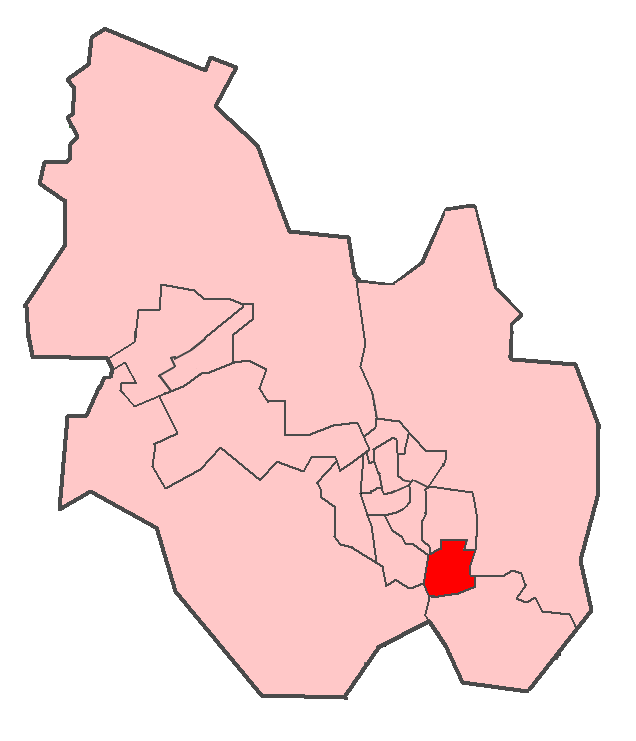
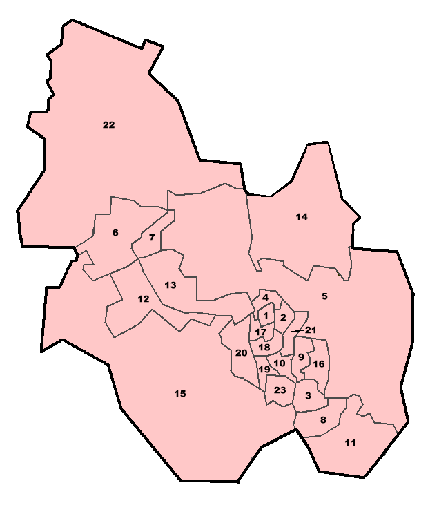
Barton Ward, representing the village of Barton Seagrave, is a 2-member ward within Kettering Borough Council. The ward was last fought at borough council level in the 2007 local council elections, in which both seats were won by the Conservatives. The current councillors are Cllr. Christopher Lamb and Cllr. Russell Roberts. Councillors Kettering Borough Council Elections 2007 *Christopher Lamb (Conservative) *Russell Roberts (Conservative) Current Ward Boundaries (2007-) Kettering Borough Council Elections 2007 *Note: due to boundary changes, vote changes listed below are based on notional results. Previous ward boundaries (1999-2007) Kettering Borough Council Elections 2003 (Vote count shown is ward average) See also *Kettering *Kettering Borough Council Kettering is a market and industrial town in North Northamptonshire, England. It is located north of London and north-east of Northampton, west of the River Ise, a tributary of the River Nene ... [...More Info...] [...Related Items...] OR: [Wikipedia] [Google] [Baidu] |
Kettering Borough Council
Kettering is a market and industrial town in North Northamptonshire, England. It is located north of London and north-east of Northampton, west of the River Ise, a tributary of the River Nene. The name means "the place (or territory) of Ketter's people (or kinsfolk)".R.L. Greenall: A History of Kettering, Phillimore & Co. Ltd, 2003, . p.7. In the 2011 census Kettering's built-up area had a population of 63,675. It is part of the East Midlands, along with other towns in Northamptonshire. There is a growing commuter population as it is on the Midland Main Line railway, with East Midlands Railway services direct to London St Pancras International taking about an hour. Early history Kettering means "the place (or territory) of Ketter's people (or kinsfolk)". Spelt variously Cytringan, Kyteringas and Keteiringan in the 10th century, although the origin of the name appears to have baffled place-name scholars in the 1930s, words and place-names ending with "-ing" usually derive f ... [...More Info...] [...Related Items...] OR: [Wikipedia] [Google] [Baidu] |
Kettering (borough)
The Borough of Kettering was from 1974 to 2021 a local government district and borough in Northamptonshire, England. It was named after its main town Kettering where the council was based. It bordered onto the district of Harborough in the neighbouring county of Leicestershire, the borough of Corby, the district of East Northamptonshire, the district of Daventry and the borough of Wellingborough. Abolition and replacement In March 2018, following suspension of the County Council arising from its becoming insolvent, due to financial and cultural mismanagement by the cabinet and officers, the then Secretary of State for Local Government, Sajid Javid, sent commissioner Max Caller into the council, who recommended the county council and all district and borough councils in the county be abolished, and replaced by two unitary authorities, one covering the West, and one the North of the county. These proposals were approved in April 2019. It meant that the districts of Daventry, Northa ... [...More Info...] [...Related Items...] OR: [Wikipedia] [Google] [Baidu] |
Northamptonshire
Northamptonshire (; abbreviated Northants.) is a county in the East Midlands of England. In 2015, it had a population of 723,000. The county is administered by two unitary authorities: North Northamptonshire and West Northamptonshire. It is known as "The Rose of the Shires". Covering an area of 2,364 square kilometres (913 sq mi), Northamptonshire is landlocked between eight other counties: Warwickshire to the west, Leicestershire and Rutland to the north, Cambridgeshire to the east, Bedfordshire to the south-east, Buckinghamshire to the south, Oxfordshire to the south-west and Lincolnshire to the north-east – England's shortest administrative county boundary at 20 yards (19 metres). Northamptonshire is the southernmost county in the East Midlands. Apart from the county town of Northampton, other major population centres include Kettering, Corby, Wellingborough, Rushden and Daventry. Northamptonshire's county flower is the cowslip. The Soke of Peterborough fal ... [...More Info...] [...Related Items...] OR: [Wikipedia] [Google] [Baidu] |
England
England is a country that is part of the United Kingdom. It shares land borders with Wales to its west and Scotland to its north. The Irish Sea lies northwest and the Celtic Sea to the southwest. It is separated from continental Europe by the North Sea to the east and the English Channel to the south. The country covers five-eighths of the island of Great Britain, which lies in the North Atlantic, and includes over 100 smaller islands, such as the Isles of Scilly and the Isle of Wight. The area now called England was first inhabited by modern humans during the Upper Paleolithic period, but takes its name from the Angles, a Germanic tribe deriving its name from the Anglia peninsula, who settled during the 5th and 6th centuries. England became a unified state in the 10th century and has had a significant cultural and legal impact on the wider world since the Age of Discovery, which began during the 15th century. The English language, the Anglican Church, and Engli ... [...More Info...] [...Related Items...] OR: [Wikipedia] [Google] [Baidu] |
Barton Seagrave
Barton Seagrave is a large village and civil parish in the North Northamptonshire, England. The village is about south-east of Kettering, town centre. The older part of the village is known for its Norman Church and attractive buildings. The villages name means 'barley farm'. 'Seagrave' was added after the manor passed to Stephen de Segrave in 1220. Demographics The 2011 Census recorded a parish population of 4,418 in 1,843 homes. Transport The A6 road linking London and Leicester joins the A14 road just to the south of the village. The A14 joins the M1 motorway at junction 19 (Catthorpe Interchange) offering easy access to Huntingdon, Felixstowe and London. The Midland Main Line runs to the west of the village, partly along the edge of the River Ise. The nearest station is Kettering railway station, which opened in 1857 and is maintained by East Midlands Railway, which run services to London, Sheffield, Corby and Derby. The village used to be connected with Cambridge by ... [...More Info...] [...Related Items...] OR: [Wikipedia] [Google] [Baidu] |
2007 Kettering Council Election
Elections to Kettering Borough Council were held on 3 May 2007. The whole council was up for election with boundary changes since the last election in 2003 reducing the number of seats by nine. The Conservative Party retained overall control of the council. Candidates and election issues Both the Conservative and Labour parties put up candidates in all wards. There were also five Liberal Democrat, four Independent and one Green party candidates. Major elections issues included refuse collection, recycling and the location of the council offices. Summary Result Ward results See also * Local Elections in Kettering Borough * Kettering town ReferencesMay 2007 Election Results: Results by wardKettering Council election 2007 (BBC) External linksEvening Telegraph coverage of election {{United Kingdom local elections, 2007 2007 English local elections 2007 File:2007 Events Collage.png, From top left, clockwise: Steve Jobs unveils Apple's first iPhone; TAM Airlines Flight ... [...More Info...] [...Related Items...] OR: [Wikipedia] [Google] [Baidu] |
Conservative Party (UK)
The Conservative Party, officially the Conservative and Unionist Party and also known colloquially as the Tories, is one of the Two-party system, two main political parties in the United Kingdom, along with the Labour Party (UK), Labour Party. It is the current Government of the United Kingdom, governing party, having won the 2019 United Kingdom general election, 2019 general election. It has been the primary governing party in Britain since 2010. The party is on the Centre-right politics, centre-right of the political spectrum, and encompasses various ideological #Party factions, factions including One-nation conservatism, one-nation conservatives, Thatcherism, Thatcherites, and traditionalist conservatism, traditionalist conservatives. The party currently has 356 Member of Parliament (United Kingdom), Members of Parliament, 264 members of the House of Lords, 9 members of the London Assembly, 31 members of the Scottish Parliament, 16 members of the Senedd, Welsh Parliament, 2 D ... [...More Info...] [...Related Items...] OR: [Wikipedia] [Google] [Baidu] |
Kettering Borough Council Elections 2003
Elections for Kettering Borough Council, which covers the Kettering (borough), Borough of Kettering, were held on 1 May 2003 and were won by the Conservative Party (UK), Conservatives, gaining overall control from Labour Party (UK), Labour. Summary results The overall results, using average ward votes for the total number of votes cast, were as follows: (Vote counts shown are ward averages) Council Before 2003 Elections Before the elections held on 1 May 2003, the composition of Kettering Borough Council was as follows: Labour Majority of 1 Ward-by-Ward Results All Saints (Kettering BC Ward), All Saints Ward (2 seats) (Vote count shown is ward average) Avondale (Kettering BC Ward), Avondale Ward (2 seats) (Vote count shown is ward average) Barton (Kettering BC Ward), Barton Ward (2 seats) (Vote count shown is ward average) Brambleside (Kettering BC Ward), Brambleside Ward (2 seats) (Vote count shown is ward average) Buccleuch (Kett ... [...More Info...] [...Related Items...] OR: [Wikipedia] [Google] [Baidu] |
Labour Party (UK)
The Labour Party is a political party in the United Kingdom that has been described as an alliance of social democrats, democratic socialists and trade unionists. The Labour Party sits on the centre-left of the political spectrum. In all general elections since 1922, Labour has been either the governing party or the Official Opposition. There have been six Labour prime ministers and thirteen Labour ministries. The party holds the annual Labour Party Conference, at which party policy is formulated. The party was founded in 1900, having grown out of the trade union movement and socialist parties of the 19th century. It overtook the Liberal Party to become the main opposition to the Conservative Party in the early 1920s, forming two minority governments under Ramsay MacDonald in the 1920s and early 1930s. Labour served in the wartime coalition of 1940–1945, after which Clement Attlee's Labour government established the National Health Service and expanded the welfa ... [...More Info...] [...Related Items...] OR: [Wikipedia] [Google] [Baidu] |


