|
Byurakn
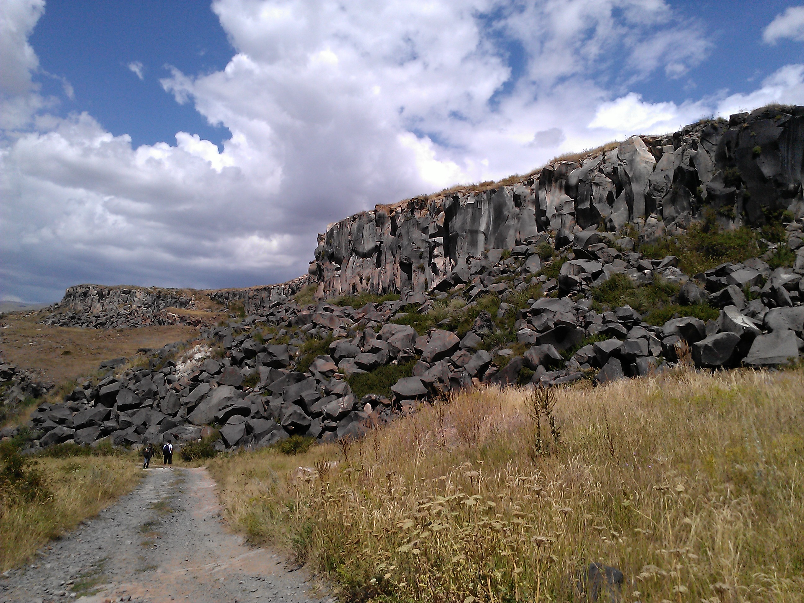
Byurakn ( hy, Բյուրակն) is a village in the Amasia Municipality of the Shirak Province of Armenia near the Armenia–Turkey border. The Statistical Committee of Armenia reported its population was 926 in 2010, up from 781 at the 2001 census. Demographics According to the 1912 publication of '' Kavkazskiy kalendar'', there was a mainly Karapapakh population of 1,046 people in the village of Gyullibulakh of the Kars Okrug of the Kars Oblast The Kars Oblast was a province (''oblast'') of the Caucasus Viceroyalty of the Russian Empire between 1878 and 1917. Its capital was the city of Kars, presently in Turkey. The ''oblast'' bordered the Ottoman Empire to the west, the Batum Oblast .... The population of the village since 1886 is as follows: References Communities in Shirak Province Populated places in Shirak Province {{Shirak-geo-stub ... [...More Info...] [...Related Items...] OR: [Wikipedia] [Google] [Baidu] |
Shirak Province
Shirak ( hy, wikt:Շիրակ, Շիրակ, ) is a provinces of Armenia, province (''Administrative divisions of Armenia, marz'') of Armenia. It is located in the north-west of the country, bordering Turkey to the west and Georgia (country), Georgia to the north. Its capital and largest city is Gyumri, which is the second largest city in Armenia. It is as much semi-desert as it is mountain meadow or high alpine. In the south, the high steppes merge into mountain terrain, being verdant green in the spring, with hues of reddish brown in the summer. The province is served by the Gyumri Shirak International Airport, Shirak International Airport of Gyumri. Etymology Shirak Province is named after the Shirak canton of the historical Ayrarat province of Kingdom of Armenia (antiquity), Ancient Armenia, ruled by the Kamsarakan noble family between the 3rd and 8th centuries. According to Movses Khorenatsi, the name Shirak is derived from Shara, who was the great-grandson of Hayk, the lege ... [...More Info...] [...Related Items...] OR: [Wikipedia] [Google] [Baidu] |
Municipalities Of Armenia
A municipality in Armenia referred to as community ( hy, համայնք ''hamaynk'', plural: hy, համայնքներ ''hamaynkner''), is an administrative subdivision consisting of a settlement ( hy, բնակավայր ''bnakavayr'') or a group of settlements ( hy, բնակավայրեր ''bnakavayrer'') that enjoys local self-government. The settlements are classified as either towns ( hy, քաղաքներ ''kaghakner'', singular hy, քաղաք ''kaghak'') or villages ( hy, գյուղեր ''gyugher'', singular ( hy, գյուղ ''gyugh''). The administrative centre of a community could either be an urban settlement (town) or a rural settlement (village). Two-thirds of the population are now urbanized. As of 2017, 63.6% of Armenians live in urban areas as compared to 36.4% in rural. As of the end of 2017, Armenia has 503 municipal communities (including Yerevan) of which 46 are urban and 457 are rural. The capital, Yerevan, also has the status of a community. Each municipal ... [...More Info...] [...Related Items...] OR: [Wikipedia] [Google] [Baidu] |
Amasia Municipality
Shirak ( hy, Շիրակ, ) is a province ('' marz'') of Armenia. It is located in the north-west of the country, bordering Turkey to the west and Georgia to the north. Its capital and largest city is Gyumri, which is the second largest city in Armenia. It is as much semi-desert as it is mountain meadow or high alpine. In the south, the high steppes merge into mountain terrain, being verdant green in the spring, with hues of reddish brown in the summer. The province is served by the Shirak International Airport of Gyumri. Etymology Shirak Province is named after the Shirak canton of the historical Ayrarat province of Ancient Armenia, ruled by the Kamsarakan noble family between the 3rd and 8th centuries. According to Movses Khorenatsi, the name Shirak is derived from Shara, who was the great-grandson of Hayk, the legendary patriarch and founder of the Armenian nation. However, according to the Shirak Regional Museum, many historians assume that the name is derived from the na ... [...More Info...] [...Related Items...] OR: [Wikipedia] [Google] [Baidu] |
Armenia–Turkey Border
The Armenia–Turkey border ( hy, Հայաստան–Թուրքիա սահման, translit=Hayastan–T’urk’ia sahman, tr, Ermenistan–Türkiye sınırı) is 311 km (193 m) in length and runs from the tripoint with Georgia (country), Georgia in the north to the tripoint with Azerbaijan in the south. The land border has been closed since April 3rd, 1993. Description The border starts in the north at the tripoint with Georgia just west of Lake Arpi and proceeds southwards via series of irregular lines through the Armenian Highlands. Upon reaching the Akhurian River it follows the river south down to the confluence with the Aras river, and then follows the Aras as it flows east and then south-east, down to the tripoint with Azerbaijan's Nakhchivan Autonomous Republic. The ancient ruins of Ani lie directly adjacent to the border on the Turkish side. History During the 19th century, the Caucasus region was contested between the declining Ottoman Empire, Qajar Iran, Persia ... [...More Info...] [...Related Items...] OR: [Wikipedia] [Google] [Baidu] |
Armenia
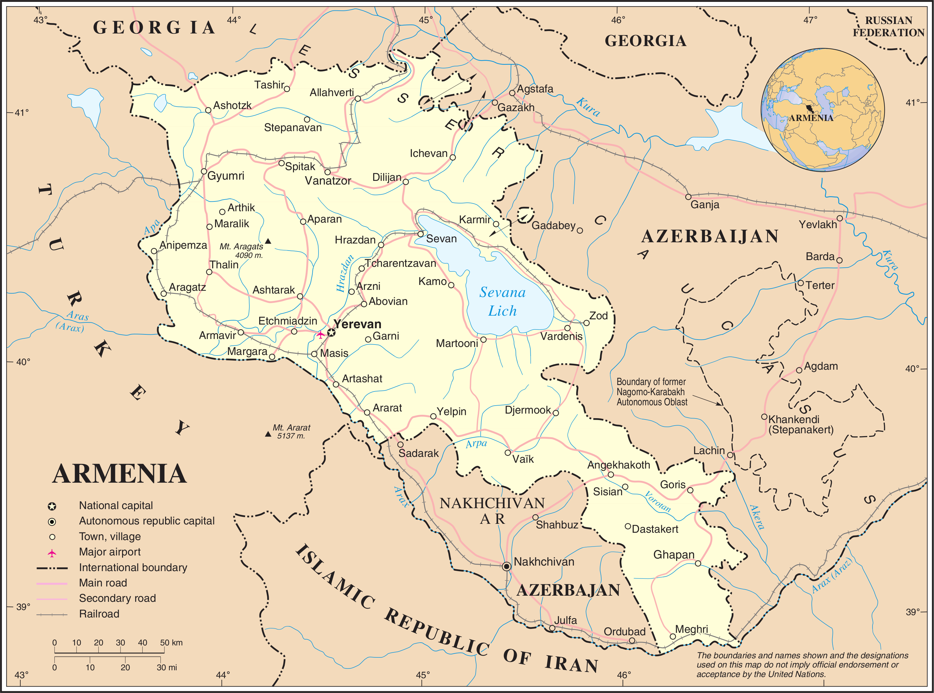
Armenia (), , group=pron officially the Republic of Armenia,, is a landlocked country in the Armenian Highlands of Western Asia.The UNbr>classification of world regions places Armenia in Western Asia; the CIA World Factbook , , and ''Oxford Reference Online'' also place Armenia in Asia. It is a part of the Caucasus region; and is bordered by Turkey to the west, Georgia to the north, the Lachin corridor (under a Russian peacekeeping force) and Azerbaijan to the east, and Iran and the Azerbaijani exclave of Nakhchivan to the south. Yerevan is the capital, largest city and the financial center. Armenia is a unitary, multi-party, democratic nation-state with an ancient cultural heritage. The first Armenian state of Urartu was established in 860 BC, and by the 6th century BC it was replaced by the Satrapy of Armenia. The Kingdom of Armenia reached its height under Tigranes the Great in the 1st century BC and in the year 301 became the first state in the world to adopt ... [...More Info...] [...Related Items...] OR: [Wikipedia] [Google] [Baidu] |
Provinces Of Armenia
Countries' first-level (top-level) administrative division Administrative division, administrative unit,Article 3(1). country subdivision, administrative region, subnational entity, constituent state, as well as many similar terms, are generic names for geographical areas into which a particular, ind ...s. ''Please note:'' This category's subcategories contain articles on each subdivision of the country while each directly included article considers the subdivisions structure of the country. ''Further note:'' This category's subcategories are indexed according to country, but its directly included articles are not: they are indexed by type of subdivision (provinces, counties, etc). Articles with non-English subdivision terms in their titles either have their redirects indexed instead, or are indexed by the common English translation for said subdivision. This facilitates comparisons between similarly named subdivisions. {{CatAutoTOC 1st-level ... [...More Info...] [...Related Items...] OR: [Wikipedia] [Google] [Baidu] |
Statistical Committee Of Armenia
The Statistical Committee of Armenia (Armenian: Հայաստանի վիճակագրական կոմիտե) is the national statistical agency of Armenia. History The statistical institution started its main activities on 7 January 1922 and was previously known as the Statistical Department of Soviet Socialist Republic of Armenia. It was also previously known as: - National Statistical Service of the Republic of Armenia (May 2000- April 2018) - Ministry of Statistics, State Register and Analysis of the Republic of Armenia (April 1998-May 2000), - State Department of Statistics, State Register and Analysis of the Republic of Armenia (1992-1998), - State Statistical Committee of the Soviet Socialist Republic of Armenia (1987-1992). International cooperation Armenia joined the International Monetary Fund's Special Data Dissemination Standard on 7 November 2003, being the third member of the Commonwealth of Independent States to join. From 1 January 2009, Armenia was a member ... [...More Info...] [...Related Items...] OR: [Wikipedia] [Google] [Baidu] |
Kavkazskiy Kalendar
''Kavkazskiy kalendar'' (russian: Кавка́зский календа́рь, lit=Caucasian calendar) was an annual almanac published in Tiflis (present-day Tbilisi) in the Russian Empire by the office of the Viceroy of the Caucasus, published between 1846 and 1917. History ''Kavkazskiy kalendar'' contained a large number of ethnographic and historical materials. Questions of public education, agricultural crops were considered, information about the customs of the Caucasian peoples, their religions, and much more was placed. In addition, there was the so-called "Chronological indication" section, containing a chronological list of significant dates in the history of the Caucasus since ancient times. A significant place in it was also given to statistical (including data on the population of the region), reference and address information about the Caucasus region, including the Dagestan, Kuban and Terek oblasts, as well as the Black Sea The Black Sea is a marginal m ... [...More Info...] [...Related Items...] OR: [Wikipedia] [Google] [Baidu] |
Karapapakh
The Karapapakhs or Tarakama ( az, Qarapapaqlar, Tərəkəmələr; tr, Karapapaklar, Terekemeler) are a Turkic people, who originally spoke the Karapapakh language, a western Oghuz language closely related to Azerbaijani and Turkish. Nowadays, the Karapapakh language has been largely supplanted by Azerbaijani and Turkish. After moving into Western Asia in the Middle Ages together with other Turkic-speakers and Mongol nomads, the Karapapakhs settled along the Debed river in eastern Georgia (along the present-day Georgian-Armenian border). They moved to Qajar Iran and the Ottoman Empire after the Treaty of Turkmenchay was concluded between Iran and Russia in 1828. The Karapapakhs who remained within the Russian Empire were counted as a separate group in Tsarist population figures. During the Soviet Union's existence the Karapapakhs were culturally and linguistically assimilated by the Azerbaijanis, and they were counted as "Azerbaijanis" in the 1959 and 1970 Soviet censuse ... [...More Info...] [...Related Items...] OR: [Wikipedia] [Google] [Baidu] |
Kars Oblast
The Kars Oblast was a province (''oblast'') of the Caucasus Viceroyalty of the Russian Empire between 1878 and 1917. Its capital was the city of Kars, presently in Turkey. The ''oblast'' bordered the Ottoman Empire to the west, the Batum Oblast (in 1883–1903 part of the Kutaisi Governorate) to the north, the Tiflis Governorate to the northeast, and the Erivan Governorate to the east. The Kars Oblast included parts of the contemporary provinces of Kars, Ardahan, and Erzurum Province of Turkey, and the Amasia Community of the Shirak Province of Armenia. History The Kars Oblast was a province established after the region's annexation into the Russian Empire through the Treaty of San Stefano in 1878, following the defeat of the Ottoman Empire and the dissolution of the latter's Kars, Childir and Erzurum ''eyalets''.Карсская об� ... [...More Info...] [...Related Items...] OR: [Wikipedia] [Google] [Baidu] |
Communities In Shirak Province
A community is a social unit (a group of living things) with commonality such as place, norms, religion, values, customs, or identity. Communities may share a sense of place situated in a given geographical area (e.g. a country, village, town, or neighbourhood) or in virtual space through communication platforms. Durable good relations that extend beyond immediate genealogical ties also define a sense of community, important to their identity, practice, and roles in social institutions such as family, home, work, government, society, or humanity at large. Although communities are usually small relative to personal social ties, "community" may also refer to large group affiliations such as national communities, international communities, and virtual communities. The English-language word "community" derives from the Old French ''comuneté'' (Modern French: ''communauté''), which comes from the Latin ''communitas'' "community", "public spirit" (from Latin '' communis'', "co ... [...More Info...] [...Related Items...] OR: [Wikipedia] [Google] [Baidu] |


.jpg)
