|
Burrill With Cowling
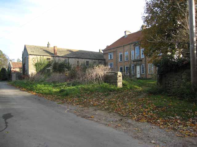
Burrill with Cowling is a civil parish in the Hambleton District of North Yorkshire, England, including the villages of Burrill and Cowling. It is only a 5-minute walk between the 2 small villages, which are 1 mile west of Bedale. It is a small parish surrounded by sparsely populated countryside and contains mainly detached and semi-detached houses. The closest city is Ripon and it is 234 miles from London. Burrill with Cowling is accessible by road from the A1(M) 3.1 miles to the east and the nearest railway station is 15 miles away in Northallerton. In 1870/72 John Marius Wilson described Burrill with Cowling as: :"A township in Bedale parish, N. R. Yorkshire; 1¾ mile SW of Bedale. It has a post office, of the name of Burrell, under Bedale. Acres, 463. Real property, £1,415. Pop., 111. Houses, 25." Demographics According to the 2011 census Burrill with Cowling is a small parish with a population of 104 and only 50 households. The average age of the population is 47 ... [...More Info...] [...Related Items...] OR: [Wikipedia] [Google] [Baidu] |
United Kingdom Census 2011
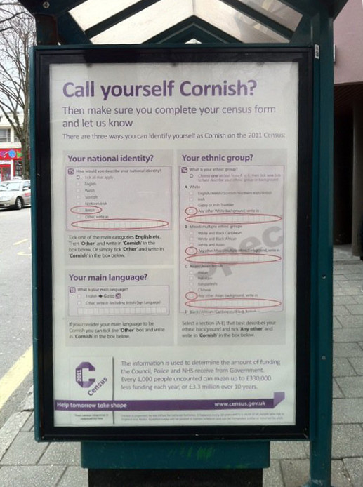
A Census in the United Kingdom, census of the population of the United Kingdom is taken every ten years. The 2011 census was held in all countries of the UK on 27 March 2011. It was the first UK census which could be completed online via the Internet. The Office for National Statistics (ONS) is responsible for the census in England and Wales, the General Register Office for Scotland (GROS) is responsible for the census in Scotland, and the Northern Ireland Statistics and Research Agency (NISRA) is responsible for the census in Northern Ireland. The Office for National Statistics is the executive office of the UK Statistics Authority, a non-ministerial department formed in 2008 and which reports directly to Parliament. ONS is the UK Government's single largest statistical producer of independent statistics on the UK's economy and society, used to assist the planning and allocation of resources, policy-making and decision-making. ONS designs, manages and runs the census in England an ... [...More Info...] [...Related Items...] OR: [Wikipedia] [Google] [Baidu] |
London
London is the capital and largest city of England and the United Kingdom, with a population of just under 9 million. It stands on the River Thames in south-east England at the head of a estuary down to the North Sea, and has been a major settlement for two millennia. The City of London, its ancient core and financial centre, was founded by the Romans as '' Londinium'' and retains its medieval boundaries.See also: Independent city § National capitals The City of Westminster, to the west of the City of London, has for centuries hosted the national government and parliament. Since the 19th century, the name "London" has also referred to the metropolis around this core, historically split between the counties of Middlesex, Essex, Surrey, Kent, and Hertfordshire, which largely comprises Greater London, governed by the Greater London Authority.The Greater London Authority consists of the Mayor of London and the London Assembly. The London Mayor is distinguished fr ... [...More Info...] [...Related Items...] OR: [Wikipedia] [Google] [Baidu] |
York
York is a cathedral city with Roman origins, sited at the confluence of the rivers Ouse and Foss in North Yorkshire, England. It is the historic county town of Yorkshire. The city has many historic buildings and other structures, such as a minster, castle, and city walls. It is the largest settlement and the administrative centre of the wider City of York district. The city was founded under the name of Eboracum in 71 AD. It then became the capital of the Roman province of Britannia Inferior, and later of the kingdoms of Deira, Northumbria, and Scandinavian York. In the Middle Ages, it became the northern England ecclesiastical province's centre, and grew as a wool-trading centre. In the 19th century, it became a major railway network hub and confectionery manufacturing centre. During the Second World War, part of the Baedeker Blitz bombed the city; it was less affected by the war than other northern cities, with several historic buildings being gutted and restore ... [...More Info...] [...Related Items...] OR: [Wikipedia] [Google] [Baidu] |
Middlesbrough
Middlesbrough ( ) is a town on the southern bank of the River Tees in North Yorkshire, England. It is near the North York Moors national park. It is the namesake and main town of its local borough council area. Until the early 1800s, the area was rural farming land. By 1830, a new industrial town and port started to be developed, driven by the coal and later ironworks. Steel production and ship building began in the late 1800s, remaining associated with the town until post-industrial decline occurred in the late twentieth century. Trade (notably through ports) and digital enterprise sectors contemporarily contribute to the local economy, Teesside University and Middlesbrough College to local education. In 1853, it became a town. The motto ("We shall be" in Latin) was adopted, it reflects ("We have been") of the Bruce clan which were Cleveland's mediaeval lords. The town's coat of arms is three ships representing shipbuilding and maritime trade and an azure (blue) lion, ... [...More Info...] [...Related Items...] OR: [Wikipedia] [Google] [Baidu] |
North York Moors National Park
North is one of the four compass points or cardinal directions. It is the opposite of south and is perpendicular to east and west. ''North'' is a noun, adjective, or adverb indicating direction or geography. Etymology The word ''north'' is related to the Old High German ''nord'', both descending from the Proto-Indo-European unit *''ner-'', meaning "left; below" as north is to left when facing the rising sun. Similarly, the other cardinal directions are also related to the sun's position. The Latin word ''borealis'' comes from the Greek '' boreas'' "north wind, north", which, according to Ovid, was personified as the wind-god Boreas, the father of Calais and Zetes. ''Septentrionalis'' is from ''septentriones'', "the seven plow oxen", a name of ''Ursa Major''. The Greek ἀρκτικός (''arktikós'') is named for the same constellation, and is the source of the English word ''Arctic''. Other languages have other derivations. For example, in Lezgian, ''kefer'' can mean b ... [...More Info...] [...Related Items...] OR: [Wikipedia] [Google] [Baidu] |
Yorkshire Dales National Park
The Yorkshire Dales National Park is a national park in England covering most of the Yorkshire Dales. Most of the park is in North Yorkshire, with a sizeable area in Westmorland (Cumbria) and a small part in Lancashire. The park was designated in 1954, and extended in 2016. Over 95% of the land in the Park is under private ownership; there are over 1,000 farms in this area. In late 2020, the park was named as an International Dark Sky Reserve. This honour confirms that the area has "low levels of light pollution with good conditions for astronomy". Some 23,500 residents live in the park (as of 2017); a 2018 report estimated that the Park attracted over four million visitors per year. The economy consists primarily of tourism and agriculture. Location The park is north-east of Manchester; Otley, Ilkley, Leeds and Bradford lie to the south, while Kendal is to the west, Darlington to the north-east and Harrogate to the south-east. The national park does not include all of ... [...More Info...] [...Related Items...] OR: [Wikipedia] [Google] [Baidu] |
Burrill With Cowling Time Series 1871-2011
Burrill is a small village in the Hambleton District of North Yorkshire, England. It is in the parish of Burrill with Cowling and west of Bedale Bedale ( ) is a market town and civil parish in the district of Hambleton, North Yorkshire, England. Historically part of the North Riding of Yorkshire, it is north of Leeds, south-west of Middlesbrough and south-west of the county town of .... References Villages in North Yorkshire {{hambleton-geo-stub ... [...More Info...] [...Related Items...] OR: [Wikipedia] [Google] [Baidu] |
United Kingdom 2011 Census
A Census in the United Kingdom, census of the population of the United Kingdom is taken every ten years. The 2011 census was held in all countries of the UK on 27 March 2011. It was the first UK census which could be completed online via the Internet. The Office for National Statistics (ONS) is responsible for the census in England and Wales, the General Register Office for Scotland (GROS) is responsible for the census in Scotland, and the Northern Ireland Statistics and Research Agency (NISRA) is responsible for the census in Northern Ireland. The Office for National Statistics is the executive office of the UK Statistics Authority, a non-ministerial department formed in 2008 and which reports directly to Parliament. ONS is the UK Government's single largest statistical producer of independent statistics on the UK's economy and society, used to assist the planning and allocation of resources, policy-making and decision-making. ONS designs, manages and runs the census in England an ... [...More Info...] [...Related Items...] OR: [Wikipedia] [Google] [Baidu] |
Northallerton
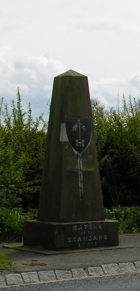
Northallerton ( ) is a market town and civil parish in the Hambleton District of North Yorkshire, England. It lies in the Vale of Mowbray and at the northern end of the Vale of York. It had a population of 16,832 in the 2011 census, an increase from 15,741 in 2001. It has served as the county town of the North Riding of Yorkshire and, since 1974, of North Yorkshire. Northallerton is made up of four wards: North, Broomfield, Romanby and Central. There has been a settlement at Northallerton since Roman times; however its growth in importance began in the 11th century when King William II gifted land to the Bishop of Durham. Under the Bishop's authority Northallerton became an important religious centre. Later, it was a focus for much conflict between the English and the Scots, most notably the Battle of the Standard, fought nearby in 1138, which saw losses of as many as 12,000 men. In later years trade and transport became more important. The surrounding area was discovere ... [...More Info...] [...Related Items...] OR: [Wikipedia] [Google] [Baidu] |
A1(M) Motorway
A1(M) is the designation given to a series of four separate controlled-access highway, motorway sections in England. Each section is an upgrade to a section of the A1 road (Great Britain), A1, a major north–south road which connects Greater London, London, the capital of England, with Edinburgh, the capital of Scotland. The first section, the Doncaster Bypass, opened in 1961 and is one of the oldest sections of motorway in Britain. Construction of a new section of A1(M) between Leeming, North Yorkshire, Leeming and Barton, North Yorkshire, Barton was completed on 29 March 2018, a year later than the anticipated opening in 2017 due to extensive archaeological excavations. Its completion linked the Barton to Washington, Tyne and Wear, Washington section with the Darrington, West Yorkshire, Darrington to Leeming Bar section, forming the longest A1(M) section overall and reducing the number of sections from five to four. In 2015 a proposal was made by three local government or ... [...More Info...] [...Related Items...] OR: [Wikipedia] [Google] [Baidu] |
Ripon
Ripon () is a cathedral city in the Borough of Harrogate, North Yorkshire, England. The city is located at the confluence of two tributaries of the River Ure, the Laver and Skell. Historically part of the West Riding of Yorkshire, the city is noted for its main feature, Ripon Cathedral, which is architecturally significant, as well as the Ripon Racecourse and other features such as its market. The city was originally known as ''Inhrypum''. Bede records that Alhfrith, king of the Southern Northumbrian kingdom of Deira, gave land at Ripon to Eata of Hexham to build a monastery and the abbot transferred some of his monks there, including a young Saint Cuthbert who was guest-master at Ripon abbey. Both Bede in his Life of Cuthbert and Eddius Stephanus in his Life of Wilfred state that when Eata was subsequently driven out by Alhfrith, the abbey was given to Saint Wilfrid who replaced the timber church with a stone built church. This was during the time of the Anglian kingdo ... [...More Info...] [...Related Items...] OR: [Wikipedia] [Google] [Baidu] |
Hambleton District
Hambleton is a local government district in North Yorkshire, England. The administrative centre is Northallerton, and the district includes the outlying towns and villages of Bedale, Thirsk, Great Ayton, Stokesley, and Easingwold. The district was formed by the Local Government Act 1972 on 1 April 1974, as a merger of Northallerton Urban District, Bedale Rural District, Easingwold Rural District, Northallerton Rural District, and parts of Thirsk Rural District, Stokesley Rural District and Croft Rural District, all in the North Riding of Yorkshire. Geography Hambleton covers an area of 1,311.17 km² most of which, 1,254.90 km², is green space. The district is named after the Hambleton Hills, part of the North York Moors National Park, on the eastern edge of the district. This area is the subject of a national habitat protection scheme as articulated in the United Kingdom's Biodiversity Action Plan. About 75% of the district lies in the Vales of Mowbray and of ... [...More Info...] [...Related Items...] OR: [Wikipedia] [Google] [Baidu] |


.jpg)
