|
Burley-in-Wharfedale
Burley in Wharfedale is a village and (as just Burley) a civil parish in the City of Bradford in West Yorkshire, England. It is situated in the Wharfedale valley. The village is situated on the A65 road, approximately north-west from Leeds, north from Bradford, from Ilkley and from Otley. The hamlet of Burley Woodhead at the foot of Burley Moor is to the south-west. Etymology The name of Burley in Wharfedale is first attested in an eleventh-century copy of a charter issued in 972, as ''Burhleg''. It appears in the Domesday Book in the spellings ''Burgelei'', ''Burgelay'', ''Burghelai'', and ''Burghelay''. The comes from the Old English words ''burg'' ('fortification') and ''lēah'' ('open land in a wood'), and thus meant 'open land in a wood, characterised by a fortification'. The specification 'in Wharfedale', deployed to avoid ambiguity with the various other English places of the same name, is first attested during the reign of Edward I of England, in the forms ''Bu ... [...More Info...] [...Related Items...] OR: [Wikipedia] [Google] [Baidu] |
Ilkley
Ilkley is a spa town and civil parish in the City of Bradford in West Yorkshire, in Northern England. Historically part of the West Riding of Yorkshire, Ilkley civil parish includes the adjacent village of Ben Rhydding and is a ward within the City of Bradford. Approximately north of Bradford and north-west of Leeds, the town lies mainly on the south bank of the River Wharfe in Wharfedale, one of the Yorkshire Dales. Ilkley's spa town heritage and surrounding countryside make tourism an important local industry. The town centre is characterised by Victorian architecture, wide streets and floral displays. Ilkley Moor, to the south of the town, is the subject of a folk song, often described as the unofficial anthem of Yorkshire, "On Ilkla Moor Baht 'at". The song's words are written in Yorkshire dialect, its title translated as "On Ilkley Moor without a hat." History The earliest evidence of habitation in the Ilkley area is from flint arrowheads or microliths, dating to the M ... [...More Info...] [...Related Items...] OR: [Wikipedia] [Google] [Baidu] |
Burley Hydro
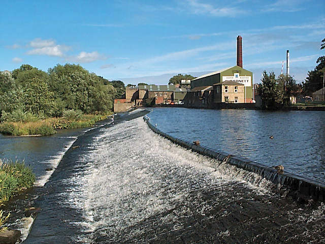
Burley Hydro Scheme, also known as Greenholme Mill Hydro is a micro hydroelectric scheme installed on the River Wharfe at Burley-in-Wharfedale, West Yorkshire, England. The power output of the hydro scheme is 330 kW with an annual output of 1,400 MWh and is the fourth hydro scheme on the river after the opening of similar power plants at Linton near Grassington, and two further downstream from Burley at Pool-in-Wharfedale and Garnett Wharfe at Otley. All of these schemes have been located on sites previously used to generate power from the water flow. History The site was previously used as a water mill from the 1790s up until 1966, when the mill that worked cotton, Greenholme Mill, went out of business. In 2010, a joint venture between Derwent Hydro Power (DHP) and Trade Link Solutions (TLS), developed a new turbine on the site to generate electricity from the water passing through the old mill race. The old mill race was diverted slightly, but cuts a path east of th ... [...More Info...] [...Related Items...] OR: [Wikipedia] [Google] [Baidu] |
Wharfedale
Wharfedale ( ) is the valley of the upper parts of the River Wharfe and one of the Yorkshire Dales. It is situated within the districts of Craven and Harrogate in North Yorkshire, and the cities of Leeds and Bradford in West Yorkshire. It is the upper valley of the River Wharfe. Towns and villages in Wharfedale (downstream, from west to east) include Buckden, Kettlewell, Conistone, Grassington, Hebden, Bolton Abbey, Addingham, Ilkley, Burley-in-Wharfedale, Otley, Pool-in-Wharfedale, Arthington, Collingham and Wetherby. Beyond Wetherby, the valley opens out and becomes part of the Vale of York. The section from the river's source to around Addingham is known as ''Upper Wharfedale'' and lies in North Yorkshire and in the Yorkshire Dales National Park. The first or so is known as Langstrothdale, including the settlements of Beckermonds, Yockenthwaite and Hubberholme, famous for its church, the resting place of the writer J. B. Priestley. As it turns southwards, the Wharfe the ... [...More Info...] [...Related Items...] OR: [Wikipedia] [Google] [Baidu] |
City Of Bradford
The City of Bradford () is a local government district of West Yorkshire, England, with the status of a city and metropolitan borough. It is named after its largest settlement, Bradford, but covers a large area which includes the towns and villages of Keighley, Shipley, Bingley, Ilkley, Haworth, Silsden, Queensbury, Thornton and Denholme. Bradford has a population of 528,155, making it the fourth-most populous metropolitan district and the sixth-most populous local authority district in England. It forms part of the West Yorkshire Urban Area conurbation which in 2011 had a population of 1,777,934, and the city is part of the Leeds-Bradford Larger Urban Zone (LUZ), which, with a population of 2,393,300, is the fourth largest in the United Kingdom after London, Birmingham and Manchester. The city is situated on the edge of the Pennines, and is bounded to the east by the City of Leeds, the south by the Metropolitan Borough of Kirklees and the south west by the Metropolitan ... [...More Info...] [...Related Items...] OR: [Wikipedia] [Google] [Baidu] |
Metropolitan Borough Of Bradford
The City of Bradford () is a local government district of West Yorkshire, England, with the status of a city and metropolitan borough. It is named after its largest settlement, Bradford, but covers a large area which includes the towns and villages of Keighley, Shipley, Bingley, Ilkley, Haworth, Silsden, Queensbury, Thornton and Denholme. Bradford has a population of 528,155, making it the fourth-most populous metropolitan district and the sixth-most populous local authority district in England. It forms part of the West Yorkshire Urban Area conurbation which in 2011 had a population of 1,777,934, and the city is part of the Leeds-Bradford Larger Urban Zone (LUZ), which, with a population of 2,393,300, is the fourth largest in the United Kingdom after London, Birmingham and Manchester. The city is situated on the edge of the Pennines, and is bounded to the east by the City of Leeds, the south by the Metropolitan Borough of Kirklees and the south west by the Metropolitan B ... [...More Info...] [...Related Items...] OR: [Wikipedia] [Google] [Baidu] |
River Wharfe
The River Wharfe ( ) is a river in Yorkshire, England originating within the Yorkshire Dales National Park. For much of its middle course it is the county boundary between West Yorkshire and North Yorkshire. Its valley is known as Wharfedale. The watercourse first becomes known as the River Wharfe at the confluence of Greenfield Beck and Oughtershaw Beck at Beckermonds. Flowing initially through Langstrothdale, it then passes by, or in some cases through, Kettlewell, Grassington, Bolton Abbey, Addingham, Ilkley, Burley-in-Wharfedale, Otley, Wetherby and Tadcaster. It then flows into the River Ouse near Cawood. The section of the river from its source to around Addingham is in Upper Wharfedale and has a very different character to the river downstream. The Wharfe is long (before it joins the Ouse), making it the 21st longest river in Britain. It is a public navigation from the weir at Tadcaster to its junction with the Ouse near Cawood and is tidal from Ulleskelf to the Ouse ... [...More Info...] [...Related Items...] OR: [Wikipedia] [Google] [Baidu] |
Otley
Otley is a market town and civil parishes in England, civil parish at a bridging point on the River Wharfe, in the City of Leeds metropolitan borough in West Yorkshire, England. Historic counties of England, Historically a part of the West Riding of Yorkshire, the population was 13,668 at the 2011 census. It is in two parts: south of the river is the historic town of Otley and to the north is Newall, West Yorkshire, Newall, which was formerly a separate township. The town is in lower Wharfedale on the A660 road which connects it to Leeds. The town is in the Otley and Yeadon (ward), Otley and Yeadon ward of Leeds City Council and the Leeds North West (UK Parliament constituency), Leeds North West UK Parliament constituencies, parliamentary constituency. History Toponymy Otley's name is derived from Otto, Otho, Othe, or Otta, a Saxon personal name and ''leah'', a woodland clearing in Old English. It was recorded as ''Ottanlege'' in 972 and ''Otelai'' or ''Othelia'' in the ''Dom ... [...More Info...] [...Related Items...] OR: [Wikipedia] [Google] [Baidu] |
2011 Census For England And Wales
A census of the population of the United Kingdom is taken every ten years. The 2011 census was held in all countries of the UK on 27 March 2011. It was the first UK census which could be completed online via the Internet. The Office for National Statistics (ONS) is responsible for the census in England and Wales, the General Register Office for Scotland (GROS) is responsible for the census in Scotland, and the Northern Ireland Statistics and Research Agency (NISRA) is responsible for the census in Northern Ireland. The Office for National Statistics is the executive office of the UK Statistics Authority, a non-ministerial department formed in 2008 and which reports directly to Parliament. ONS is the UK Government's single largest statistical producer of independent statistics on the UK's economy and society, used to assist the planning and allocation of resources, policy-making and decision-making. ONS designs, manages and runs the census in England and Wales. In its capacity as t ... [...More Info...] [...Related Items...] OR: [Wikipedia] [Google] [Baidu] |
Roman Britain
Roman Britain was the period in classical antiquity when large parts of the island of Great Britain were under occupation by the Roman Empire. The occupation lasted from AD 43 to AD 410. During that time, the territory conquered was raised to the status of a Roman province. Julius Caesar invaded Britain in 55 and 54 BC as part of his Gallic Wars. According to Caesar, the Britons had been overrun or culturally assimilated by other Celtic tribes during the British Iron Age and had been aiding Caesar's enemies. He received tribute, installed the friendly king Mandubracius over the Trinovantes, and returned to Gaul. Planned invasions under Augustus were called off in 34, 27, and 25 BC. In 40 AD, Caligula assembled 200,000 men at the Channel on the continent, only to have them gather seashells ('' musculi'') according to Suetonius, perhaps as a symbolic gesture to proclaim Caligula's victory over the sea. Three years later, Claudius directed four legi ... [...More Info...] [...Related Items...] OR: [Wikipedia] [Google] [Baidu] |
Anglo-Saxons
The Anglo-Saxons were a Cultural identity, cultural group who inhabited England in the Early Middle Ages. They traced their origins to settlers who came to Britain from mainland Europe in the 5th century. However, the ethnogenesis of the Anglo-Saxons happened within Britain, and the identity was not merely imported. Anglo-Saxon identity arose from interaction between incoming groups from several Germanic peoples, Germanic tribes, both amongst themselves, and with Celtic Britons, indigenous Britons. Many of the natives, over time, adopted Anglo-Saxon culture and language and were assimilated. The Anglo-Saxons established the concept, and the Kingdom of England, Kingdom, of England, and though the modern English language owes somewhat less than 26% of its words to their language, this includes the vast majority of words used in everyday speech. Historically, the Anglo-Saxon period denotes the period in Britain between about 450 and 1066, after Anglo-Saxon settlement of Britain, th ... [...More Info...] [...Related Items...] OR: [Wikipedia] [Google] [Baidu] |
Industrialisation
Industrialisation ( alternatively spelled industrialization) is the period of social and economic change that transforms a human group from an agrarian society into an industrial society. This involves an extensive re-organisation of an economy for the purpose of manufacturing. Historically industrialization is associated with increase of polluting industries heavily dependent on fossil fuels. With the increasing focus on sustainable development and green industrial policy practices, industrialization increasingly includes technological leapfrogging, with direct investment in more advanced, cleaner technologies. The reorganization of the economy has many unintended consequences both economically and socially. As industrial workers' incomes rise, markets for consumer goods and services of all kinds tend to expand and provide a further stimulus to industrial investment and economic growth. Moreover, family structures tend to shift as extended families tend to no longer live ... [...More Info...] [...Related Items...] OR: [Wikipedia] [Google] [Baidu] |
Goit
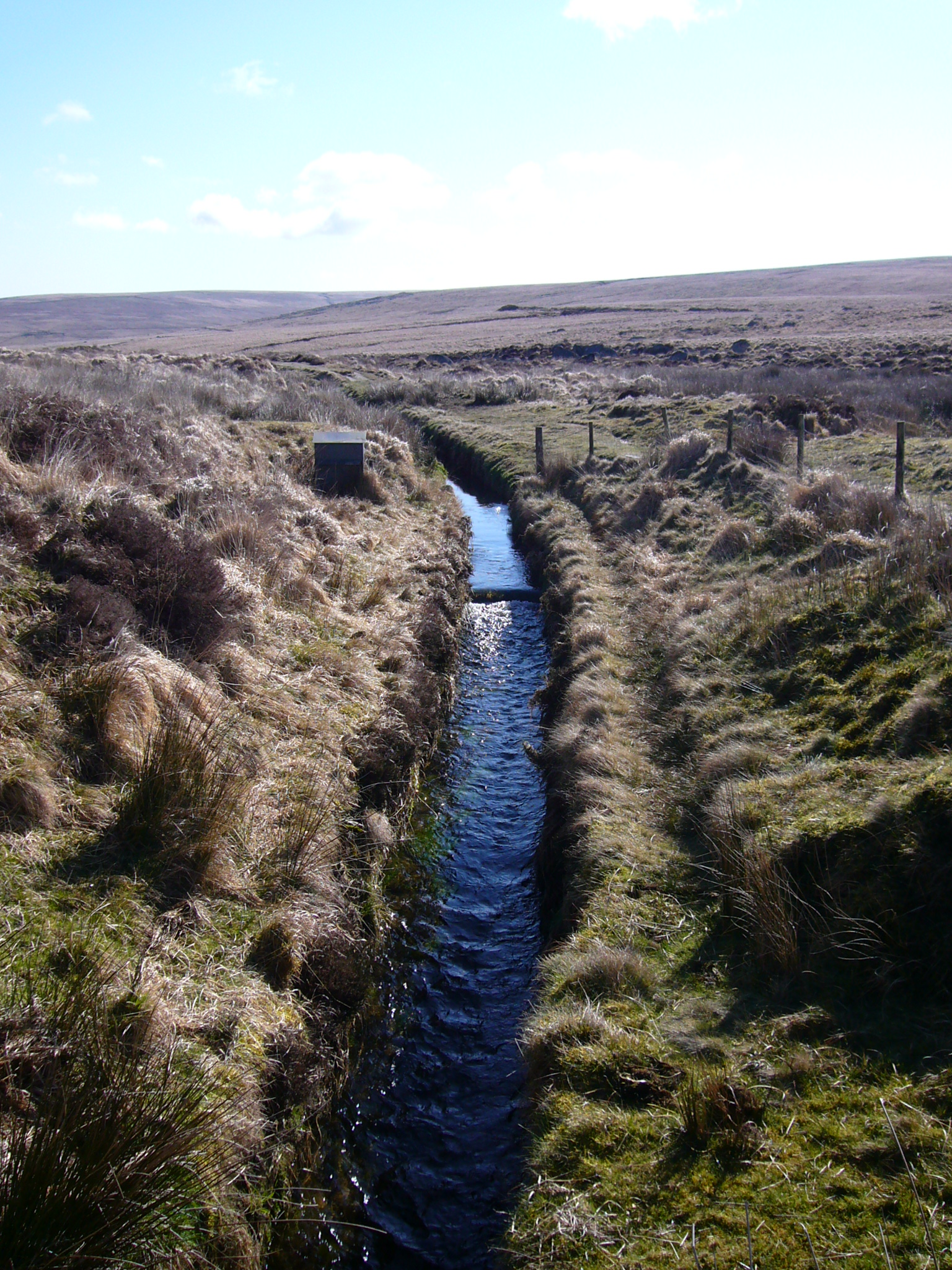
A leat (; also lete or leet, or millstream) is the name, common in the south and west of England and in Wales, for an artificial watercourse or Aqueduct (watercourse), aqueduct dug into the ground, especially one supplying water to a watermill or its mill pond. Other common uses for leats include delivery of water for hydraulic mining and Buddle pit, mineral concentration, for irrigation, to serve a Dyeing, dye works or other industrial plant, and provision of drinking water to a farm or household or as a catchment cut-off to improve the yield of a reservoir. According to the ''Oxford English Dictionary'', ''leat'' is cognate with ''let'' in the sense of "allow to pass through". Other names for the same thing include ''fleam'' (probably a leat supplying water to a mill that did not have a millpool). In parts of northern England, for example around Sheffield, the equivalent word is ''goit''. In southern England, a leat used to supply water for water-meadow irrigation is often cal ... [...More Info...] [...Related Items...] OR: [Wikipedia] [Google] [Baidu] |


