|
Burgwald
Burgwald is a municipality in Waldeck-Frankenberg in Hesse, Germany. Geography Location Burgwald lies east of Battenberg and roughly 30 km north of the university town of Marburg. The community lies on the northwestern edge of the Burgwald range, Hesse's biggest contiguous woodland. Neighbouring communities Burgwald borders in the north on the town of Frankenberg, in the east on the community of Haina, in the south on the town of Rosenthal (all in Waldeck-Frankenberg), in the southwest on the community of Münchhausen (Marburg-Biedenkopf), and in the west on the town of Battenberg and the community of Allendorf (both in Waldeck-Frankenberg). Constituent communities The community is divided into Birkenbringhausen in the northwest, Bottendorf somewhat more towards the northeast, Burgwald and Wiesenfeld towards the centre, and Ernsthausen to the south. History ''Burgwald'' is quite a new name for the main community. Until 1996, it was known as ''Industriehof''. Amalgam ... [...More Info...] [...Related Items...] OR: [Wikipedia] [Google] [Baidu] |
Frankenberg, Hesse
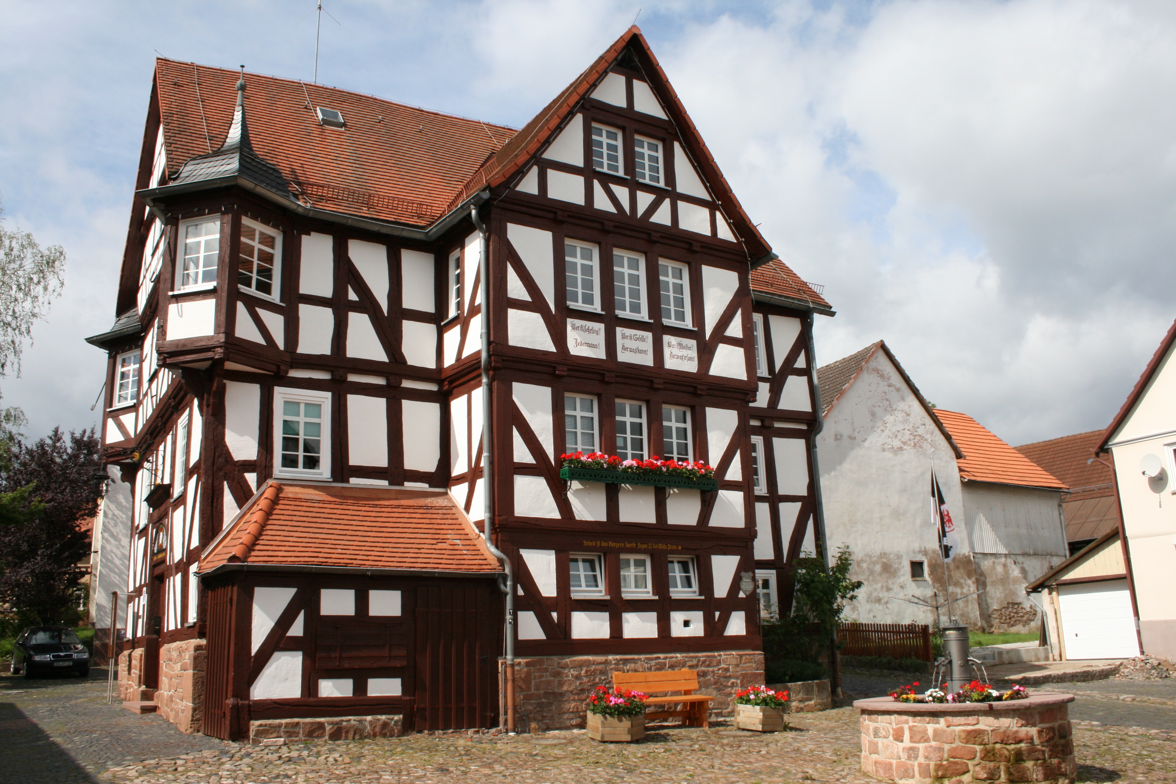
Frankenberg an der Eder is a town in Waldeck-Frankenberg district, Hesse, Germany. The mountain at a ford over the Eder north of the Burgwald range was for a long time a fortified place, playing an especially important role under the Franks in the Saxon Wars. The town was built in 1233-1234 by the Thuringian Landgrave at the junction of two trade routes. The renovated Old and New Town have many half-timbered houses. In 2018 the town adopted the additional name "Philipp Soldan Stadt". Geography Frankenberg lies between the Burgwald range in the south and the Breite Struth (hills) in the northwest, where the river Nemphe empties into the Eder. North of the town, the Nuhne empties into the same river at the constituent community of Schreufa. It is north of Marburg. Neighbouring communities Frankenberg borders in the north on the community of Vöhl, in the east on the town of Frankenau, in the southeast on the community of Haina, in the southwest on the community of Burgwald, in ... [...More Info...] [...Related Items...] OR: [Wikipedia] [Google] [Baidu] |
Allendorf (Eder)
Allendorf (Eder) () is a municipality which situated in the north west of Hesse, Germany. The municipality is within the Waldeck-Frankenberg district in a rural region called the upper Eder Valley. The Burgwald range is located west of Allendorf while the Breite Struth hills are in Allendorf's east. With regard to towns, Allendorf lies to the east of Frankenberg/Eder (12 km) and to the west of Battenberg (2.6 km) and Biedenkopf (21 km). In the north of Allendorf are Hallenberg (12 km), Winterberg (26 km), and Korbach (39 km). In its south is the university city Marburg (32 km). Allendorf is internationally known because of the heating company Viessmann, which has its headquarters in Allendorf/Eder. Moreover, the FC Ederbergland - an amalgamation of the football divisions of the SV Allendorf and the TSV Battenberg - successfully plays in the Hessian regional league. Allendorf is also attractive to tourists because of its half-timbered houses ... [...More Info...] [...Related Items...] OR: [Wikipedia] [Google] [Baidu] |
Battenberg, Hesse
Battenberg (Eder) is a small town in Waldeck-Frankenberg district, the state of Hesse, Germany. The town is noted for giving its name to the Battenberg family, a morganatic branch of the ruling House of Hesse-Darmstadt, and through it, the name Mountbatten used by members of the British royal family, a literal translation of Battenberg. Geography Location The centre of Battenberg lies in the ''Ederbergland'', or Eder Highland, to which the Burgwald abutting the town to the east also belongs, on the southern edge of the Sauerland and the Rothaargebirge. Lying between 320 and 650 m above sea level, the town is also crossed by the river Eder (Fulda), Eder. Neighbouring communities Battenberg borders in the north on the community of Bromskirchen, in the northeast on the community of Allendorf (Eder), Allendorf, in the southeast on the community of Burgwald (all three in Waldeck-Frankenberg), in the south on the community of Münchhausen am Christenberg (Marburg-Biedenkopf) ... [...More Info...] [...Related Items...] OR: [Wikipedia] [Google] [Baidu] |
Haina
Haina (Kloster) is a municipality in Waldeck-Frankenberg in northwest Hesse, Germany. Geography Location Haina lies in Waldeck-Frankenberg south of Frankenberg and east of Burgwald at the southwest slope of the Kellerwald range. It lies on the river Wohra not far west of the Hohes Lohr (the Kellerwald range's second highest peak at 657 m). Neighbouring communities Haina borders in the northwest on the town of Frankenau, in the northeast on the town of Bad Wildungen (both in Waldeck-Frankenberg), in the east on the community of Bad Zwesten, in the southeast on the communities of Jesberg and Gilserberg (all three in the Schwalm-Eder-Kreis), in the south on the town of Gemünden, and in the west on the community of Burgwald and the town of Frankenberg (all three in Waldeck-Frankenberg). Constituent communities Haina consists of the following 12 centres: Altenhaina, Battenhausen, Bockendorf, Dodenhausen, Haddenberg, Haina (administrative seat), Halgehausen, Hüttenrode, Lö ... [...More Info...] [...Related Items...] OR: [Wikipedia] [Google] [Baidu] |
Rosenthal, Hesse
Rosenthal is a small town in southeast Waldeck-Frankenberg district in Hesse, Germany. Geography Location Rosenthal lies in the Burgwald range 11 km southeast of Frankenberg and 18 km northeast of Marburg. Neighbouring communities Rosenthal borders in the north on the community of Burgwald, in the east on the town of Gemünden (both in Waldeck-Frankenberg), in the southeast on the community of Wohratal, in the south on the towns of Rauschenberg and Wetter, and in the west on the community of Münchhausen (all in Marburg-Biedenkopf). Constituent communities Besides the main town, which bears the same name as the whole, the town of Rosenthal consists of the centres of Roda and Willershausen. History Rosenthal was founded in 1327 as a Mainz town and outpost in the dispute over the Hessian fief, but nevertheless passed to the Landgraviate of Hesse in 1464. In 1688, the town achieved dubious fame by being the scene of Hesse's last witch burnings. In 1866, Rosenthal p ... [...More Info...] [...Related Items...] OR: [Wikipedia] [Google] [Baidu] |
Münchhausen Am Christenberg
The municipality of Münchhausen is found north of Marburg on the northern edge of Marburg-Biedenkopf district. It has 3,286 inhabitants (2020) and has had its current boundaries since 1974. The municipality's area is roughly 41 km². Geography Location West of the community lies the Rothaargebirge, a low mountain range. The municipal area is bounded on the east by the ''Burgwald'', another low mountain range. The constituent communities of Münchhausen and Simtshausen lie in the Wetschaft valley. Wollmar lies on the like-named river Wollmar, which empties into the Wetschaft in Münchhausen. Through the constituent communities of Oberasphe and Niederasphe flows the river Asphe. Neighbouring communities Münchhausen's neighbours are Burgwald, Rosenthal, Wetter, Biedenkopf and Battenberg. Constituent communities *Münchhausen (1285 inhabitants) (as of January 2004) *Niederasphe (914 inhabitants) *Oberasphe (356 inhabitants) *Simtshausen (495 inhabitants) *Wollmar (701 in ... [...More Info...] [...Related Items...] OR: [Wikipedia] [Google] [Baidu] |
Waldeck-Frankenberg
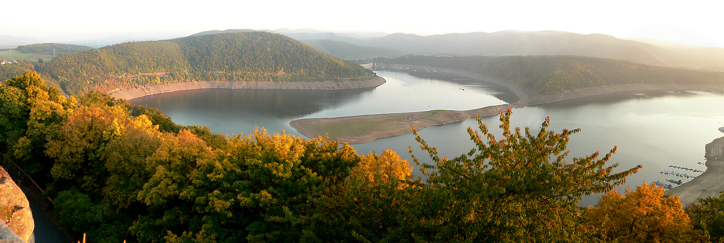
Waldeck-Frankenberg is a ''Kreis'' (district) in the north of Hesse, Germany. Neighbouring districts are Höxter, Kassel, Schwalm-Eder, Marburg-Biedenkopf, Siegen-Wittgenstein, Hochsauerland. History The district was created in 1972 by merging the two districts of Frankenberg and Waldeck. Most of the area of the district was previously part of the ''Freistaat Waldeck'', the successor of the principality of Waldeck. Geography The district is located in the mountains of the Sauerland, with the highest elevation in the district of . With , it's the largest district in Hessen. Four artificial lakes created by dams are in the district, the biggest is the Edersee, which covers an area of . The Eder is also the main river in the district; the Diemel in the north is a smaller river. Mountains * Sähre Coat of arms ;Blason :''“Per bend sinister Azure a lion rampant issuant per fess Argent and Gules and Or a star with eight rays Sable.”'' The coat of arms shows the lion of Hesse i ... [...More Info...] [...Related Items...] OR: [Wikipedia] [Google] [Baidu] |
Korbach
Korbach (pronunciation: ˈkoːɐˌbax), officially the Hanseatic City of Korbach (German language, German: Hansestadt Korbach), is the district seat of Waldeck-Frankenberg in northern Hesse, Germany. It is over a thousand years old and is located on the German Timber-Frame Road. In 2018, the town has hosted the 58th Hessentag state festival. Geography and geology Korbach lies at the north-east edge of the Rhenish Slate Mountains (here known as the ''Waldeck'sches Upland'', the second word being a German language, German proper name, not the English word "upland"). Neighbouring towns and communities are, clockwise from the northwest, Willingen, Diemelsee, Twistetal, Waldeck, Hesse, Waldeck, Vöhl, Lichtenfels, Hesse, Lichtenfels (likewise all in Waldeck-Frankenberg) and Medebach (Hochsauerlandkreis in North Rhine-Westphalia). The town lies on an unwooded tableland called the Waldecker Tafel that once harboured a great many wild chickens, leading to the townsfolk's nickname as ''"F ... [...More Info...] [...Related Items...] OR: [Wikipedia] [Google] [Baidu] |
Coat Of Arms
A coat of arms is a heraldry, heraldic communication design, visual design on an escutcheon (heraldry), escutcheon (i.e., shield), surcoat, or tabard (the latter two being outer garments). The coat of arms on an escutcheon forms the central element of the full achievement (heraldry), heraldic achievement, which in its whole consists of a shield, supporters, a crest (heraldry), crest, and a motto. A coat of arms is traditionally unique to an individual person, family, state, organization, school or corporation. The term itself of 'coat of arms' describing in modern times just the heraldic design, originates from the description of the entire medieval chainmail 'surcoat' garment used in combat or preparation for the latter. Roll of arms, Rolls of arms are collections of many coats of arms, and since the early Modern Age centuries, they have been a source of information for public showing and tracing the membership of a nobility, noble family, and therefore its genealogy across tim ... [...More Info...] [...Related Items...] OR: [Wikipedia] [Google] [Baidu] |
Bicycle
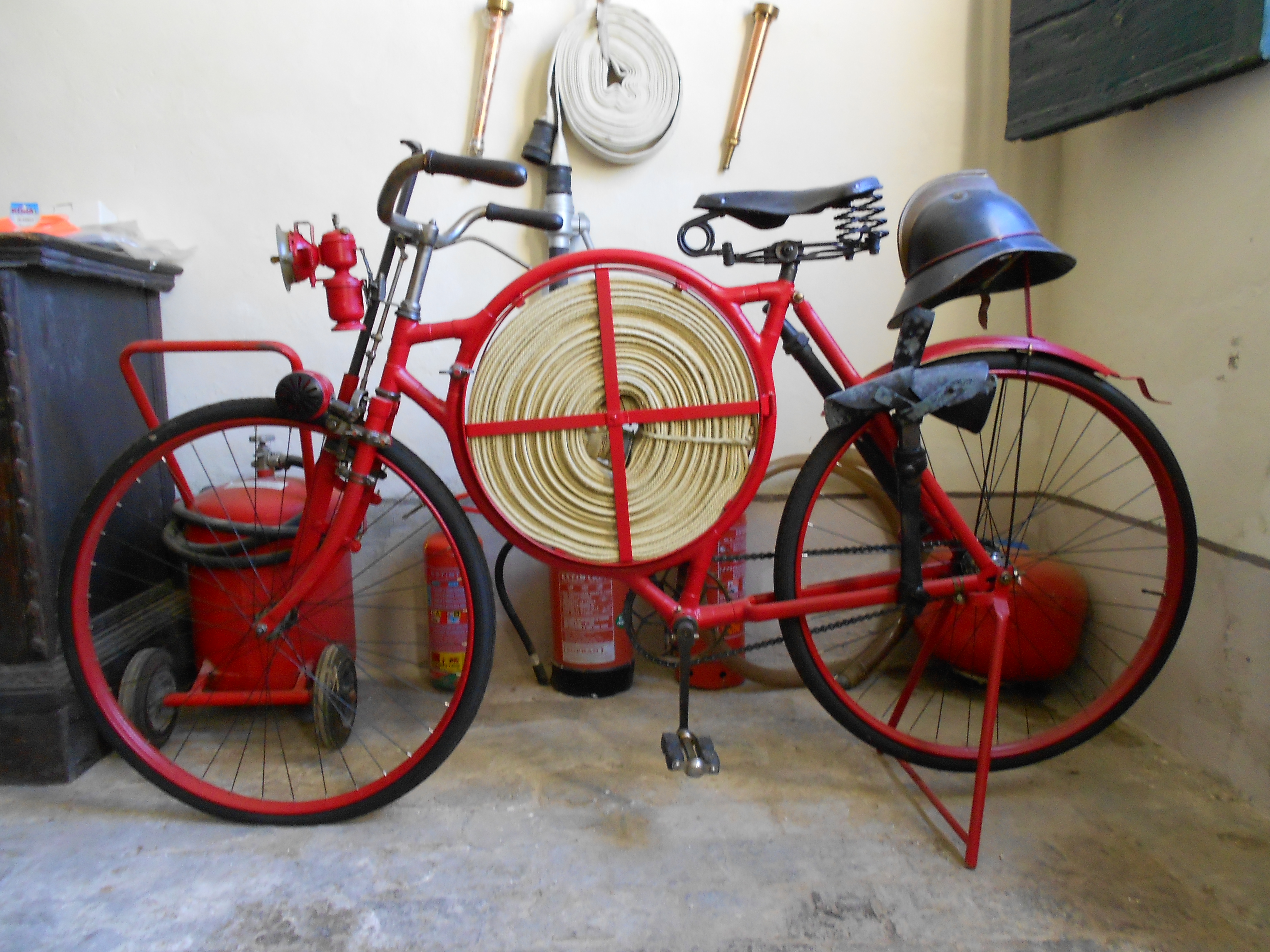
A bicycle, also called a pedal cycle, bike or cycle, is a human-powered or motor-powered assisted, pedal-driven, single-track vehicle, having two wheels attached to a frame, one behind the other. A is called a cyclist, or bicyclist. Bicycles were introduced in the 19th century in Europe. By the early 21st century, more than 1 billion were in existence. These numbers far exceed the number of cars, both in total and ranked by the number of individual models produced. They are the principal means of transportation in many regions. They also provide a popular form of recreation, and have been adapted for use as children's toys, general fitness, military and police applications, courier services, bicycle racing, and bicycle stunts. The basic shape and configuration of a typical upright or "safety bicycle", has changed little since the first chain-driven model was developed around 1885. However, many details have been improved, especially since the advent of modern ... [...More Info...] [...Related Items...] OR: [Wikipedia] [Google] [Baidu] |
Railway
Rail transport (also known as train transport) is a means of transport that transfers passengers and goods on wheeled vehicles running on rails, which are incorporated in tracks. In contrast to road transport, where the vehicles run on a prepared flat surface, rail vehicles (rolling stock) are directionally guided by the tracks on which they run. Tracks usually consist of steel rails, installed on sleepers (ties) set in ballast, on which the rolling stock, usually fitted with metal wheels, moves. Other variations are also possible, such as "slab track", in which the rails are fastened to a concrete foundation resting on a prepared subsurface. Rolling stock in a rail transport system generally encounters lower frictional resistance than rubber-tyred road vehicles, so passenger and freight cars (carriages and wagons) can be coupled into longer trains. The operation is carried out by a railway company, providing transport between train stations or freight customer facilit ... [...More Info...] [...Related Items...] OR: [Wikipedia] [Google] [Baidu] |
Hungary
Hungary ( hu, Magyarország ) is a landlocked country in Central Europe. Spanning of the Carpathian Basin, it is bordered by Slovakia to the north, Ukraine to the northeast, Romania to the east and southeast, Serbia to the south, Croatia and Slovenia to the southwest, and Austria to the west. Hungary has a population of nearly 9 million, mostly ethnic Hungarians and a significant Romani minority. Hungarian, the official language, is the world's most widely spoken Uralic language and among the few non-Indo-European languages widely spoken in Europe. Budapest is the country's capital and largest city; other major urban areas include Debrecen, Szeged, Miskolc, Pécs, and Győr. The territory of present-day Hungary has for centuries been a crossroads for various peoples, including Celts, Romans, Germanic tribes, Huns, West Slavs and the Avars. The foundation of the Hungarian state was established in the late 9th century AD with the conquest of the Carpathian Basin by Hungar ... [...More Info...] [...Related Items...] OR: [Wikipedia] [Google] [Baidu] |


