|
Bumayong
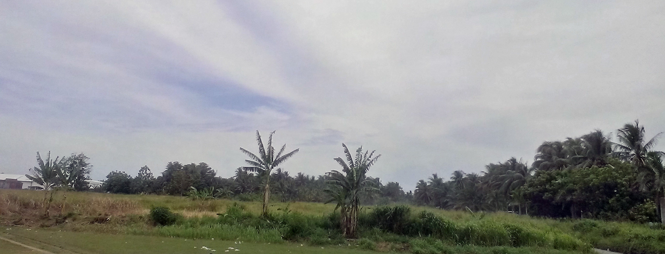
Bumayong is an outer suburb of Lae in the Morobe Province, Papua New Guinea. Location Bumayong is located 12 km North of Lae on Independence Drive up the road from the University of Technology on the Independence Drive loop. A Bailey bridge crosses the Busu River on the road to the villages of Bualu and Situm. Lutheran Mission Training There are three main Lutheran training locations in Lae; Martin Luther Seminary in Malahang, Balob Teachers College in Butibum and the Bumayong Lutheran High school Lutheran Church in Papua New Guinea accessed 7 February 2014 Law and Order In November 2011, large scale riots broke out in Lae following a petition and march on the Morobe Provincial Admin (Tutumang). The petition addressed four points, namely; # La ...[...More Info...] [...Related Items...] OR: [Wikipedia] [Google] [Baidu] |
Situm,Papua New Guinea
Situm is a government ex-servicemen block outside of Lae in Labuta Rural LLG, Morobe Province, Papua New Guinea. Geography Location Situm is located north-east of Lae, on The Bukawa-Finchaffen National Highway Road across the Busu river and over the Bupu River causeway. It is above sea level. Geology The area around Situm is located on the Pacific Ring of Fire and geologic instability has produced numerous faults, resulting in earthquakes. Situm sits between the larger Indo-Australian Plate and the Pacific Plate on the South Bismarck Plate in the Ramu-Markham Fault Zone where the New Guinea Highlands Deforming Zone and South Bismarck tectonic plates are converging at up to /yr and the seismic hazard is significant. The Ramu-Markham Fault Zone, which follows the northern edge of the Markham Valley, is the active plate boundary between the South Bismarck Plate and terranes within the New Guinea Highlands Deforming Zone. The Ramu-Markham Fault Zone has generated large t ... [...More Info...] [...Related Items...] OR: [Wikipedia] [Google] [Baidu] |
Yalu, Papua New Guinea
Yalu is a large village in Wampar Rural LLG, located in the Markham Valley of Morobe Province, Papua New Guinea. It lies along the Highlands Highway north-west of Lae, southeast of Nadzab. The landscape is typically lowland rainforest. History In 1930, a delegation including the District Officer and Patrol Officer (Kiap based around Nadzab, inspected Markham Valley villages. The report to the Council of the League of Nations states: :''"The Yalu natives had recently abandoned their old village, and have established themselves nearby in a more accessible position. I inspected the village and saw 120 natives, none had complaints"'' During World War 2, Number 3 Platoon, 2/1 Forestry Company, Royal Australian Engineers established a forestry camp at Yalu to provide timber and the New Guinea RAAF Training School was located in and around Yalu. In 2008, three weeks of rain recorded at 107mm for a 24-hour period has led to extensive flooding in Papua New Guinea's Morobe province wi ... [...More Info...] [...Related Items...] OR: [Wikipedia] [Google] [Baidu] |
Malahang, Papua New Guinea
Malahang is a suburb of Lae, Morobe Province in Papua New Guinea. Location Malahang is located North East of Lae, Morobe Province, Papua New Guinea on Busu Road across the Bumbu River. History In the late 1800s the German New Guinea Company arrived on ''Neu Guinea'' (German New Guinea), to select land for plantation development on the north-east coast of New Guinea and establish trading posts. The Lutheran Malahang Mission Station was established around the same time as the various coconut plantations located opposite the Malahang Industrial Area. On 8 March 1942 the Imperial Japanese landed at Malahang Beach as part of the Invasion of Lae-Salamaua during World War II. Malahang airfield was upgraded by the Japanese so the runway was long by wide and used as satellite of Lae Airport. On 8 January 1943, the cargo ship was damaged by an aerial attack by United States Army Air Forces aircraft during the Battle of Wau, and was subsequently beached and abandoned at Malahan ... [...More Info...] [...Related Items...] OR: [Wikipedia] [Google] [Baidu] |
Taraka,Papua New Guinea
Taraka is a suburb of Lae in the Morobe Province, Papua New Guinea. The main campus for the Papua New Guinea University of Technology is located in Taraka. Location Both East Taraka and West Taraka are located 7 km from Lae on Rigel Road. A tributary for the Bumbu River meanders through Taraka. East Taraka is predominately commercial and industrial while West Taraka is mostly residential. Population In 1963 it was estimated that 10% of Lae's population lived in " Shanty-town settlements which describe both Omili and Taraka and there is evidence that these settlements have grown well above the average rate of Lae. Housing In May 1992, another study examined migrant settlement in and around Lae examining ''Tent Siti'' and ''West Taraka''.TAJIMA, Yasuhiro 1992, New Migrant settlement in Lae, ''Traditional Social Systems and Their Transformation''accessed 3 February 2014 :''Tent Siti'' :''Tensiti is situated in the northern part of the city and was first formed by pe ... [...More Info...] [...Related Items...] OR: [Wikipedia] [Google] [Baidu] |
Lae Nadzab Airport
Lae Nadzab Airport is a regional airport located at Nadzab outside Lae, Morobe Province, Papua New Guinea along the Highlands Highway. It is served by both private and regional aircraft with domestic flights. The airport replaced the Lae Airfield in 1977. Nadzab is located on the Erap River, North of the Markham River. The settlements of Gabmatsung/Gabmatzung and Gabsonkek are located on the East side of the airport. History In about 1910 the Gabmatsung/Gabmazung Lutheran mission station was established at Nadzab. and established an airfield for use by small planes until the outbreak of the Pacific War when it became overgrown with dense kunai grass. World War II In March 1942, the Japanese occupied Lae and Salamaua. Between April 1943 and July 1943, the Allied Geographical Section of South West Pacific Area (command) conducted reconnaissance after the Japanese invasion. The Terrain Handbook states at page 18: ''Nazdab is located twenty-seven miles NW of Lae by ... [...More Info...] [...Related Items...] OR: [Wikipedia] [Google] [Baidu] |
Vox Populi
( )Vox Populi . Oxford Dictionaries (online). . is a phrase that literally means "voice of the people". It is used in English in the meaning "the opinion of the majority of the people". In , vox pop or man on the street refers to short |
Butibam, Papua New Guinea
Butibam is a village on the outskirts of Lae, Morobe Province in Papua New Guinea. Location Butibam lies to the east of the Bumbu River and north of Busu Road. The Butibam market and primary school lies to the south of Busu Road. The Buku (Sepik) settlement lies to the south of the primary school and covers up to the Huon Gulf beach. Churches Following a dispute with the German New Guinea Company, Pastor Gottfried Schmutterer from the Neuendettelsau Mission Society was forced to relocate his original mission camp in July 1912 and was offered a location on the banks of the Bumbu known as Ampo. The Ampo Lutheran Church was built in 1937 and later used as a WW2 field hospital and remains the oldest building in Lae. Several Lutheran churches, schools and headquarter buildings now occupy the surrounds. In the 1920s, the Lutheran Church had a significant impact on the Butibum and Malahang communities and garnered a great deal of loyalty to the faith. By way of example, in 1971, t ... [...More Info...] [...Related Items...] OR: [Wikipedia] [Google] [Baidu] |
Morobe Province
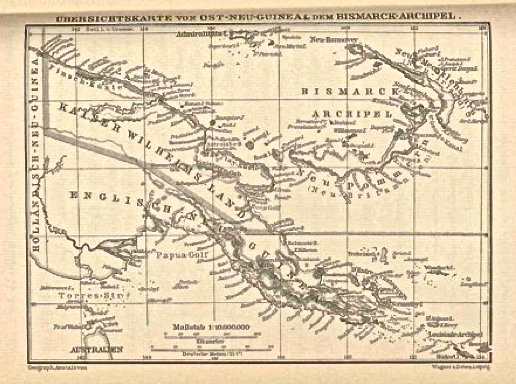
Morobe Province is a province on the northern coast of Papua New Guinea. The provincial capital and largest city is Lae. The province covers 33,705 km2, with a population of 674,810 (2011 census), and since the division of Southern Highlands Province in May 2012 it is the most populous province. It includes the Huon Peninsula, the Markham River, and delta, and coastal territories along the Huon Gulf. The province has nine administrative districts. At least 101 languages are spoken, including Kâte and Yabem language. English language, English and Tok Pisin are common languages in the urban areas, and in some areas pidgin forms of German are mixed with the native language. History Nomenclature The Morobe Province takes its name from former German administration center of ''Morobe'' southeast of the Lae. Under German administration, Morobe (meaning post) was named Adolfhafen for the German Deutsch Neuguinea-Kompagnie's Adolf von Hansemann and German word ''hafen'' (''heɪfən' ... [...More Info...] [...Related Items...] OR: [Wikipedia] [Google] [Baidu] |
Provinces Of Papua New Guinea
For administrative purposes, Papua New Guinea is divided into administrative divisions Administrative division, administrative unit,Article 3(1). country subdivision, administrative region, subnational entity, constituent state, as well as many similar terms, are generic names for geographical areas into which a particular, ind ... called provinces. There are 22 provincial-level divisions, which include #List of provinces, 20 provinces, the Autonomous Region of Bougainville, and the National Capital District (Papua New Guinea), National Capital District of Port Moresby. In 2009, the National Parliament of Papua New Guinea created two additional provinces, that officially came into being on 17 May 2012. [...More Info...] [...Related Items...] OR: [Wikipedia] [Google] [Baidu] |
Busu River
The Busu River is a river located near Wagang, Lae in Morobe Province of Papua New Guinea Papua New Guinea (abbreviated PNG; , ; tpi, Papua Niugini; ho, Papua Niu Gini), officially the Independent State of Papua New Guinea ( tpi, Independen Stet bilong Papua Niugini; ho, Independen Stet bilong Papua Niu Gini), is a country i .... It is the fastest-flowing river in Papua New Guinea and the sixth-fastest in the world. References Rivers of Papua New Guinea Morobe Province Lae {{PapuaNewGuinea-river-stub ... [...More Info...] [...Related Items...] OR: [Wikipedia] [Google] [Baidu] |
Bailey Bridge
A Bailey bridge is a type of portable, pre-fabricated, truss bridge. It was developed in 1940–1941 by the British for military use during the Second World War and saw extensive use by British, Canadian and American military engineering units. A Bailey bridge has the advantages of requiring no special tools or heavy equipment to assemble. The wood and steel bridge elements were small and light enough to be carried in trucks and lifted into place by hand, without the use of a crane. The bridges were strong enough to carry tanks. Bailey bridges continue to be used extensively in civil engineering construction projects and to provide temporary crossings for pedestrian and vehicle traffic. A Bailey bridge and its construction were prominently featured in the 1977 film '' A Bridge Too Far''. Design The success of the Bailey bridge was due to the simplicity of the fabrication and assembly of its modular components, combined with the ability to erect and deploy sections with a minimu ... [...More Info...] [...Related Items...] OR: [Wikipedia] [Google] [Baidu] |


