|
Bubastis Portal
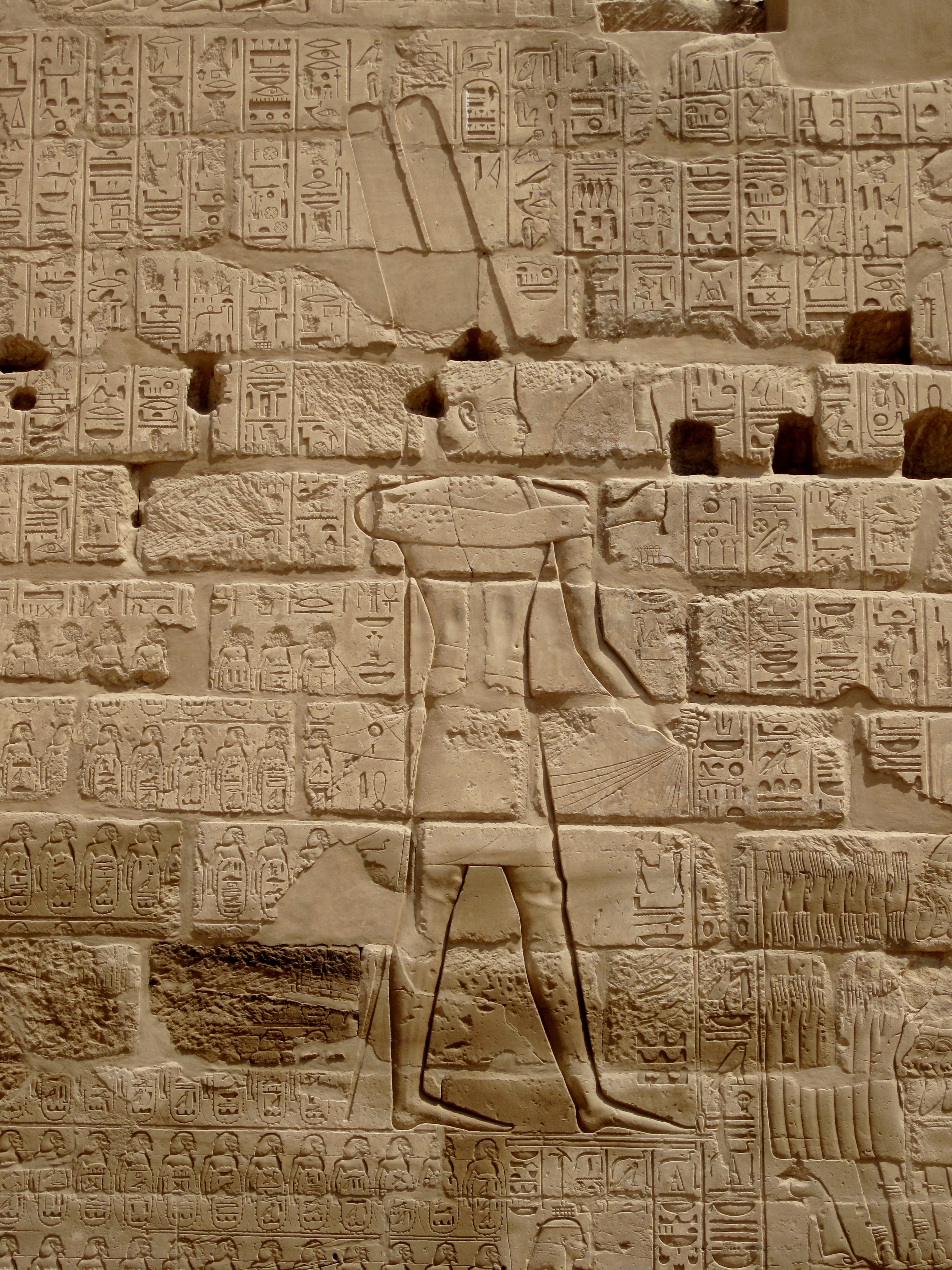
The Bubastite Portal gate is located in Karnak, within the Precinct of Amun-Re temple complex, between the temple of Ramesses III and the second pylon. It records the conquests and military campaigns in c.925 BC of Shoshenq I, of the Twenty-second Dynasty. Shoshenq has been identified with the biblical Shishaq, such that the relief is also known as the Shishak Inscription or Shishaq Relief. History This gate was erected by the kings of the Twenty-second Dynasty of Egypt, also known as the "Bubastite Dynasty". It is located to the south-east side of the Temple of Ramesses III. Although Karnak had been known to Europeans since the end of the Middle Ages, the possible significance of the Bubastite Portal was not apparent prior to the decipherment of hieroglyphs. Jean-François Champollion visited Karnak in 1828, six years after his publication of the Rosetta Stone translation. In his letters he wrote: Description One facade shows King Sheshonq I, Teklot and Osorkon of the 22nd ... [...More Info...] [...Related Items...] OR: [Wikipedia] [Google] [Baidu] |
Karnak Tempel 19
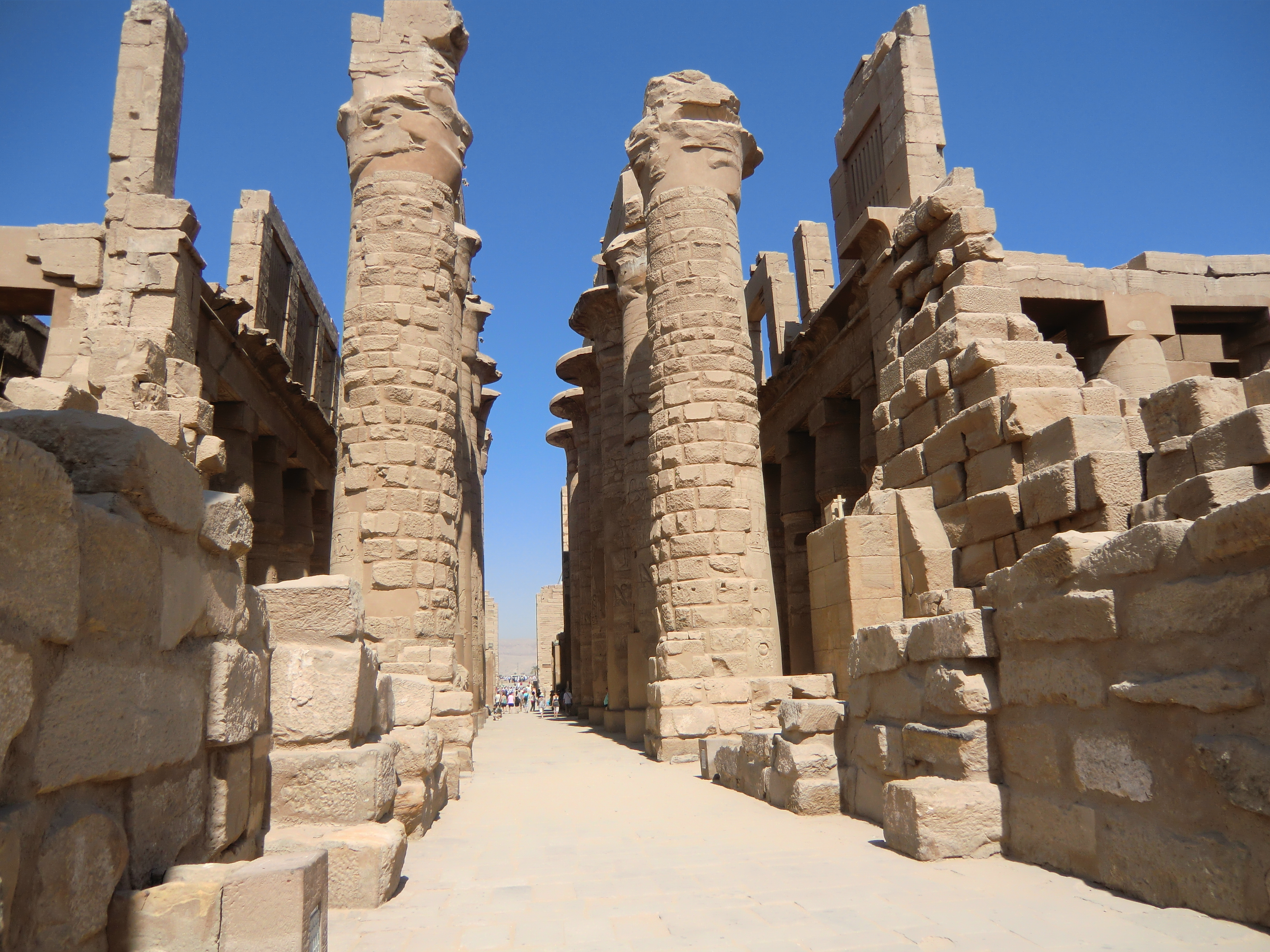
The Karnak Temple Complex, commonly known as Karnak (, which was originally derived from ar, خورنق ''Khurnaq'' "fortified village"), comprises a vast mix of decayed temples, pylons, chapels, and other buildings near Luxor, Egypt. Construction at the complex began during the reign of Senusret I (reigned 1971–1926 BCE) in the Middle Kingdom (around 2000–1700 BCE) and continued into the Ptolemaic Kingdom (305–30 BCE), although most of the extant buildings date from the New Kingdom. The area around Karnak was the ancient Egyptian ''Ipet-isut'' ("The Most Selected of Places") and the main place of worship of the 18th Dynastic Theban Triad, with the god Amun as its head. It is part of the monumental city of Thebes, and in 1979 it was inscribed on the UNESCO World Heritage List along with the rest of the city. The Karnak complex gives its name to the nearby, and partly surrounded, modern village of El-Karnak, north of Luxor. Overview The complex is a vast open site and ... [...More Info...] [...Related Items...] OR: [Wikipedia] [Google] [Baidu] |
Nine Bows
The Nine Bows is a visual representation in Ancient Egyptian art of foreigners or others. Besides the nine bows, there were no other generic representations of foreigners. Due to its ability to stand in for any nine enemies to Ancient Egypt, the peoples covered by this term changed over time as enemies changed, and there is no true list of the nine bows. Alternatively, the nine bows may have had a separate or complementary meaning. In Egyptian hieroglyphs, the word 'Nine Bows' is spelled out as a bow and three sets of three vertical lines. The bow, holding the phonic value "pḏ," means "stretch, (be) wide," and the three sets of lines makes the word plural. The number nine was used metaphorically to express totality. Using this more literal translation of the hieroglyphs, the nine bows could also refer to endless, innumerable foreign lands or the totality of foreign lands. It is important to note that Ancient Egyptians believed in dualism or that two cosmic forces, order and ch ... [...More Info...] [...Related Items...] OR: [Wikipedia] [Google] [Baidu] |
Gibeon (ancient City)
Gibeon ( he, , ''Gīḇəʻōn''; grc-gre, Γαβαων, ''Gabaōn'') was a Canaanite and, later, an Israelite city which was located north of Jerusalem. According to and , the pre-Israelite-conquest inhabitants, the Gibeonites, were Hivites; according to they were Amorites. The remains of Gibeon are located in the southern portion of the Palestinian village of al-Jib. Biblical account Canaanite city After the destruction of Jericho and Ai, the Hivite people of Gibeon sent ambassadors to trick Joshua and the Israelites into making a treaty with them. According to the Bible, the Israelites were commanded to destroy all non-Israelite Canaanites in Palestine. The Gibeonites presented themselves as ambassadors from a distant, powerful land. Without consulting God (), the Israelites entered into a covenant or peace treaty with the Gibeonites. The Israelites soon found out that the Gibeonites were actually their neighbors, living within three days walk of them ( Joshua 9:17) and ... [...More Info...] [...Related Items...] OR: [Wikipedia] [Google] [Baidu] |
Mahanaim
Mahanaim ( he, מַחֲנַיִם ''Maḥănayīm'', "camps") is a place mentioned a number of times by the Bible said to be near Jabbok, in the same general area as Jabesh-gilead, beyond the Jordan River. Although two possible sites have been identified, the precise location of Mahanaim is uncertain. Tell edh-Dhahab el-Gharbi, the western one of the twin Tulul adh-Dhahab tells, is one proposed identification. Biblical narrative In the Biblical narrative, the first mentioned of Mahanaim occurs in the Book of Genesis as the place where Jacob, returning from Padan-aram to southern Canaan, had a vision of angels (). Believing it to be "God's camp", Jacob names the place Mahanaim (Hebrew for "Two Camps", or "Two Companies") to memorialize the occasion of his own company sharing the place with God's. Later in the story, Jacob is moved by fear at the approach of his brother Esau (whom he has reason to fear) and as a result divided his retinue into ''two hosts'' (two companies), henc ... [...More Info...] [...Related Items...] OR: [Wikipedia] [Google] [Baidu] |
Dura, Hebron
Dura ( ar, دورا) is a Palestinian city located eleven kilometers southwest of Hebron, in the southern West Bank, in the Hebron Governorate of the State of Palestine. According to the Palestinian Central Bureau of Statistics, the town had a population of over 28,268 in 2007. The current mayor is Ahmad Salhoub. In 1517, the village was incorporated into the Ottoman Empire with the rest of Syria. After the British Mandate, in the wake of the 1948 Arab–Israeli War, Dura came under Jordanian rule. Dura was established as a municipality on January 1, 1967, five months before it came under Israeli occupation after the Six-Day War. Since 1995, it has been governed by the Palestinian National Authority, as part of Area A of the West Bank and as part of the Hebron Governorate of the State of Palestine. Etymology The present-day name of ''Dura'' has been identified with ancient ''Adoraim'' or the ''Adora'' of 1 Macc.13.20Robinson and Smith, 1841, vol 3, p4/ref> The village was origin ... [...More Info...] [...Related Items...] OR: [Wikipedia] [Google] [Baidu] |
Kingdom Of Israel (Samaria)
The Kingdom of Israel (), or the Kingdom of Samaria, was an Israelite kingdom in the Southern Levant during the Iron Age. The kingdom controlled the areas of Samaria, Galilee and parts of Transjordan. Its capital, for the most part, was Samaria (modern Sebastia). The Hebrew Bible depicts the Kingdom of Israel as one of two successor states to the former United Kingdom of Israel ruled by King David and his son Solomon, the other being the Kingdom of Judah; most historians and archaeologists, however, do not believe in the existence of a United Kingdom as depicted in the Bible.The debate is described in Amihai Mazar, "Archaeology and the Biblical Narrative: The Case of the United Monarchy" (see bibliography), p.29 fn.2: "For conservative approaches defining the United Monarchy as a state “from Dan to Beer Sheba” including “conquered kingdoms” (Ammon, Moab, Edom) and “spheres of influence” in Geshur and Hamath cf. e.g. Ahlström (1993), 455–542; Meyers (1998); Le ... [...More Info...] [...Related Items...] OR: [Wikipedia] [Google] [Baidu] |
Hapharaim
This is a list of places mentioned in the Bible, which do not have their own Wikipedia articles. See also the list of biblical places for locations which do have their own article. A Abana Abana, according to 2 Kings 5:12, was one of the "rivers of Damascus", along with the Pharpar river. Abdon Abdon was a Levitical city in Asher allocated to the Gershonites according to Joshua 21:30 and 1 Chronicles 6:74. Abel-Shittim Abel-Shittim, the last Israelite encampment before crossing into the Promised Land, is identified by Josephus with Abila in Peraea, probably the site of modern Tell el-Hammam in Jordan. Adam Adam was a location which, according to Joshua 3:16, was along the Jordan River, near Zarethan. According to Cheyne and Black, it may be a scribal error for "Adamah". Adadah Adadah is the name of a town mentioned in Joshua 15:22, in a list of towns inside the territory of the Tribe of Judah. The name "Adadah" appears nowhere else in the Bible."Adadah", in According to t ... [...More Info...] [...Related Items...] OR: [Wikipedia] [Google] [Baidu] |
Rehob
Tel Rehov ( he, תל רחוב) or Tell es-Sarem ( ar, تل الصارم), is an archaeological site in the Bet She'an Valley, a segment of the Jordan Valley, Israel, approximately south of Beit She'an and west of the Jordan River. It was occupied in the Bronze Age and Iron Age. The site is one of several suggested as Rehov (also Rehob), meaning "broad", "wide place", The oldest apiary discovered anywhere by archaeologists, including man-made beehives and remains of the bees themselves, dating between the mid-10th century BCE and the early 9th century BCE, came to light on the tell. In the nearby ruins of the mainly Byzantine-period successor of Iron Age Rehov, a Jewish town named Rohob or Roōb, archaeologists discovered the longest mosaic inscription found so far in the Land of Israel. Identification Tel Rehov does not correspond to the Hebrew Bible places named as Rehov, of which two were in the more westerly allotment of the Tribe of Asher, and one more northerly. [...More Info...] [...Related Items...] OR: [Wikipedia] [Google] [Baidu] |
Beit She'an
Beit She'an ( he, בֵּית שְׁאָן '), also Beth-shean, formerly Beisan ( ar, بيسان ), is a town in the Northern District (Israel), Northern District of Israel. The town lies at the Beit She'an Valley about 120 m (394 feet) below sea level. Beit She'an is believed to be one of the oldest cities in the region. It has played an important role in history due to its geographical location at the junction of the Jordan River, Jordan River Valley and the Jezreel Valley. The town's ancient tell contains remains beginning in the Chalcolithic, Chalcolithic period. It served as an New Kingdom of Egypt, Egyptian administrative center during the Late Bronze Age. During the Hellenistic period, the settlement was known as Scythopolis (Ancient Greek: ''Σκυθόπολις''). After the region came under Roman Empire, Roman rule, Scythopolis gained imperial free status and was the leading city of the Decapolis. Later, under Byzantine rule, it served as the capital of Palaestina Sec ... [...More Info...] [...Related Items...] OR: [Wikipedia] [Google] [Baidu] |
Shunem
Shunaam ( he, שׁוּנֵם; in LXX grc, Σουνὰν) was a small village mentioned in the Bible in the possession of the Tribe of Issachar. It was located near the Jezreel Valley, north of Mount Gilboa (). Shunaam is where the Philistines camped when they fought Saul the King, Saul, the first king of Israel (). It was the hometown of Abishag, David, King David's companion in his old age (). The prophet Elisha was hospitably entertained there by a wealthy woman whose Raising of the son of the woman of Shunem, deceased son Elisha brought back to life. (2 Kings 4:8) Shunaam is listed as a town conquered by the Egyptian pharaohs Thutmose III and Shoshenk I. Shunaam may have been located at the site of the modern village of Sulam.John L. McKenzie, Dictionary of the Bible, Touchstone Press, 1965 See also * Shunamitism References {{coord, 32, 36, 20.28, N, 35, 20, 3.50, E, type:city, display=title Hebrew Bible places ... [...More Info...] [...Related Items...] OR: [Wikipedia] [Google] [Baidu] |
Taanach
Ti'inik, also transliterated Ti’innik ( ar, تعّنك), or Ta'anakh/Taanach ( he, תַּעְנַךְ), is a Palestinian village, located 13 km northwest of the city of Jenin in the northern West Bank. According to the Palestinian Central Bureau of Statistics, the village had a population of 1,095 inhabitants in mid-year 2006. Antiquity Tell Ta'annek/Tel Ta'anach: Bronze Age to Abbasid period Just to the north of Ti'inik is a 40-metre-high mound which was the site of the biblical city of Taanach or Tanach ( he, תַּעֲנָךְ; grc, Θαναάχ), a Levitical city allocated to the Kohathites.Freedman et al., 2000, p1228 "Its identification with modern Tell Ta'annek (171214) is undisputed because of the continuity in the name and because of its location on the southern branch of the Via Maris, next to the pass of Megiddo." Excavations at the tell were carried out by Albert Glock mostly during the 1970s and 1980s. Twelve Akkadian cuneiform tablets were found here. Approxima ... [...More Info...] [...Related Items...] OR: [Wikipedia] [Google] [Baidu] |
Rubutu
Rubutu was a city, or city-state located in ancient northern Israel, between the city of ''Gazru''-(modern Gezer), and Jerusalem during the time of the Amarna letters Text corpus, correspondence, a 15-20 year Time period, period at about 1350 BC, 1350-1335 BC. Some scholars place Rubutu near present-day Arraba, Jenin, Arrabah in the northern West Bank.Zertal, Adam; ''Arubboth, Hepher, and the Third Solomonic District'', 1984: 72-76, 112-114, 133-136Na'aman, Nadav;'' Canaan in the second millennium B.C.E.'', 2005: 212. The Amarna letters were mostly written to the pharaoh of Ancient Egypt, and three mayors of Gazru: Abimilku, Milkilu, and Yapahu authored 20 letters of the 382–letter, Amarna letters Text corpus, corpus. The reference to Rubutu is found in 2 letters of Abdi-Heba of Jerusalem, EA 289, and 290, (EA (el Amarna), EA for 'el Amarna'). They mention the war of various cities, the Habiru, and of: ''"the seizure of Rubutu"''. The 2 letters of city--''Rubutu'' EA 289, tit ... [...More Info...] [...Related Items...] OR: [Wikipedia] [Google] [Baidu] |

%2C_cisterns_(marked_Cis)_and_Caves.png)


._Beisan_mound_LOC_matpc.17062.jpg)

