|
Brunsberg (Harburg)
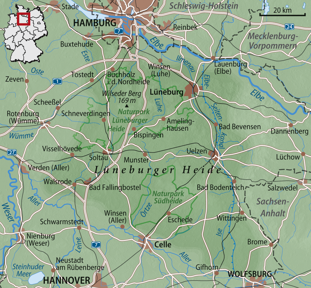
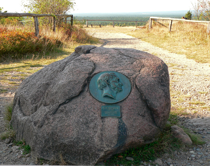
The Brunsberg is a high hill on the northwestern edge of the Lüneburg Heath in northern Germany. It lies in the Brunsberg Nature Reserve, reserve no. LÜ 010 with an area of , near Sprötze between the towns of Buchholz in der Nordheide and Tostedt. From its summit, covered with heather and grazed by moorland sheep, there is a good view over the neighbouring heaths and in good visibility the Wilseder Berg, , and ''Heidepark'' at Soltau can be seen to the south. To the southwest the tower of St. John's Church (''Johanneskirche'') can be seen in Tostedt. The view towards Hamburg is blocked by the Harburg Hills The Harburg Hills (German: Harburger Berge) are a low ridge in the northeastern part of the German state of Lower Saxony and the southern part of the city state of Hamburg. They are up to high. Geography and history The Harburg Hills lie northwe .... Not far from the top is the holiday home for the youth organisation ''Deutsche Schreberjugend'' Landesverband Hamburg eV. ... [...More Info...] [...Related Items...] OR: [Wikipedia] [Google] [Baidu] |
Lower Saxony
Lower Saxony (german: Niedersachsen ; nds, Neddersassen; stq, Läichsaksen) is a German state (') in northwestern Germany. It is the second-largest state by land area, with , and fourth-largest in population (8 million in 2021) among the 16 ' federated as the Federal Republic of Germany. In rural areas, Northern Low Saxon and Saterland Frisian are still spoken, albeit in declining numbers. Lower Saxony borders on (from north and clockwise) the North Sea, the states of Schleswig-Holstein, Hamburg, , Brandenburg, Saxony-Anhalt, Thuringia, Hesse and North Rhine-Westphalia, and the Netherlands. Furthermore, the state of Bremen forms two enclaves within Lower Saxony, one being the city of Bremen, the other its seaport, Bremerhaven (which is a semi-enclave, as it has a coastline). Lower Saxony thus borders more neighbours than any other single '. The state's largest cities are state capital Hanover, Braunschweig (Brunswick), Lüneburg, Osnabrück, Oldenburg, Hildesheim, Salzgitt ... [...More Info...] [...Related Items...] OR: [Wikipedia] [Google] [Baidu] |
Lüneburg Heath
Lüneburg Heath (german: Lüneburger Heide) is a large area of heath, geest, and woodland in the northeastern part of the state of Lower Saxony in northern Germany. It forms part of the hinterland for the cities of Hamburg, Hanover and Bremen and is named after the town of Lüneburg. Most of the area is a nature reserve. Northern Low Saxon is still widely spoken in the region. Lüneburg Heath has extensive areas, and the most yellow of heathland, typical of those that covered most of the North German countryside until about 1800, but which have almost completely disappeared in other areas. The heaths were formed after the Neolithic period by overgrazing of the once widespread forests on the poor sandy soils of the geest, as this slightly hilly and sandy terrain in northern Europe is called. Lüneburg Heath is therefore a historic cultural landscape. The remaining areas of heath are kept clear mainly through grazing, especially by a North German breed of moorland sheep called th ... [...More Info...] [...Related Items...] OR: [Wikipedia] [Google] [Baidu] |
Germany
Germany,, officially the Federal Republic of Germany, is a country in Central Europe. It is the second most populous country in Europe after Russia, and the most populous member state of the European Union. Germany is situated between the Baltic and North seas to the north, and the Alps to the south; it covers an area of , with a population of almost 84 million within its 16 constituent states. Germany borders Denmark to the north, Poland and the Czech Republic to the east, Austria and Switzerland to the south, and France, Luxembourg, Belgium, and the Netherlands to the west. The nation's capital and most populous city is Berlin and its financial centre is Frankfurt; the largest urban area is the Ruhr. Various Germanic tribes have inhabited the northern parts of modern Germany since classical antiquity. A region named Germania was documented before AD 100. In 962, the Kingdom of Germany formed the bulk of the Holy Roman Empire. During the 16th ce ... [...More Info...] [...Related Items...] OR: [Wikipedia] [Google] [Baidu] |
Sprötze
The former independent municipality of Sprötze in the north German state of Lower Saxony was merged in 1972 with another five villages into the town of Buchholz in der Nordheide. Transportation The village of Sprötze lies on the B 3 federal road between Trelde and Welle. Sprötze has a station on the main line from Bremen to Hamburg, and is part of the Hamburg Transport Network. History Sprötze was first mentioned in 1105 as ''Sproccinla''. At that time the inhabitants had just celebrated the 900th anniversary of their village. Its name changed over the course of time through Spretzenlo, Sprotzelo, Sprotzel and Sprötzel to the present-day name of Sprötze. Sprötze has a fine brick church from the last century. Features One of the highest elevations in north Germany is located near Sprötze: the Brunsberg south of the village is above sea level. From here the '' Nordheide'' ("North Heath") can be viewed. The Sprötze shooting festival takes place on the second w ... [...More Info...] [...Related Items...] OR: [Wikipedia] [Google] [Baidu] |
Buchholz In Der Nordheide
Buchholz in der Nordheide (Northern Low Saxon: ''Bookholt'') is the largest town in the district of Harburg, in Lower Saxony, Germany. It is situated approximately 25 km southwest of Hamburg. Geography Buchholz is home to the Brunsberg, at 129m the highest mountain in the region. It is on the northern edge of the Lüneburg Heath (''Lüneburger Heide''), hence the suffix to the name. History In 1958, Buchholz received its city charter. In 1992, Buchholz was struck by a small tornado which destroyed many trees and damaged numerous houses. In 2002, the temperature in Buchholz rose above 38 degrees celsius, marking an all-time high for its region. In 2006, Buchholz tried to set a new world record by placing a crowd of 2000 people in the form of a large heart near the local swimming pool. The attempt ultimately failed because 39 people did not show up. Division of the town The districts of Steinbeck, Dibbersen, Seppensen, Holm-Seppensen, Sprötze and Trelde belong to Buchholz ... [...More Info...] [...Related Items...] OR: [Wikipedia] [Google] [Baidu] |
Tostedt
Tostedt (Low German ''Töst'') is a municipality in the district of Harburg, in Lower Saxony, Germany. It is the central administration of the collective municipality (Samtgemeinde Tostedt) which consists of 9 joint communities. Geography Geography Tostedt is located on the northwestern edge of Lüneburger Heide, 35 km southwest of Hamburg and 55 km east of Bremen. The areas highest point of 70 meters above sea level is to be found at the entrance facing Welle, its lowest point is 43 meters above sea level at the eastend of ''Todtglüsingen''. Near Tostedt the river Este flows towards Hollenstedt, and there are the spring of the river Oste towards Sittensen, as well as the streams ''Dohrener Mühlenbach'', ''Langeloher Bach'' and ''Todtglüsinger Bach''. Neighboring cities and municipalities * Buchholz in der Nordheide * Dohren * Handeloh * Heidenau * Kakenstorf * Königsmoor * Otter * Welle * Wistedt Municipality Approximately 10,500 residents live ... [...More Info...] [...Related Items...] OR: [Wikipedia] [Google] [Baidu] |
Calluna
''Calluna vulgaris'', common heather, ling, or simply heather, is the sole species in the genus ''Calluna'' in the flowering plant family Ericaceae. It is a low-growing evergreen shrub growing to tall, or rarely to and taller, and is found widely in Europe and Asia Minor on acidic soils in open sunny situations and in moderate shade. It is the dominant plant in most heathland and moorland in Europe, and in some bog vegetation and acidic pine and oak woodland. It is tolerant of grazing and regenerates following occasional burning, and is often managed in nature reserves and grouse moors by sheep or cattle grazing, and also by light burning. ''Calluna'' was separated from the closely related genus ''Erica'' by Richard Anthony Salisbury, who devised the generic name ''Calluna'' probably from the Ancient Greek (), "beautify, sweep clean", in reference to its traditional use in besoms. The specific epithet ''vulgaris'' is Latin for 'common'. ''Calluna'' is differentiated from ''Er ... [...More Info...] [...Related Items...] OR: [Wikipedia] [Google] [Baidu] |
Heidschnucke
The Heidschnucke is a group of three types of moorland sheep from northern Germany. Like a number of other types from Scandinavia and Great Britain, they are Northern European short-tailed sheep. The three breeds of Heidschnucke (in order of population size) are: * German Grey Heath () at www.heidschnucken-verband.de. Accessed on 19 Aug 2010. * ( or ) * White Horned Heath () The main breeding areas are the north German heathland and moors of the . That said, this sheep, which is easy to look after, may nowadays be found in all ... [...More Info...] [...Related Items...] OR: [Wikipedia] [Google] [Baidu] |
Wilseder Berg
At , the Wilseder Berg is the highest point on the Lüneburg Heath in North Germany. Due to its position in the middle of the nature reserve Lüneburg Heath it is a popular tourist destination, especially in the period when the heather is in flower. Description The Wilseder Berg is part of a nature reserve within the Lüneburg Heath and lies near the villages of Wilsede and Bispingen in the Heidekreis. The hill was formed during the penultimate ice age, the Saale glaciation, and was part of a terminal moraine. It has a broad plateau and a flat summit. Around it lies a varied landscape of hollows, valleys and small ravines. The surrounding area has leached, gravelly-sandy soils with layers of hardpan, covered by open sand, large areas of heathland and extensive coniferous forest. The heathland is grazed by a variety of moorland sheep, known as the '' Heidschnucke''. The Wilseder Berg lies on a watershed, from which several headstreams emerge, such as those of the Este, Lu ... [...More Info...] [...Related Items...] OR: [Wikipedia] [Google] [Baidu] |
Hamburg
(male), (female) en, Hamburger(s), Hamburgian(s) , timezone1 = Central (CET) , utc_offset1 = +1 , timezone1_DST = Central (CEST) , utc_offset1_DST = +2 , postal_code_type = Postal code(s) , postal_code = 20001–21149, 22001–22769 , area_code_type = Area code(s) , area_code = 040 , registration_plate = , blank_name_sec1 = GRP (nominal) , blank_info_sec1 = €123 billion (2019) , blank1_name_sec1 = GRP per capita , blank1_info_sec1 = €67,000 (2019) , blank1_name_sec2 = HDI (2018) , blank1_info_sec2 = 0.976 · 1st of 16 , iso_code = DE-HH , blank_name_sec2 = NUTS Region , blank_info_sec2 = DE6 , website = , footnotes ... [...More Info...] [...Related Items...] OR: [Wikipedia] [Google] [Baidu] |
Harburg Hills
The Harburg Hills (German: Harburger Berge) are a low ridge in the northeastern part of the German state of Lower Saxony and the southern part of the city state of Hamburg. They are up to high. Geography and history The Harburg Hills lie northwest of the Lüneburg Heath in the Lower Saxony, Lower Saxon district of Landkreis Harburg and in the Hamburg quarters of Eißendorf, Hausbruch, Heimfeld, Marmstorf and Neugraben-Fischbek within the Harburg, Hamburg, Harburg borough. Thus they are located between the city of Hamburg to the north, Seevetal to the east, the Lüneburg Heath to the southeast, Handeloh, Welle (Niedersachsen), Welle and Otter (Niedersachsen), Otter to the south, Tostedt and Buchholz in der Nordheide to the southwest, Hollenstedt and Beckdorf to the west and Neu Wulmstorf to the northwest. At the centre of this hill country is the municipal district of Rosengarten (Landkreis Harburg), Rosengarten (which consists of ten separate villages and covers an area of some 64 ... [...More Info...] [...Related Items...] OR: [Wikipedia] [Google] [Baidu] |


