|
Brogdale
Brogdale is a hamlet in Kent, England, immediately south of the M2 motorway (Great Britain), M2 motorway, south of Faversham. It is one of several hamlets making up the civil parishes in England, civil parish of Ospringe and is in the Borough of Swale. Its western half is in the Kent Downs Area of Outstanding Natural Beauty. History Brogdale was once called Brokedale. This name is shared with the family of John de Brokedale, its lords of the manorialism, manor of the early middle ages. After no Brokedale sons or other male-line issue remaining, the manor was owned by John Clerk – living in Brogdale in 1383. In 1734, the manor was owned by John Knowler, Mayor of Faversham. On 10 August 2003 the temperature at Brogdale reached , once a UK Weather Records, record for the United Kingdom. Farm Brogdale Farm is home to the National Fruit Collection, one of the largest collections of fruit trees and plants in the world. Spread over it hosts the collection since it moved from ... [...More Info...] [...Related Items...] OR: [Wikipedia] [Google] [Baidu] |
National Fruit Collection
The United Kingdom's National Fruit Collection is one of the largest collections of fruit trees and plants in the world. Over 2,040 varieties of apple, 502 of pear, 350 of plum, 322 of cherry and smaller collections of bush fruits, nuts and grapes are grown, in of orchards. Retrieved 26 June 2010 It has been curated and maintained at Brogdale Farm, Brogdale, Kent since 1952 and is owned by the Department for Environme ...
[...More Info...] [...Related Items...] OR: [Wikipedia] [Google] [Baidu] |
Wye College
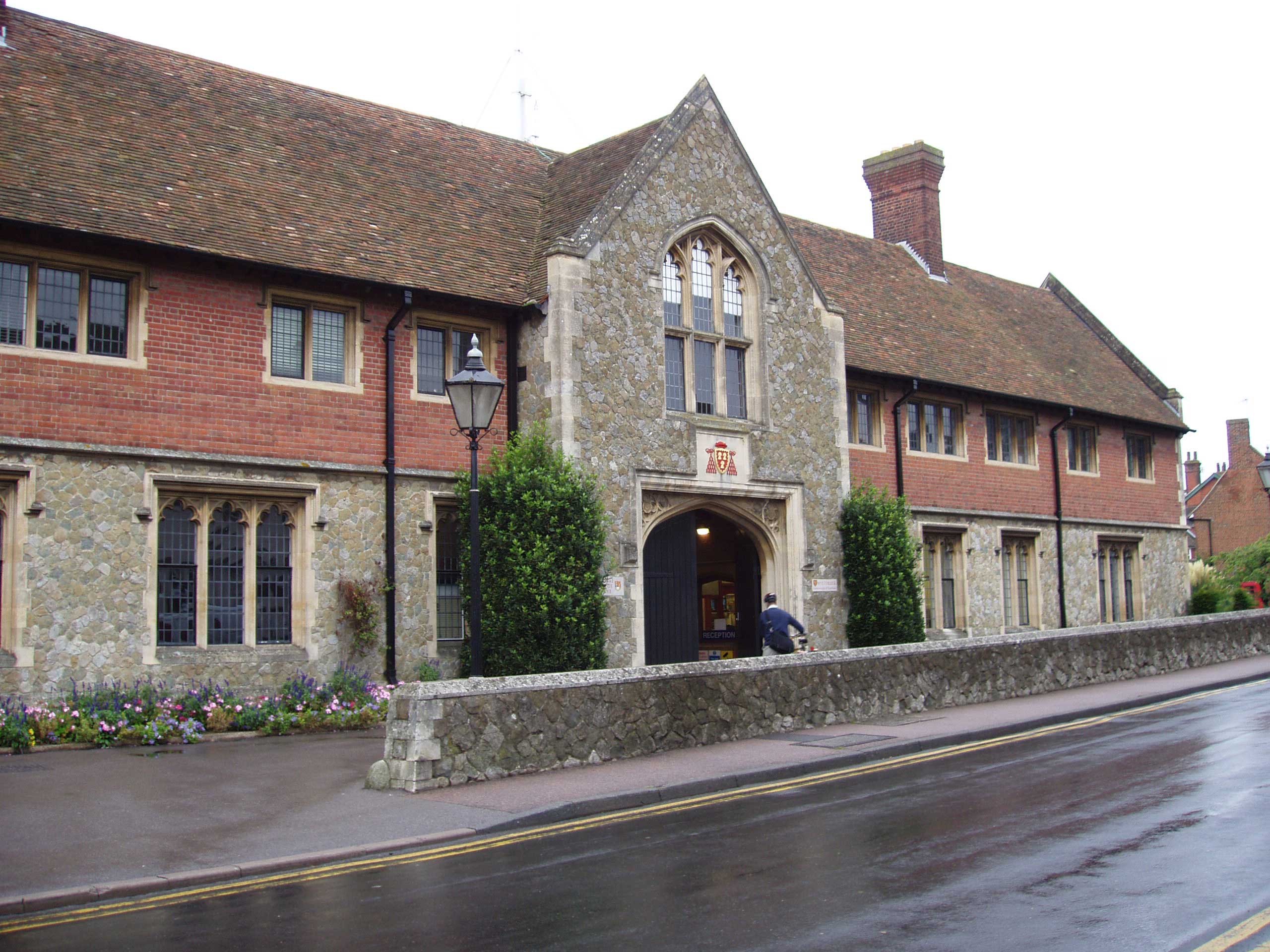
bio sciences -> social sciences -> business school Pictures of OLT, Old Hall,Cloister, Parlour --> The College of St Gregory and St Martin at Wye, commonly known as Wye College, was an education and research institution in the village of Wye, Kent. In 1447, Cardinal John Kempe founded his chantry there which also educated local children. , it still includes a rare, complete example of medieval chantry college buildings. After abolition in 1545, parts of the chantry buildings were variously occupied as mansion, grammar school and charity school, before purchase by Kent and Surrey County Councils to provide technical education. For over a hundred years Wye became that college of London University most concerned with rural subjects, including agricultural sciences; business management; agriculture; horticulture, and agricultural economics. Chemist and Actonian Prize winner, Louis Wain developed synthetic auxin selective herbicides 2,4-DB, MCPB, Bromoxynil and Ioxynil at Wye ... [...More Info...] [...Related Items...] OR: [Wikipedia] [Google] [Baidu] |
Ospringe
Ospringe is a village and area of Faversham in the English county of Kent. It is also the name of a civil parish, which since 1935 has not included the village of Ospringe. The village lies on the Roman road Watling Street (nowadays the A2 road), called Ospringe Street in the village. The historic Maison Dieu is on Ospringe Street. The remains of substantial Roman buildings have been found to its north west; the ruins of the abandoned Stone Chapel lie nearby. The largest settlement in the civil parish of Ospringe is now Painters Forstal, which lies a mile south west of the village of Ospringe. The civil parish also includes the hamlets of Brogdale and Whitehill. The civil parish had a population of 715 in 2001, increasing to 771 at the 2011 census. The parish church of St Paul and St Peter, a Grade II* listed building, lies half a mile south of the village of Ospringe and within the civil parish. It was built in the early 1200s. The church is in the diocese of Canterbury, ... [...More Info...] [...Related Items...] OR: [Wikipedia] [Google] [Baidu] |
Faversham
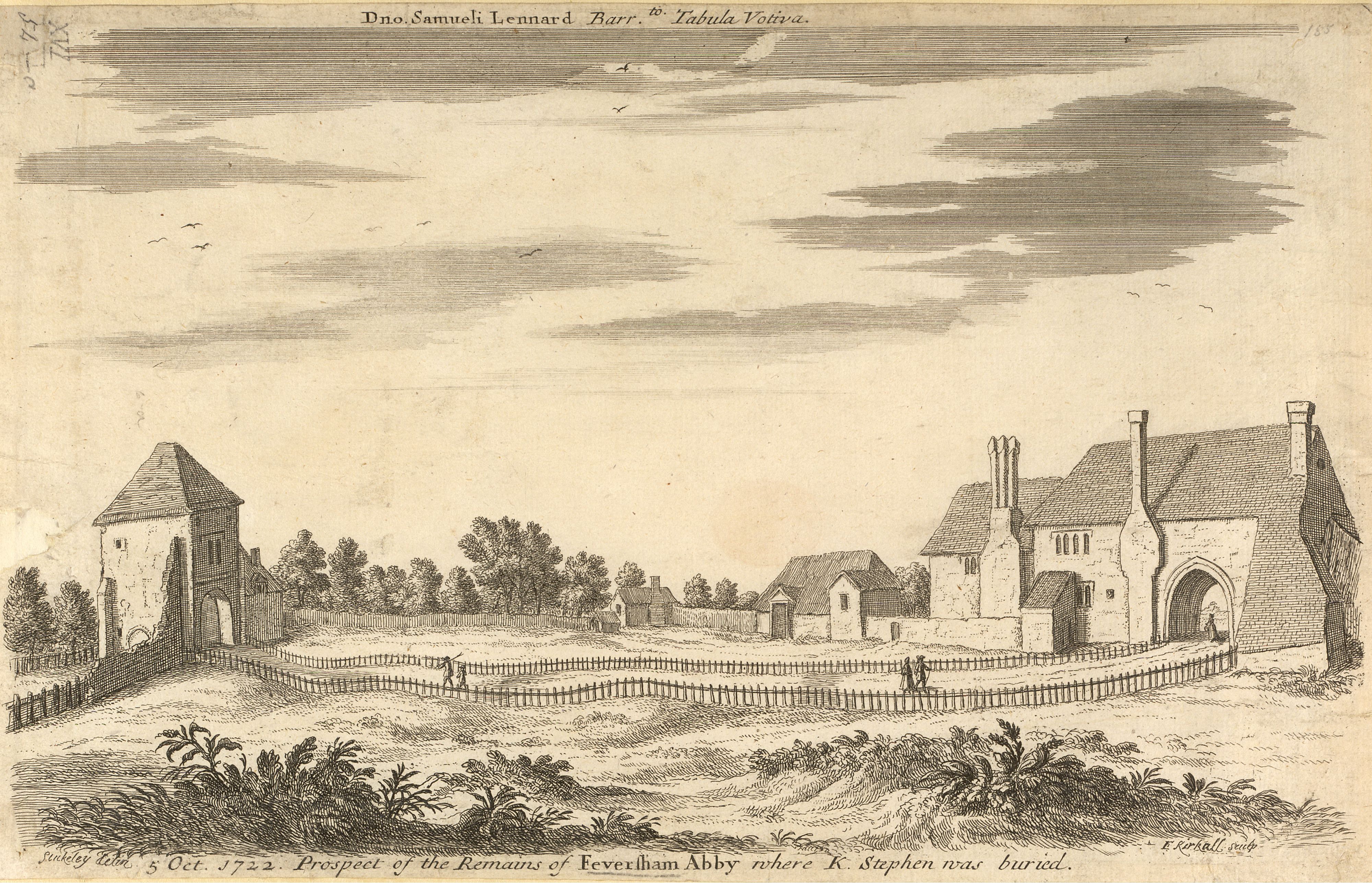
Faversham is a market town in Kent, England, from London and from Canterbury, next to the Swale, a strip of sea separating mainland Kent from the Isle of Sheppey in the Thames Estuary. It is close to the A2, which follows an ancient British trackway which was used by the Romans and the Anglo-Saxons, and known as Watling Street. The name is of Old English origin, meaning "the metal-worker's village". There has been a settlement at Faversham since pre-Roman times, next to the ancient sea port on Faversham Creek. It was inhabited by the Saxons and mentioned in the Domesday Book of 1086 as ''Favreshant''. The town was favoured by King Stephen who established Faversham Abbey, which survived until the Dissolution of the Monasteries in 1538. Subsequently, the town became an important seaport and established itself as a centre for brewing, and the Shepherd Neame Brewery, founded in 1698, remains a significant major employer. The town was also the centre of the explosives industry ... [...More Info...] [...Related Items...] OR: [Wikipedia] [Google] [Baidu] |
Kent
Kent is a county in South East England and one of the home counties. It borders Greater London to the north-west, Surrey to the west and East Sussex to the south-west, and Essex to the north across the estuary of the River Thames; it faces the French department of Pas-de-Calais across the Strait of Dover. The county town is Maidstone. It is the fifth most populous county in England, the most populous non-Metropolitan county and the most populous of the home counties. Kent was one of the first British territories to be settled by Germanic tribes, most notably the Jutes, following the withdrawal of the Romans. Canterbury Cathedral in Kent, the oldest cathedral in England, has been the seat of the Archbishops of Canterbury since the conversion of England to Christianity that began in the 6th century with Saint Augustine. Rochester Cathedral in Medway is England's second-oldest cathedral. Located between London and the Strait of Dover, which separates England from mainla ... [...More Info...] [...Related Items...] OR: [Wikipedia] [Google] [Baidu] |
Borough Of Swale
Swale is a local government district with borough status in Kent, England and is bounded by Medway to the west, Canterbury to the east, Ashford to the south and Maidstone to the south west. Its council is based in Sittingbourne. The district is named after the narrow channel called The Swale, that separates the mainland of Kent from the Isle of Sheppey, and which occupies the central part of the district. The district was formed in 1974 under the Local Government Act 1972, from the Borough of Faversham; the Borough of Queenborough-in-Sheppey, which covered the whole of Sheppey; the Sittingbourne and Milton Urban District; and Swale Rural District. Most of the southern half of the Borough lies within the Kent Downs Area of Outstanding Natural Beauty, whilst Sittingbourne and the Isle of Sheppey forms the concluding part of the Thames Gateway growth area. There are four towns in the borough: Sittingbourne and Faversham on the mainland, and Sheerness and Queenborough on S ... [...More Info...] [...Related Items...] OR: [Wikipedia] [Google] [Baidu] |
Faversham And Mid Kent (UK Parliament Constituency)
Faversham and Mid Kent is a constituency represented in the House of Commons of the UK Parliament. Since 2015, the seat has been represented by Helen Whately of the Conservative Party. Constituency profile Faversham and Mid Kent covers a mainly rural sweep around the North Downs, including part of Swale and Maidstone boroughs. Some of the traditional farming industry remains. Residents' health and wealth are around average for the UK. Boundaries 1997–2010: The Borough of Swale wards of Abbey, Boughton & Courtenay, Davington Priory, East Downs, St Ann's, Teynham and Lynsted, and Watling, and the Borough of Maidstone wards of Bearsted, Boxley, Detling, Harrietsham and Lenham, Headcorn, Hollingbourne, Langley, Leeds, Park Wood, Shepway East, Shepway West, Sutton Valence, and Thurnham. 2010–present: The Borough of Swale wards of Abbey, Boughton and Courtenay, Davington Priory, East Downs, St Ann's, and Watling, and the Borough of Maidstone wards of Bearsted, Boughton Monchelsea ... [...More Info...] [...Related Items...] OR: [Wikipedia] [Google] [Baidu] |
M2 Motorway (Great Britain)
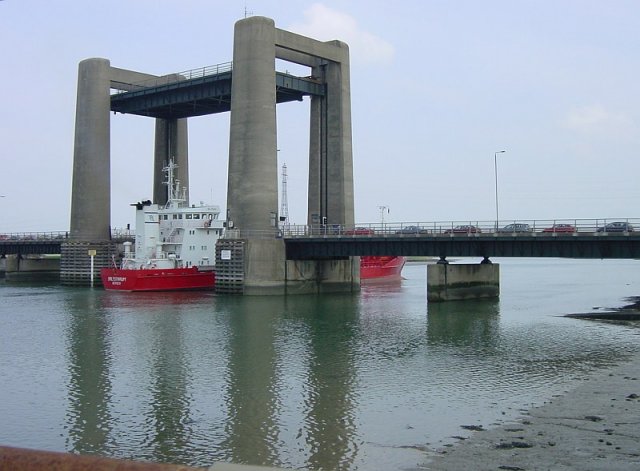
The M2 is a motorway in Kent, England. It is long and acts as a bypass of the section of the A2 road to run past the Medway Towns, Sittingbourne, Faversham, and to provide an alternative route to the Port of Dover, supplementing the M20. It feeds into the A2, forming a 62 mile long trunk road from London to (almost) Dover. Route The M2 starts west of Strood, Kent at Three Crutches, diverging southeastwards from the A2 road that heads ESE from Central London, one of five roads of dual carriageway width or greater reaching into the southern half of Greater London. From Junction 1 it has four lanes each way that slope into the Medway Valley south of Rochester. On the west bank of the River Medway is Junction 2 intersecting the A228 between Strood and West Malling, a junction where the master exit roundabout passes under the HS1 track and which retains, by footbridge and tunnel, the North Downs Way (a public footpath). By this point the road is mounted on the Medway Viaduct, ... [...More Info...] [...Related Items...] OR: [Wikipedia] [Google] [Baidu] |
Civil Parishes In England
In England, a civil parish is a type of Parish (administrative division), administrative parish used for Local government in England, local government. It is a territorial designation which is the lowest tier of local government below districts of England, districts and metropolitan and non-metropolitan counties of England, counties, or their combined form, the Unitary authorities of England, unitary authority. Civil parishes can trace their origin to the ancient system of Parish (Church of England), ecclesiastical parishes, which historically played a role in both secular and religious administration. Civil and religious parishes were formally differentiated in the 19th century and are now entirely separate. Civil parishes in their modern form came into being through the Local Government Act 1894, which established elected Parish councils in England, parish councils to take on the secular functions of the vestry, parish vestry. A civil parish can range in size from a sparsely ... [...More Info...] [...Related Items...] OR: [Wikipedia] [Google] [Baidu] |
Kent Downs
The Kent Downs is an Area of Outstanding Natural Beauty (AONB) in Kent, England. They are the eastern half of the North Downs and stretch from the London/ Surrey borders to the White Cliffs of Dover, including a small section of the London Borough of Bromley. The AONB also includes the Greensand Ridge, a prominent sandstone escarpment which lies south of the chalk escarpment of the North Downs. It was first designated as an AONB in July 1968 and covers 878 square km (326 square miles). The AONB's highest point is Toy's Hill, at 250m above sea level, and its boundaries include three main rivers: the Darent, Medway and Stour. To the west, Surrey Hills AONB adjoins the Kent Downs AONB, and includes a continuation of the North Downs chalk ridge which runs through the Kent Downs, stretching from Farnham to the English Channel and reappearing within the Parc Naturel Régional des Caps et Marais d’Opale in France. High Weald AONB lies to the south east, separated by a distance ... [...More Info...] [...Related Items...] OR: [Wikipedia] [Google] [Baidu] |
Area Of Outstanding Natural Beauty
An Area of Outstanding Natural Beauty (AONB; , AHNE) is an area of countryside in England, Wales, and Northern Ireland, that has been designated for conservation due to its significant landscape value. Areas are designated in recognition of their national importance by the relevant public body: Natural England, Natural Resources Wales, and the Northern Ireland Environment Agency respectively. In place of AONB, Scotland uses the similar national scenic area (NSA) designation. Areas of Outstanding Natural Beauty enjoy levels of protection from development similar to those of UK national parks, but unlike national parks the responsible bodies do not have their own planning powers. They also differ from national parks in their more limited opportunities for extensive outdoor recreation. History The idea for what would eventually become the AONB designation was first put forward by John Dower in his 1945 ''Report to the Government on National Parks in England and Wales''. Dower ... [...More Info...] [...Related Items...] OR: [Wikipedia] [Google] [Baidu] |
Manorialism
Manorialism, also known as the manor system or manorial system, was the method of land ownership (or "tenure") in parts of Europe, notably France and later England, during the Middle Ages. Its defining features included a large, sometimes fortified manor house in which the lord of the manor and his dependents lived and administered a rural estate, and a population of labourers who worked the surrounding land to support themselves and the lord. These labourers fulfilled their obligations with labour time or in-kind produce at first, and later by cash payment as commercial activity increased. Manorialism is sometimes included as part of the feudal system. Manorialism originated in the Roman villa system of the Late Roman Empire, and was widely practiced in medieval western Europe and parts of central Europe. An essential element of feudal society, manorialism was slowly replaced by the advent of a money-based market economy and new forms of agrarian contract. In examining the o ... [...More Info...] [...Related Items...] OR: [Wikipedia] [Google] [Baidu] |


