|
Brighstone Bay
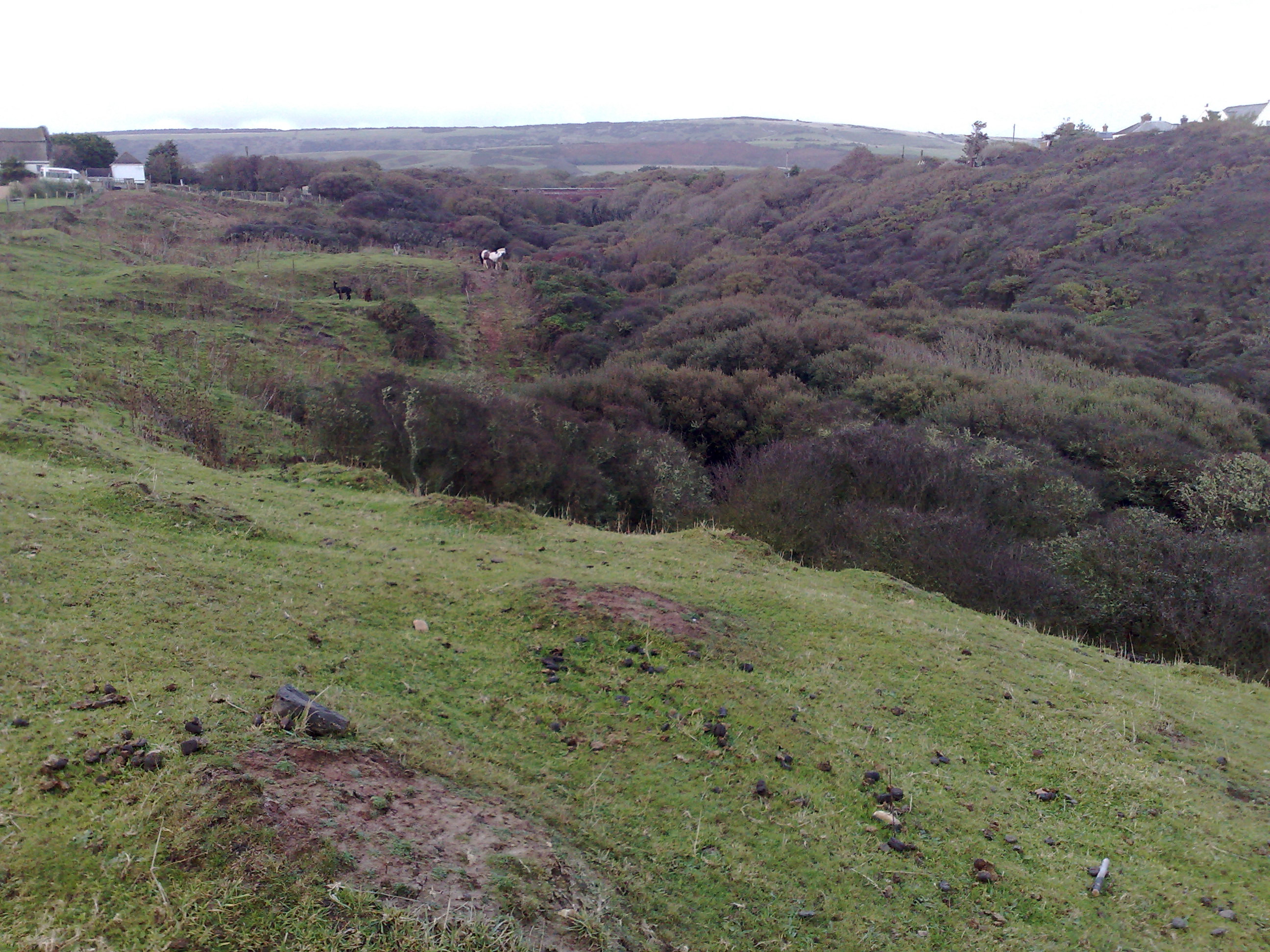
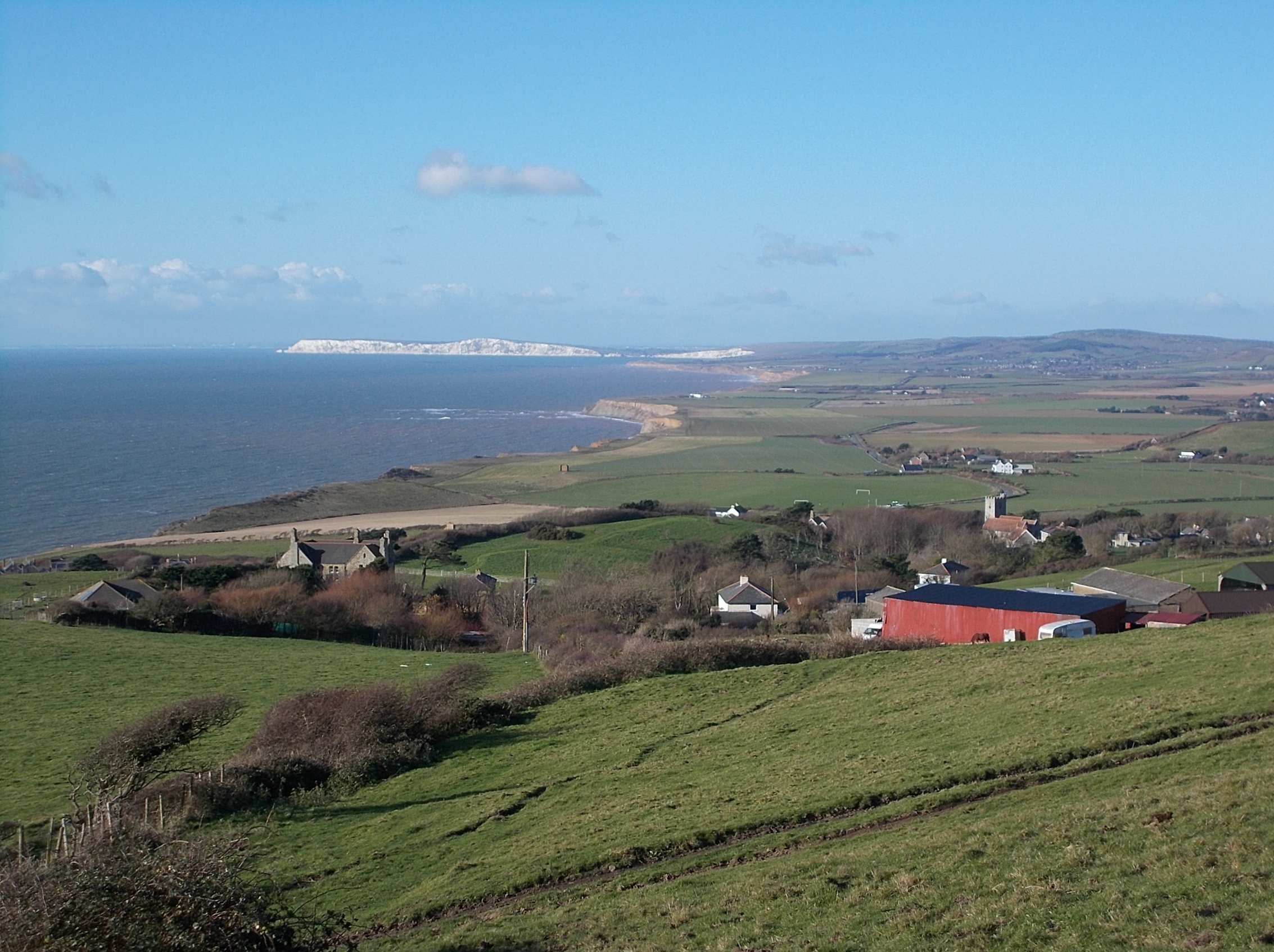
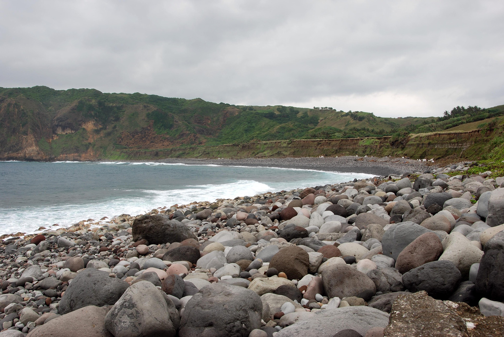
Brighstone Bay is a bay on the south west coast of the Isle of Wight, England. It lies to the south and west of the village of Brighstone from which it takes its name. It faces south west towards the English Channel, its shoreline is 7 km in length and is gently curving. It stretches from Sudmoor Point in the north west to Artherfield Point in the south east. Several chines, some with streams like the Buddle Brook (Grange Chine) lie along this coast. Like most of the coast along the South-West of the Island, Brighstone Bay is suffering from coastal erosion. Projecting out from this coast is one several ledges along the Back of the Wight. Brighstone Ledge has been the site of many shipwrecks as storms drive ships onto the hidden rocks. J.C Medland, "Shipwrecks of the Wight". Coach House Publications Ltd 2004 The seabed is a mixture of mud, sand and shells. The beach is predominantly shingle. The bay is best viewed from along the Isle of Wight Coastal Path Th ... [...More Info...] [...Related Items...] OR: [Wikipedia] [Google] [Baidu] |
Brighstone Bay, Isle Of Wight, UK
Brighstone is a village and civil parish on the Isle of Wight, 6 miles southwest of Newport, Isle of Wight, Newport on the B3399 road. Brighstone was previously known as "Brixton". The name derives from the Saxon name "Egbert of Wessex, Ecgbert's Tun". Brighstone is the largest village in the area locally known as the Back of the Wight and extends toward Limerstone and Mottistone. In Roman times a villa was built to the north, to take advantage of the clean waters of the Buddle Brook. History Brighstone history dates back to the 9th century when it was given to the Bishopric of Winchester by King Egbert. Brighstone parish was formed in 1644. The civil parish comprises the main village of Brighstone together with the smaller villages of Brook, Isle of Wight, Brook, Hulverstone, Limerstone and Mottistone. The entire parish lies within an area of the Isle of Wight Area of Outstanding Natural Beauty, Isle of Wight AONB and its coastline is designated as Heritage Coast and Site o ... [...More Info...] [...Related Items...] OR: [Wikipedia] [Google] [Baidu] |
Isle Of Wight
The Isle of Wight ( ) is a county in the English Channel, off the coast of Hampshire, from which it is separated by the Solent. It is the largest and second-most populous island of England. Referred to as 'The Island' by residents, the Isle of Wight has resorts that have been popular holiday destinations since Victorian times. It is known for its mild climate, coastal scenery, and verdant landscape of fields, downland and chines. The island is historically part of Hampshire, and is designated a UNESCO Biosphere Reserve. The island has been home to the poets Algernon Charles Swinburne and Alfred, Lord Tennyson. Queen Victoria built her summer residence and final home, Osborne House at East Cowes, on the Isle. It has a maritime and industrial tradition of boat-building, sail-making, the manufacture of flying boats, hovercraft, and Britain's space rockets. The island hosts annual music festivals, including the Isle of Wight Festival, which in 1970 was the largest rock music ... [...More Info...] [...Related Items...] OR: [Wikipedia] [Google] [Baidu] |
Brighstone
Brighstone is a village and civil parish on the Isle of Wight, 6 miles southwest of Newport on the B3399 road. Brighstone was previously known as "Brixton". The name derives from the Saxon name " Ecgbert's Tun". Brighstone is the largest village in the area locally known as the Back of the Wight and extends toward Limerstone and Mottistone. In Roman times a villa was built to the north, to take advantage of the clean waters of the Buddle Brook. History Brighstone history dates back to the 9th century when it was given to the Bishopric of Winchester by King Egbert. Brighstone parish was formed in 1644. The civil parish comprises the main village of Brighstone together with the smaller villages of Brook, Hulverstone, Limerstone and Mottistone. The entire parish lies within an area of the Isle of Wight AONB and its coastline is designated as Heritage Coast and Site of Special Scientific Interest. St. Mary's Church, Brighstone is a venerable old church that has stood for ... [...More Info...] [...Related Items...] OR: [Wikipedia] [Google] [Baidu] |
English Channel
The English Channel, "The Sleeve"; nrf, la Maunche, "The Sleeve" (Cotentinais) or ( Jèrriais), (Guernésiais), "The Channel"; br, Mor Breizh, "Sea of Brittany"; cy, Môr Udd, "Lord's Sea"; kw, Mor Bretannek, "British Sea"; nl, Het Kanaal, "The Channel"; german: Ärmelkanal, "Sleeve Channel" ( French: ''la Manche;'' also called the British Channel or simply the Channel) is an arm of the Atlantic Ocean that separates Southern England from northern France. It links to the southern part of the North Sea by the Strait of Dover at its northeastern end. It is the busiest shipping area in the world. It is about long and varies in width from at its widest to at its narrowest in the Strait of Dover."English Channel". ''The Columbia Encyclopedia'', 2004. It is the smallest of the shallow seas around the continental shelf of Europe, covering an area of some . The Channel was a key factor in Britain becoming a naval superpower and has been utilised by Britain as a natural def ... [...More Info...] [...Related Items...] OR: [Wikipedia] [Google] [Baidu] |
Buddle Brook
Buddle Brook a small river on the Isle of Wight, England. The Brook drains water from the southern side of Brighstone Down and as far to the east as the village of Shorwell. Its flow is the greatest of the streams in the South-West of the Island (the Back of the Wight Back of the Wight is an area on the Isle of Wight in England. The area has a distinct historical and social background, and is geographically isolated by the chalk hills, immediately to the North, as well as poor public transport infrastructure. ...). Near the village of Brighstone its body is split into a series of mill ponds built to power Yafford Mill and Brighstone Mill, and controlled ways passing through the village and under the noted local landmark, the Dragon Tree Brighstone. Beyond the village the stream is re-connected into one and flows into Grange/Marsh Chine. These are heavily vegetated and are the largest chine on the Island. The Brook runs all the way to the beach where its mouth is at least 4m ... [...More Info...] [...Related Items...] OR: [Wikipedia] [Google] [Baidu] |
Grange Chine
Grange Chine and Marsh Chine form a geological feature on the south west coast of the Isle of Wight, England. They lie to the south of the village of Brighstone. These two chines form the largest chine feature on the Isle of Wight. The Grange Chine starts at the southern edge of Brighstone and runs south-west, crosses under the A3055 Military Road at the hamlet of Marsh Green then continues for about five hundred metres to reach the beach at Brighstone Bay. The Marsh Chine starts to the east of Marsh Green alongside the A3055 and runs west where it joins the larger Grange Chine before it reaches the beach. Both chines have much shallower sides than other chines on the Isle of Wight and are extensively covered with hardy bushes, stunted trees and scrub. The Chines drain water from the southern slopes of Brighstone Down and from as far as Shorwell to the east. The stream ( the Buddle Brook) formed is significant enough to power two mills, Yafford Mill and Brighstone Mill ... [...More Info...] [...Related Items...] OR: [Wikipedia] [Google] [Baidu] |
Coastal Erosion
Coastal erosion is the loss or displacement of land, or the long-term removal of sediment and rocks along the coastline due to the action of waves, currents, tides, wind-driven water, waterborne ice, or other impacts of storms. The landward retreat of the shoreline can be measured and described over a temporal scale of tides, seasons, and other short-term cyclic processes. Coastal erosion may be caused by hydraulic action, abrasion, impact and corrosion by wind and water, and other forces, natural or unnatural. On non-rocky coasts, coastal erosion results in rock formations in areas where the coastline contains rock layers or fracture zones with varying resistance to erosion. Softer areas become eroded much faster than harder ones, which typically result in landforms such as tunnels, bridges, columns, and pillars. Over time the coast generally evens out. The softer areas fill up with sediment eroded from hard areas, and rock formations are eroded away. Also erosion commonly ... [...More Info...] [...Related Items...] OR: [Wikipedia] [Google] [Baidu] |
Back Of The Wight
Back of the Wight is an area on the Isle of Wight in England. The area has a distinct historical and social background, and is geographically isolated by the chalk hills, immediately to the North, as well as poor public transport infrastructure. Primarily agricultural, the Back of the Wight is made up of small villages spread out along the coast, including Brighstone, Shorwell and Mottistone. Geography The geographical boundaries of the Back of the Wight are imprecise and vary according to interpretation, however roughly speaking it comprises all the land located South of the Downs and East of Freshwater Bay until the curve in the Downs meets the sea near St. Catherine's Point. The main part of the Back of the Wight is formed of a large bay 18 miles long. The shore is edged by cliffs averaging around 300 feet high from Freshwater to Compton, broken at two points, Grange Chine and Brook Chine, which provide the only easy, natural access to the sea through steep gorges. Stretchi ... [...More Info...] [...Related Items...] OR: [Wikipedia] [Google] [Baidu] |
Shingle Beach
A shingle beach (also referred to as rocky beach or pebble beach) is a beach which is armoured with pebbles or small- to medium-sized cobbles (as opposed to fine sand). Typically, the stone composition may grade from characteristic sizes ranging from diameter. While this beach landform is most commonly found in Europe, examples are found in Bahrain, North America, and a number of other world regions, such as the west coast of New Zealand's South Island, where they are associated with the shingle fans of braided rivers. Though created at shorelines, post-glacial rebound can raise shingle beaches as high as above sea level, as on the High Coast in Sweden. The ecosystems formed by this unique association of rock and sand allow colonization by a variety of rare and endangered species. Formation Shingle beaches are typically steep, because the waves easily flow through the coarse, porous surface of the beach, decreasing the effect of backwash erosion and increasing the formati ... [...More Info...] [...Related Items...] OR: [Wikipedia] [Google] [Baidu] |

%2C_IW%2C_UK.jpg)


.jpg)


