Brighstone Bay on:
[Wikipedia]
[Google]
[Amazon]

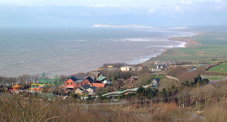
 Brighstone Bay is a bay on the south west coast of the

 Brighstone Bay is a bay on the south west coast of the
 Isle of Wight
The Isle of Wight ( ) is a county in the English Channel, off the coast of Hampshire, from which it is separated by the Solent. It is the largest and second-most populous island of England. Referred to as 'The Island' by residents, the Isle of ...
, England. It lies to the south and west of the village of Brighstone
Brighstone is a village and civil parish on the Isle of Wight, 6 miles southwest of Newport on the B3399 road. Brighstone was previously known as "Brixton". The name derives from the Saxon name " Ecgbert's Tun".
Brighstone is the largest vi ...
from which it takes its name. It faces south west towards the English Channel
The English Channel, "The Sleeve"; nrf, la Maunche, "The Sleeve" (Cotentinais) or ( Jèrriais), (Guernésiais), "The Channel"; br, Mor Breizh, "Sea of Brittany"; cy, Môr Udd, "Lord's Sea"; kw, Mor Bretannek, "British Sea"; nl, Het Kana ...
, its shoreline is 7 km in length and is gently curving. It stretches from Sudmoor Point in the north west to Artherfield Point in the south east.
Several chines, some with streams like the Buddle Brook (Grange Chine
Grange Chine and Marsh Chine form a geological feature on the south west coast of the Isle of Wight, England. They lie to the south of the village of Brighstone.
These two chines form the largest chine feature on the Isle of Wight. The Gran ...
) lie along this coast.
Like most of the coast along the South-West of the Island, Brighstone Bay is suffering from coastal erosion
Coastal erosion is the loss or displacement of land, or the long-term removal of sediment and rocks along the coastline due to the action of waves, currents, tides, wind-driven water, waterborne ice, or other impacts of storms. The landward ...
.
Projecting out from this coast is one several ledges along the Back of the Wight
Back of the Wight is an area on the Isle of Wight in England. The area has a distinct historical and social background, and is geographically isolated by the chalk hills, immediately to the North, as well as poor public transport infrastructure. ...
. Brighstone Ledge has been the site of many shipwrecks as storms drive ships onto the hidden rocks. J.C Medland, "Shipwrecks of the Wight". Coach House Publications Ltd 2004
The seabed is a mixture of mud, sand and shells. The beach is predominantly shingle.
The bay is best viewed from along the Isle of Wight Coastal Path
The Isle of Wight Coastal Path (or Coastal Footpath) is a circular long-distance footpath of 70 miles (113 km) around the Isle of Wight, UK. It follows public footpaths and minor lanes, with some sections along roads.
Route
The pa ...
which follows the whole bay along the cliff top.
References
External links
{{coord, 50.63, -1.4, type:waterbody_region:GB, display=title Bays of the Isle of Wight Brighstone