|
Bridport Sand Formation
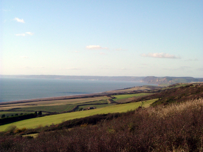
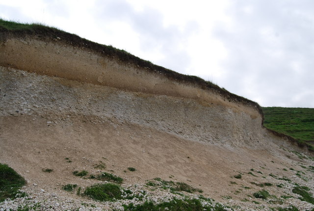
The Bridport Sand Formation is a formation of Toarcian (Early Jurassic) age found in the Worcester and Wessex Basins of central and southern England. It forms one of the reservoir units in the Wytch Farm oilfield in Dorset. The sandstone is very-fine grained to fine-grained and contains regular narrow bands that are calcite- cemented and more resistant to weathering, giving it a characteristic banded appearance at outcrop, such as in the cliffs between Bridport and Burton Bradstock in Dorset. It is named for Bridport and has previously been known as the Midford Sand(s), Cotteswold Sands, Yeovil Sands and Upper Lias Sand(s). It forms a locally important aquifer, particularly around Yeovil. Extent and thickness The Bridport Sand Formation is known from exposures in Dorset, Somerset and Gloucestershire and from the subsurface in numerous boreholes. It is also present offshore in the Portland–South Wight Basin, a sub-basin of the Wessex Basin. It reaches a maximum thickness of over ... [...More Info...] [...Related Items...] OR: [Wikipedia] [Google] [Baidu] |
Burton Bradstock
Burton Bradstock is a village and civil parish in Dorset, England, approximately southeast of Bridport and inland from the English Channel at Chesil Beach. In the 2011 United Kingdom census, 2011 Census the parish had a population of 948. The village lies in the Bride Valley, close to the mouth of the small River Bride, Dorset, River Bride. It comprises 16th- and 17th-century thatched cottages, a parish church (dedicated to St Mary the Virgin), two pubs, a primary school, shop, post office stores, beach café, hotel, garage, village hall, reading room a library. The parish has a National Coastwatch Institution Station, Lyme Bay Station. History The place was first recorded in the Domesday Book of 1086 as ''Bridetone'', it had 28 households and the lord of the manor was the Abbey of Saint-Wandrille. The toponym means the place (Old English ''tūn'') on the River Bride, and therefore has a different origin from most places named "Burton", including Burton, Dorset. In 1286 land ... [...More Info...] [...Related Items...] OR: [Wikipedia] [Google] [Baidu] |
Wytch Farm
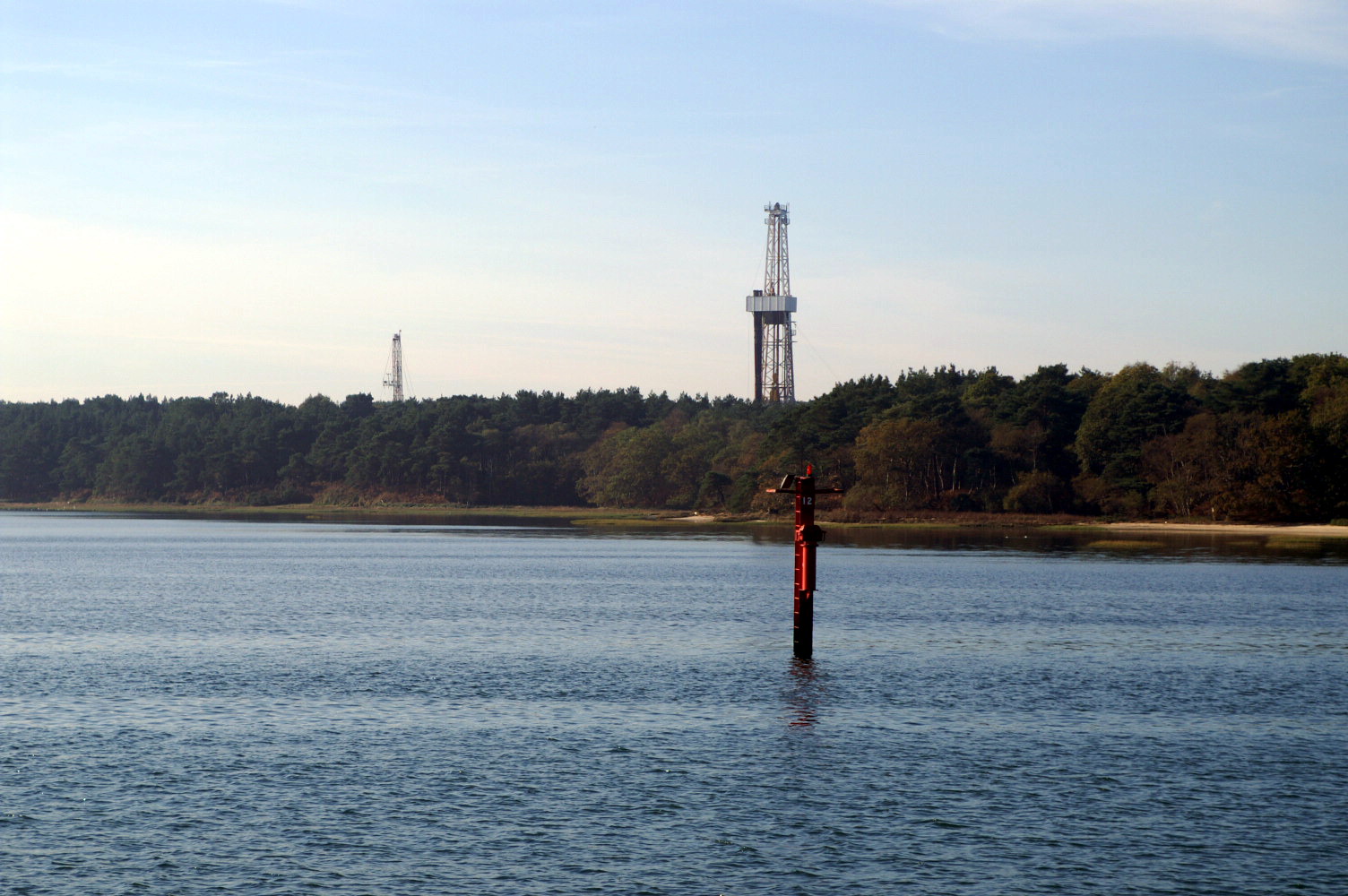
Wytch Farm is an oil field and processing facility in the Purbeck district of Dorset, England. It is the largest onshore oil field in western Europe. The facility, taken over by Perenco in 2011, was previously operated by BP. It is located in a coniferous forest on Wytch Heath on the southern shore of Poole Harbour, two miles (3.2 km) north of Corfe Castle. Oil and natural gas (methane) are both exported by pipeline; liquefied petroleum gas is exported by road tanker. History Name The oil field takes its name from the neighbouring Wytch Farm which had existed on the site for many centuries on the fringes of Wytch Heath. Pre-1973 The earliest industry in the Wytch Farm area dated to the early medieval period and featured multiple salt production workshops. The workshops, adjacent to the modern oilfield, were part of a medieval salt industry owned by Milton Abbey. The site was excavated by Bournemouth University under the directorship of Dr Derek Pitman. The Isle of Purbe ... [...More Info...] [...Related Items...] OR: [Wikipedia] [Google] [Baidu] |
Goethite
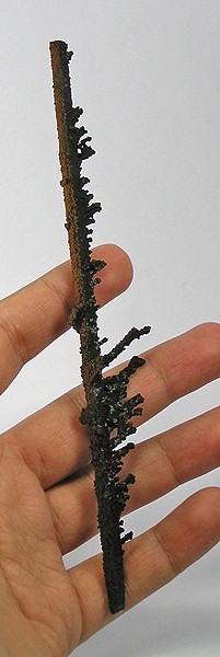
Goethite (, ) is a mineral of the diaspore group, consisting of iron(III) oxide-hydroxide, specifically the "α" polymorph. It is found in soil and other low-temperature environments such as sediment. Goethite has been well known since ancient times for its use as a pigment (brown ochre). Evidence has been found of its use in paint pigment samples taken from the caves of Lascaux in France. It was first described in 1806 based on samples found in the Hollertszug Mine in Herdorf, Germany. The mineral was named after the German polymath and poet Johann Wolfgang von Goethe (1749–1832). Composition Goethite is an iron oxyhydroxide containing ferric iron. It is the main component of rust and bog iron ore. Goethite's hardness ranges from 5.0 to 5.5 on the Mohs Scale, and its specific gravity varies from 3.3 to 4.3. The mineral forms prismatic needle-like crystals ("needle ironstone") but is more typically massive. Feroxyhyte and lepidocrocite are both polymorphs of the iron oxy ... [...More Info...] [...Related Items...] OR: [Wikipedia] [Google] [Baidu] |
Cementation (geology)
Cementation involves ions carried in groundwater chemically precipitating to form new crystalline material between sedimentary grains. The new pore-filling minerals forms "bridges" between original sediment grains, thereby binding them together. In this way, ''sand'' becomes sandstone, and ''gravel'' becomes conglomerate or breccia. Cementation occurs as part of the diagenesis or lithification of sediments. Cementation occurs primarily below the water table regardless of sedimentary grain sizes present. Large volumes of pore water must pass through sediment pores for new mineral cements to crystallize and so millions of years are generally required to complete the cementation process. Common mineral cements include calcite, quartz, and silica phases like cristobalite, iron oxides, and clay minerals; other mineral cements also occur. Cementation is continuous in the groundwater zone, so much so that the term "zone of cementation" is sometimes used interchangeably. Cementati ... [...More Info...] [...Related Items...] OR: [Wikipedia] [Google] [Baidu] |
Limestone
Limestone ( calcium carbonate ) is a type of carbonate sedimentary rock which is the main source of the material lime. It is composed mostly of the minerals calcite and aragonite, which are different crystal forms of . Limestone forms when these minerals precipitate out of water containing dissolved calcium. This can take place through both biological and nonbiological processes, though biological processes, such as the accumulation of corals and shells in the sea, have likely been more important for the last 540 million years. Limestone often contains fossils which provide scientists with information on ancient environments and on the evolution of life. About 20% to 25% of sedimentary rock is carbonate rock, and most of this is limestone. The remaining carbonate rock is mostly dolomite, a closely related rock, which contains a high percentage of the mineral dolomite, . ''Magnesian limestone'' is an obsolete and poorly-defined term used variously for dolomite, for limes ... [...More Info...] [...Related Items...] OR: [Wikipedia] [Google] [Baidu] |
Glauconite
Glauconite is an iron potassium phyllosilicate ( mica group) mineral of characteristic green color which is very friable and has very low weathering resistance. It crystallizes with a monoclinic geometry. Its name is derived from the Greek () meaning 'bluish green', referring to the common blue-green color of the mineral; its sheen ( mica glimmer) and blue-green color. Its color ranges from olive green, black green to bluish green, and yellowish on exposed surfaces due to oxidation. In the Mohs scale it has hardness of 2. The relative specific gravity range is 2.4 - 2.95. It is normally found in dark green rounded brittle pellets, and with the dimension of a sand grain size. It can be confused with chlorite (also of green color) or with a clay mineral. Glauconite has the chemical formula . Glauconite particles are one of the main components of greensand, glauconitic siltstone and glauconitic sandstone. Glauconite has been called a marl in an old and broad sense of that word. ... [...More Info...] [...Related Items...] OR: [Wikipedia] [Google] [Baidu] |
Calcareous
Calcareous () is an adjective meaning "mostly or partly composed of calcium carbonate", in other words, containing lime or being chalky. The term is used in a wide variety of scientific disciplines. In zoology ''Calcareous'' is used as an adjectival term applied to anatomical structures which are made primarily of calcium carbonate, in animals such as gastropods, i.e., snails, specifically about such structures as the operculum, the clausilium, and the love dart. The term also applies to the calcium carbonate tests of often more or less microscopic Foraminifera. Not all tests are calcareous; diatoms and radiolaria have siliceous tests. The molluscs are calcareous, as are calcareous sponges ( Porifera), that have spicules which are made of calcium carbonate. In botany ''Calcareous grassland'' is a form of grassland characteristic of soils containing much calcium carbonate from underlying chalk or limestone rock. In medicine The term is used in pathology, for example i ... [...More Info...] [...Related Items...] OR: [Wikipedia] [Google] [Baidu] |
Facies
In geology, a facies ( , ; same pronunciation and spelling in the plural) is a body of rock with specified characteristics, which can be any observable attribute of rocks (such as their overall appearance, composition, or condition of formation), and the changes that may occur in those attributes over a geographic area. A facies encompasses all of the characteristics of a rock including its chemical, physical, and biological features that distinguish it from adjacent rock. The term facies was introduced by the Swiss geologist Amanz Gressly in 1838 and was part of his significant contribution to the foundations of modern stratigraphy, which replaced the earlier notions of Neptunism. Types of facies Sedimentary facies Ideally, a Sedimentary structures, sedimentary facies is a distinctive rock unit that forms under certain conditions of sedimentation, reflecting a particular process or environment. Sedimentary facies are either descriptive or interpretative. Sedimentary facies ... [...More Info...] [...Related Items...] OR: [Wikipedia] [Google] [Baidu] |
Lithology
The lithology of a rock unit is a description of its physical characteristics visible at outcrop, in hand or core samples, or with low magnification microscopy. Physical characteristics include colour, texture, grain size, and composition. Lithology may refer to either a detailed description of these characteristics, or a summary of the gross physical character of a rock. Examples of lithologies in the second sense include sandstone, slate, basalt, or limestone. Lithology is the basis of subdividing rock sequences into individual lithostratigraphic units for the purposes of mapping and correlation between areas. In certain applications, such as site investigations, lithology is described using a standard terminology such as in the European geotechnical standard Eurocode 7. Rock type The naming of a lithology is based on the rock type. The three major rock types are igneous, sedimentary, and metamorphic. Igneous rocks are formed directly from magma, which is a mixture of ... [...More Info...] [...Related Items...] OR: [Wikipedia] [Google] [Baidu] |
Gloucestershire
Gloucestershire ( abbreviated Glos) is a county in South West England. The county comprises part of the Cotswold Hills, part of the flat fertile valley of the River Severn and the entire Forest of Dean. The county town is the city of Gloucester and other principal towns and villages include Cheltenham, Cirencester, Kingswood, Bradley Stoke, Stroud, Thornbury, Yate, Tewkesbury, Bishop's Cleeve, Churchdown, Brockworth, Winchcombe, Dursley, Cam, Berkeley, Wotton-under-Edge, Tetbury, Moreton-in-Marsh, Fairford, Lechlade, Northleach, Stow-on-the-Wold, Chipping Campden, Bourton-on-the-Water, Stonehouse, Nailsworth, Minchinhampton, Painswick, Winterbourne, Frampton Cotterell, Coleford, Cinderford, Lydney and Rodborough and Cainscross that are within Stroud's urban area. Gloucestershire borders Herefordshire to the north-west, Worcestershire to the north, Warwickshire to the north-east, Oxfordshire to the east, Wiltshire to the south, Bristol and Somerset ... [...More Info...] [...Related Items...] OR: [Wikipedia] [Google] [Baidu] |
Somerset
( en, All The People of Somerset) , locator_map = , coordinates = , region = South West England , established_date = Ancient , established_by = , preceded_by = , origin = , lord_lieutenant_office =Lord Lieutenant of Somerset , lord_lieutenant_name = Mohammed Saddiq , high_sheriff_office =High Sheriff of Somerset , high_sheriff_name = Mrs Mary-Clare Rodwell (2020–21) , area_total_km2 = 4171 , area_total_rank = 7th , ethnicity = 98.5% White , county_council = , unitary_council = , government = , joint_committees = , admin_hq = Taunton , area_council_km2 = 3451 , area_council_rank = 10th , iso_code = GB-SOM , ons_code = 40 , gss_code = , nuts_code = UKK23 , districts_map = , districts_list = County council area: , MPs = * Rebecca Pow (C) * Wera Hobhouse ( LD) * Liam Fox (C) * David Warburton (C) * Marcus Fysh (C) * Ian Liddell-Grainger (C) * James Heappey (C) * Jacob Rees-Mogg (C) * John Penrose (C) , police = Avon and Somerset Police ... [...More Info...] [...Related Items...] OR: [Wikipedia] [Google] [Baidu] |
Aquifer
An aquifer is an underground layer of water-bearing, permeable rock, rock fractures, or unconsolidated materials (gravel, sand, or silt). Groundwater from aquifers can be extracted using a water well. Aquifers vary greatly in their characteristics. The study of water flow in aquifers and the characterization of aquifers is called hydrogeology. Related terms include aquitard, which is a bed of low permeability along an aquifer, and aquiclude (or ''aquifuge''), which is a solid, impermeable area underlying or overlying an aquifer, the pressure of which could create a confined aquifer. The classification of aquifers is as follows: Saturated versus unsaturated; aquifers versus aquitards; confined versus unconfined; isotropic versus anisotropic; porous, karst, or fractured; transboundary aquifer. Challenges for using groundwater include: overdrafting (extracting groundwater beyond the Dynamic equilibrium, equilibrium yield of the aquifer), groundwater-related subsidence of land, gro ... [...More Info...] [...Related Items...] OR: [Wikipedia] [Google] [Baidu] |


