|
Bridgeport, New Jersey
Bridgeport is a census-designated place{ (CDP) and unincorporated community that is part of Logan Township, in Gloucester County, in the U.S. state of New Jersey. At the 2020 United States census, the population of the CDP was 389. in the 2010 census, the population was 504.DP-1 Profile of General Population and Housing Characteristics: 2010 from the 2010 Demographic Profile Data for ZCTA5 08014 , . Accessed March 16, 2015. The area is served as |
Census-designated Place
A census-designated place (CDP) is a concentration of population defined by the United States Census Bureau for statistical purposes only. CDPs have been used in each decennial census since 1980 as the counterparts of incorporated places, such as self-governing cities, towns, and villages, for the purposes of gathering and correlating statistical data. CDPs are populated areas that generally include one officially designated but currently unincorporated community, for which the CDP is named, plus surrounding inhabited countryside of varying dimensions and, occasionally, other, smaller unincorporated communities as well. CDPs include small rural communities, edge cities, colonias located along the Mexico–United States border, and unincorporated resort and retirement communities and their environs. The boundaries of any CDP may change from decade to decade, and the Census Bureau may de-establish a CDP after a period of study, then re-establish it some decades later. Most unin ... [...More Info...] [...Related Items...] OR: [Wikipedia] [Google] [Baidu] |
Swedesboro, New Jersey
Swedesboro is a borough in Gloucester County in the U.S. state of New Jersey. As of the 2010 U.S. census, the borough's population was 2,584,DP-1 - Profile of General Population and Housing Characteristics: 2010 for Swedesboro borough, Gloucester County, New Jersey , . Accessed January 26, 2012. [...More Info...] [...Related Items...] OR: [Wikipedia] [Google] [Baidu] |
New Jersey Route 324
Route 324 is an isolated and partially closed state highway in Logan Township in the U.S. state of New Jersey. The two-lane concrete route runs along the alignment of Old Ferry Road from the shore of the Delaware River to a cul-de-sac near the interchange between U.S. Route 322 (US 322) and US 130 in Logan Township. The route does not intersect with any state routes or county routes along its entire alignment. The portion from the Delaware River to Springers Lane, consisting of over half of the route, is marked with a "Road Closed" sign, with minimal if any maintenance — potholes and overgrowing vegetation plague this section. Route 324 was a former alignment of US 322 that served the Bridgeport-Chester ferry between Bridgeport, New Jersey, and Chester, Pennsylvania. The ferry first ran on July 1, 1930, with US 322 being designated along the ferry and its access road in 1936 from Pennsylvania. The highway and ferry also shared the co-designa ... [...More Info...] [...Related Items...] OR: [Wikipedia] [Google] [Baidu] |
New Jersey Route 44
Route 44 is a state highway located in Gloucester County in the U.S. state of New Jersey. It runs from Barker Avenue in Bridgeport to a cul-de-sac at a ramp from southbound Interstate 295 (I-295) and U.S. Route 130 (US 130) in Thorofare. The route, which is mostly a two-lane undivided road, passes through the communities of Gibbstown and Paulsboro in the northern part of the county, a short distance south of the Delaware River. Route 44 generally runs a short distance to the north of I-295/US 130 for much of its length. In 1923, Route 17S was legislated along the current route followed by Route 44 today, running between Penns Grove and Westville. The only portion of Route 17S ever built ran from Penns Grove to Salem. Route 44 was designated in 1927 to replace Route 17S between Penns Grove and Westville. By the 1940s, Route 44 was extended south to Salem and US 130 was designated concurrent with the route north of Penns Grove. Several spurs of Route 44 had existed or were ... [...More Info...] [...Related Items...] OR: [Wikipedia] [Google] [Baidu] |
Interstate 295 (Delaware–Pennsylvania)
Interstate 295 (I-295) in Delaware, New Jersey, and Pennsylvania is an auxiliary Interstate Highway, designated as a bypass around Philadelphia and a partial beltway of Trenton, New Jersey. The route begins at a junction with I-95 south of Wilmington, Delaware, and runs to an interchange with I-95 in Bristol Township, Pennsylvania. The highway heads east from I-95 and crosses the Delaware River into New Jersey on the Delaware Memorial Bridge concurrent with U.S. Route 40 (US 40). Upon entering New Jersey, I-295 runs concurrent with the New Jersey Turnpike and US 40 for a brief until splitting away at Exit 1, and runs parallel to the turnpike for most of its course in the state. After a concurrency with US 130 in Gloucester County, I-295 has an interchange with I-76 and Route 42 in Camden County. The freeway continues northeast toward Trenton, where it intersects I-195 and Route 29 before bypassing the city to the east, north, and west, ... [...More Info...] [...Related Items...] OR: [Wikipedia] [Google] [Baidu] |
Commodore Barry Bridge
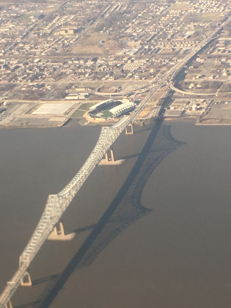
The Commodore Barry Bridge (also known as the Commodore John Barry Bridge or John Barry Bridge) is a cantilever bridge that spans the Delaware River from Chester, Pennsylvania to Bridgeport, in Logan Township, New Jersey. It is named after the American Revolutionary War hero and Philadelphia resident John Barry. Along with the Betsy Ross Bridge, the Benjamin Franklin Bridge and the Walt Whitman Bridge, the Commodore Barry Bridge is one of the four toll bridges connecting the metropolitan Philadelphia region with southern New Jersey owned by the Delaware River Port Authority (DRPA). Originally designed to connect with a now-cancelled freeway, the limited-access bridge has recently been retrofitted to better serve the local area. Between 2007 and 2011, both the DRPA and the PennDOT, in conjunction with the Chester Redevelopment Authority, built a pair of entrance-exit ramps that allowed motorists, primarily heavy truck traffic, to access the Chester Waterfront, via Pennsylvan ... [...More Info...] [...Related Items...] OR: [Wikipedia] [Google] [Baidu] |
Raccoon Creek (New Jersey)
Raccoon Creek is a U.S. Geological Survey. National Hydrography Dataset high-resolution flowline dataThe National Map accessed April 1, 2011 tributary of the Delaware River in southern New Jersey. Location Raccoon Creek rises to the west of Glassboro, and flows west, meeting Cartwheel Brook at Wrights Mill. Just below, it is impounded to form Gilman Lake. It turns to the north and is again dammed to form Ewan Lake. Clems Run and Miery Run empty into the stream, which is steeply banked on the east side. It flows through Mullica Hill (formerly the head of navigation), where it is dammed to form Mullica Hill Pond, and turns west again, flowing through a wide but steep valley. The South Branch (of the creek) joins it about east of the town. Flowing along the north side of Swedesboro, the creek becomes tidal and passes under the Locke Avenue Bridge, a swing bridge replaced in 2002 by a fixed span. The creek turns north again and meanders through the marshlands, passing under the ... [...More Info...] [...Related Items...] OR: [Wikipedia] [Google] [Baidu] |
Delaware River
The Delaware River is a major river in the Mid-Atlantic (United States), Mid-Atlantic region of the United States. From the meeting of its branches in Hancock (village), New York, Hancock, New York, the river flows for along the borders of New York (state), New York, Pennsylvania, New Jersey, and Delaware, before emptying into Delaware Bay. It is the longest free-flowing river in the Eastern United States. The river has been recognized by the National Wildlife Federation as one of the country's Great Waters. The river's drainage basin, watershed drains an area of and provides drinking water for 17 million people. The river has two branches that rise in the Catskill Mountains of New York: the West Branch Delaware River, West Branch at Mount Jefferson (New York), Mount Jefferson in Jefferson, New York, Jefferson, Schoharie County, New York, Schoharie County, and the East Branch Delaware River, East Branch at Grand Gorge, New York, Grand Gorge, Delaware County, New York, ... [...More Info...] [...Related Items...] OR: [Wikipedia] [Google] [Baidu] |
The Washington Post
''The Washington Post'' (also known as the ''Post'' and, informally, ''WaPo'') is an American daily newspaper published in Washington, D.C. It is the most widely circulated newspaper within the Washington metropolitan area and has a large national audience. Daily broadsheet editions are printed for D.C., Maryland, and Virginia. The ''Post'' was founded in 1877. In its early years, it went through several owners and struggled both financially and editorially. Financier Eugene Meyer purchased it out of bankruptcy in 1933 and revived its health and reputation, work continued by his successors Katharine and Phil Graham (Meyer's daughter and son-in-law), who bought out several rival publications. The ''Post'' 1971 printing of the Pentagon Papers helped spur opposition to the Vietnam War. Subsequently, in the best-known episode in the newspaper's history, reporters Bob Woodward and Carl Bernstein led the American press's investigation into what became known as the Watergate scandal ... [...More Info...] [...Related Items...] OR: [Wikipedia] [Google] [Baidu] |
Irradiated Mail
Irradiated mail is mail that has been deliberately exposed to radiation, typically in an effort to disinfect it. The most notable instance of mail irradiation in the US occurred in response to the 2001 anthrax attacks; the level of radiation chosen to kill anthrax spores was so high that it often changed the physical appearance of the mail. The United States Postal Service began to irradiate mail in November 2001, in response to the discovery of large-scale contamination at several of its facilities that handled the letters that were sent in the attacks. A facility in Bridgeport, New Jersey, operated by Sterigenics International, uses a Rhodotron continuous wave electron beam accelerator built by IBA Industrial, to irradiate the mail. A few facilities were planning to use cobalt-60 sources, though it is unclear whether this was ever done. Effect on mail The USPS warned that a number of products could be adversely affected, such as seeds, photographic film, biological samples, f ... [...More Info...] [...Related Items...] OR: [Wikipedia] [Google] [Baidu] |
2001 Anthrax Attacks
The 2001 anthrax attacks, also known as Amerithrax (a portmanteau of "America" and "anthrax", from its FBI case name), occurred in the United States over the course of several weeks beginning on September 18, 2001, one week after the September 11 terrorist attacks. Letters containing anthrax spores were mailed to several news media offices and to Democratic Senators Tom Daschle and Patrick Leahy, killing five people and infecting 17 others. According to the FBI, the ensuing investigation became "one of the largest and most complex in the history of law enforcement". A major focus in the early years of the investigation was bioweapons expert Steven Hatfill, who was eventually exonerated. Bruce Edwards Ivins, a scientist at the government's biodefense labs at Fort Detrick in Frederick, Maryland, became a focus around April 4, 2005. On April 11, 2007, Ivins was put under periodic surveillance and an FBI document stated that he was "an extremely sensitive suspect in the 2001 anthrax ... [...More Info...] [...Related Items...] OR: [Wikipedia] [Google] [Baidu] |
Stockholm
Stockholm () is the Capital city, capital and List of urban areas in Sweden by population, largest city of Sweden as well as the List of urban areas in the Nordic countries, largest urban area in Scandinavia. Approximately 980,000 people live in the Stockholm Municipality, municipality, with 1.6 million in the Stockholm urban area, urban area, and 2.4 million in the Metropolitan Stockholm, metropolitan area. The city stretches across fourteen islands where Mälaren, Lake Mälaren flows into the Baltic Sea. Outside the city to the east, and along the coast, is the island chain of the Stockholm archipelago. The area has been settled since the Stone Age, in the 6th millennium BC, and was founded as a city in 1252 by Swedish statesman Birger Jarl. It is also the county seat of Stockholm County. For several hundred years, Stockholm was the capital of Finland as well (), which then was a part of Sweden. The population of the municipality of Stockholm is expected to reach o ... [...More Info...] [...Related Items...] OR: [Wikipedia] [Google] [Baidu] |
.jpg)


