|
Breadalbane Hydro-Electric Scheme
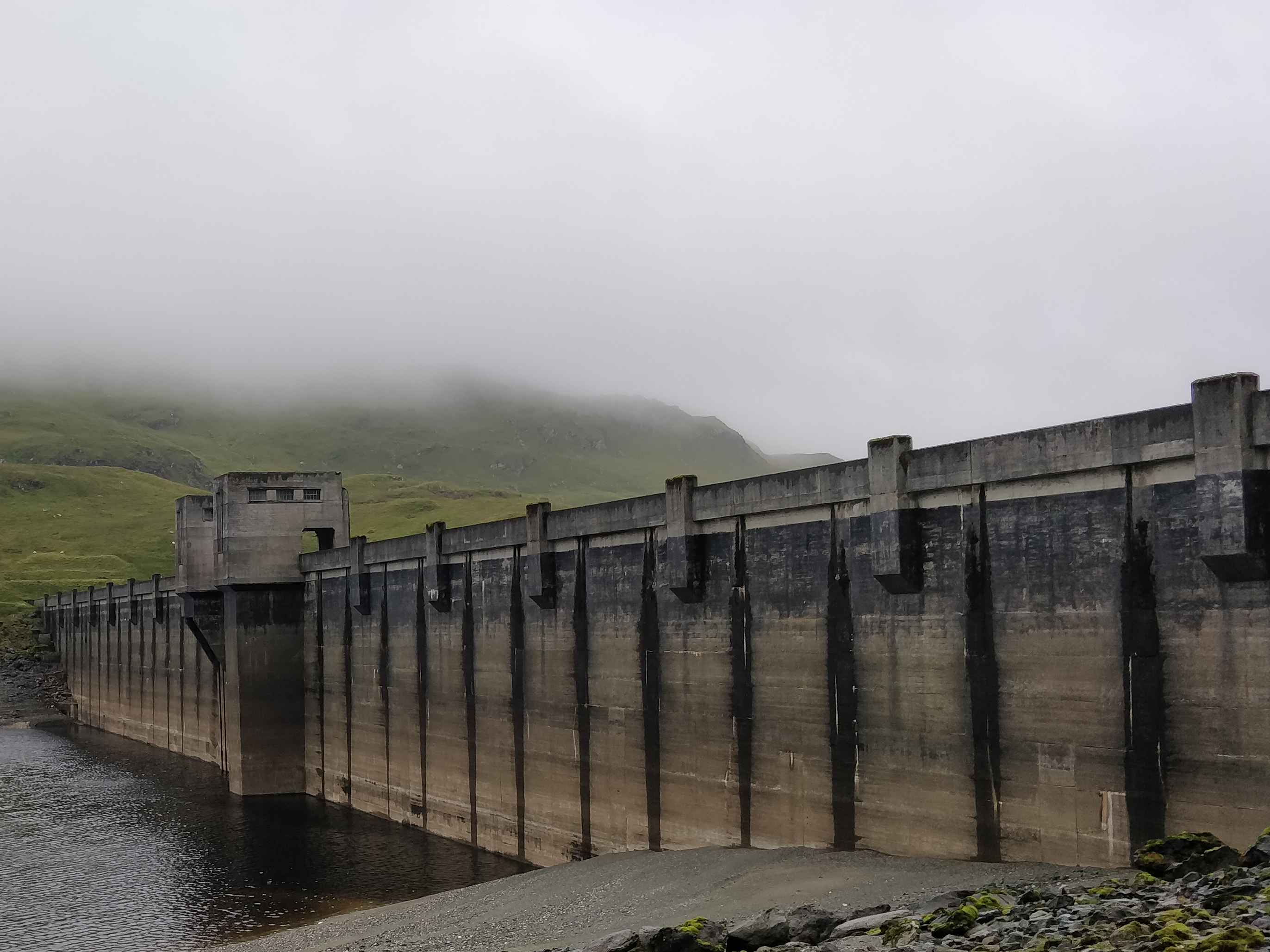
The Breadalbane Hydro-Electric Scheme is a hydroelectric scheme in the Breadalbane area of Perthshire, Scotland. It comprises seven power stations which generate 120MW of power from the dams around Loch Lyon, Loch Earn and Loch Tay. History Construction began in 1951. The Lawers Dam section began generating in 1956. The dam measures long and in height. Water descends a vertical distance of , the highest drop of any scheme in Scotland. Further facilities were added at Killin Killin (; (Scottish Gaelic: ''Cill Fhinn'') is a village in Perthshire in the central highlands of Scotland. Situated at the western head of Loch Tay, it is administered by the Stirling Council area. Killin is a historic conservation village an ... and Stronuich. The construction was completed in 1961. References External links Hydroelectric power stations in Scotland Buildings and structures in Perth and Kinross {{powerstation-stub ... [...More Info...] [...Related Items...] OR: [Wikipedia] [Google] [Baidu] |
Hydroelectric
Hydroelectricity, or hydroelectric power, is electricity generated from hydropower (water power). Hydropower supplies one sixth of the world's electricity, almost 4500 TWh in 2020, which is more than all other renewable sources combined and also more than nuclear power. Hydropower can provide large amounts of low-carbon electricity on demand, making it a key element for creating secure and clean electricity supply systems. A hydroelectric power station that has a dam and reservoir is a flexible source, since the amount of electricity produced can be increased or decreased in seconds or minutes in response to varying electricity demand. Once a hydroelectric complex is constructed, it produces no direct waste, and almost always emits considerably less greenhouse gas than fossil fuel-powered energy plants. [...More Info...] [...Related Items...] OR: [Wikipedia] [Google] [Baidu] |
Breadalbane, Scotland
Breadalbane , from Scottish Gaelic ''Bràghaid Albann'' ("upper Alba" or "upland of Alba"), is a region of the southern/central Scottish Highlands. It is a mountainous region comprising the watershed of Loch Tay; its boundaries are roughly the West Highland Way in the west, Rannoch Moor in the northwest, Loch Rannoch in the north, the River Tummel in the east, the Highland boundary in the southeast, and Loch Earn and Loch Voil- Loch Doine in the south. The former Breadalbane district was surrounded by the districts of Atholl, Strathearn, Menteith, The Lennox, Argyll and Lochaber. The Breadalbane Hydro-Electric Scheme lies within the region. The ''Atholl and Breadalbane Gathering'' is a popular 2/4 March tune for the Great Highland Bagpipes. History 350px, A 1689 map, showing the borders of Breadalbane as a distinct Province (in blue, at the centre of the map, as "broad alba-in") Breadalbane formed one of the traditional provinces of Scotland, surrounded by Atholl ... [...More Info...] [...Related Items...] OR: [Wikipedia] [Google] [Baidu] |
Perthshire
Perthshire ( locally: ; gd, Siorrachd Pheairt), officially the County of Perth, is a historic county and registration county in central Scotland. Geographically it extends from Strathmore in the east, to the Pass of Drumochter in the north, Rannoch Moor and Ben Lui in the west, and Aberfoyle in the south; it borders the counties of Inverness-shire and Aberdeenshire to the north, Angus to the east, Fife, Kinross-shire, Clackmannanshire, Stirlingshire and Dunbartonshire to the south and Argyllshire to the west. It was a local government county from 1890 to 1930. Perthshire is known as the "big county", or "the Shire", due to its roundness and status as the fourth largest historic county in Scotland. It has a wide variety of landscapes, from the rich agricultural straths in the east, to the high mountains of the southern Highlands. Administrative history Perthshire was an administrative county between 1890 and 1975, governed by a county council. Initially, Perths ... [...More Info...] [...Related Items...] OR: [Wikipedia] [Google] [Baidu] |
Scotland
Scotland (, ) is a country that is part of the United Kingdom. Covering the northern third of the island of Great Britain, mainland Scotland has a border with England to the southeast and is otherwise surrounded by the Atlantic Ocean to the north and west, the North Sea to the northeast and east, and the Irish Sea to the south. It also contains more than 790 islands, principally in the archipelagos of the Hebrides and the Northern Isles. Most of the population, including the capital Edinburgh, is concentrated in the Central Belt—the plain between the Scottish Highlands and the Southern Uplands—in the Scottish Lowlands. Scotland is divided into 32 administrative subdivisions or local authorities, known as council areas. Glasgow City is the largest council area in terms of population, with Highland being the largest in terms of area. Limited self-governing power, covering matters such as education, social services and roads and transportation, is devolved from the ... [...More Info...] [...Related Items...] OR: [Wikipedia] [Google] [Baidu] |
Loch Lyon
Loch Lyon (Scottish Gaelic, ''Loch Lìobhann'') . Accessed 25 March 2017. is a freshwater in Glen Lyon, located in , , which feeds the [...More Info...] [...Related Items...] OR: [Wikipedia] [Google] [Baidu] |
Loch Earn
Loch Earn (Scottish Gaelic, ''Loch Eire/Loch Éireann'') is a freshwater loch in the southern highlands of Scotland, in the districts of Perth and Kinross and Stirling. The name is thought to mean "Loch of Ireland", and it has been suggested that this might derive from the time when the Gaels were expanding their kingdom of Dál Riata eastwards into Pictland. Geography It is a long narrow loch, 10 miles (17 km) west of Crieff and is approximately 7 miles (10.5 km) long, ¾ miles (1.2 km) at its widest point (56.38N, 4.22W) and at its deepest point (approximately halfway along) about 285' (87 metres). Lochearnhead village is situated at the western end of the loch and St. Fillans village at the eastern end. From here, the River Earn flows eastwards from the loch, through Strathearn, and eventually joins the Firth of Tay some 50 miles (75 km) away. Lochearnhead is the centre for the water sports activities on the loch; water skiing, canoeing and saili ... [...More Info...] [...Related Items...] OR: [Wikipedia] [Google] [Baidu] |
Loch Tay
Loch Tay ( gd, Loch Tatha) is a freshwater loch in the central highlands of Scotland, in the Perth and Kinross and Stirling council areas. It is the largest body of fresh water in Perth and Kinross, and the sixth largest loch in Scotland. The watershed of Loch Tay traditionally formed the historic province of Breadalbane. It is a long, narrow loch of around long, and typically around wide, following the line of the strath from the south west to north east. It is the sixth-largest loch in Scotland by area and over deep at its deepest. Pre-history and archaeology Between 1996 and 2005, a large scale project was carried out to investigate the heritage and archaeology of Loch Tay, the Ben Lawers Historic Landscape (BLHL) Project. It took place primarily on the National Trust for Scotland’s property but included some local landowners who held the agricultural lands between the head-dyke and the loch-shore. Mesolithic period Before 1996 the earliest known evidence for o ... [...More Info...] [...Related Items...] OR: [Wikipedia] [Google] [Baidu] |
Hydraulic Head
Hydraulic head or piezometric head is a specific measurement of liquid pressure above a vertical datum., 410 pages. See pp. 43–44., 650 pages. See p. 22. It is usually measured as a liquid surface elevation, expressed in units of length, at the entrance (or bottom) of a piezometer. In an aquifer, it can be calculated from the depth to water in a piezometric well (a specialized water well), and given information of the piezometer's elevation and screen depth. Hydraulic head can similarly be measured in a column of water using a standpipe piezometer by measuring the height of the water surface in the tube relative to a common datum. The hydraulic head can be used to determine a ''hydraulic gradient'' between two or more points. "Head" in fluid dynamics In fluid dynamics, ''head'' is a concept that relates the energy in an incompressible fluid to the height of an equivalent static column of that fluid. From Bernoulli's principle, the total energy at a given point in a flui ... [...More Info...] [...Related Items...] OR: [Wikipedia] [Google] [Baidu] |
Killin
Killin (; (Scottish Gaelic: ''Cill Fhinn'') is a village in Perthshire in the central highlands of Scotland. Situated at the western head of Loch Tay, it is administered by the Stirling Council area. Killin is a historic conservation village and sits within the Loch Lomond and The Trossachs National Park. It is the central settlement of the historic region of Breadalbane. Killin is notable as a historically important part of the Gaidhealtachd of Perthshire and a centre of wildlife and adventure tourism. A recent analysis (July 2021) by a leading mental health life insurance provider identified Killin as the second-best holiday destination for wellness in the United Kingdom Location and Etymology The west end of the village is magnificently sited around the scenic Falls of Dochart (Scottish Gaelic: ''Eas Dochard''). The falls are crossed by a narrow, multi-arched stone bridge carrying the main A827 road into Killin. The main street then leads down towards the Loch at the ... [...More Info...] [...Related Items...] OR: [Wikipedia] [Google] [Baidu] |


