|
Braughing (hundred)
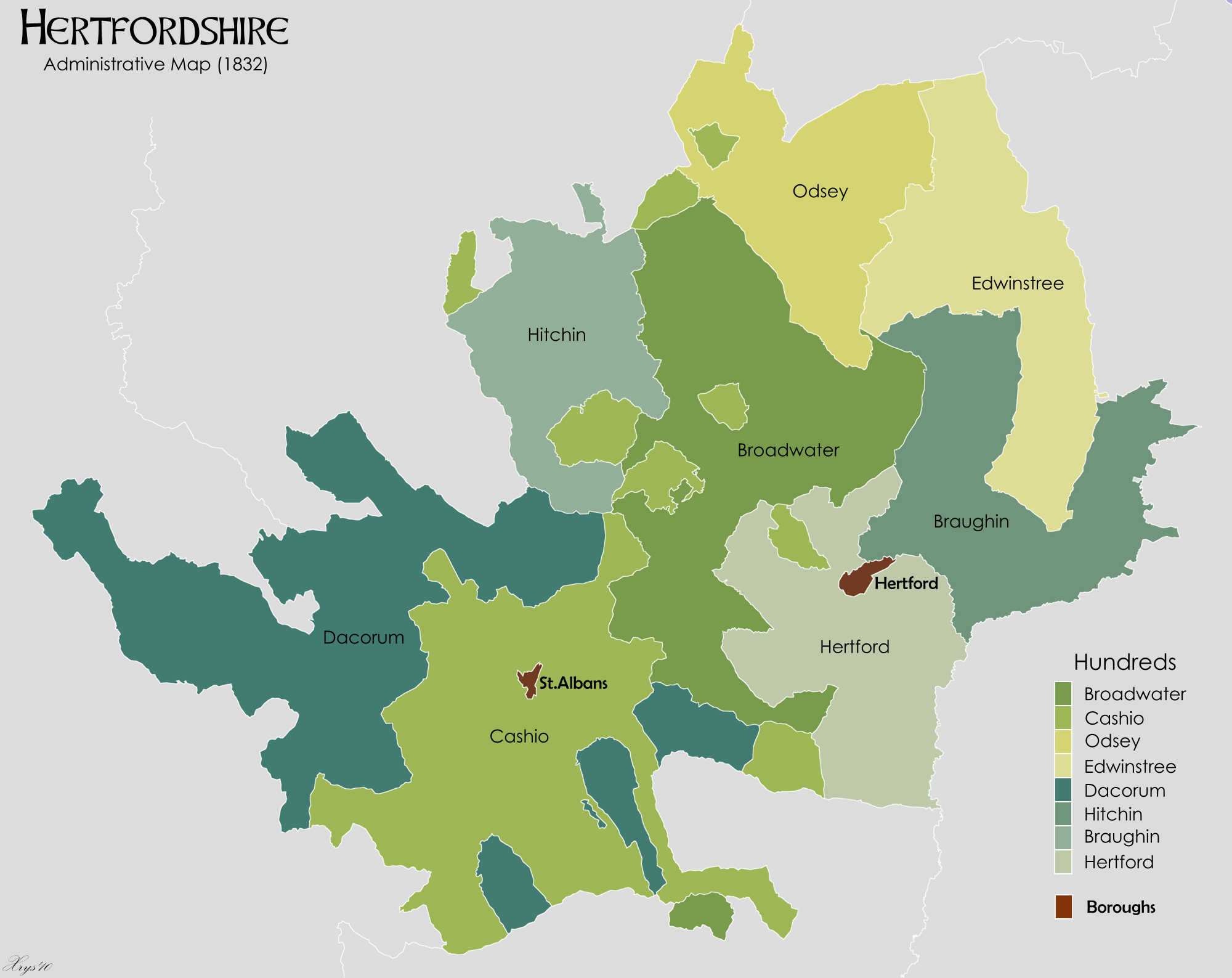
Braughing hundred was a judicial and taxation subdivision of Hertfordshire, in the east of the county, that existed from the 10th to the 19th century. It comprised the following thirteen parishes: Bishop's Stortford, Braughing, Eastwick, Gilston, Hunsdon, Sawbridgeworth, Standon, Stanstead Abbots, Thorley, Thundridge, Ware, Westmill and Widford. The hundred meeting point was at Braughing, which was one of the main Roman settlements in what is today Eastern Hertfordshire. The area was settled by the Saxon tribe called the Brahingas and became part of the area of the Middle Saxons within the Kingdom of Essex la, Regnum Orientalium Saxonum , conventional_long_name = Kingdom of the East Saxons , common_name = Essex , era = Heptarchy , status = , status_text = , government_type = Monarch .... When Christianity was introduced into Essex in 604, Braughing hundred became part of the Archdeaconry of Middlesex within ... [...More Info...] [...Related Items...] OR: [Wikipedia] [Google] [Baidu] |
Hertfordshire
Hertfordshire ( or ; often abbreviated Herts) is one of the home counties in southern England. It borders Bedfordshire and Cambridgeshire to the north, Essex to the east, Greater London to the south, and Buckinghamshire to the west. For government statistical purposes, it forms part of the East of England region. Hertfordshire covers . It derives its name – via the name of the county town of Hertford – from a hart (stag) and a ford, as represented on the county's coat of arms and on the flag. Hertfordshire County Council is based in Hertford, once the main market town and the current county town. The largest settlement is Watford. Since 1903 Letchworth has served as the prototype garden city; Stevenage became the first town to expand under post-war Britain's New Towns Act of 1946. In 2013 Hertfordshire had a population of about 1,140,700, with Hemel Hempstead, Stevenage, Watford and St Albans (the county's only ''city'') each having between 50,000 and 100,000 r ... [...More Info...] [...Related Items...] OR: [Wikipedia] [Google] [Baidu] |
Thundridge
Thundridge is a village and civil parish in the East Hertfordshire district, in the county of Hertfordshire, England. It is about two miles away from the town of Ware and about seven miles away from the large town of Hertford, the county town of Hertfordshire. Nearby settlements Nearby villages include Wadesmill and Tonwell, and the hamlets of Cold Christmas and High Cross. Transport Road Thundridge is on Ermine Street, which is a Roman road, and it was on the A10 road until it was by-passed in 2005, restoring it to a quiet village. Rail Ware is the nearest railway station. There was formerly a line in the Rib valley, the Buntingford branch line Amenities Thundridge has a primary school, along with three pubs in the shape of The Anchor, The Maltons (previously The Sow & Pigs), and The Feathers. The village also has a cricket team, along with Thundridge United Football Club, who play in the Hertford and District League 2. History The village of Thundridg ... [...More Info...] [...Related Items...] OR: [Wikipedia] [Google] [Baidu] |
Archdeacon Of Middlesex
The Archdeacon of Middlesex is a senior cleric in the Church of England, co-responsible for the Archdeaconry of "Middlesex", which mirrors the "Kensington" episcopal area of the Diocese of London — the other person responsible being the Bishop of Kensington. History The ancient archdeaconry has been a division of London diocese since archdeaconries were first created in England in the 12th century. Historically it covered most of London other than the City of London and the East End. It was for ten years in the Marian-period (Roman Catholic) Diocese of Westminster from 1540, then re-absorbed back into the London diocese in 1550 as the church parted, for the final time, from Rome. It was split on 23 July 1912 to create the Archdeaconry of Hampstead and since further split to create the Archdeaconries of Northolt (in 1970) and of Charing Cross (in ). List of archdeacons High Medieval *bef. 1102–aft. 1106: RobertThe first Robert is not recorded as "Archdeacon of Middle ... [...More Info...] [...Related Items...] OR: [Wikipedia] [Google] [Baidu] |
Kingdom Of Essex
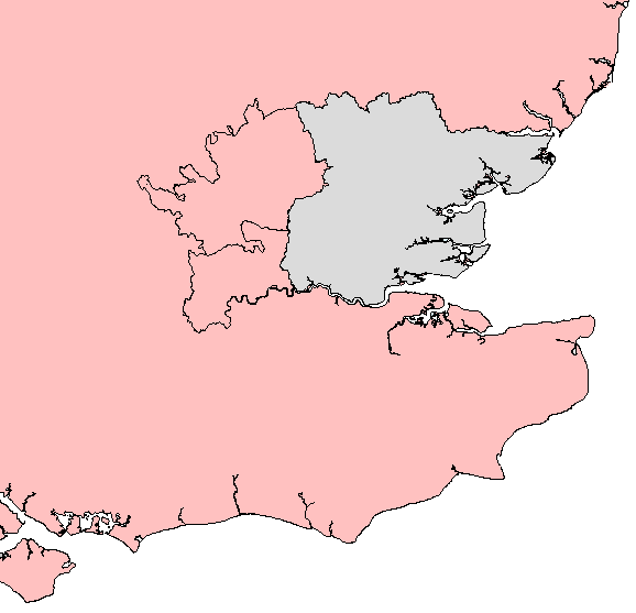
la, Regnum Orientalium Saxonum , conventional_long_name = Kingdom of the East Saxons , common_name = Essex , era = Heptarchy , status = , status_text = , government_type = Monarchy , event_start = , date_start = , year_start = 527 , event_end = , date_end = , year_end = 825 , event1 = , date_event1 = , event2 = , date_event2 = , event3 = , date_event3 = , event4 = , date_event4 = , p1 = Sub-Roman Britain , flag_p1 = Vexilloid of the Roman Empire.svg , border_p1 = no , s1 = Kingdom of England , flag_s1 = Flag of Wessex.svg , border_s1 = no , image_flag = , flag = , flag_type = , image_ ... [...More Info...] [...Related Items...] OR: [Wikipedia] [Google] [Baidu] |
Middle Saxons
The Middle Saxons or Middel Seaxe were a people whose territory later became, with somewhat contracted boundaries, the county of Middlesex, England. The first known mention of Middlesex stems from a royal charter of 704 between king Swæfred of Essex, the abdicating king Æthelred of Mercia and succeeding king Coenred of Mercia, granting some land to bishop Walhere in ''Tuican hom'' (Twickenham) in the ''provincia'' called ''Middleseaxan''. It included the early London settlement, and probably Surrey, the "south region" of the Middle Saxon territory. There is also some evidence that may suggest Middle Saxon settlement in West Kent. The name reflects the situation of these people being in the middle between the South Saxons, the East Saxons and the West Saxons, and distinguishing them from the Angles in the north. Unlike these neighbours, the Middle Saxons did not manage to create a lasting kingdom of their own. According to G. F. Bosworth (1913), 'there is no evidence that Mid ... [...More Info...] [...Related Items...] OR: [Wikipedia] [Google] [Baidu] |
Brahhingas
The ''Brahhingas'' or ''Brahingas'' were a tribe or clan of Anglo-Saxon England whose territory was centred on the settlement of Braughing in modern-day Hertfordshire. The name of the tribe means "the people of Brahha", with Brahha likely to have been either a leader of the tribe or a real or mythical ancestor. The tribe are first recorded in a charter dating from the 830s or 840s, and their '' regio'' or administrative territory is likely to have included the later parishes of Reed, Barkway, Barley, Nuthampstead, Buckland, Wyddial, Anstey, Throcking, Aspenden, Layston, Great Hormead, Little Hormead, Westmill and Standon, in the valleys of the River Rib and River Quin. The ''Brahhingas'' were originally within the area of the Middle Saxons but fell under the control of the East Saxons at an early date. The area remained part of the Archdeaconry of Middlesex even after it became part of Hertfordshire. The territory of the ''Brahhingas'' exhibits a high degree of continuity with pr ... [...More Info...] [...Related Items...] OR: [Wikipedia] [Google] [Baidu] |
Widford, Hertfordshire
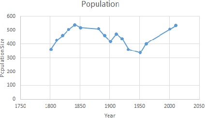
Widford is a village and civil parish between Ware and Much Hadham in the East Hertfordshire district of Hertfordshire in England. It covers an area of approximately 1,167 acres and contains 220 houses. The River Ash flows through the north of the parish. Widford had a population of 534 people in the 2011 census. History The name Widford comes from the old English word 'wid' meaning willow tree and the word 'ford' The Widford commons were extensive and were enclosed under an award of 1856. There was a wood called Lily Wood to the west of the village which was cut down in the late 19th century. Between 1870 and 1872, John Marius Wilson described Widford as: "a parish, with a village, in Ware district, Herts; near the Buntingford railway, 4 miles E by N of Ware. It has a post-office under Ware, and a r. station." Demography and employment The population of Widford was first recorded in 1801 at 361. The population peaked in 1841 at 539. In the most recent census in 2011 the p ... [...More Info...] [...Related Items...] OR: [Wikipedia] [Google] [Baidu] |
Westmill
Westmill is an English village and civil parish in the East Hertfordshire district of Hertfordshire, with an area of 1036 hectares. A population of 264 was recorded in the 2001 National Census. It lies just to the south of Buntingford, beside the River Rib. Communications The Prime Meridian passes to the east of Westmill, as does the Roman road Ermine Street, which ran from London to Lincoln and York.British History Online. WestmillRetrieved 29 July 2014./ref> Its route is followed here by the A10 trunk road. There is a skeleton bus service to Buntingford. West Mill railway station on the Great Eastern Railway's Buntingford Branch Line from St Margarets to Buntingford opened on 3 July 1863. Passenger traffic thrived until the mid-1950s and the rise of car ownership. The line and station closed to passengers on 16 November 1964. The station buildings had been demolished by 1968. Historic buildings The large medieval parish church, dedicated to St Mary the Virgin and restored i ... [...More Info...] [...Related Items...] OR: [Wikipedia] [Google] [Baidu] |
Ware, Hertfordshire
Ware is a town in Hertfordshire, England close to the county town of Hertford. It is also a civil parishes in England, civil parish in East Hertfordshire district. Location The town lies on the north–south A10 road (Great Britain), A10 road which is partly shared with the east–west A414 road, A414 (for Hertford to the west and Harlow to the east). There is a large Kingsmead Viaduct, viaduct over the River Lee (England), River Lea at Kings Meads. The £3.6m two-mile bypass opened on 17 January 1979. At the north end of the bypass is the Wodson Park Sports and Leisure Centre and Hanbury Manor, a hotel and country club. The former route of the A10 through the town is now the A1170. The Ware railway station, railway station is on the Hertford East Branch Line and operated by Greater Anglia (train operating company), Greater Anglia and is on a short single track section of the otherwise double track line. History Archaeology has shown that Ware has been occupied since at least t ... [...More Info...] [...Related Items...] OR: [Wikipedia] [Google] [Baidu] |
Thorley, Hertfordshire
__NOTOC__ Thorley is a village and civil parish in East Hertfordshire district of Hertfordshire, England. The parish includes the hamlets of Thorley Street, Thorley Wash and Old Thorley, and is bordered at the north by the market town of Bishop's Stortford. History Thorley is listed in the ''Domesday book'' as "Torlei", belonging to Geoffrey de Mandeville, a notable Norman baron. During the reign of Edward the Confessor, Thorley Manor belonged to Earl Tostig. Thorley is less than one mile north from Blounts Farm in the adjoining parish of High Wych, the place where, in 1966, the criminal Harry Roberts was found by police during a long manhunt after he had participated in the Shepherd's Bush murders of three London-based policemen. He was found in a barn hiding under straw. Roberts was familiar with the area as he had often visited it as a child with his mother. Landmarks Thorley Church, dedicated to St James the Great, is a Grade I listed building. It dates to the 13th centu ... [...More Info...] [...Related Items...] OR: [Wikipedia] [Google] [Baidu] |
Hertfordshire Administrative Map 1832
Hertfordshire ( or ; often abbreviated Herts) is one of the home counties in southern England. It borders Bedfordshire and Cambridgeshire to the north, Essex to the east, Greater London to the south, and Buckinghamshire to the west. For government statistical purposes, it forms part of the East of England region. Hertfordshire covers . It derives its name – via the name of the county town of Hertford – from a Hart (deer), hart (stag) and a Ford (crossing), ford, as represented on the county's coat of arms and on the Flag of Hertfordshire, flag. Hertfordshire County Council is based in Hertford, once the main market town and the current county town. The largest settlement is Watford. Since 1903 Letchworth has served as the prototype Garden city movement, garden city; Stevenage became the first town to expand under post-war Britain's New Towns Act 1946, New Towns Act of 1946. In 2013 Hertfordshire had a population of about 1,140,700, with Hemel Hempstead, Stevenage, Watford ... [...More Info...] [...Related Items...] OR: [Wikipedia] [Google] [Baidu] |
Stanstead Abbotts
Stanstead Abbotts (alternatively Stanstead Abbots) is a village and civil parish in the district of East Hertfordshire, Hertfordshire, England; it lies on the county boundary with Essex. At the 2001 census, the parish had a population of 1,983. The village is situated approximately south-southeast of Ware, southeast of Hertford, north-northeast of Hoddesdon and west of Harlow. The village is separated from the village of Stanstead St Margarets by the River Lea. History Name and origins The village's name was recorded as "Stanstede" at the time of the Domesday Survey in the late eleventh century. In the twelfth century the manor passed to the abbot of Waltham Holy Cross. By the fourteenth century the suffix "Abbatis", "Abbotts" or "Abbot" formed part of the parish's name. The abbey continued possession of the manor until its dissolution in 1531. The manor of Stanstead Abbotts was granted to Anne Boleyn and remained with the crown after her execution. In 1559 Queen Elizabeth ... [...More Info...] [...Related Items...] OR: [Wikipedia] [Google] [Baidu] |


