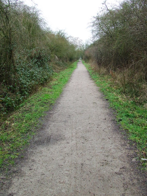
|
Boyton End, Essex
Boyton End is a hamlet in the Uttlesford district of Essex, England. It is located approximately one mile north-east of Thaxted on the B1051 road.  Hamlets in Essex
Thaxted
{{Essex-geo-stub ...
[...More Info...] [...Related Items...] OR: [Wikipedia] [Google] [Baidu] |
Essex
Essex () is a county in the East of England. One of the home counties, it borders Suffolk and Cambridgeshire to the north, the North Sea to the east, Hertfordshire to the west, Kent across the estuary of the River Thames to the south, and Greater London to the south and south-west. There are three cities in Essex: Southend, Colchester and Chelmsford, in order of population. For the purposes of government statistics, Essex is placed in the East of England region. There are four definitions of the extent of Essex, the widest being the ancient county. Next, the largest is the former postal county, followed by the ceremonial county, with the smallest being the administrative county—the area administered by the County Council, which excludes the two unitary authorities of Thurrock and Southend-on-Sea. The ceremonial county occupies the eastern part of what was, during the Early Middle Ages, the Anglo-Saxon Kingdom of Essex. As well as rural areas and urban areas, it forms ... [...More Info...] [...Related Items...] OR: [Wikipedia] [Google] [Baidu] |
Uttlesford
Uttlesford is a local government district in Essex, England. Its council is based in the market town of Saffron Walden. At the 2011 Census, the population of the district was 79,443. Other notable settlements include Great Dunmow, Elmdon, Stebbing, Stansted Mountfitchet, Thaxted, Debden, Little Chesterford and Felstead among other settlements. History Its name is derived from its location within the ancient Hundred (county subdivision), hundred of Uttlesford,Open Domesday: Hundred of Uttlesford. Accessed 6 January 2022. usually spelled ''Vdelesford'' Open Domesday: Saffron Walden. Accessed 6 January 2022. or ''Wdelesford'' [...More Info...] [...Related Items...] OR: [Wikipedia] [Google] [Baidu] |
Thaxted
Thaxted is a town and civil parish in the Uttlesford district of north-west Essex, England. The town is in the valley of the River Chelmer, not far from its source in the nearby village of Debden, and is 97 metres (318 feet) above sea level (where the parish church stands). The town is north from the county town of Chelmsford, and east from the M11 motorway. The parish contains the hamlets of Cutlers Green, Bardfield End Green, Sibleys Green, Monk Street, and Richmond's Green. Much of its status as a "town" rests on its prominent late medieval guildhall, a place where guilds of skilled tradesmen regulated their trading practices, and its English Perpendicular parish church. History According to ''A Dictionary of British Place Names'', Thaxted derives from the Old English ''thoec'' or ''þæc'' combined with ''stede'', being a "place where thatching materials are got". In the 1086 ''Domesday Book,'' the settlement is referred to as 'Tachesteda' and in subsequent official ... [...More Info...] [...Related Items...] OR: [Wikipedia] [Google] [Baidu] |
B1051 Road
B roads are numbered routes in Great Britain of lesser importance than A roads. See the article Great Britain road numbering scheme The Great Britain road numbering scheme is a numbering scheme used to classify and identify all roads in Great Britain. Each road is given a single letter (which represents the road's category) and a subsequent number (between 1 and 4 digits) ... for the rationale behind the numbers allocated. Zone 1 (3 digits) Zone 1 (4 digits) {{DEFAULTSORT:B Roads In Zone 1 Of The Great Britain Numbering Scheme 1 1 ... [...More Info...] [...Related Items...] OR: [Wikipedia] [Google] [Baidu] |
Road Sign - Geograph
A road is a linear way for the conveyance of traffic that mostly has an improved surface for use by vehicles (motorized and non-motorized) and pedestrians. Unlike streets, the main function of roads is transportation. There are many types of roads, including parkways, avenues, controlled-access highways (freeways, motorways, and expressways), tollways, interstates, highways, thoroughfares, and local roads. The primary features of roads include lanes, sidewalks (pavement), roadways (carriageways), medians, shoulders, verges, bike paths (cycle paths), and shared-use paths. Definitions Historically many roads were simply recognizable routes without any formal construction or some maintenance. The Organization for Economic Co-operation and Development (OECD) defines a road as "a line of communication (travelled way) using a stabilized base other than rails or air strips open to public traffic, primarily for the use of road motor vehicles running on their own wheels", whic ... [...More Info...] [...Related Items...] OR: [Wikipedia] [Google] [Baidu] |


