|
Boroughmuirhead
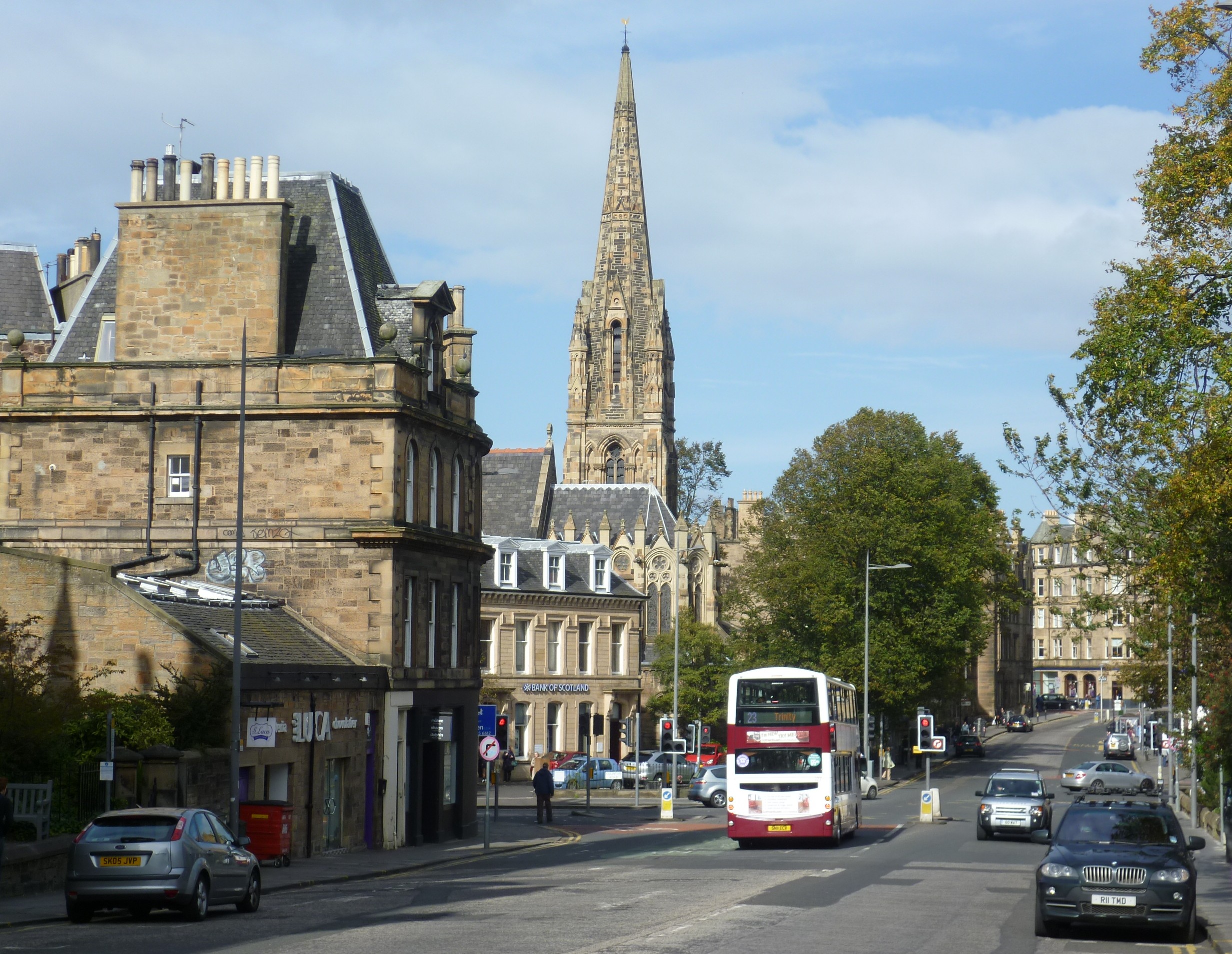
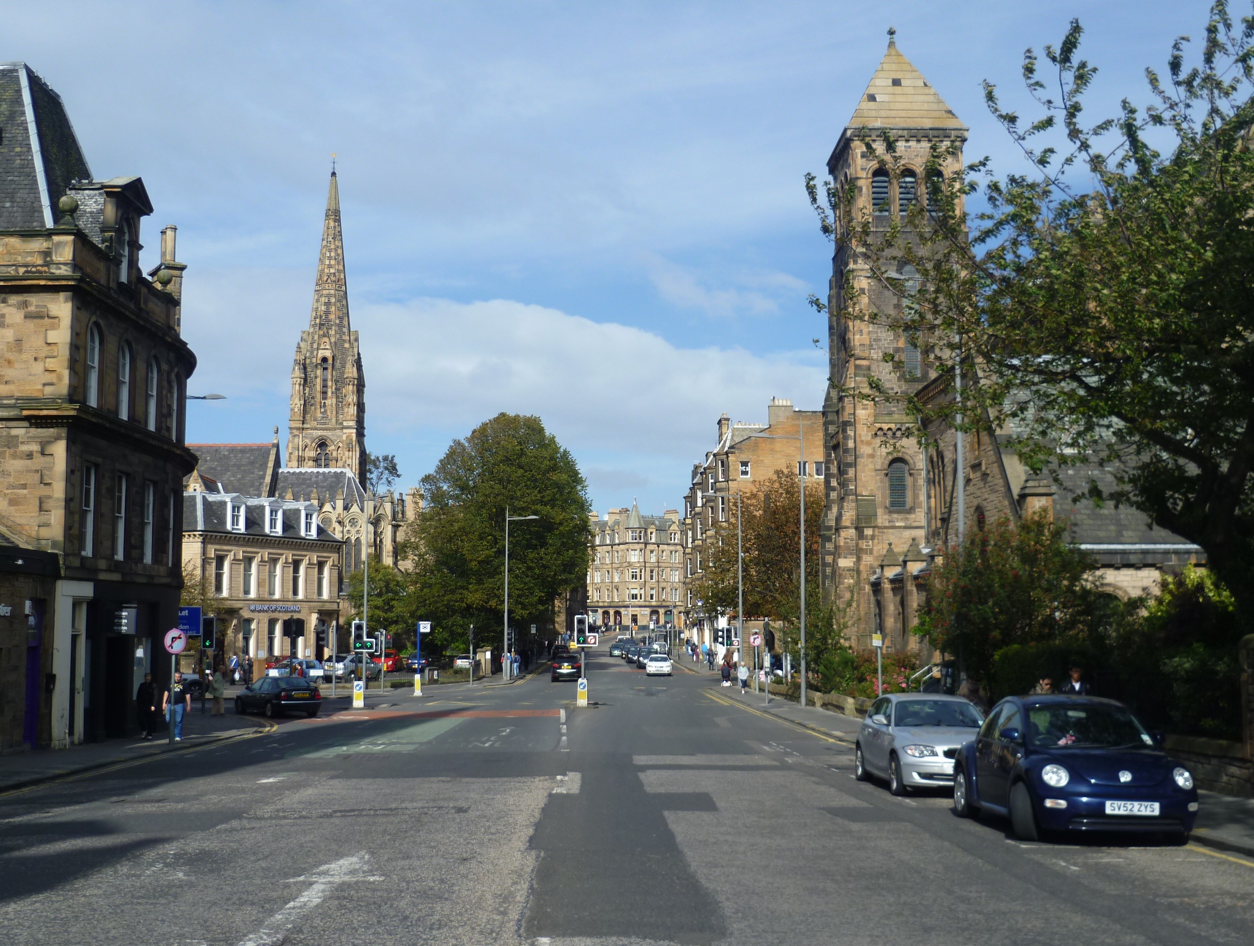
Burghmuirhead (sometimes anglicised as Boroughmuirhead) is an area of Edinburgh, Scotland. The area lies between Bruntsfield to the north and Morningside, Edinburgh, Morningside to the south. West is Merchiston and east is Greenhill, Edinburgh, Greenhill and then Grange, Edinburgh, The Grange. The area was once part of the lands of Greenhill. It takes its name from the Burgh Muir, an area of oak forest which stretched over much of today's south Edinburgh; all that now remains is the parkland of Bruntsfield Links. The anglicised form of the name was used for Boroughmuirhead Post Office which closed in 2010 (replaced by Bruntsfield Post Office in Bruntsfield Place), and also was the former name of the now Grangebank House, located down a lane to the west of Morningside Road. Today the names Holy Corner and Church Hill, Edinburgh, Church Hill are more commonly used to describe the respective northern and southern parts of Burghmuirhead. References * Smith, Charles J., ''Mornings ... [...More Info...] [...Related Items...] OR: [Wikipedia] [Google] [Baidu] |
Burgh Muir
The Burgh Muir is the historic term for an extensive area of land lying to the south of Edinburgh city centre, upon which much of the southern part of the city now stands following its gradual spread and more especially its rapid expansion in the late 18th and 19th centuries. The name has been retained today in the partly anglicised form ''Boroughmuir'' for a much smaller district within Bruntsfield, vaguely defined by the presence of Boroughmuir High School, and, until 2010, Boroughmuirhead post office in its north-west corner. In terms of today's street names, the historic muir ( ''Scots'' for 'moor') extended from Leven Street, Bruntsfield Place and Morningside Road in the west to Dalkeith Road in the east, and as far south as the Jordan Burn and east to Peffermill, thus covering an area of approximately five square miles. The names of the historic roads that bounded it were the "Easter Hiegait", corresponding to Dalkeith Road, and the "Wester Hiegait" corresponding to Brunt ... [...More Info...] [...Related Items...] OR: [Wikipedia] [Google] [Baidu] |
Edinburgh
Edinburgh ( ; gd, Dùn Èideann ) is the capital city of Scotland and one of its 32 Council areas of Scotland, council areas. Historically part of the county of Midlothian (interchangeably Edinburghshire before 1921), it is located in Lothian on the southern shore of the Firth of Forth. Edinburgh is Scotland's List of towns and cities in Scotland by population, second-most populous city, after Glasgow, and the List of cities in the United Kingdom, seventh-most populous city in the United Kingdom. Recognised as the capital of Scotland since at least the 15th century, Edinburgh is the seat of the Scottish Government, the Scottish Parliament and the Courts of Scotland, highest courts in Scotland. The city's Holyrood Palace, Palace of Holyroodhouse is the official residence of the Monarchy of the United Kingdom, British monarchy in Scotland. The city has long been a centre of education, particularly in the fields of medicine, Scots law, Scottish law, literature, philosophy, the sc ... [...More Info...] [...Related Items...] OR: [Wikipedia] [Google] [Baidu] |
Scotland
Scotland (, ) is a country that is part of the United Kingdom. Covering the northern third of the island of Great Britain, mainland Scotland has a border with England to the southeast and is otherwise surrounded by the Atlantic Ocean to the north and west, the North Sea to the northeast and east, and the Irish Sea to the south. It also contains more than 790 islands, principally in the archipelagos of the Hebrides and the Northern Isles. Most of the population, including the capital Edinburgh, is concentrated in the Central Belt—the plain between the Scottish Highlands and the Southern Uplands—in the Scottish Lowlands. Scotland is divided into 32 administrative subdivisions or local authorities, known as council areas. Glasgow City is the largest council area in terms of population, with Highland being the largest in terms of area. Limited self-governing power, covering matters such as education, social services and roads and transportation, is devolved from the Scott ... [...More Info...] [...Related Items...] OR: [Wikipedia] [Google] [Baidu] |
Bruntsfield
Bruntsfield is a largely residential area around Bruntsfield Place in Southern Edinburgh, Scotland. In feudal times, it fell within the barony of Colinton. Location Bruntsfield Place is less than south on the A702 main road from the West end of Edinburgh's principal street, Princes Street. The modern district of Bruntsfield lies west of Bruntsfield Links, beyond which lies the district of Marchmont. Merchiston is to the west and Tollcross to the north. To the south and east lies the former estate of Greenhill, and to the south Morningside. The estate built on land originally belonging to Bruntsfield House is called Marchmont, which the Warrender family began feuing in 1872. Many of the street names reflect the association with that family. The whole area lay within the Burgh Muir of Edinburgh, from which a former farm Burghmuirhead took its name which passed eventually to a small area within Bruntsfield. The Burgh Muir stretched all the way through from the present-day ... [...More Info...] [...Related Items...] OR: [Wikipedia] [Google] [Baidu] |
Morningside, Edinburgh
Morningside is a district and former village in the south of Edinburgh, Scotland. It lies alongside the main arterial Morningside Road, part of an ancient route from Edinburgh to the south west of Scotland. The original village served several farms and estates in the area. In the 19th century, it developed as a residential suburb, its growth being stimulated by the arrival of a railway service and other transport improvements. Location Morningside is located approximately south of Edinburgh's city centre. It is bordered by Bruntsfield to the north, the Grange to the north east, Blackford to the east, Comiston to the south, Greenbank to the south west, and Merchiston to the north west. It includes Braidburn Valley Park, the Royal Edinburgh Hospital and parts of the Braid Hills and Blackford Hill. The district is bisected by the A702 road, which forms part of an ancient route from Edinburgh to Biggar and the south west of Scotland. The south eastern part of Morningside (a ... [...More Info...] [...Related Items...] OR: [Wikipedia] [Google] [Baidu] |
Merchiston
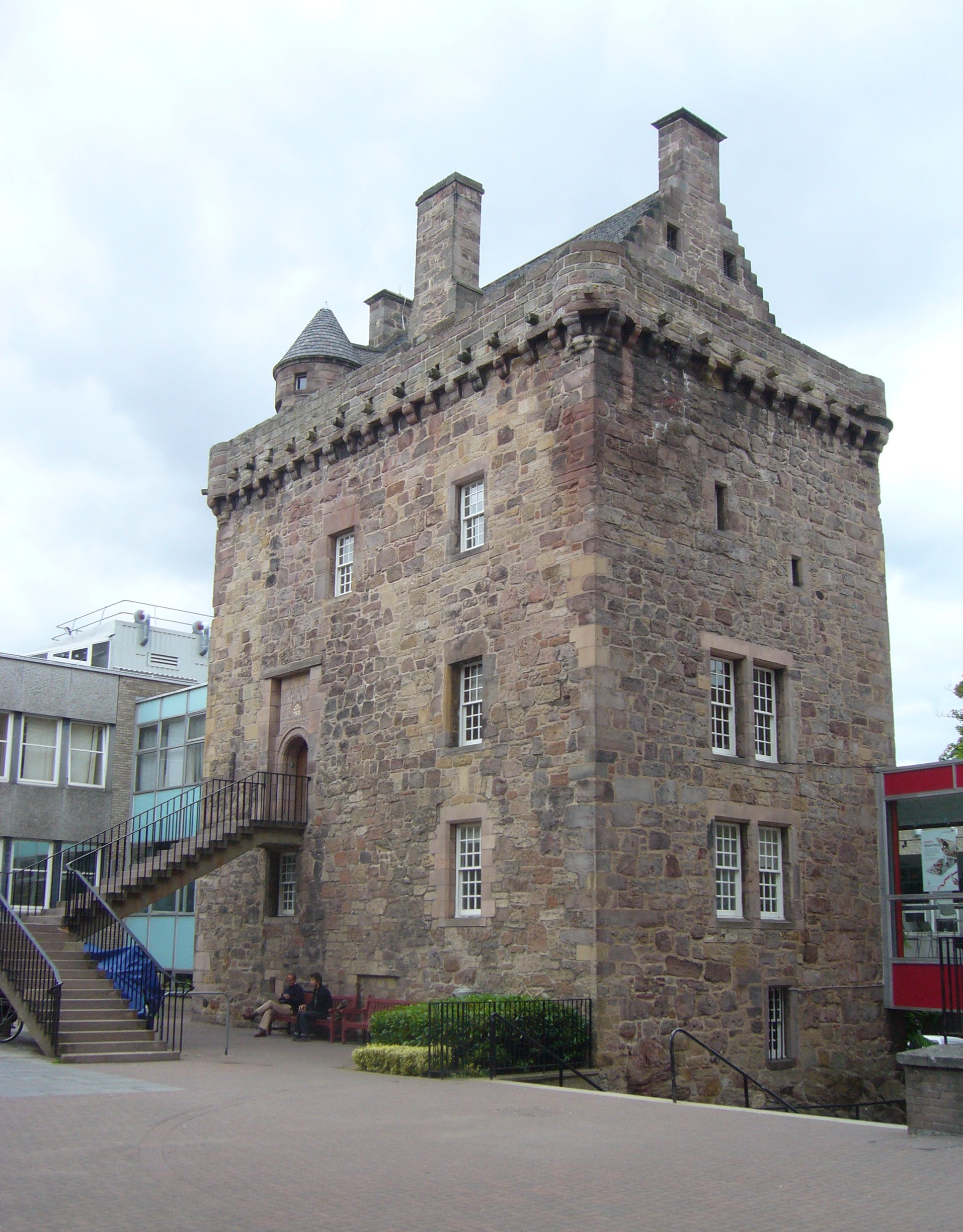
Merchiston ( ) is a residential area around Merchiston Avenue in the south-west of Edinburgh, Scotland. Location Merchiston Avenue is 1.3 miles Southwest of the West End of Edinburgh's principal street, Princes Street. Other areas near Merchiston include Morningside to the southeast, Burghmuirhead (including Holy Corner and Church Hill) to the east and Bruntsfield to the northeast. History The first known reference to Merchiston is found in the 1266 Exchequer Rolls of Scotland. At this point Merchiston consisted of one of a number of independently owned estates to the southwest of the Burgh Muir. Alexander Napier, a wealthy Edinburgh merchant and provost of the city, acquired the estate from King James I in 1436. He or his son, also Alexander Napier, were responsible for the construction of Merchiston Tower (or Castle) in the mid 15th century. Merchiston Tower was later the home of John Napier, 8th Laird of Merchiston and the inventor of logarithms. The tower was sold ... [...More Info...] [...Related Items...] OR: [Wikipedia] [Google] [Baidu] |
Greenhill, Edinburgh
Greenhill is a small area of Edinburgh, the capital of Scotland. Situated south of the city centre, Greenhill is normally taken to be part of Bruntsfield, which skirts it to the north. Greenhill borders Marchmont and The Grange to the east, Morningside to the south, and Merchiston, beyond Holy Corner, to the west. It comprises a mixture of Georgian and Victorian villas and some tenement housing. History The name derives from the former estate of Greenhill, which was one of the original lots purchased when the Edinburgh magistrates feued the Burgh Muir in 1586. The owner was Thomas Aikenhead, an Edinburgh merchant. Two further lots were later added to the original portion of Greenhill, including the ground that became known as Burghmuirhead, and sold to separate owners, one of whom was William Rig. Aikenhead was a skinner (glover) by occupation and held the positions of councillor, bailie and Dean of Guild. In 1636, the estate was sold to John Livingston, an Edinburgh apothec ... [...More Info...] [...Related Items...] OR: [Wikipedia] [Google] [Baidu] |
Grange, Edinburgh
The Grange (originally St Giles' Grange) is an affluent suburb of Edinburgh, just south of the city centre, with Morningside and Greenhill to the west, Newington to the east, The Meadows park and Marchmont to the north, and Blackford Hill to the south. It is a conservation area characterised by large early Victorian stone-built villas and mansions, often with very large gardens. The Grange was built mainly between 1830 and 1890, and the area represented the idealisation of country living within an urban setting. The suburb includes streets which are renowned for their pricey properties, and it is home to some of Scotland's richest people, top lawyers and businessmen. Whitehouse Terrace, in the Grange area of the Capital, was named as the priciest postcode in Zoopla's 'Rich List for 2021'. Character of the Area The architectural form and green environment of The Grange are attributable to the picturesque movement and characterised by romantic revivalism of the architectur ... [...More Info...] [...Related Items...] OR: [Wikipedia] [Google] [Baidu] |
Post Office
A post office is a public facility and a retailer that provides mail services, such as accepting letters and parcels, providing post office boxes, and selling postage stamps, packaging, and stationery. Post offices may offer additional services, which vary by country. These include providing and accepting government forms (such as passport applications), and processing government services and fees (such as road tax, postal savings, or bank fees). The chief administrator of a post office is called a postmaster. Before the advent of postal codes and the post office, postal systems would route items to a specific post office for receipt or delivery. During the 19th century in the United States, this often led to smaller communities being renamed after their post offices, particularly after the Post Office Department began to require that post office names not be duplicated within a state. Name The term "post-office" has been in use since the 1650s, shortly after the legali ... [...More Info...] [...Related Items...] OR: [Wikipedia] [Google] [Baidu] |
Holy Corner
Holy Corner is a colloquial name for a small area of Edinburgh, Scotland, and (along with Church Hill) is part of the area more properly known as Burghmuirhead, itself part of the lands of Greenhill. Holy Corner lies between the areas of Bruntsfield and Morningside. Location The name derives from the crossroads, where Morningside Road, Colinton Road and Chamberlain Road meet; on each of the corners of the crossroad is a church (although two are slightly set back.) Church Hill is the small area to the south and includes the Church Hill Theatre, formerly yet another church. Beyond is Morningside, with the former parish church (formally part of Napier University, now returned to ecclesiastical use by Chalmers Church) only just beyond Church Hill. The north end of the crossroads leads into Bruntsfield Place. Merchiston is along Colinton Road to the west. The churches of Holy Corner are: Christ Church (Scottish Episcopal Church), Morningside United (Church of Scotland and Un ... [...More Info...] [...Related Items...] OR: [Wikipedia] [Google] [Baidu] |
Church Hill, Edinburgh
Church Hill is a street and small surrounding area in Edinburgh, Scotland. Geography It lies immediately to the north of Morningside and south of Bruntsfield; technically it is part of Burghmuirhead, together with Holy Corner. All of Burghmuirhead was once part of the lands of Greenhill. The original Burghmuirhead House remains at the end of a lane on the west side of Morningside Road near Church Hill (the street) itself. To the west is Merchiston and east are Greenhill and The Grange. The area is mainly Georgian and Victorian villas, and Victorian tenements A tenement is a type of building shared by multiple dwellings, typically with flats or apartments on each floor and with shared entrance stairway access. They are common on the British Isles, particularly in Scotland. In the medieval Old Town, i ..., often with shops at ground-floor level. The area is affluent, as with much of south Edinburgh, with a mixture of residential and retail buildings. Church Hill Theatre ... [...More Info...] [...Related Items...] OR: [Wikipedia] [Google] [Baidu] |


